Highlighted Media
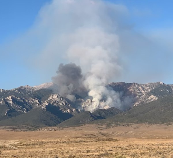

Smoke is very visible during the day to residents of Currant, Duckwater and surrounding areas as well as motorists on U.S. Highway 6. On days where there is increase fire activities the smoke is visible in Ely. Smoke and fire activity will likely be seen into September and October until the first snow hits the mountain. For updates on air quality, visit: www.fire.airnow.gov.
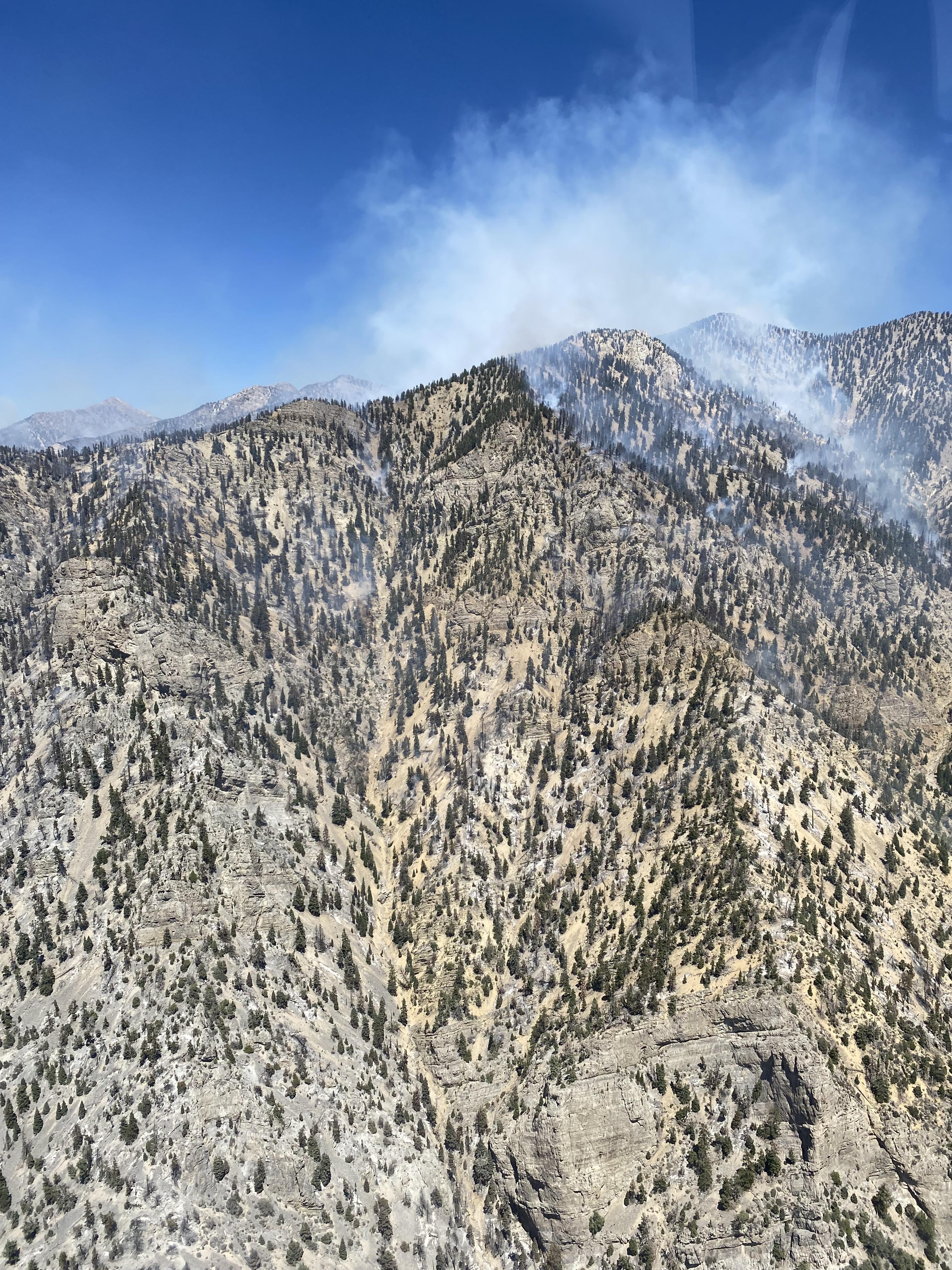

An aerial photo of the top of the very steep and rugged Currant Mountain where smoke is being produced by the Broom Canyon Fire.
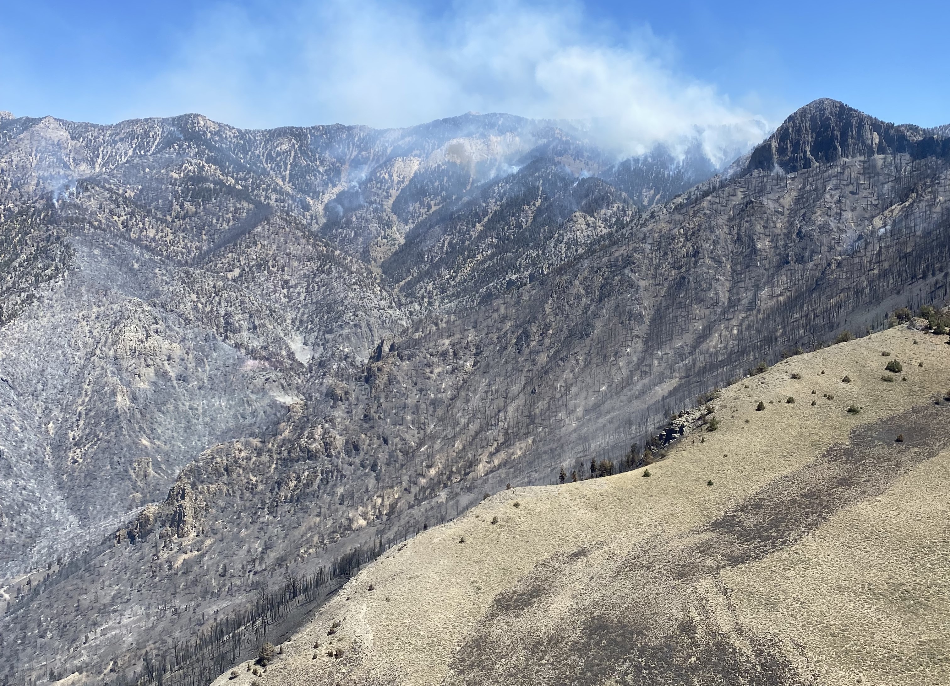

This lightning-caused fire is currently located in an area where firefighter safety mitigations cannot be achieved therefore fire suppression actions are not being taken. The Ely Ranger District is managing the Broom Canyon Fire under a confine and contain strategy. A planning boundary has been established for areas which provide safe opportunities for suppression actions.
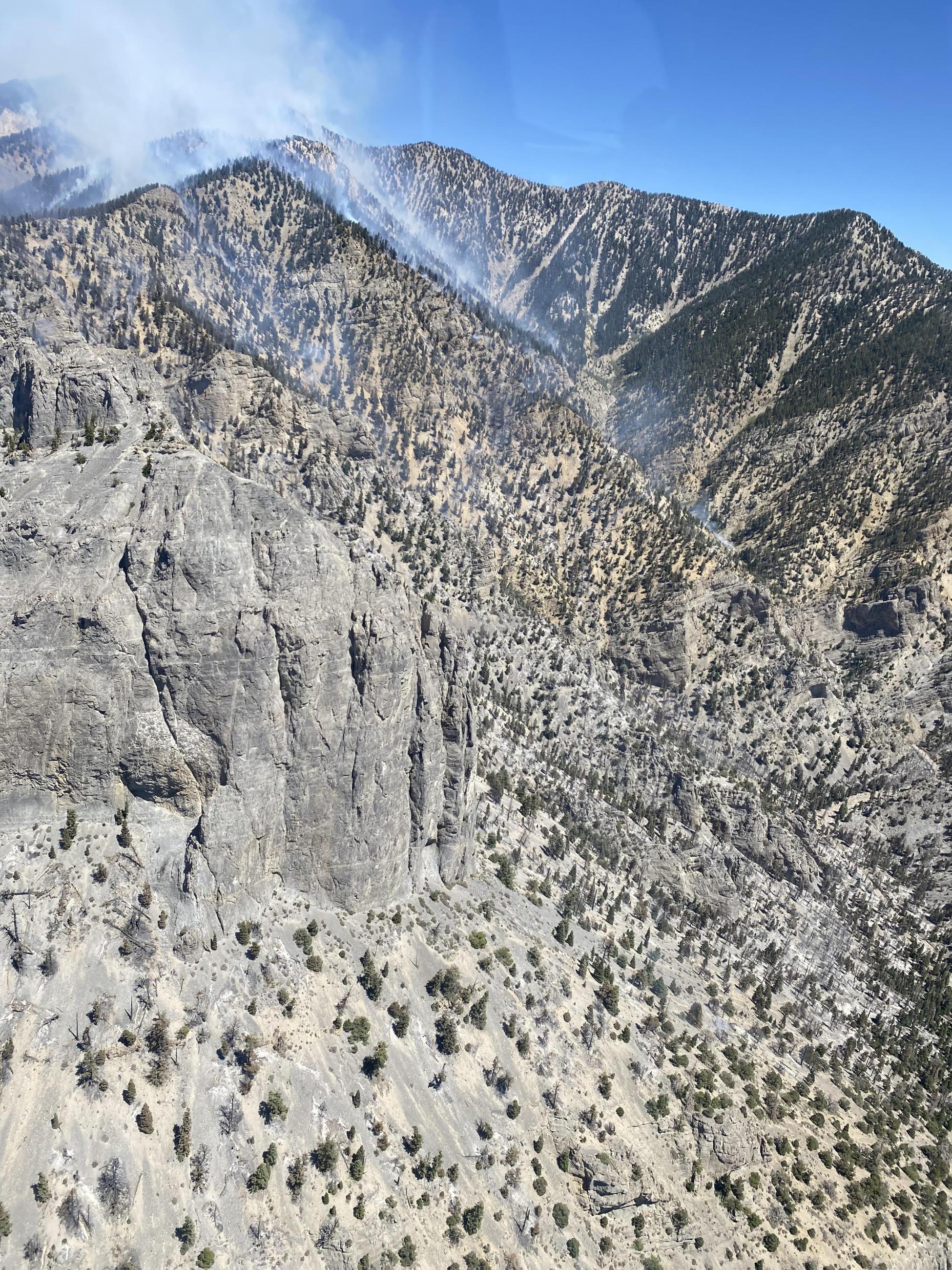
The Broom Canyon Fire is burning within the Currant Mountain Wilderness on the Humboldt-Toiyabe National's Ely Ranger District. The lightning-caused fire is located nine miles east of Duckwater or 60 miles southwest of Ely, Nevada. It was first reported at approximately 8 p.m. on Monday, July 29.
The Broom Canyon Fire is burning within the Currant Mountain Wilderness on the Humboldt-Toiyabe National's Ely Ranger District. The lightning-caused fire is located nine miles east of Duckwater or 60 miles southwest of Ely, Nevada. It was first reported at approximately 8 p.m. on Monday, July 29.
| Current as of | Wed, 09/11/2024 - 11:54 |
|---|---|
| Incident Time Zone | America/Los_Angeles |
| Incident Type | Wildfire |
| Cause | Lightning |
| Date of Origin | |
| Location | Burning on Currant Mountain in the Current Mountain Wilderness, which is nine miles east of Duckwater or 60 miles southwest of Ely, Nevada. |
| Incident Commander | Type 3 Incident Commander Seth Trodahl. |
| Incident Description | The Broom Canyon Fire is burning in steep, rugged, and inaccessible terrain above 7,000 Feet on Currant Mountain within the Currant Mountain Wilderness. The Ely Ranger District is managing the fire under a confine and contain strategy. This Lightning-caused fire is currently located in an area where firefighter safety mitigations cannot be achieved therefore fire suppression actions are not being taken at this time. Areas within the planning boundary have been identified for safe opportunities for suppression actions. Firefighters are also improving roads that have been identified as contingency fire lines should the fire move outside the planning boundary to the west. |
| Coordinates |
38° 53' 13'' Latitude
-115° 26' 38
'' Longitude
|
| Total Personnel: | 89 |
|---|---|
| Size | 8,345 Acres |
| Percent of Perimeter Contained | 15% |
| Fuels Involved | The fire is burning in white fir, pinyon pine and juniper, but also leaving lots of unburned vegetation resulting in a mosaic pattern. |
| Planned Actions |
Personnel will continue efforts to locate areas where firefighters can engage and monitor the behavior and movement of the fire. Firefighters have almost completed the contingency lines around the fire should the fire move west and/or outside the wilderness and planning area boundaries. |
|---|---|
| Projected Incident Activity |
Sept. 10: Fire behavior may increase to high and gusty winds in combination of low relative humidity values and red flag condition. Fire spreading to the North is expected as well as some spotting to the East. Management action point three work, as per the WFDSS, is well underway improving the Currant Creek and White River roads. On the Southern flank of the incident, activity is showing on interior pockets but no expected threat of fire movement. Though the fire is not actively moving to the West or South flanks, advanced preparation of constructing containment lines is ongoing. Sept. 11: As a result of the seasonal weather, there is expected to be an increase in fire behavior including creeping and isolated torching with terrain driven runs and moderate fire activity. Fire spreading to the North is expected as well as some spotting to the East. Management action point three work, as per the WFDSS, is well underway improving the Currant Creek and White River roads. On the Southern flank of the incident, activity is showing on interior pockets but no expected threat of fire movement. Though the fire is not actively moving to the West or South flanks, advanced preparation of constructing containment lines is ongoing. Sept. 12: More active fire behavior is expected with temperatures returning to seasonal norms and breezy afternoon winds. As a result of the seasonal weather, there is expected to be an increase in fire behavior including creeping and isolated torching with terrain driven runs and moderate fire activity. Fire spreading to the North is expected as well as some spotting to the East. Management action point three work, as per the WFDSS, is well underway improving the Currant Creek and White River roads. On the Southern flank of the incident, activity is showing on interior pockets but no expected threat of fire movement. Though the fire is not actively moving to the West or South flanks, advanced preparation of constructing containment lines is ongoing. |
| Remarks |
Smoke and fire activity will likely be seen into September and October until the first snow hits the mountain. For updates on air quality, visit: www.fire.airnow.gov. |
| Weather Concerns | Encroaching surface cold front from the northwest produces elevated fire weather conditions this afternoon, Sept. 10, due to minimum relative humidity values around 15% or less and west-southwesterly breezes with gusts 25 to 30 mph. The front progresses into Nevada Wednesday, Sept. 11, and a dry frontal passage is expected. Strong winds with gusts 35 to 40 mph paired with minimum afternoon relative humidity values around 15% or less will produce critical fire weather conditions. Winds shift north-northwest post frontal during the evening hours. For updated weather for Ely, Nevada, visit: https://forecast.weather.gov/MapClick.php?CityName=Ely&state=NV&site=LKN&textField1=39.2475&textField2=-114.888&e=0 |
|---|

 InciWeb