Highlighted Media

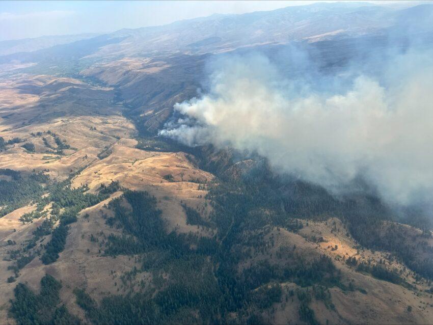
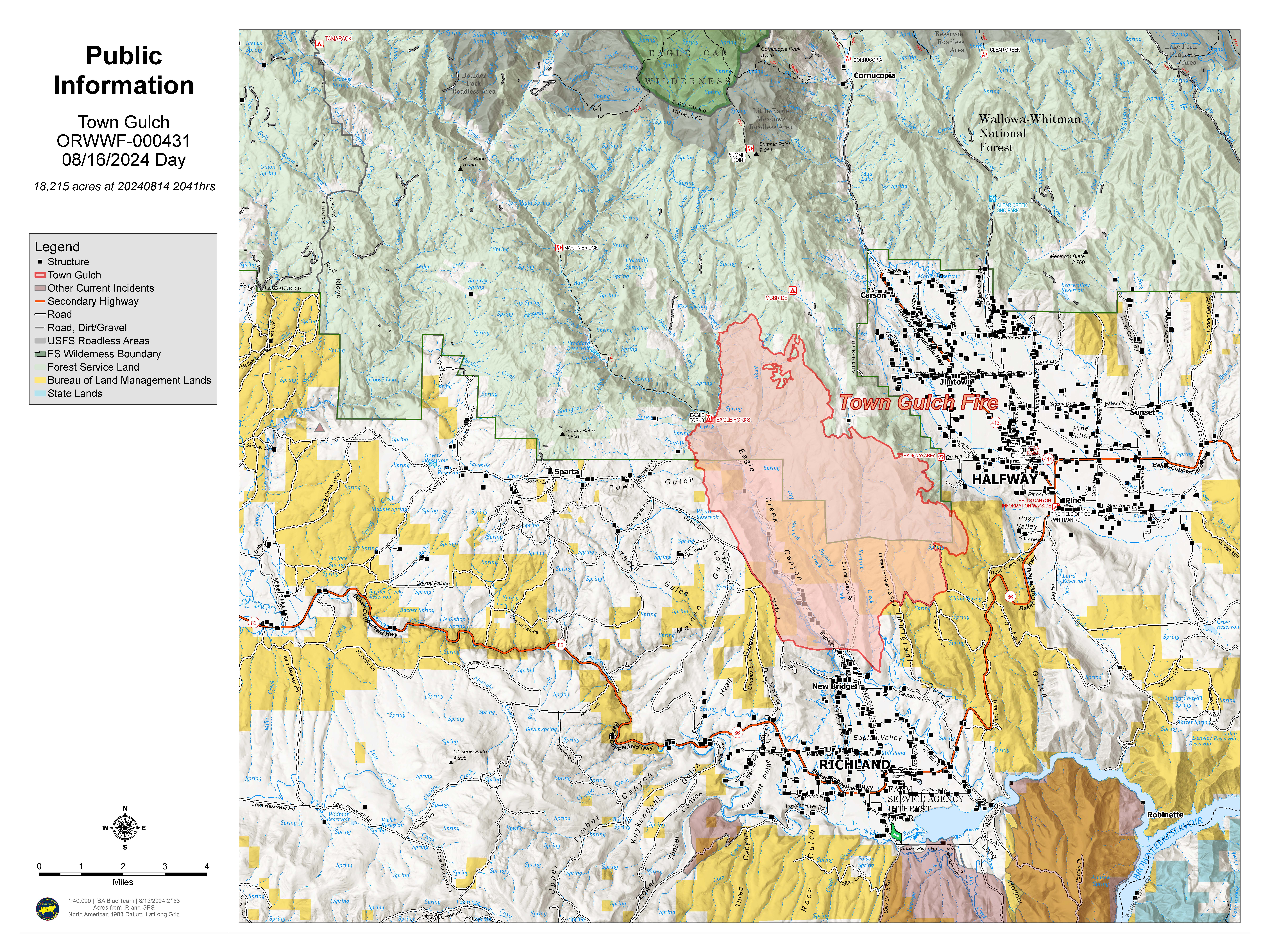
The Town Gulch Fire ignited due to lightning and was observed and reported on Monday, August 5 at 9:27 AM PDT along Eagle Creek about eight miles NNW of Richland. Steep terrain and cliffs remain a threat to crews operating inside the fire perimeter. Winding canyon roads pose a hazard for crews traveling near the incident.
Town Gulch is being managed as a full suppression incident. Firefighters, the public and other incident responders' safety remain the top priority; followed by protection of structures, community assets and private property.
A slight decrease in acreage of the fire is due to more accurate mapping.
| Current as of | Fri, 08/16/2024 - 20:18 |
|---|---|
| Incident Time Zone | America/Los_Angeles |
| Incident Type | Wildfire |
| Cause | Lightning/Natural |
| Date of Origin | |
| Location | Eagle Creek Rd Area, 24 Miles East of Baker City OR, 8 Miles N of Richland, OR |
| Incident Commander | Charles Patterson, IC Andy Baker, Deputy IC John Wallace, IC (t) Southern Area Blue Complex Incident Management Team |
| Coordinates |
44° 52' 39'' Latitude
-117° 15' 18
'' Longitude
|
| Total Personnel: | 285 |
|---|---|
| Size | 18,220 Acres |
| Percent of Perimeter Contained | 89% |
| Estimated Containment Date | 08/26/2024 |
| Fuels Involved |
ERC and BI indices in the Blue Mountain FDOP area are currently below average due to the light rain received yesterday in some areas of the fire. Good portions of the fire received little to no rain. Areas which received rain will have some relief for the warming trend that begins today. Fuels in the area are mixed grass/sagebrush with timber stands. As the fire moves to the north, the timber component increases. |
| Significant Events | Moderate Interior pockets conintue to burn and be consumed. |
| Planned Actions |
Continuing mop up and patrol on all divisions of the fire. Suppression and repair also continues. |
|---|---|
| Projected Incident Activity |
12 hours: Minimal threat of fire spreading overnight. 24 hours: Remaining heat on the Town Gulch Fire should not present a threat to the line after receiving rain on Thursday. The warming and drying trend begins in earnest, with temps close to 90 in the fire area, and RH’s in the low teens or even single digit. Wind will be a factor with speeds exceeding the threshold for fire spread. Any new starts will start to become active as fuels dry and wind speeds increase. 48 hours: Little threat from the Town Gulch Fire. The warming and drying trend continues, with slightly cooler temps on Sunday. 72 hours: Monday brings another hot, dry and windy day, with temps approaching 90 again, along with very low RHs. ERCs should be well on their way to rebounding after the precipitation last week. 72 hours(+): Saturday and Monday will be the hottest days, but conditions will likely remain warm and dry through the week. Several systems will skirt the area. |
| Remarks |
Oregon Governor Tina Kotek invoked the conflagration act on 08/06/2024 at 1720. The Southern Area Blue Team will transition the fire to a Type III team at 2000 today. |
| Weather Concerns | Weather influences: Thursday brought a cooler start to the day combined with excellent overnight relative humidity recoveries between 80 and 90 percent. Drying conditions will occur throughout the day Friday as the region moves into a hot, dry and windy pattern. On Saturday, temperatures will skyrocket to be 8 – 10 degrees warmer (near 90 at 4,000 feet on the fire), with strong winds out of the south-southwest developing by late Saturday afternoon. Winds out of the southwest will not be quite as strong on Sunday, but will peak again on Monday. Daytime relative humidities on the fire Saturday through early next week will dry into the 9-15% range each day with temperatures between 85 and 95. |
|---|

 InciWeb
