
Highlighted Activity
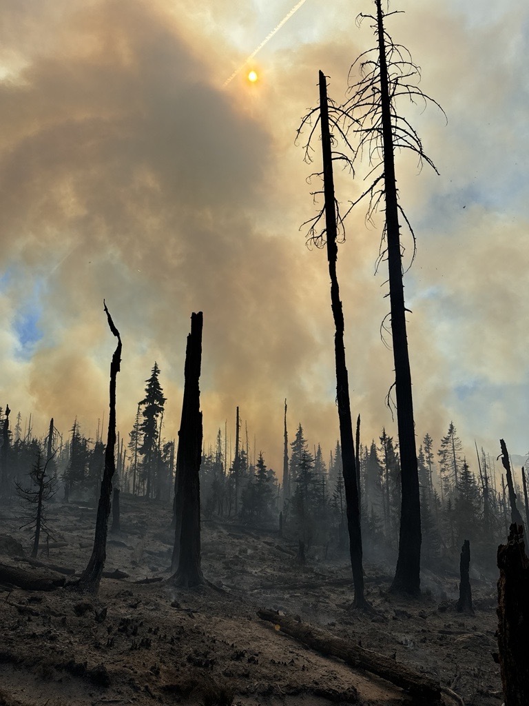

The Bingham Fire, located east of the Bingham Ridge Trailhead near Marion Forks, was reported on the evening of September 30th, 2024. The fire is burning partially within an older fire scar along the Bingham Ridge Trail that extends into the Mount Jefferson Wilderness area.
LEVEL 3: GO NOW! Evacuation Alerts have been issued by the Linn County Sheriff’s Office for a large area of the Mount Jefferson Wilderness. Additionally, LEVEL 2: GET SET Evacuation Alerts have been issued for the area around Marion Forks Campground, and Marion Forks Fish Hatchery. The Level 2 evacuation area also extends along Highway 22, to ½-mile west of Highway 22, from Pamelia Road (NFS Road 2246) south to Parrish Lake Road (NFS Road 2266). Please refer to the Linn County Wildfire Map for more detailed information: https://tinyurl.com/LinnCoFireMap. Highway 22 remains open at this time.
| Current as of | Thu, 10/03/2024 - 21:36 |
|---|---|
| Incident Time Zone | America/Los_Angeles |
| Incident Type | Wildfire |
| Cause | Undetermined |
| Date of Origin | |
| Location | Bingham Ridge; 2 miles East of Marion Forks; 10 miles SE of Idanha |
| Incident Commander | Marcel Potvin, Type 3 Incident Commander |
| Coordinates |
44° 36' 49'' Latitude
-121° 54' 3
'' Longitude
|
| Total Personnel: | 126 |
|---|---|
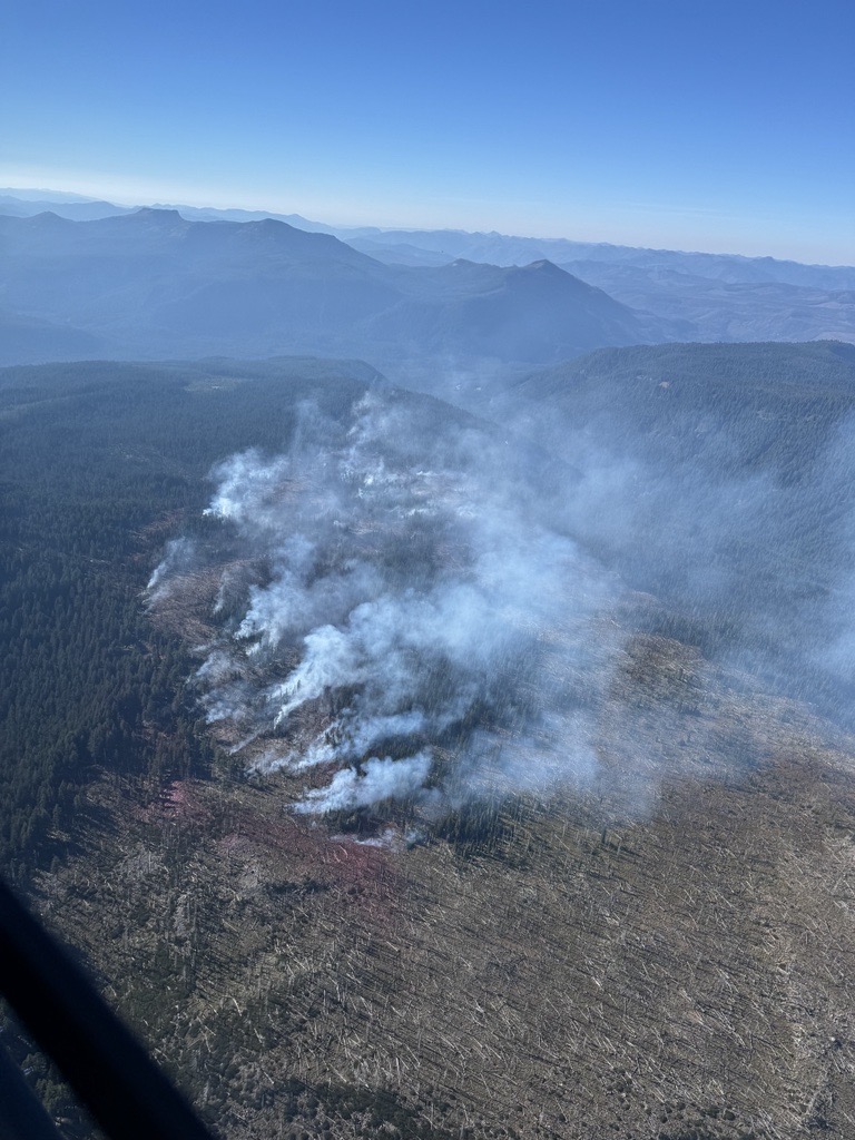
| Size | 195 Acres |
| Fuels Involved | Closed Timber Litter Burning in area that includes 2 separate old fire scars (10+ years old) with heavy loading of standing dead, downed trees, and snags. |
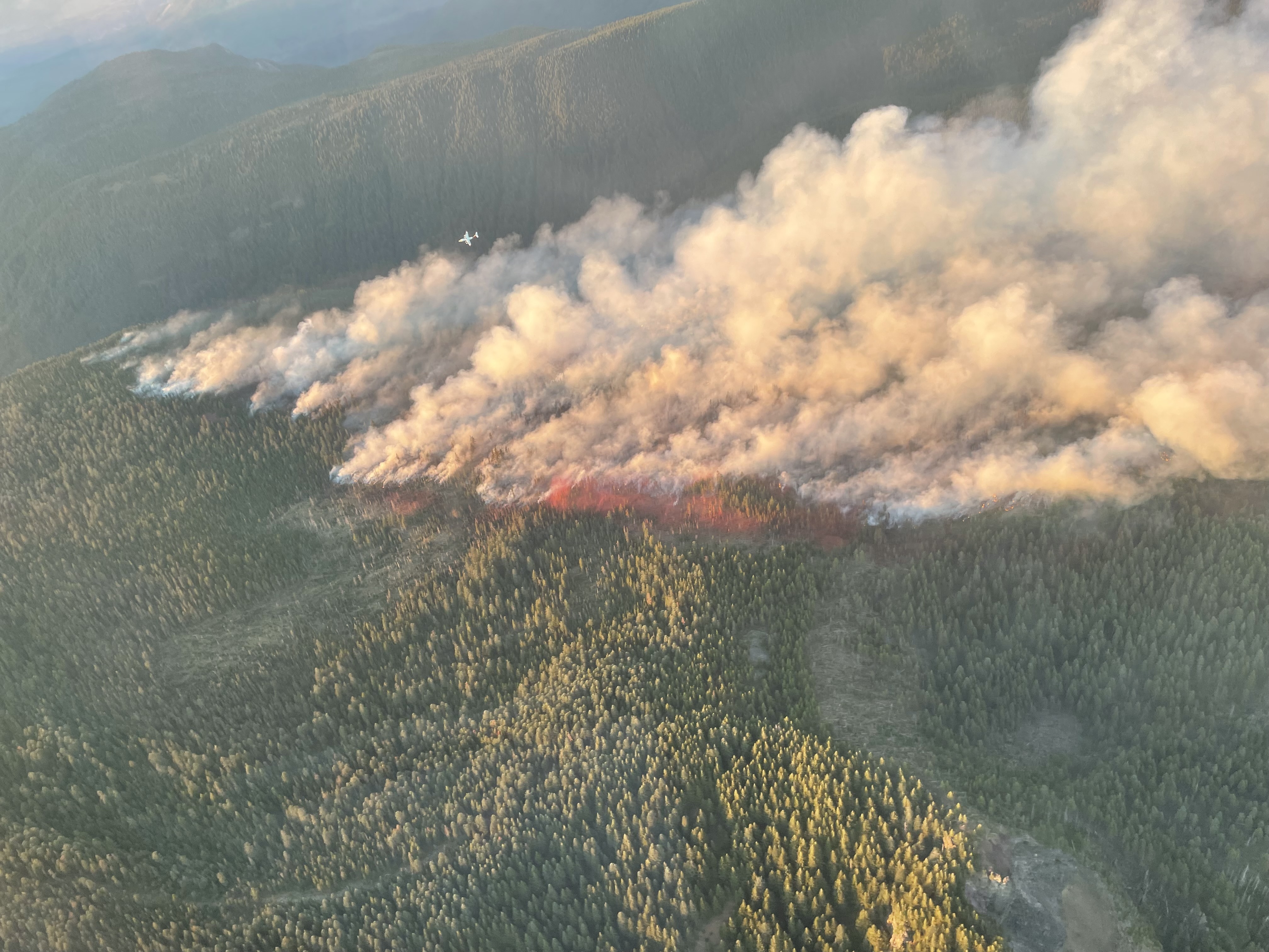
| Significant Events | Extreme Short Crown Runs Short-Range Spotting Torching |
| Planned Actions |
Use aircraft and ground resources to minimize fire spread using direct suppression tactics. |
|---|---|
| Projected Incident Activity |
12 hours: Fire anticipated to move west towards Marion Forks and HWY 22 with east winds predicted up to 15mph. Short to long range spotting potential with winds. 24 hours: Fire anticipated to move west towards Marion Forks and HWY 22 with east winds predicted up to 15mph. Short to long range spotting potential with winds. Critically low humidities will increase fire behavior. 48 hours: Westward wind shift will move fire spread into steep, rugged, roadless areas, wilderness, and old burn scars heavy with snags and downed wood. 72 hours: Wind predicted to shift back easterly. Anticipated after 72 hours: Westward wind shift will move fire spread into steep, rugged, roadless areas, wilderness, and old burn scars heavy with snags and downed wood. No rain predicted in extended forecast. |
| Weather Concerns | Excellent relative humidity recoveries expected Tuesday night with winds becoming light, resulting in decreasing fire activity. Main concern is Wednesday afternoon through Thursday when critical relative humidity values as low as 15-20% are expected. The low humidity will occur simultaneously with breezy easterly winds up to 15 mph. Expect fire activity to increase Wednesday afternoon and continue through Thursday as a result. That being said, forecast winds are n t quite strong enough to suggest rapid or explosive fire spread. |
|---|