
Please note: The last InciWeb update for the Bingham Fire was Monday, October 14, 2024. No more updates are anticipated, unless conditions warrant otherwise.
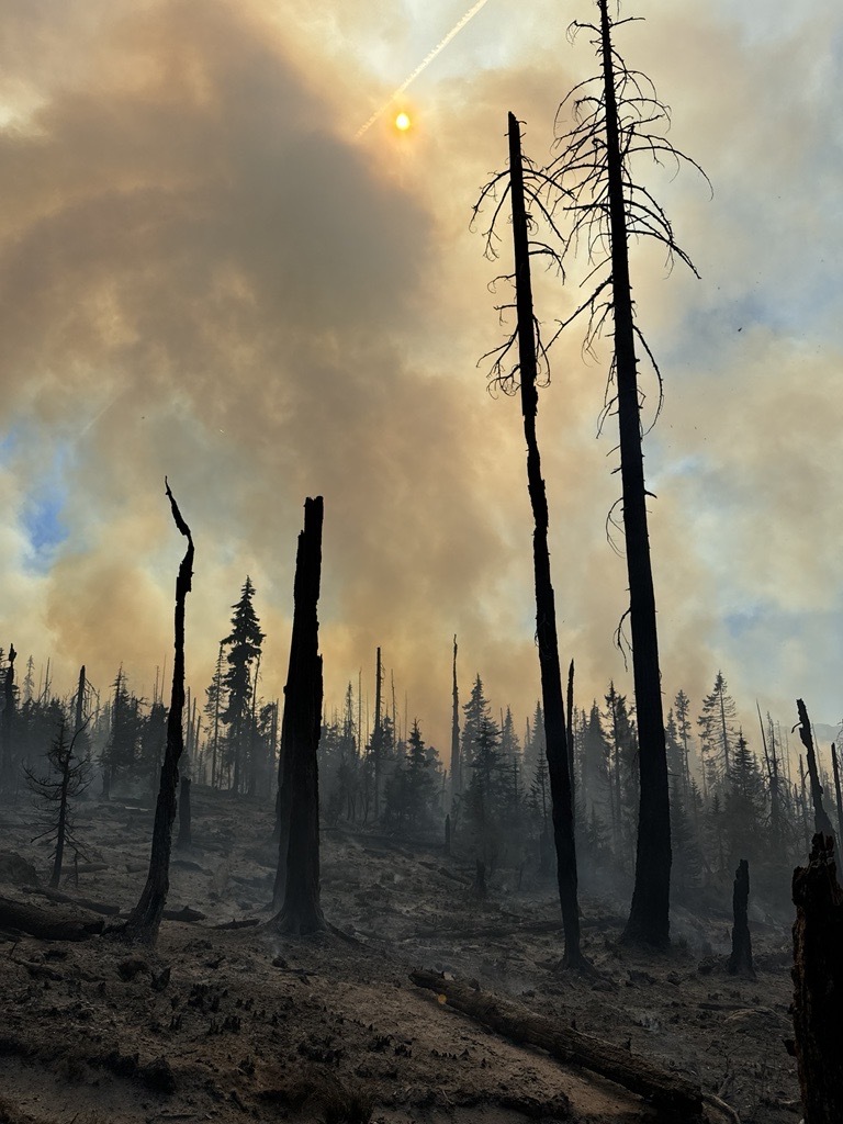
The Bingham Fire, located east of the Bingham Ridge Trailhead near Marion Forks, was reported on the evening of September 30, 2024. The fire is burning partially within an older fire scar along the Bingham Ridge Trail that extends into the Mount Jefferson Wilderness.
Complex Incident Management Team (CIMT) California Team 1 took command of the fire Sunday, October 6 at 6 a.m.
Evacuations: LEVEL 3: GO NOW! evacuation alerts have been issued by the Linn County Sheriff’s Office for a large area of the Mount Jefferson Wilderness. Additionally, LEVEL 2: GET SET evacuation alerts have been issued for the area around Marion Forks Campground and Marion Forks Fish Hatchery. The Level 2 evacuation area also extends along Highway 22 to a ½-mile west of Highway 22 and from Pamelia Road (NFS Road 2246) south to Parrish Lake Road (NFS Road 2266). Please refer to the Linn County Wildfire Map for more detailed information: https://tinyurl.com/LinnCoFireMap. Highway 22 remains open at this time.
Closures and Fire Restrictions: For Willamette National Forest closure and restriction information, visit https://www.fs.usda.gov/alerts/willamette/alerts-notices.
Please note: The last InciWeb update for the Bingham Fire was Monday, October 14, 2024. No more updates are anticipated, unless conditions warrant otherwise.
The Bingham Fire, located east of the Bingham Ridge Trailhead near Marion Forks, was reported on the evening of September 30, 2024. The fire is burning partially within an older fire scar along the Bingham Ridge Trail that extends into the Mount Jefferson Wilderness.
Complex Incident Management Team (CIMT) California Team 1 took command of the fire Sunday, October 6 at 6 a.m.
Evacuations: LEVEL 3: GO NOW! evacuation alerts have been issued by the Linn County Sheriff’s Office for a large area of the Mount Jefferson Wilderness. Additionally, LEVEL 2: GET SET evacuation alerts have been issued for the area around Marion Forks Campground and Marion Forks Fish Hatchery. The Level 2 evacuation area also extends along Highway 22 to a ½-mile west of Highway 22 and from Pamelia Road (NFS Road 2246) south to Parrish Lake Road (NFS Road 2266). Please refer to the Linn County Wildfire Map for more detailed information: https://tinyurl.com/LinnCoFireMap. Highway 22 remains open at this time.
Closures and Fire Restrictions: For Willamette National Forest closure and restriction information, visit https://www.fs.usda.gov/alerts/willamette/alerts-notices.
| Current as of | Tue, 10/15/2024 - 21:23 |
|---|---|
| Incident Time Zone | America/Los_Angeles |
| Incident Type | Wildfire |
| Cause | Lightning/Natural |
| Date of Origin | |
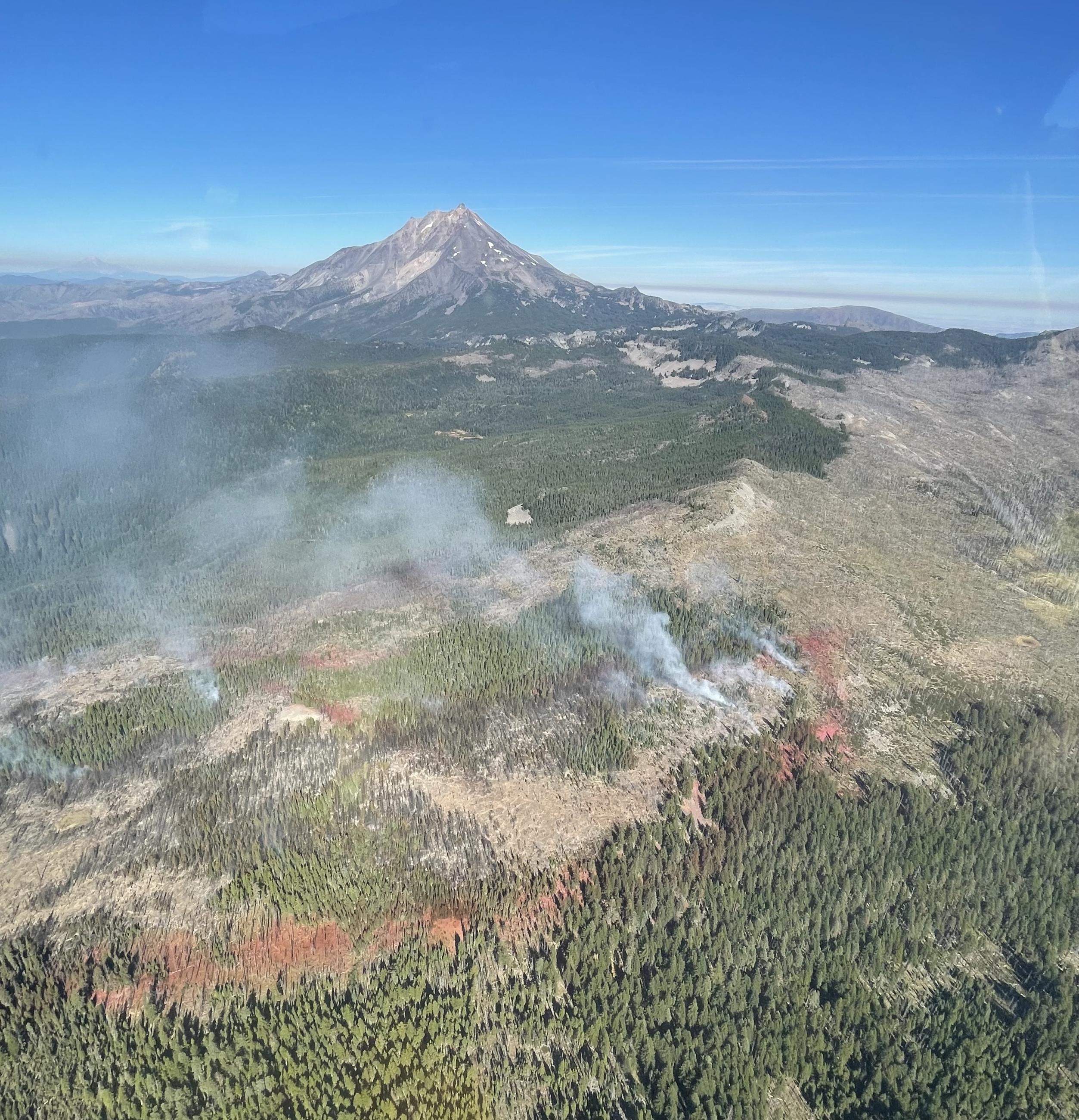
| Location | Bingham Ridge: 2 miles east of Marion Forks and 10 miles south east of Idanha |
| Incident Commander | Michael Waugh, Willamette National Forest* *Command transitioned to Willamette National Forest type 4 team at 6 p.m. Monday, October 14, 2024. Fire information can be obtained at 503-854-3366. |
| Coordinates |
44° 36' 49'' Latitude
-121° 54' 3
'' Longitude
|
| Total Personnel: | 131 |
|---|---|
| Size | 199 Acres |
| Percent of Perimeter Contained | 94% |
| Estimated Containment Date | 10/18/2024 |
| Fuels Involved |
The burn area includes two separate old fire scars (10+ years old) with a heavy fuel loading of standing dead, downed trees, snags, etc. |
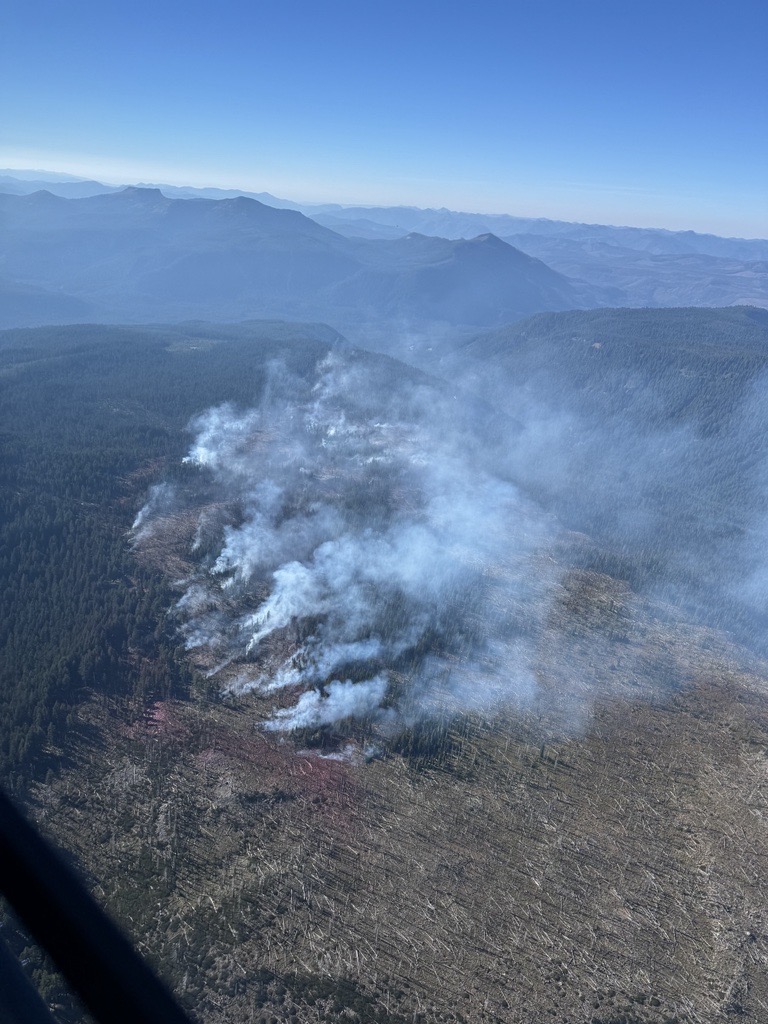
| Significant Events | Minimal fire activity; smoldering fire behavior in larger vegetation, such as stumps and logs. Limited drying will show additional smokes within the interior. |
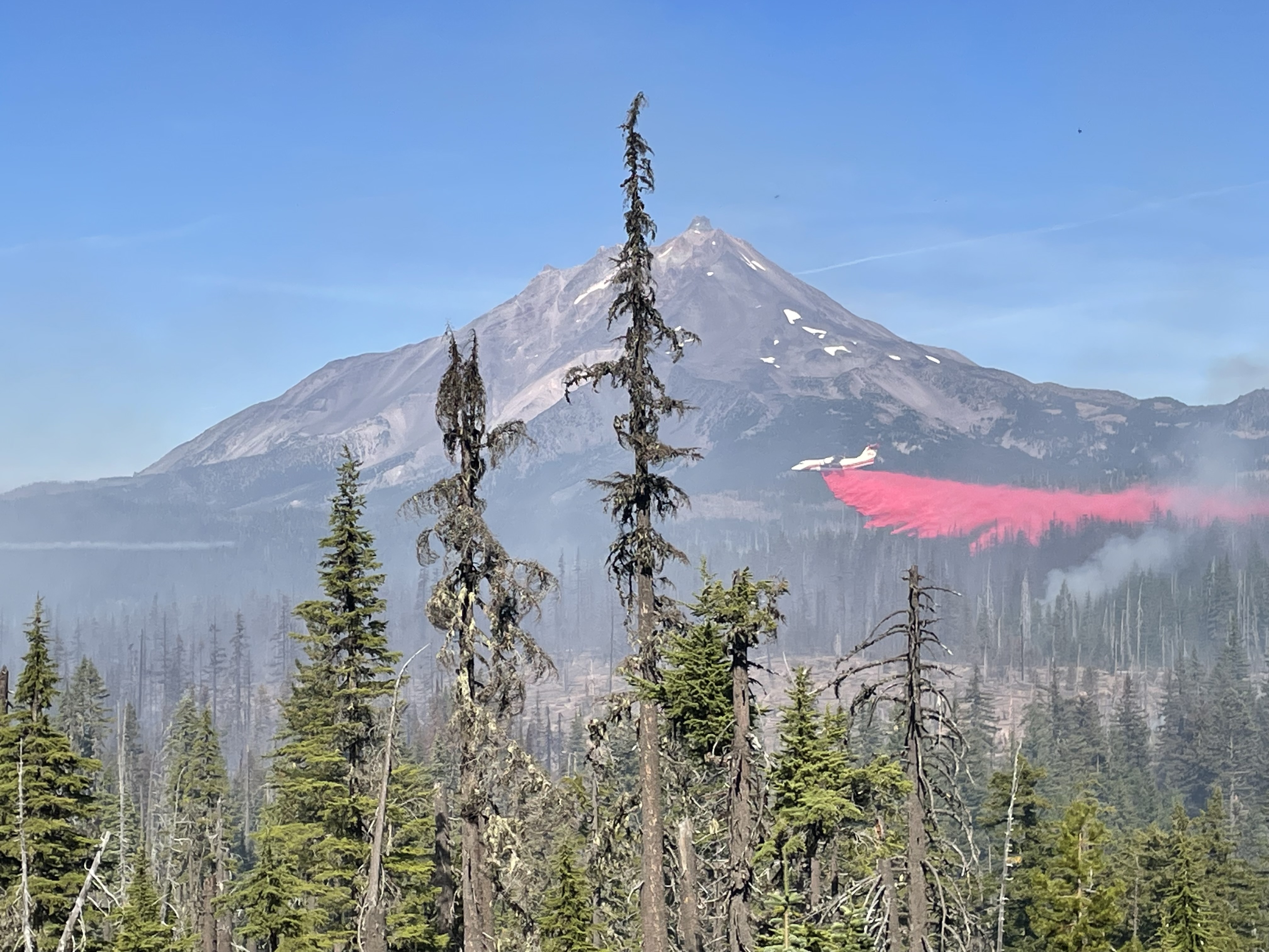
| Planned Actions |
Reinforce containment lines, mop up, and continue hazard tree abatement both within the current perimeter and any trees with potential to threaten containment lines. |
|---|---|
| Projected Incident Activity |
12 hours: Smoldering fire behavior. 48 hours: Smoldering fire behavior. |
| Weather Concerns | No weather concerns through Monday, Oct. 14. A storm system will bring much colder temperatures and periods of rain Tuesday, Oct. 15 into Saturday, Oct. 19. The rain may mix and change to snow Wednesday night, Oct. 16 through Friday morning, Oct. 18. Observed: As of 1 p.m., temperatures were 60 to 65 degrees, relative humidity values were 30 to 35 percent, and winds were varying between south and east-southeast at 2 to 6 mph and gusts to 11 mph. Forecasted: A couple of degrees cooler Monday. There will be a slight chance of light showers late Monday night. Otherwise, a series of storm systems will move into Oregon starting Tuesday and persist into Saturday. These systems will be cold and wet, with the potential for rain changing over to snow in the fire area Wednesday night into Thursday, and then again Thursday night into Friday morning. |
|---|