
Highlighted Activity
Highlighted Media
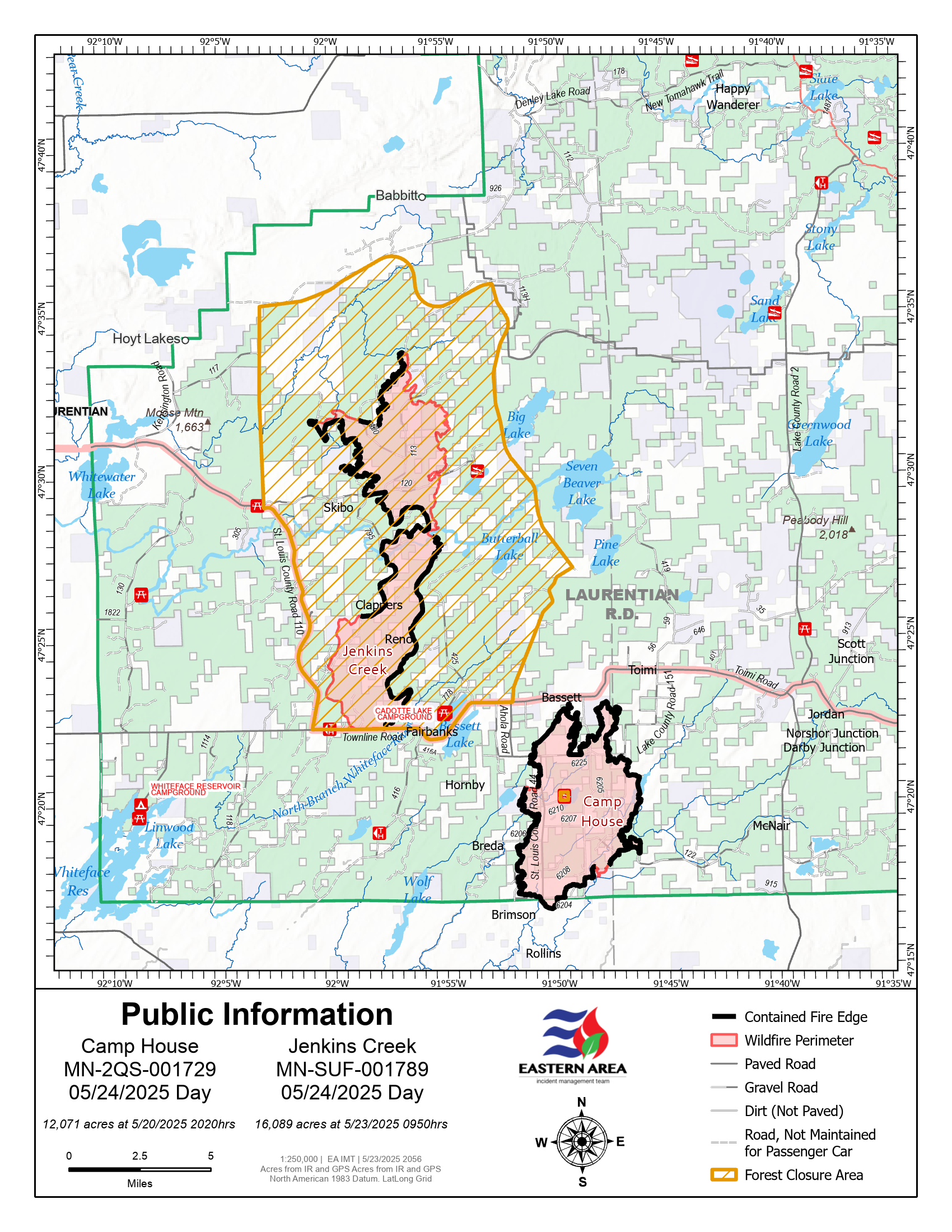
Map of the Camp House and Jenkins Creek Fires for May 24, 2025. The Jenkins Creek Fire (16,089 acres) and Camp House Fire (12,071 acres) are shown with updated perimeters. Forest closure areas are indicated in yellow hatching. Fire containment efforts are ongoing, with crews continuing mop-up, patrol, and suppression repair.
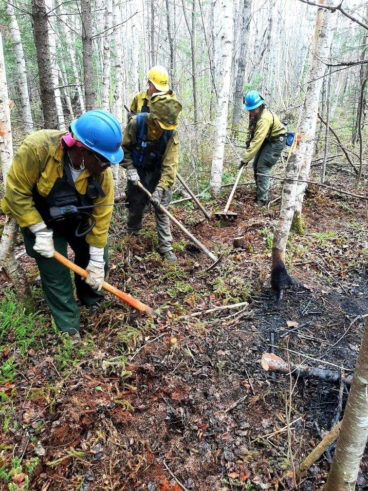
Brimson Complex firefighters construct handline on May 18, 2025.
The Jenkins Creek Fire ignited on Monday, May 12, 2025, around 11:00 a.m. It was detected east of County Road 110 and north of County Road 16 near Jenkins Creek, approximately 15 miles southeast of Hoyt Lakes, Minnesota. The fire rapidly expanded due to hot temperatures, low relative humidity, and strong south winds, burning through mixed boreal forest and grassy ground cover, including areas heavily infested by spruce budworm, which contributed to the fire's intensity.
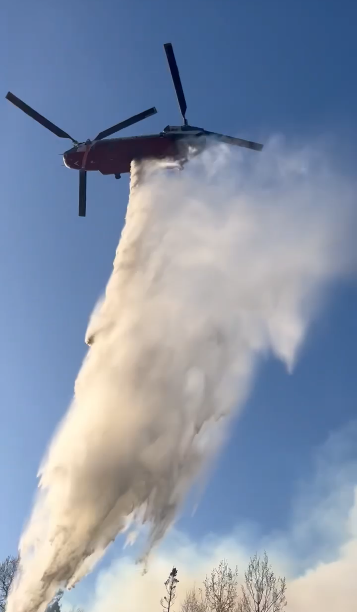
The Eastern Area Complex Incident Management Team, led by Incident Commander Brian Jenkins, took command of the fire on May 14, 2025. In addition to firefighting crews, resources deployed include multiple engines, bulldozers, tracked vehicles, and aerial support. Firefighters are focusing on full suppression tactics, structure protection, and establishing containment lines.
The fire has exhibited extreme behavior, including crown fires and rapid spread through dense forested areas. The presence of dead and dying trees, particularly those affected by spruce budworm infestations, has provided ample fuel for the fire's growth.
Evacuations have been ordered for areas near the fire, including the Cadotte Lake Campground. Several roads, including portions of Forest Highway 11 and Townline Road, are closed due to active fire conditions.
Local communities and organizations are supporting firefighting efforts and assisting displaced residents. Evacuation centers have been established, and donations of food and supplies are being coordinated to aid those affected.
The Jenkins Creek Fire ignited on Monday, May 12, 2025, around 11:00 a.m. It was detected east of County Road 110 and north of County Road 16 near Jenkins Creek, approximately 15 miles southeast of Hoyt Lakes, Minnesota. The fire rapidly expanded due to hot temperatures, low relative humidity, and strong south winds, burning through mixed boreal forest and grassy ground cover, including areas heavily infested by spruce budworm, which contributed to the fire's intensity.
The Eastern Area Complex Incident Management Team, led by Incident Commander Brian Jenkins, took command of the fire on May 14, 2025. In addition to firefighting crews, resources deployed include multiple engines, bulldozers, tracked vehicles, and aerial support. Firefighters are focusing on full suppression tactics, structure protection, and establishing containment lines.
The fire has exhibited extreme behavior, including crown fires and rapid spread through dense forested areas. The presence of dead and dying trees, particularly those affected by spruce budworm infestations, has provided ample fuel for the fire's growth.
Evacuations have been ordered for areas near the fire, including the Cadotte Lake Campground. Several roads, including portions of Forest Highway 11 and Townline Road, are closed due to active fire conditions.
Local communities and organizations are supporting firefighting efforts and assisting displaced residents. Evacuation centers have been established, and donations of food and supplies are being coordinated to aid those affected.
| Current as of | Sat, 05/24/2025 - 11:25 |
|---|---|
| Incident Time Zone | Central Standard Time |
| Incident Type | Wildfire |
| Cause | Undetermined |
| Date of Origin | |
| Incident Time Zone | Central Standard Time |
| Location | 15 miles SE of Hoyt Lakes, MN |
| Incident Commander | Eastern Area Complex Incident Management Team 1 - Brian Jenkins, IC |
| Coordinates |
47° 22' 33'' Latitude
-91° 58' 64
'' Longitude
|
| Total Personnel: | 226 |
|---|---|
| Size | 16,089 Acres |
| Percent of Perimeter Contained | 70% |
| Estimated Containment Date | 06/15/2025 |
| Fuels Involved | Coniferous live fuel moistures remain critically low. Grasses are actively growing and hardwoods are beginning to leaf out, but heavy fuels remain dry and capable of retaining heat, increasing the risk of flare-ups. Extensive patches of dead balsam fir remain due to previous spruce beetle outbreaks. Numerous falling snags have been reported throughout the incident area, posing safety hazards. |
| Significant Events | Strong east winds over the past few days have revealed very few lingering heat sources, as confirmed by daily infrared flights. However, a warmer and drier weather pattern has now set in and is expected to continue for at least the next week. Because of recent cold temperatures, green-up is delayed, and the growing season index is actually declining—meaning that vegetation isn't becoming as lush or moist as usual for this time of year. As a result, any new fire starts could still spread, showing moderate fire behavior. |
| Planned Actions |
Fire crews are actively searching for and extinguishing remaining heat detected by infrared, both inside and outside the fire line. Mop-up and patrol efforts are ongoing. Suppression repair work is starting in cooler areas of the fire, and assessments by the Burned Area Emergency Response (BAER) team will begin soon. |
|---|---|
| Projected Incident Activity |
12 hours: The fire is expected to stay within established lines with little visible smoke. |
| Weather Concerns | Sunny and warmer conditions are expected, with low humidity. There's a slight chance of isolated thunderstorms on Saturday. Overall, a warming and drying trend is forecast to continue through at least the next week. |
|---|