Incident Media Photographs
Could not determine your location.
 Wildfire
 Prescribed Fire
 Burned Area
Response
Burned Area
Response Other
Other
Photographs Gallery
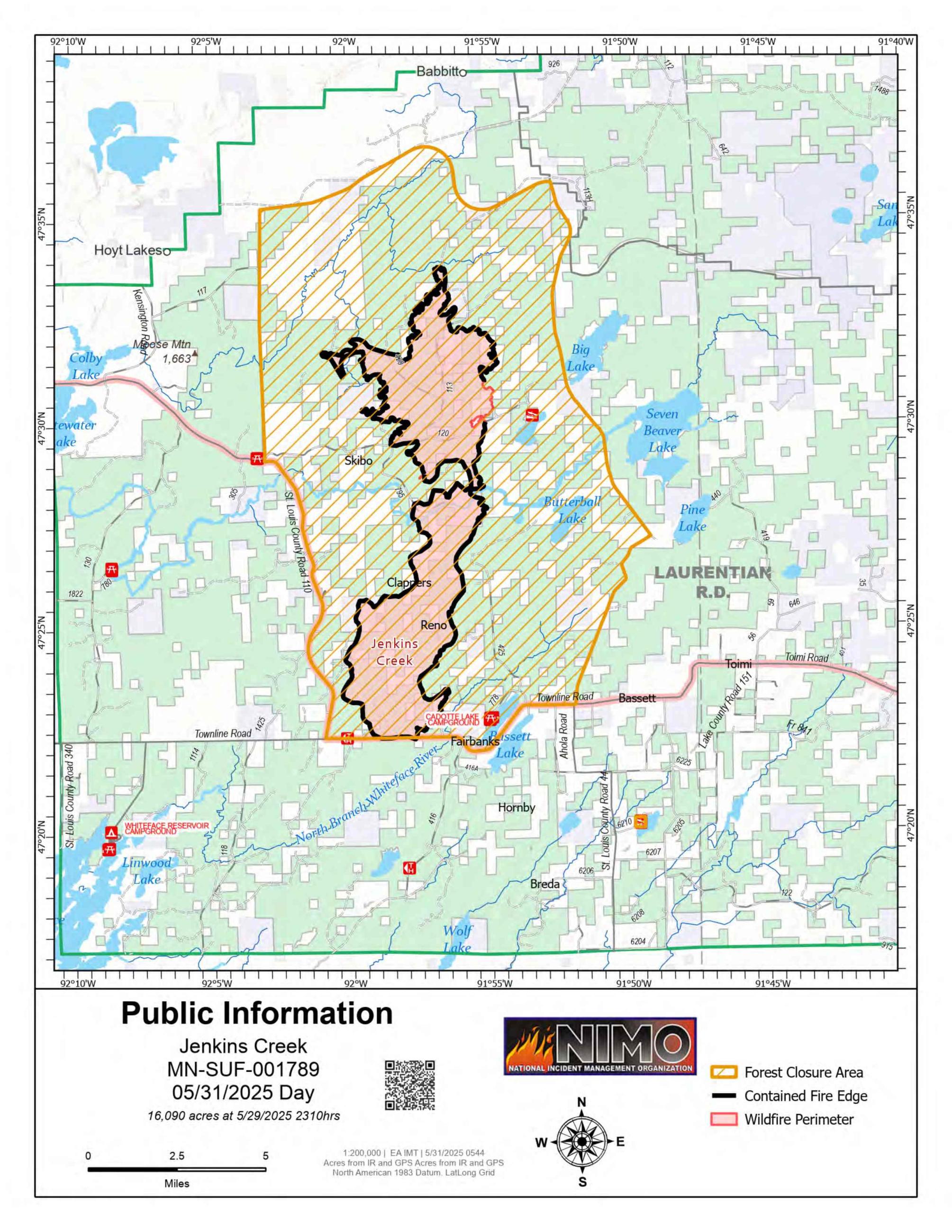
This map shows the current perimeter and containment of the Jenkins Creek Fire in northeastern Minnesota. As of May 31, the fire has burned approximately 16,090 acres. A forest closure area is in effect, and containment lines continue to be established. The National Incident Management Organization (NIMO) Team is coordinating suppression efforts and public safety operations.
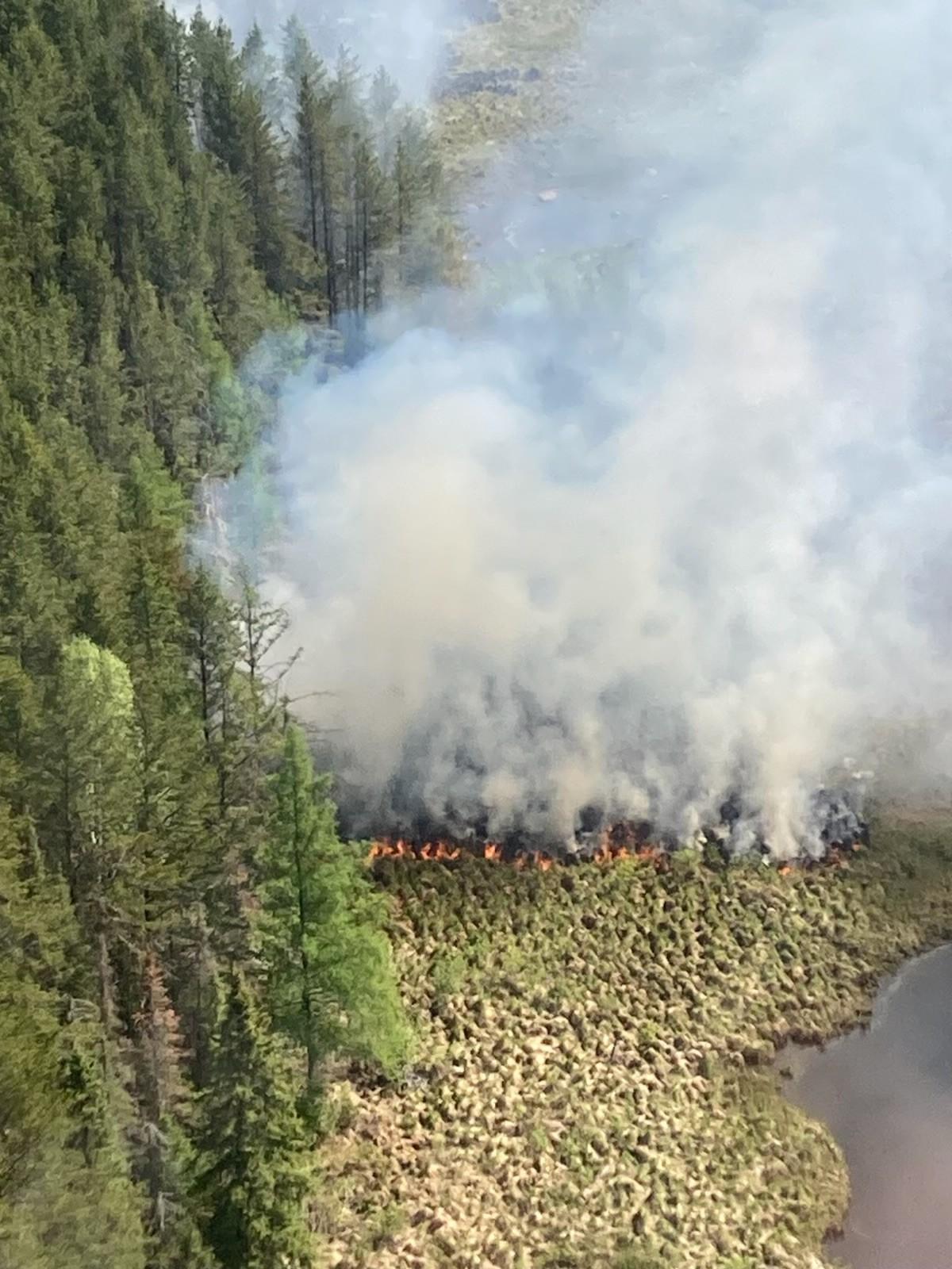
Photo of the spot fire first detected the night of May 28 in the vicinity of Laird Creek on the Jenkins Creek Fire.
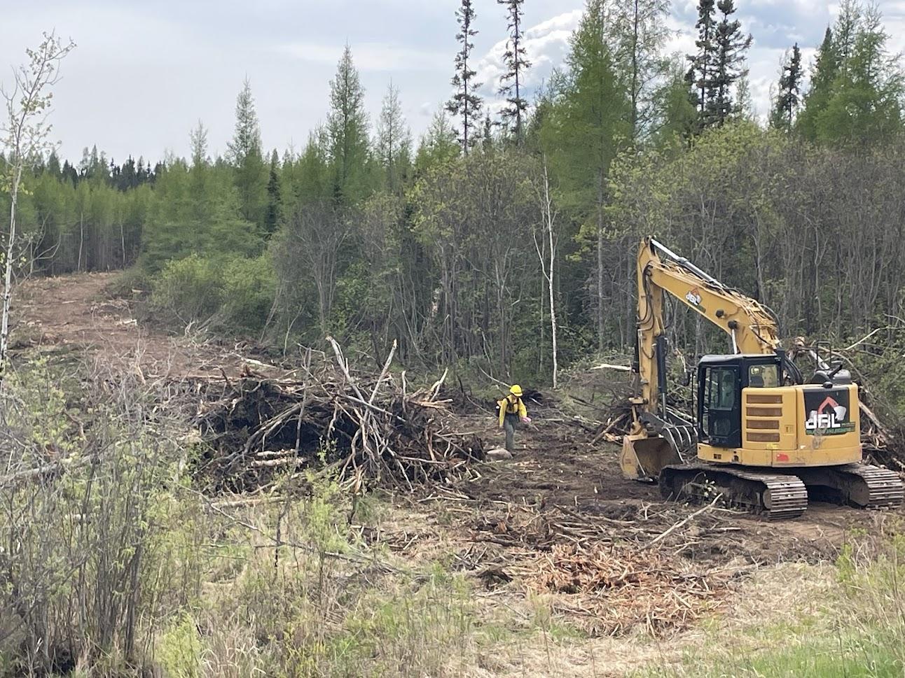
Suppression repair, Dozer Line
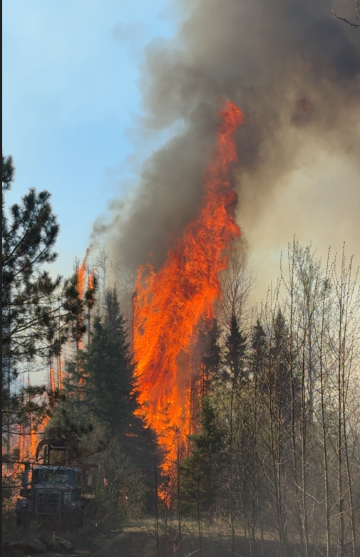
A piece of firefighting equipment is parked in front of a large flame consuming trees.
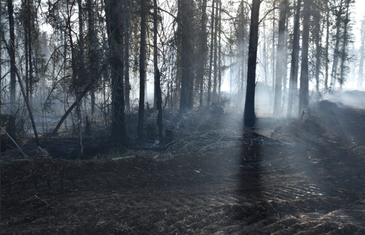
Lingering smoke drifts through fire-damaged timber as crews continue work along a dozer line on the Brimson Complex, May 2025. Hazardous snags and smoldering fuels remain a concern as containment efforts progress.
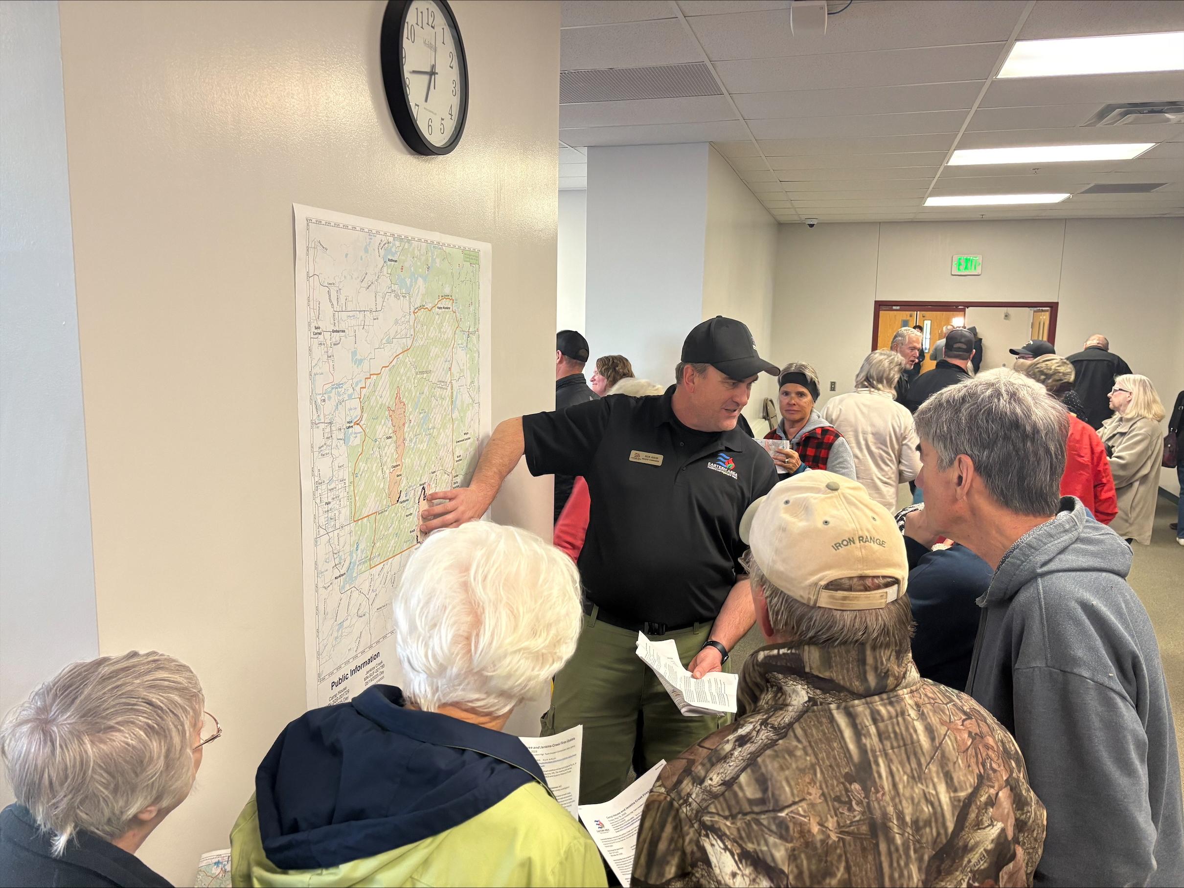
Incident Commander Brian Jenkins points to a map of the Camp House & Jenkins Fires on the wall while talking to a group of four people.
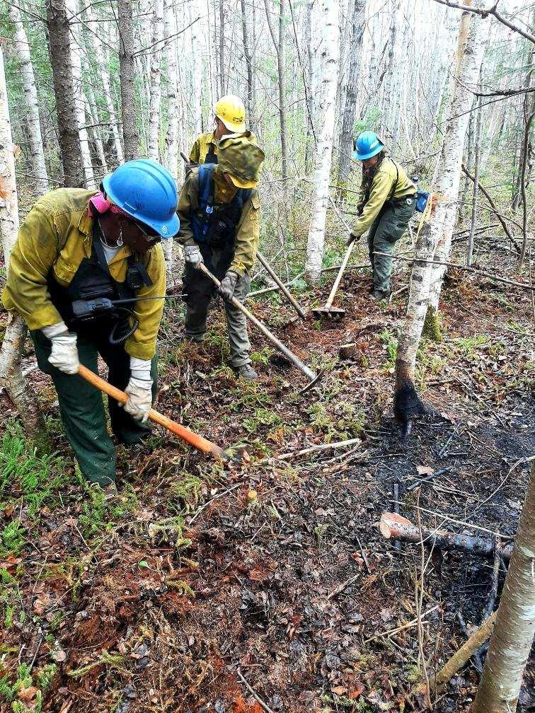
Brimson Complex firefighters construct handline on May 18, 2025.
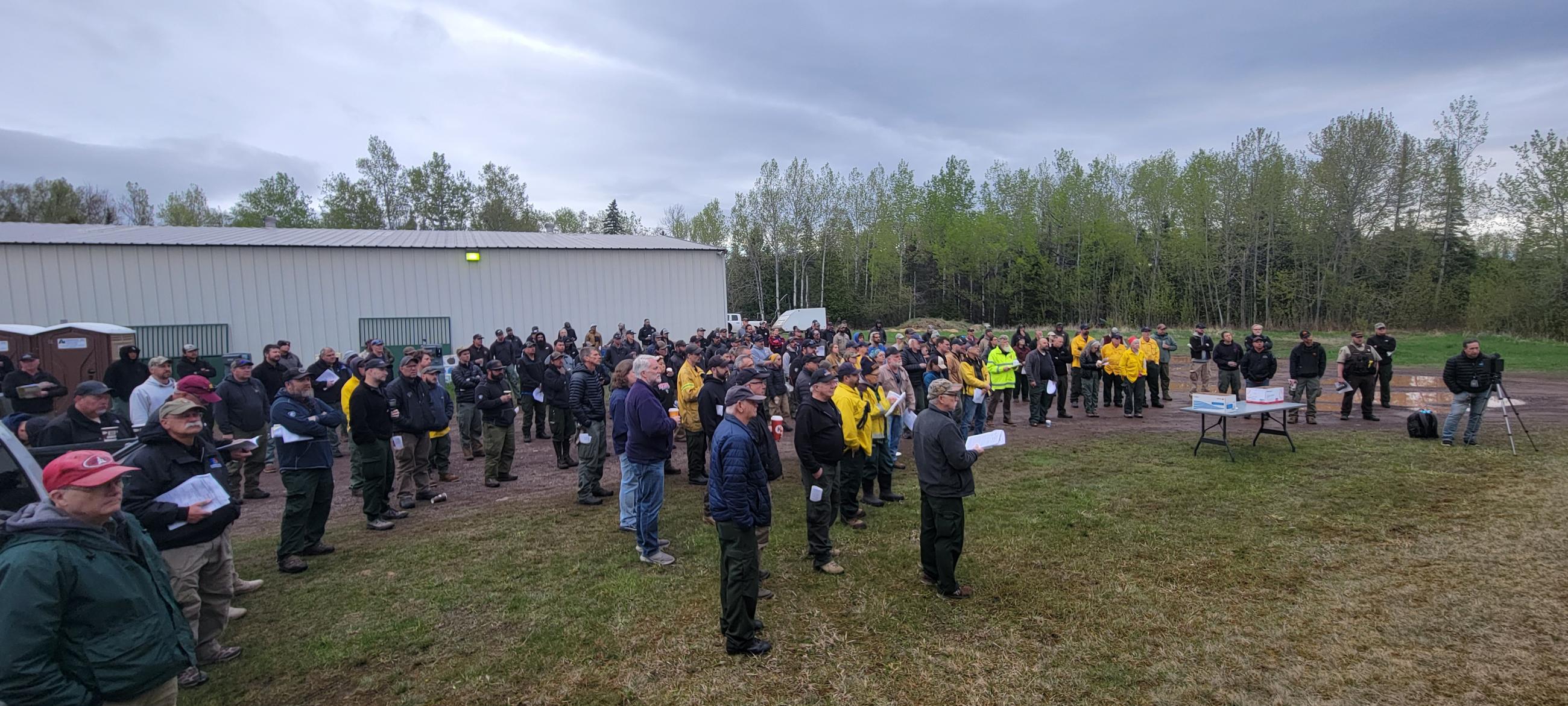
Firefighters stand in attendance for the Camp House & Jenkins Fire Morning Briefing on May 17, 2025

Camp House & Jenkins Fire Community Meeting Announcement for May 19, 2025 at 6:00 pm.
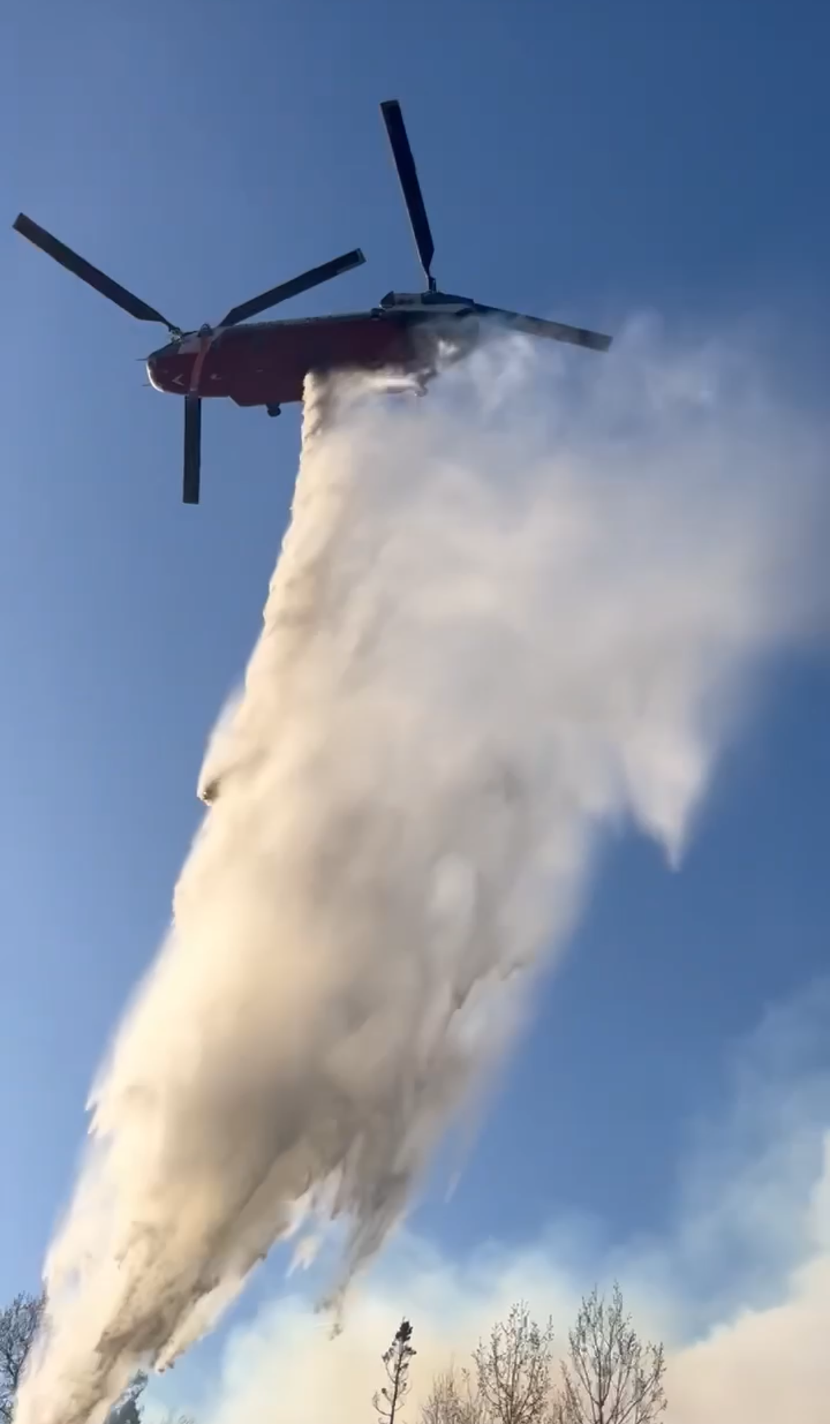
Chinook Helicopter dropping water on the Jenkins Creek Fire -U.S. Forest Service photo by C. Skustad