
Winter 2022 Pile Burning planned near Drake Glenhaven12 30 2022
Related Incident: Arapaho and Roosevelt National Forests Pile Burning
Publication Type: News
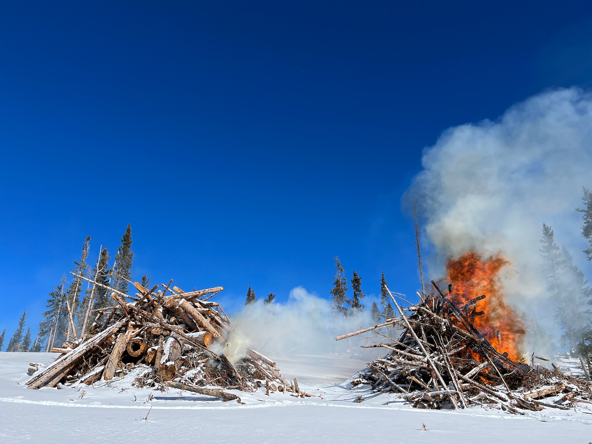
FORT COLLINS, Colo. (Dec. 30, 2022) – Firefighters plan to burn slash piles from multiple fuels reduction and hazardous tree removal projects on the Canyon Lakes Ranger District starting next week, as early as Tuesday, January 3, 2023, as conditions allow. Burning of these piles could take place throughout the upcoming snowy, winter months.
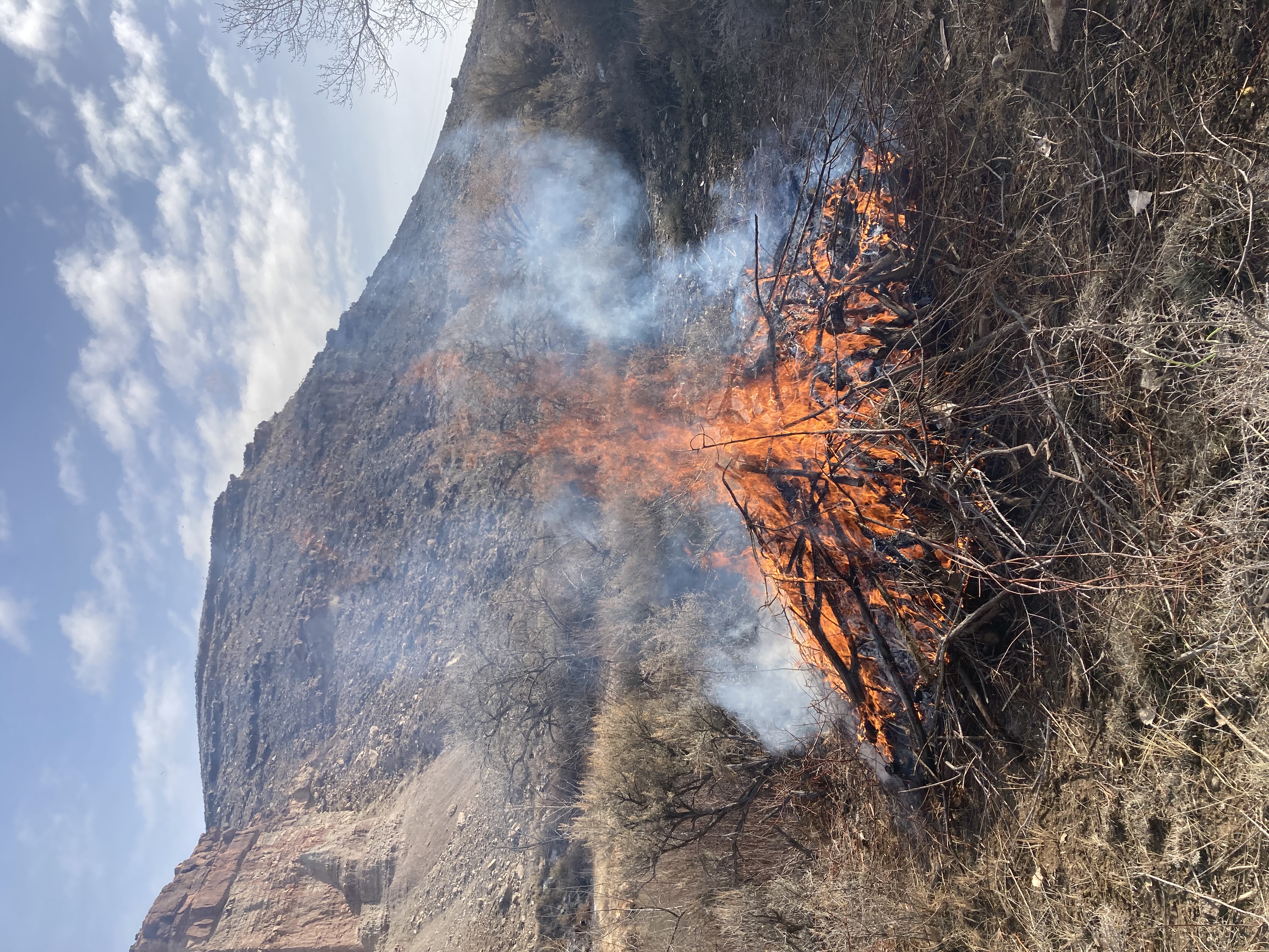
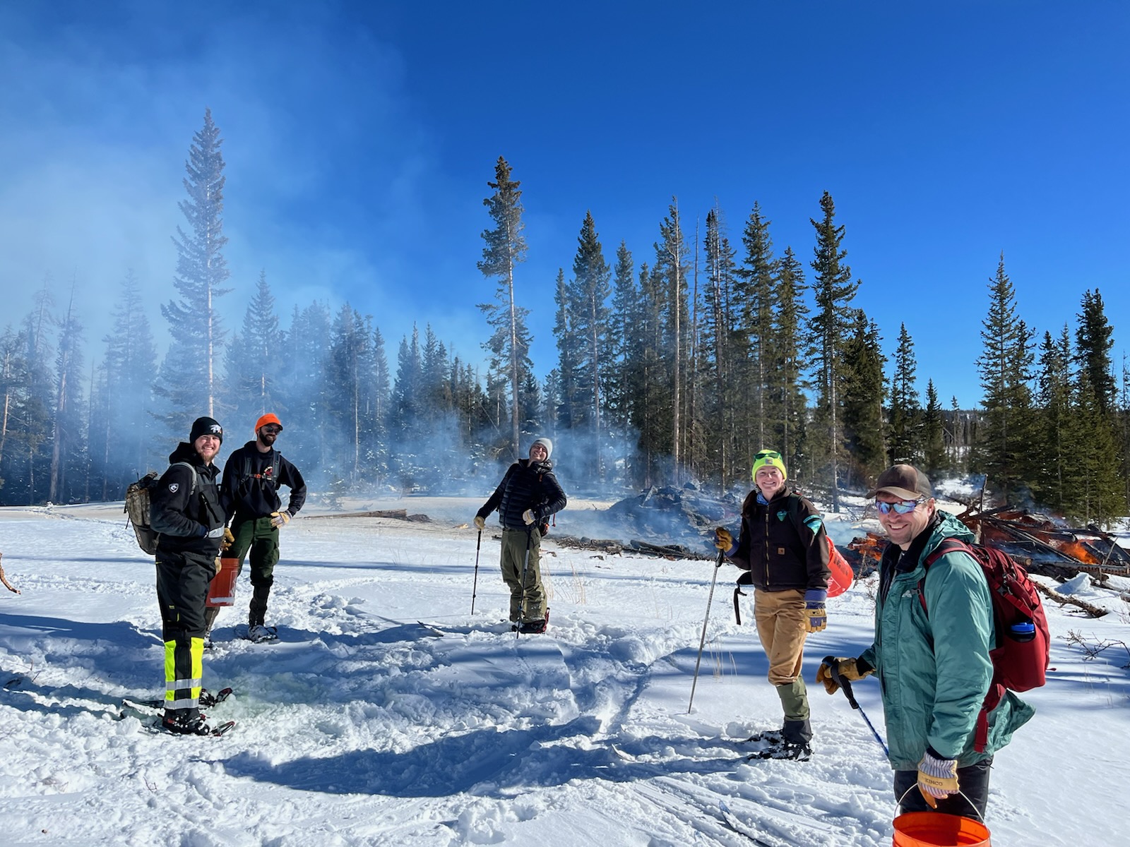
Piles are only ignited under certain conditions, including favorable smoke dispersal and adequate snow cover. These conditions direct firefighters on where within project areas burning can occur due to the localized nature of conditions. Smoke, flames, and glowing embers are often visible, and are a normal part of pile burning operations. This can be visible throughout the night. Moisture, namely snow, helps contain the piles and firefighters monitor the area during and after the burn. Monitoring continues until the piles are considered out. Public and firefighter safety is always the number one priority in burning operations.
Areas that could be burned next week as conditions allow include:
- Cedar Park 1: 10,000 hand piles General Location: Hwy-34 and FSR-128 Storm Mountain Road, near Drake
- Cedar Park 2: 3,780 hand piles General Location: FSR 128 and Cedar Park subdivision, near Drake
- Cedar Park 3: 22,240 hand piles General Location: FSR299 and Cedar Cove Road at Cedar Park subdivision
- Thompson River 5: 6,120 hand piles General Location: Hwy 36 and FSR 124 near Estes Park
- Glen Haven 2: 9,660 hand piles General Location: CR 43 and FSR 433, adjacent to Glen Haven
- Glen Haven 3: 12,340 hand piles General Location: CR43 and FSR 326 adjacent to Glen Haven
- Magic Sky 4: 7,000 hand piles General Location: CR-74E and Red Feather Highlands subdivision, east of Red Feather Lakes
If you would like to receive regular updates about burning in your area and are not already on our email list, please contact Christopher Green at christopher.green2@usda.gov to get added to the district’s email contact list. Information for all pile burning this winter is posted online at https://inciweb.nwcg.gov/incident-information/coarf-arapaho-roosevelt-national-forests-pile-burning. Prescribed fire smoke may affect your health. For more information see https://www.colorado.gov/pacific/cdphe/wood-smoke-and-health.
Current Pile Burning Activity12 29 2022
Related Incident: Arapaho and Roosevelt National Forests Pile Burning
Publication Type: Announcement
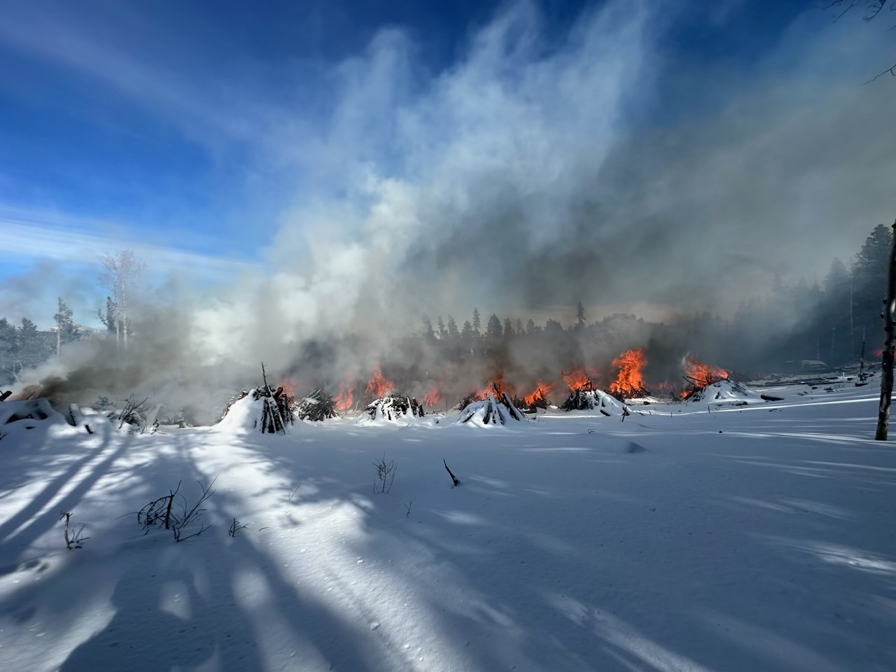
BOULDER, Colo. (Dec. 29, 2022) – Firefighters plan to burn slash piles from multiple fuels reduction and hazardous tree removal projects on the Boulder Ranger District next week, as early as Tuesday, January 3, 2023, as conditions allow. Burning of these piles could take place throughout the upcoming snowy, winter months.
Piles are only ignited under certain conditions, including favorable smoke dispersal and adequate snow cover. These conditions direct firefighters on where within project areas burning can occur due to the localized nature of conditions. Smoke, flames, and glowing embers are often visible, and are a normal part of pile burning operations. This can be visible throughout the night. Moisture, namely snow, helps contain the piles and firefighters monitor the area during and after the burn. Monitoring continues until the piles are considered out. Public and firefighter safety is always the number one priority in burning operations.
Areas that could be burned next week as conditions allow include:
- James Creek Unit M1701: 8,000 hand piles General Location: East of Hwy 72 near Peaceful Valley
- Lump Gulch 18: 250 hand piles General Location: Gilpin County a half-mile north of Rollinsville on west of Hwy 119 Peak to Peak
- Lump Gulch 29, 30: 150 hand piles General Location: Gilpin County west of Lump Gulch Road, 1.5 miles south of Rollinsville on west side of Hwy 119
- Lump Gulch 35: 150 machine piles General Location: Gilpin County south of Gilpin Road, 3 miles south of Rollinsville on west of Hwy 119
- Forsythe II Units 26, 27, 28: 75 Machine Piles General Location: 2 miles north of Rollinsville, just north of Shoshone Road
- Forsythe II Units 9, 10: 75 Machine Piles General Location: 2 miles east of Nederland, north of Magnolia Road, adjacent to FS Trail 606
- Forsythe II Units 6, 9, 11, 102, 103: 2000 hand piles General Location: 2 miles east of Nederland, north of Magnolia Road, adjacent to FS Trail 606 and near the intersection of Magnolia Road and Lazy Z Road
If you would like to receive regular updates about burning in your area and are not already on our email list, please contact Christopher Green at christopher.green2@usda.gov to get added to the district’s email contact list. Information for all pile burning this winter is posted online at https://inciweb.nwcg.gov/incident-information/coarf-arapaho-roosevelt-national-forests-pile-burning. Prescribed fire smoke may affect your health. For more information see https://www.colorado.gov/pacific/cdphe/wood-smoke-and-health.
RX pile burn successful at BLM Gunnison Gorge NCA on Dec 13 2023
Related Incident:
Publication Type: News
Recent precipitation and favorable conditions created an opportunity for firefighters to prescribed burn 5 acres of piles on the BLM Gunnison Gorge National Conservation Area on Dec. 13, 2023. The tamarisk piles burned down, but light smoke might be visible for a couple of days as interior vegetation smolders. Burn unit is located 4 miles east of Delta, Colorado.
For information on prescribed burns, visit the Southwest District BLM Prescribed Fire InciWeb page https://inciweb.nwcg.gov/incident/7852/ and follow us on Twitter https://twitter.com/SWD_Fire and Facebook http://www.facebook.com/BLMMontroseFireUnit.
BLM winter prescribed pile burning planned in Gunnison Gorge National Conservation Area
Related Incident:
Publication Type: News
December 12, 2022
BLM winter prescribed pile burning planned in Gunnison Gorge National Conservation Area
MONTROSE, Colo. – The Bureau of Land Management (BLM) Uncompahgre Field Office plans to conduct prescribed burning of slash piles this winter within the Gunnison Gorge National Conservation Area. This project will assist in the removal of invasive species (tamarisk and Russian olive) and reduce hazardous fuel loading. Pile burning will occur once favorable conditions allow. Burn unit is located along the Gunnison River, 4 miles east of Delta, Colorado.
“The goal of the project is to remove invasive species to regenerate native plant communities in riparian areas and reduce hazardous fuels which pose a wildfire risk to the public and firefighter safety,” said Cameron Shaughnessy, BLM Fire Management Specialist.
The prescribed pile burning may take multiple days to complete once initiated and will be monitored throughout the process to ensure public safety. While smoke may be visible in the area at times, most of the smoke will lift and dissipate during the warmest parts of the day. A detailed burn plan outlines the parameters for prescribed burns.
The BLM obtained smoke permits from the Colorado State Air Pollution Control Division, which identify atmospheric conditions under which the burns can be implemented. Prescribed fire smoke may affect your health. For more information, visit https://www.colorado.gov/pacific/cdphe/wood-smoke-and-health.
For information on prescribed burns, visit the Southwest District BLM Prescribed Fire InciWeb page (https://inciweb.nwcg.gov/incident/7852/) or follow us on Twitter (https://twitter.com/SWD_Fire) and Facebook (http://www.facebook.com/BLMMontroseFireUnit).
The Southwest Colorado BLM District covers the BLM Gunnison Field Office, Uncompahgre Field Office, and Tres Rios Field Office in the Colorado counties of Archuleta, Conejos, Delta, Dolores, Gunnison, Hinsdale, La Plata, Mesa, Mineral, Montezuma, Montrose, Ouray, Rio Grande, Saguache, San Juan, and San Miguel.
The BLM manages more than 245 million acres of public land located primarily in 11 Western states, including Alaska. The BLM also administers 700 million acres of sub-surface mineral estate throughout the nation. The agency’s mission is to sustain the health, diversity, and productivity of America’s public lands for the use and enjoyment of present and future generations. Diverse activities authorized on these lands generated $111 billion in economic output across the country in fiscal year 2020—more than any other agency in the Department of the Interior. These activities supported more than 498,000 jobs.
Current Pile Burning Activity12 09 2022
Related Incident: Arapaho and Roosevelt National Forests Pile Burning
Publication Type: Announcement
GRANBY, Colo. (Dec. 9, 2022) – Firefighters plan to burn slash piles from multiple fuels reduction and hazardous tree removal projects on the Sulphur Ranger District starting Monday and continuing throughout the week as conditions allow.
Areas that could be burned over the following week as conditions allow include:
- Snow Mountain: 20 machine piles General Location: West of Snow Mountain Ranch
- Little HO: 20 machine piles General Location: 6 miles east of Granby
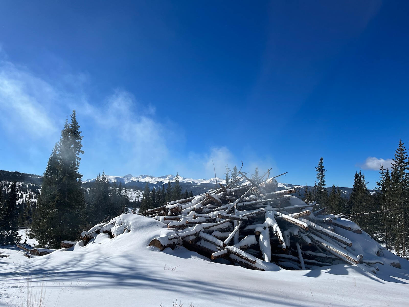
Piles are only ignited under certain conditions, including favorable smoke dispersal and adequate snow cover. These conditions direct firefighters on where within project areas burning can occur due to the localized nature of conditions. Smoke, flames, and glowing embers are often visible, and are a normal part of pile burning operations. This can be visible throughout the night. Moisture, namely snow, helps contain the piles and firefighters monitor the area during and after the burn. Monitoring continues until the piles are considered out. Public and firefighter safety is always the number one priority in burning operations.
Information for all pile burning this winter is posted online at https://inciweb.nwcg.gov/incident-information/coarf-arapaho-roosevelt-national-forests-pile-burning. Prescribed fire smoke may affect your health. For more information see https://www.colorado.gov/pacific/cdphe/wood-smoke-and-health.
BLM Gunnison Field Office Baldy Pine RX Pile Burn accomplished 280 acres on December 8 2022
Related Incident:
Publication Type: News
Yesterday was a beautiful day with great snow cover and blue skies to pile burn on the Baldy Pine Unit on the BLM Southwest District, Gunnison Field Office BLM-administered lands. The crew prescribe burned 28 piles, accomplishing 280 acres of reduced hazardous vegetation removal. The beetle kill lodgepole pine piles are made up of branches and non-salvageable parts of the trees from an old timber sale.
This project area is located approx. 14 miles west of Powderhorn, CO and 4 miles west of Highway 149. Light smoke maybe visible from Hwy 149 and Powderhorn area until the piles burn completely.
For more information about prescribed fire smoke and health impacts, visit https://www.colorado.gov/pacific/cdphe/wood-smoke-and-health.
BLM SWD RX Burn Info, visit: Southwest District BLM Prescribed Fire InciWeb https://inciweb.nwcg.gov/incident/news/7852/ and follow us on Twitter @SWD_Fire and Facebook http://www.facebook.com/BLMMontroseFireUnit.
RX Pile Burn Planned in Baldy Pine Area Gunnison Field Office December 8 2022
Related Incident:
Publication Type: Announcement
#BeAdvised BLM Southwest District loves the recent snow that gives us an opportunity to prescribe burn piles this week on the Gunnison Field Office BLM-administered lands in the Baldy Pine area.
The project area is located approx. 14 miles west of Powderhorn, CO and 4 miles west of Highway 149. If conditions are favorable, piles of beetle kill lodgepole pine slash from a timber sale will be burned on December 8. Smoke maybe visible from Hwy 149 and Powderhorn area.
For more information about prescribed fire smoke and health impacts, visit https://www.colorado.gov/pacific/cdphe/wood-smoke-and-health.
BLM SWD RX Burn Info, visit: Southwest District BLM Prescribed Fire InciWeb https://inciweb.nwcg.gov/incident/news/7852/ and follow us on Twitter @SWD_Fire and Facebook http://www.facebook.com/BLMMontroseFireUnit.
Current Pile Burning Activity12 05 2022
Related Incident: Arapaho and Roosevelt National Forests Pile Burning
Publication Type: Announcement
BOULDER, Colo. (Dec. 5, 2022) – Firefighters plan to burn slash piles from multiple fuels reduction and hazardous tree removal projects on the Boulder Ranger District starting tomorrow and continuing throughout the week as conditions allow. Burning of these piles could take place throughout the upcoming snowy, winter months.
Piles are only ignited under certain conditions, including favorable smoke dispersal and adequate snow cover. These conditions direct firefighters on where within project areas burning can occur due to the localized nature of conditions. Smoke, flames, and glowing embers are often visible, and are a normal part of pile burning operations. This can be visible throughout the night. Moisture, namely snow, helps contain the piles and firefighters monitor the area during and after the burn. Monitoring continues until the piles are considered out. Public and firefighter safety is always the number one priority in burning operations.
Areas that could be burned over the following week as conditions allow include:
- James Creek Unit M1701: 8,000 hand piles General Location: East of Hwy 72 near Peaceful Valley
- Lump Gulch 18: 250 hand piles General Location: Gilpin County a half-mile north of Rollinsville on west of Hwy 119 Peak to Peak
- Lump Gulch 29, 30: 150 hand piles General Location: Gilpin County west of Lump Gulch Road, 1.5 miles south of Rollinsville on west side of Hwy 119
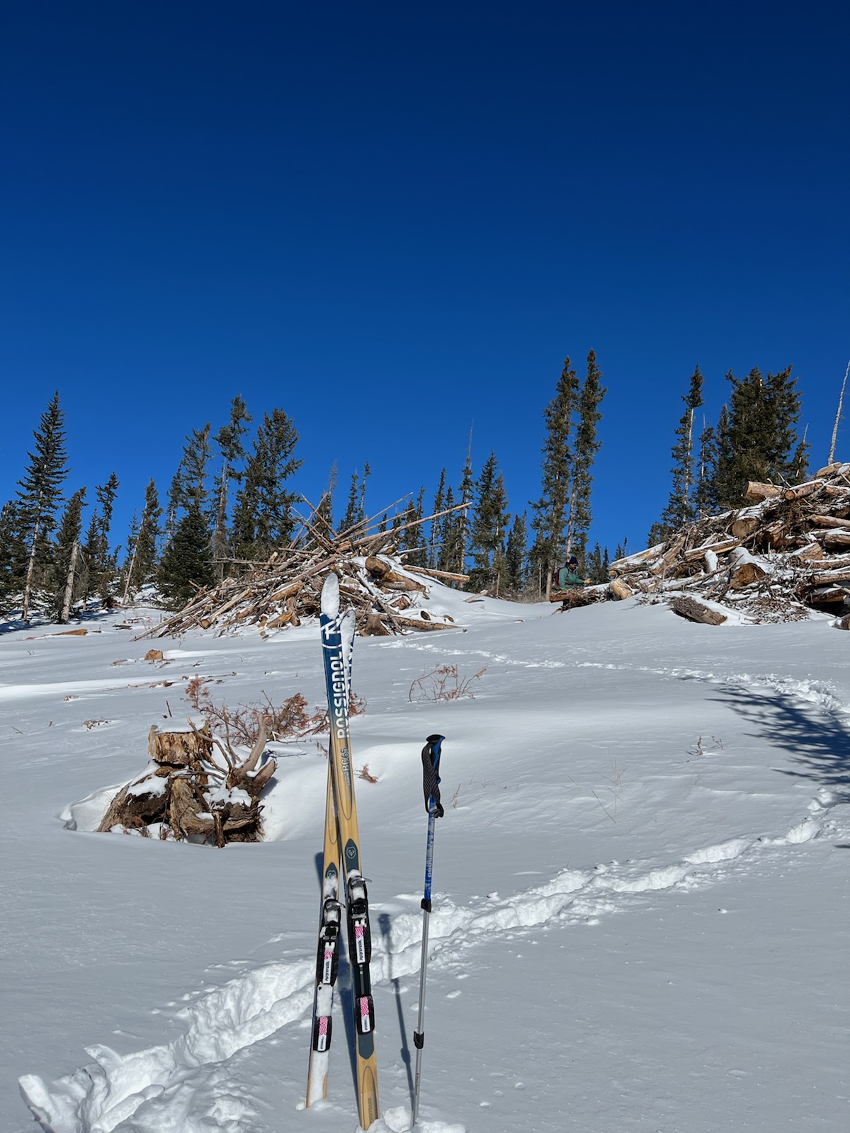
Typically crews are permitted to burn as many as 250 to 1,000 smaller hand piles a day at each location if conditions are met, which includes a minimum of three inches of snow cover, and one to 40 larger machine piles could be burned a day with a minimum of six inches of snow.
If you would like to receive regular updates about burning in your area and are not already on our email list, please contact Chris Green at Christopher.green2@usda.gov to get added to the district’s email contact list and information for all pile burning this winter is posted online at https://inciweb.nwcg.gov/incident-information/coarf-arapaho-roosevelt-national-forests-pile-burning. Prescribed fire smoke may affect your health. For more information see https://www.colorado.gov/pacific/cdphe/wood-smoke-and-health.
Umatilla National Forest Pile Burning Dec 6 2022
Related Incident: 2023 Umatilla NF Prescribed Fire
Publication Type: News
The Umatilla National Forest will continue to conduct pile burning operations over the next few weeks in various locations across the Forest. Visitors may see smoke from these operations and are encouraged to use caution if approaching an active pile burn. Roads and areas surrounding pile burning activity will be signed.
All burns will be monitored until a season ending rain or snow event occurs.
Additional information about pile burning activities will be posted at https://bluemtnprescribedfire.blogspot.com/
Pile burning this week:
- The Heppner Ranger District will be pile burning along Forest Service Road (FSR) 25.
Current Pile Burning Activity12 05 2022
Related Incident: Arapaho and Roosevelt National Forests Pile Burning
Publication Type: Announcement
GRANBY, Colo. (Dec. 5, 2022) – Firefighters plan to burn slash piles from multiple fuels reduction and hazardous tree removal projects on the Sulphur Ranger District starting today and continuing throughout the week as conditions allow. Burning of these piles could take place throughout the upcoming snowy, winter months.
Piles are only ignited under certain conditions, including favorable smoke dispersal and adequate snow cover. These conditions direct firefighters on where within project areas burning can occur due to the localized nature of conditions. Smoke, flames, and glowing embers are often visible, and are a normal part of pile burning operations. This can be visible throughout the night. Moisture, namely snow, helps contain the piles and firefighters monitor the area during and after the burn. Monitoring continues until the piles are considered out. Public and firefighter safety is always the number one priority in burning operations.
Areas that could be burned over the following week as conditions allow include:
- High Lonesome: 75 hand piles General Location: FSR 129, W of Meadow Creek Reservoir
- Kawland Unit 90: 20 machine piles, 400 hand piles General Location: Between Vasquez and East Elk Creeks on FSR 159, West of Winter Park Resort
Typically crews are permitted to burn as many as 250 to 1,000 smaller hand piles a day at each location if conditions are met, which includes a minimum of three inches of snow cover, and one to 40 larger machine piles could be burned a day with a minimum of six inches of snow.
If you would like to receive regular updates about burning in your area and are not already on our email list, please contact Chris Green at Christopher.green2@usda.gov to get added to the district’s email contact list and information for all pile burning this winter is posted online at https://inciweb.nwcg.gov/incident-information/coarf-arapaho-roosevelt-national-forests-pile-burning. Prescribed fire smoke may affect your health. For more information see https://www.colorado.gov/pacific/cdphe/wood-smoke-and-health.