
Bighorn Fire Morning Update Friday June 26
Related Incident:
Publication Type: News
Bighorn Fire Morning Update, June 26, 2020
Northern Rockies Incident Management Team
Mike Goicoechea, Incident Commander
Bighorn Fire Info: (520) 329-7439 & (520) 276-8981, 8AM-8PM
Media Phone Line: (520) 329-7640, 8AM-8PM
Website: https://inciweb.nwcg.gov/incident/6741/
Facebook: https://www.facebook.com/bighornfireinfo
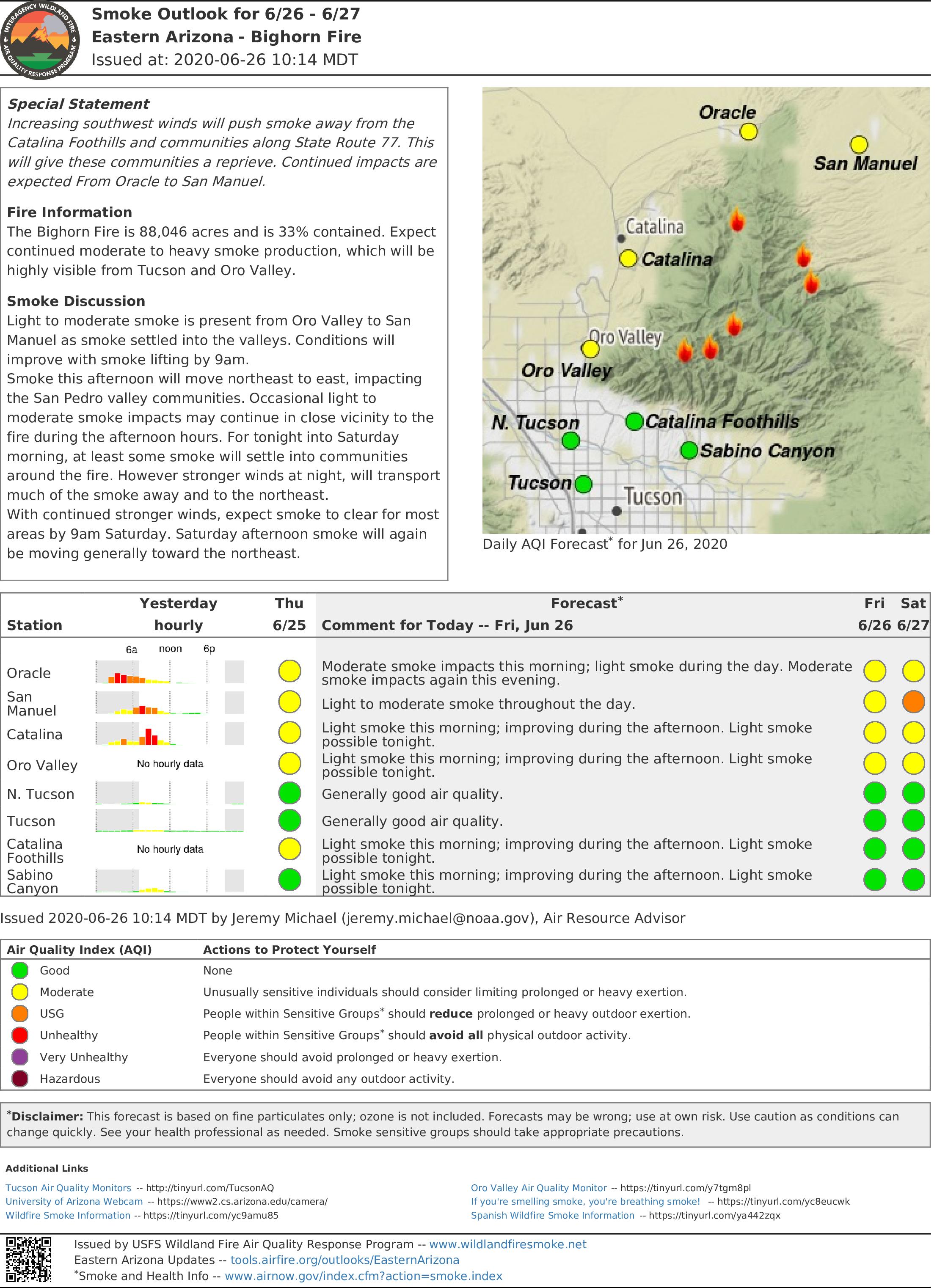
Smoke: https://wildlandfiresmoke.net/outlooks/EasternArizona
Burned Area Response: https://inciweb.nwcg.gov/incident/6796/
Incident Statistics
Location: Santa Catalina Mountains
Size: 88,046 acres
Containment: 33%
Date detected: June 5, 2020
Cause: Lightning
Injuries: 7 minor
Estimated cost: $25.2 MM
Resources: 24 Hand Crews, 6 Dozers, 87, 10 Water-tenders, 10 Helicopters, 1,196 Total Personnel
Weather: It will be a hot, dry and windy day. Fire activity will increase early in the day due to higher winds. High temperatures 88 degrees in the mountains, 106 in the valley. West-southwest winds 14-18 mph with gusts to 30 mph.
Yesterday’s Activity: Yesterday, humidity reached the lowest levels of the season and the fire was very active near Magee Creek, Green Mountain, and Maverick Spring. During the day, crews focused on holding the fire. Overnight, burnout operations were conducted to improve the fireline near Palisades and Willow Canyon. Hold and mop up operations were east of Biosphere, southwest of Oracle, and east of Saddlebrook along Baby Jesus Trail. On the east side of the fire, dozers constructed contingency line by connecting old road systems in the Davis Spring Road area. Fire behavior was fairly quiet in Sabino Canyon yesterday and helicopters delivered bucket drops to hot spots.
Today’s Activities: Priority will be focused on holding, improving, and mopping up from yesterday’s burnout operations in anticipation of increasing winds today into the weekend. Contingency line construction will continue along the east side of the fire as a buffer against the Burro fire scar. Firefighters will improve the firelines around Palisades and Willow Canyon following last night’s burning operations. Sabino, Rattlesnake, and Bird canyons will be closely monitored as fire activity continues to decrease. Two structural protection groups will provide coverage in the Summerhaven and Saddlebrook areas. South of Oracle, the north side of the fire will be in mop up and patrol status. An initial attack group will be available for new fire starts.
Virtual public meeting tonight at 8 PM at Bighorn Fire Info https://www.facebook.com/bighornfireinfo.
Evacuation Notices: Visit pima.gov/bighorn or pinalcountyaz.gov/emergencymanagement
GO - Evacuate
Mt. Bigelow & Lower Soldier HOA
Community of Summerhaven
Willow Canyon
Lower Catalina Highway/Lower Mt. Lemmon Communities from Organization Ridge Road to South Willow Canyon
SET – Be Alert
Community of Oracle
Portions of East Golder Ranch
Catalina Foothills between Alvernon Way and Sabino Canyon Road, north of Skyline Drive
Peppersauce Canyon to Highjinks Road and Campo Bonito
READY – Prepare Now
Oro Valley area from Catalina State Park south to Magee Road
Catalina foothills areas from First Avenue to Alvernon Way
Sign up to receive emergency alerts at myalerts.pima.gov or pinalcountyaz.gov/emergencymanagement.
A temporary flight restriction is in place over the fire area. If you fly, we can’t. knowbeforeyoufly.org.
Closures: Sabino Canyon, Bear Canyon, and Catalina State Park are closed. Closures and maps at inciweb.nwcg.gov/incident/closures/6741/. Catalina Highway is closed to the public at milepost zero. Oracle Control Road is closed.
National Forest conditions: https://www.fs.usda.gov/alerts/coronado/alerts-notices
Bighorn Fire June 25 2020 Evening Update
Related Incident:
Publication Type: News
Bighorn Fire Update
June 25, 2020 Evening Update
Northern Rockies Incident Management Team
Mike Goicoechea, Incident Commander
Bighorn Fire Info: (520) 329-7439 & (520) 276-8981, 8AM-8PM
Website: https://inciweb.nwcg.gov/incident/6741/
Facebook: https://www.facebook.com/bighornfireinfo
Smoke: https://wildlandfiresmoke.net/outlooks/EasternArizona
Burned Area Response: https://inciweb.nwcg.gov/incident/6796/
Incident Statistics
Location: Santa Catalina Mountains
Size: 81,702 acres
Containment: 33%
Date Detected: June 5
Cause: Lightning
Resources: 24 Hand Crews, 87 Engines, 10 Helicopter, 6 Dozers, 10 Water Tenders, 1,196 Personnel
Injuries: 7 minor
Estimated Cost: $25.2 million
Weather: Low temperatures of 6O in the mountains and 77 in the valley are forecasted tonight. West-southwest ridge winds will be 15-20 mph.
Today’s Activity: In the Summerhaven area, crews provided structure protection, held, and improved containment lines. The fire was active near Maverick Spring and Green Mountain about 1¼ miles northeast of Willow Canyon. Burnout operations were conducted to improve containment 1 mile east of Biosphere and 4 miles southwest of Oracle. Hotshot crews performed burnout operations to clean up fireline along Baby Jesus Trail 3 miles northeast of Catalina State Park. On the east side of the fire, dozers constructed contingency fireline in the Davis Spring Road area. Fire behavior was fairly quiet in Sabino Canyon today as helicopters performed bucket drops on several hot spots.
Tonight’s Activities: Firing operations are planned south of Biosphere 2 and east of Saddlebrook. This work is being conducted to remove unburned fuels and secure the area before winds move into the area Friday and this coming weekend. In the Summerhaven and Willow Canyon areas, ground resources are prepared to respond if the active fire in Maverick Canyon and Green Mountain threatens values at risk. Firefighters will monitor the fire in Sabino Canyon. Structural protection and ground resources are available to respond in the foothills if necessary. The northeast and southwest sides of the fire will be patrolled.
Virtual public meeting tonight at 8 PM at Bighorn Fire Info https://www.facebook.com/bighornfireinfoEvacuation Notices: Visit pima.gov/bighorn or pinalcountyaz.gov/emergencymanagement
GO – Evacuate
Mount Bigelow and Lower Soldier HOA
Community of Summerhaven
Willow Creek
Lower Catalina Highway/ Lower Mt. Lemmon Communities from Organization Ridge Road to South Willow Canyon
SET – Be Alert
Community of Oracle
Portions of East Golder Ranch
Catalina foothills between Alvernon Way and Sabino Canyon Road, north of Skyline Road
Peppersauce Canyon to Highjinks Road and Campo Bonito
READY – Prepare Now
Oro Valley area from Catalina State Park south to Magee Road
Catalina foothills area from First Avenue to Alvernon Way
Sign up to receive emergency alerts at myalerts.pima.gov or pinalcountyaz.gov/emergencymanagement.
A temporary flight restriction is in place over the fire area. If you fly, we can’t. knowbeforeyoufly.org.
Closures: Sabino Canyon, Bear Canyon, and Catalina State Park are closed.
Closures and maps at inciweb.nwcg.gov/incident/closures/6741/.
Catalina Highway is closed to the public at milepost zero.
Oracle Control Road is closed.
National Forest conditions: https://www.fs.usda.gov/alerts/coronado/alerts-notices
Gusty Winds and Lightning May Cause New Wildfires Saturday through Tuesday
Related Incident:
Publication Type: Announcement
The National Weather Service warns that isolated to scattered thunderstorms may occur in the Tucson area, Saturday through Tuesday.
Isolated to scattered thunderstorms are expected Saturday through Tuesday, mainly during the
afternoon and evening hours and mostly from Tucson eastward. The main concern will be gusty and
erratic outflow winds and lightning that could ignite new wildfires. Gusts could exceed 40 mph.
Brief downpours are possible with these storms but rain amounts will generally remain low.
Best potential for thunderstorms will be in Santa Cruz, Cochise County and the White Mountains. The Tucson
Metro area will be on the western edge of any thunderstorm threat.
Outside of thunderstorm areas, gusty afternoon winds will continue across all of southeast Arizona into
next week.
Slightly cooler temperatures this weekend into early next week.
For the latest forecast updates, visit www.weather.gov/tucson
Bighorn Fire Morning Update Thursday June 25
Related Incident:
Publication Type: News
Bighorn Fire Morning Update, June 25, 2020
Northern Rockies Incident Management Team
Mike Goicoechea, Incident Commander
Bighorn Fire Info: (520) 329-7439 & (520) 276-8981, 8AM-8PM
Media Phone Line: (520) 329-7640, 8AM-8PM
Website: https://inciweb.nwcg.gov/incident/6741/
Facebook: https://www.facebook.com/bighornfireinfo
Smoke: https://wildlandfiresmoke.net/outlooks/EasternArizona
Burned Area Response: https://inciweb.nwcg.gov/incident/6796/
Incident Statistics
Location: Santa Catalina Mountains
Size: 81,702 acres
Containment: 33%
Date detected: June 5, 2020
Cause: Lightning
Resources: 22 Hand Crews, 6 Dozers, 79 Engines, 10 Water-tenders, 10 Helicopters, 1,072 Total Personnel
Injuries: 7 minor
Estimated cost $24.4 MM
Weather: Weather is expected to be hot and dry today and continue through Friday. Winds along ridges are expected to increase to 15-20 mph this afternoon. Winds speeds are predicted to be in this range through Friday.
Yesterday’s Activity: Crews prioritized structure protection and fireline reinforcement in Summerhaven and Willow Canyon areas. Firing operations were conducted off the Catalina Highway near Spencer Peak, the Charouleau Gap area east of Saddlebrook and southeast of Biosphere 2.
Today’s Activities: In the Summerhaven area, crews will mop up and hold containment lines and focus on structure protection. Fireline off the Catalina Highway near Spencer Peak and Spencer Canyon will be improved. Crews will continue firing operations to extend the containment line south from Biosphere 2. The fire backing off Samaniego Ridge will be monitored. Crews will scout for contingency line opportunities if needed east of the fire off of Davis Spring Road. Medium and heavy helicopter bucket drops will be used to slow fire spread and limit fire intensity in Sabino Canyon. Firefighters in Sabino Canyon will direct helicopter bucket drops and scout for areas to safely engage the fire. The fireline south of Oracle will be held and improved today. An initial attack group is available to respond to new fire starts in the area.
Virtual public meeting tonight at 8 PM at Bighorn Fire Info https://www.facebook.com/bighornfireinfo.
Evacuation Notices: Visit pima.gov/bighorn or pinalcountyaz.gov/emergencymanagement
GO - Evacuate
Mt. Bigelow & Lower Soldier HOA
Community of Summerhaven
Willow Canyon
Lower Catalina Highway/Lower Mt. Lemmon Communities from Organization Ridge Road to South Willow Canyon
SET – Be Alert
Community of Oracle
Portions of East Golder Ranch
Catalina Foothills between Alvernon Way and Sabino Canyon Road, north of Skyline Drive
Peppersauce Canyon to Highjinks Road and Campo Bonito
READY – Prepare Now
Oro Valley area from Catalina State Park south to Magee Road
Catalina foothills areas from First Avenue to Alvernon Way
Sign up to receive emergency alerts at myalerts.pima.gov or pinalcountyaz.gov/emergencymanagement.
A temporary flight restriction is in place over the fire area. If you fly, we can’t. knowbeforeyoufly.org.
Closures: Sabino Canyon, Bear Canyon, and Catalina State Park are closed. Closures and maps at inciweb.nwcg.gov/incident/closures/6741/. Catalina Highway is closed to the public at milepost zero. Oracle Control Road is closed.
National Forest conditions: https://www.fs.usda.gov/alerts/coronado/alerts-notices
Bighorn Fire June 24 2020 Evening Update
Related Incident:
Publication Type: News
Bighorn Fire Update
June 24, 2020 Evening Update
Northern Rockies Incident Management Team
Mike Goicoechea, Incident Commander
Bighorn Fire Info: (520) 329-7439 & (520) 276-8981, 8AM-8PM
Media Phone Line: (520) 329-7640, 8AM-8PM
Website: https://inciweb.nwcg.gov/incident/6741/
Facebook: https://www.facebook.com/bighornfireinfo
Smoke: https://wildlandfiresmoke.net/outlooks/EasternArizona
Burned Area Response: https://inciweb.nwcg.gov/incident/6796/
Incident Statistics – Last Updated 06/23 Evening
Incident Statistics
Location: Santa Catalina Mountains
Size: 74,547 acres
Containment: 33%
Date Detected: June 5
Cause: Lightning
Resources: 22 Hand Crews, 79 Engines, 13 Helicopter, 6 Dozers, 10 Water Tenders, 1072 Personnel
Injuries: 7 minor
Estimated Cost: $24.4 million
Weather: Low humidities tonight with warm temperatures and ridgetop winds 10 -15 mph.
Today’s Activity: With today’s high temperatures, fire behavior was active. Smoke columns and flames were visible across the burn area. Crews prioritized structure protection and fireline reinforcement in Summerhaven and Willow Canyon areas. Aerial resources successfully slowed fire spread and reduced fire intensity in the west fork of Sabino, Bird, and Rattlesnake canyons. Aerial firing operations in the Charouleau Gap area four miles east of Saddlebrook started around 5 pm.
Tonight’s Activities: Firing operations to increase containment are planned off the Catalina Highway near Spencer Peak and Spencer Canyons one mile east of Summerhaven. Aerial firing operations in the Charouleau Gap area four miles east of Saddlebrook will continue into the evening and night shift crews will patrol the area once operations are complete. Firing operations to reinforce fireline will also be conducted near Dodge Wash, two miles south of Oracle. Tonight, engines will patrol the Ventana, Esperero, Bird, Rattlesnake, and Sabino canyon foothills.
Virtual public meeting tonight at 8 PM at Bighorn Fire Info https://www.facebook.com/bighornfireinfoEvacuation Notices: Visit pima.gov/bighorn or pinalcountyaz.gov/emergencymanagement
GO – Evacuate
Mount Bigelow and Lower Soldier HOA
Community of Summerhaven
Willow Creek
Lower Catalina Highway/ Lower Mt. Lemmon Communities from Organization Ridge Road to South Willow Canyon
SET – Be Alert
Community of Oracle
Portions of East Golder Ranch|
Catalina foothills between Alvernon Way and Sabino Canyon Road, north of Skyline Road
Peppersauce Canyon to Highjinks Road and Campo Bonito
READY – Prepare Now
Oro Valley area from Catalina State Park south to Magee Road
Catalina foothills area from First Avenue to Alvernon Way
Sign up to receive emergency alerts at myalerts.pima.gov or pinalcountyaz.gov/emergencymanagement.
A temporary flight restriction is in place over the fire area. If you fly, we can’t. knowbeforeyoufly.org.
Closures: Sabino Canyon, Bear Canyon, and Catalina State Park are closed. Closures and maps at inciweb.nwcg.gov/incident/closures/6741/. Catalina Highway is closed to the public at milepost zero. Oracle Control Road is closed.
National Forest conditions: https://www.fs.usda.gov/alerts/coronado/alerts-notices
###
Bighorn Fire Morning Update June 24 2020
Related Incident:
Publication Type: News
Bighorn Fire Morning Update – June 24, 2020
Northern Rockies Incident Management Team
Mike Goicoechea, Incident Commander
Bighorn Fire Info: (520) 329-7439 & (520) 276-8981, 8AM-8PM
Media Phone Line: (520) 329-7640, 8AM-8PM
Website: https://inciweb.nwcg.gov/incident/6741/
Facebook: https://www.facebook.com/bighornfireinfo
Smoke: https://wildlandfiresmoke.net/outlooks/EasternArizona
Burned Area Response: https://inciweb.nwcg.gov/incident/6796/
Incident Statistics
Location: Santa Catalina Mountains
Size: 75,574 acres
Containment: 33%
Date detected: June 5, 2020
Cause: Lightning
Resources: 20 hand crews, 6 dozers, 19 water tenders, 81 engines, 10 helicopters, 876 total personnel.
Injuries: 4 minor
Estimated cost: $21.7 MM
Weather: Today’s temperatures will be the highest, near 108, so far this year with low relative humidity and light terrain winds.
Yesterday’s Activity: Fire behavior was active yesterday with smoke and flames visible from many areas. Ground and structure protection crews successfully held and reinforced line in the Summerhaven and Willow Canyon areas. The fire crossed into upper Sabino Canyon. Crews patrolled and improved containment lines along the southern flank. The fire backed down off Samaniego Ridge closer to lighter fuels where crews can safely engage. Aerial and ground firing operations focused on the Rice Peak and Oracle Ridge areas south of Oracle.
Today’s Activities: With today’s high temperatures, fire activity is expected to be active and smoke columns and flames may be visible. Crews will work to reinforce firelines in the Summerhaven and Willow Canyon areas. Aerial resources will check fire spread into Sabino and upper Lemmon canyons, and ground crews will scout for areas where they can safely engage. The south end of Ventana and Esperero canyons will be patrolled. The northern/northwest containment lines will continue to be improved with helicopters being used for aerial firing operations, including the Charouleau Gap area east of Saddlebrook.
Virtual public meeting tonight at 8 PM at Bighorn Fire Info https://www.facebook.com/bighornfireinfo.
Evacuation Notices: Visit pima.gov/bighorn or pinalcountyaz.gov/emergencymanagement
GO - Evacuate
Mt. Bigelow & Lower Soldier HOA
Community of Summerhaven
Willow Canyon
Lower Catalina Highway/Lower Mt. Lemmon Communities from Organization Ridge Road to South Willow Canyon
SET – Be Alert
Community of Oracle
Portions of East Golder Ranch
Catalina Foothills between Alvernon Way and Sabino Canyon Road, north of Skyline Drive
Peppersauce Canyon to Highjinks Road and Campo Bonito
READY – Prepare Now
Oro Valley area m Catalina State Park south to Magee Road
Catalina foothills areas from First Avenue to Alvernon Way
Sign up to receive emergency alerts at myalerts.pima.gov or pinalcountyaz.gov/emergencymanagement.
A temporary flight restriction is in place over the fire area. If you fly, we can’t. knowbeforeyoufly.org.
Closures: The Coronado National Forest closure order includes Sabino and Bear Canyons. Catalina State Park is closed. Closures and maps at inciweb.nwcg.gov/incident/closures/6741/. Catalina Highway is closed to the public at milepost zero. Oracle Control Road is also closed.
National Forest conditions: https://www.fs.usda.gov/alerts/coronado/alerts-notices
Bighorn Fire June 23 2020 Evening Update
Related Incident:
Publication Type: News
Bighorn Fire Evening Update June 23, 2020
Northern Rockies Incident Management Team
Mike Goicoechea, Incident Commander
Website: https://inciweb.nwcg.gov/incident/6741/
Facebook: https://www.facebook.com/bighornfireinfo
Smoke: https://wildlandfiresmoke.net/outlooks/EasternArizona
Incident Statistics
Location: Santa Catalina Mountains
Size: 65,536 acres
Date Detected: June 5
Cause: Lightning
Resources: 20 Hand Crews, 81 Engines, 10 Helicopter, 6 Dozers, 19 Water Tenders, 876 Personnel
Injuries: 4 minor
Estimated Cost: $21.7 million
Weather: Highs reached 107 in the valley and 88 on the mountain today. Poor humidity recovery and light downslope terrain winds are forecast for tonight.
Today’s Activity: Structure protection and containment work, supported by helicopter bucket drops, focused around Mt. Lemmon, Summerhaven, and Willow Canyon. Low-intensity firing operations removed pockets of unburned fuels in these areas. Aerial firing operations were conducted south of Oracle. These efforts near Oracle Ridge and Rice Peak are intended to reduce the risk of uncontrolled fire growth to the north in the coming days.
Tonight’s Activities: Along the southern flank, smoke was visible during the day and flames will be visible tonight as the fire moves east towards Sabino Canyon. While very visible, this fire activity does not pose an immediate threat to structures. Night shift crews will patrol and remove pockets of unburned fuels in the Summerhaven and Willow Canyon area. Engines will patrol the fireline in the area of Ventana, Esperero, and Lemmon canyons. The fire backing off the Samaniego Ridge will continue to be monitored.
A virtual public meeting will be streamed via Facebook Live tonight at 8 PM at Bighorn Fire Info at https://www.facebook.com/bighornfireinfo.
|
Evacuation Notices: Visit pima.gov/bighorn or pinalcountyaz.gov/emergencymanagement
GO – Evacuate
Mount Bigelow and Lower Soldier HOA
Community of Summerhaven
Willow Creek
Lower Catalina Highway/ Lower Mt. Lemmon Communities from Organization Ridge Road to South Willow Canyon
SET – Be Alert
Community of Oracle
Portions of East Golder Ranch|
Catalina foothills between Alvernon Way and Sabino Canyon Road, north of Skyline Road
Peppersauce Canyon to Highjinks Road and Campo Bonito
READY – Prepare Now
Oro Valley area from Catalina State Park south to Magee Road
Catalina foothills area from First Avenue to Alvernon Way
Sign up to receive emergency alerts at myalerts.pima.gov or pinalcountyaz.gov/emergencymanagement.
A temporary flight restriction is in place over the fire area. If you fly, we can’t. Visit knowbeforeyoufly.org.
Closures: The Coronado National Forest closure order includes Sabino and Bear Canyons. Catalina State Park is closed. Closures and maps at inciweb.nwcg.gov/incident/closures/6741/. Catalina Highway is closed to the public at milepost zero. Oracle Control Road is also closed.
National Forest conditions: https://www.fs.usda.gov/alerts/coronado/alerts-notices
Bighorn Fire June 23 2020 Morning Update
Related Incident:
Publication Type: News
Bighorn Fire Morning Update, June 23, 2020
Northern Rockies Incident Management Team
Mike Goicoechea, Incident Commander
Bighorn Fire Information: (520) 329-7439 & (520) 276-8981, 8AM-8PM
Media Phone Line: (520) 329-7640, 8AM-8PM
Website: https://inciweb.nwcg.gov/incident/6741/
Facebook: https://www.facebook.com/bighornfireinfo
Smoke Outlook: https://wildlandfiresmoke.net/outlooks/EasternArizona
Incident Statistics
Location: Santa Catalina Mountains
Size: 58,553 acres
Containment: 33%
Date detected: June 5, 2020
Cause: Lightning
Resources: 25 hand crews, 6 dozers, 80 engines, 19 water tenders, 10 helicopters, 988 Total personnel.
Injuries: 4 minor
Estimated cost $19.9 MM
Weather: Increasing hot temperatures with low humidity today. Winds light and terrain driven.
Yesterday’s Activities: The fire moved into Lemmon Canyon and smoke was visible from Tucson as upslope winds pushed the fire back towards the Wilderness of Rocks. Firefighters focused on containment operations in the Summerhaven area and along the Catalina Highway. The line south of Oracle was patrolled and continued to hold.
Today’s Activities: Today’s priority will be structure protection and containment in the Mt. Lemmon, Summerhaven, and Willow Canyon areas. If conditions are favorable, low to moderate intensity firing operations may be conducted to consume unburned fuels in all areas including along the eastern flank. Opportunities to deepen the line south of Oracle will be explored today. Firing operations may produce more visible smoke later in the day. The fire backing off the Samaniego Ridge will continue to be monitored. An initial attack team will be available to support suppression of any new fire starts in the surrounding area.
A virtual public meeting will be streamed via Facebook Live tonight at 8 PM at facebook.com/bighorn.
Evacuation Notices: Visit pima.gov/bighorn or pinalcountyaz.gov/emergencymanagement
GO - Evacuate
Mt. Bigelow & Lower Soldier HOA
Community of Summerhaven
Willow Canyon
Lower Catalina Hwy./Lower Mt. Lemmon Communities from Organization Ridge Rd. to South Willow Canyon
SET – Be Alert
Community of Oracle
Portions of East Golder Ranch
Catalina Foothills between Alvernon Way and Sabino Canyon Road, north of Skyline Drive
Peppersauce Canyon to Highjinks Road and Campo Bonito
READY – Prepare Now
Oro Valley area from Catalina State Park south to Magee Road
Catalina foothills areas from First Avenue to Alvernon Way
Sign up to receive emergency alerts at myalerts.pima.gov or pinalcountyaz.gov/emergencymanagement.
A temporary flight restriction is in place over the fire area. If you fly, we can’t. Visit knowbeforeyoufly.org.
Closures: The Coronado National Forest closure order includes Sabino and Bear Canyons. Catalina State Park is closed. Closures and maps at inciweb.nwcg.gov/incident/closures/6741/. Catalina Highway is closed to the public at milepost zero. Oracle Control Road is also closed.
National Forest conditions: https://www.fs.usda.gov/alerts/coronado/alerts-notices
Bighorn Fire June 22 2020 Evening Update
Related Incident:
Publication Type: News
Bighorn Fire Evening Update June 22, 2020
Northern Rockies Incident Management Team
Mike Goicoechea, Incident Commander
Bighorn Fire Information: (520) 329-7439 & (520) 329-7439, 8AM-8PM
Media Phone Line: (520) 329-7640, 8AM-8PM
Website: https://inciweb.nwcg.gov/incident/6741/
Facebook: https://www.facebook.com/bighornfireinfo
Smoke Outlook: https://wildlandfiresmoke.net/outlooks/EasternArizona
Size: 58,553 acres
Percent Containment: 33%
Date detected: June 5, 2020
Cause: Lightning
Location: Santa Catalina Mountains
Personnel: 988
Injuries: 4 minor
Estimated cost: $19.9 MM
Resources: 25 hand crews, 6 bulldozers, 80 engines, 19 Water tenders, 10 helicopters
Weather: Temperatures in the 60’s with poor humidity recovery tonight. Terrain-driven winds, downslope later in the evening.
Today’s Activities: The Northern Rockies Type I Incident Management Team 1 assumed command of the Bighorn Fire at 6 PM today.
Resources worked to contain spot fires and improve structure protection from last night's fire activity in the Marshall Gulch, Radio Ridge, Summerhaven and Willow Canyon areas. The fire is expected to burn actively in this area again tonight. The fire’s southern edge continues to move east and back towards lighter fuels on the valley floor near Esperero Canyon. Firefighters scouted and monitored Samaniego Ridge where the fire continues to move downslope. Yesterday’s successful firing operations south of Oracle have burned to the containment line. This line continues to deepen as burning continues south toward the main fire. Containment lines were improved along the eastern flank in preparation for potential firing operations.
A virtual public meeting was held tonight at 8 PM. See the Bighorn Fire Facebook page for a recording.
Evacuation Notices: Visit pima.gov/bighorn or pinalcountyaz.gov/emergencymanagement
GO - Evacuate
Mt. Bigelow & Lower Soldier HOA
Community of Summerhaven
Willow Canyon
Lower Catalina Hwy./Lower Mt. Lemmon Communities from Organization Ridge Rd. to South Willow Canyon
SET – Be Alert
Community of Oracle
Portions of East Golder Ranch
Catalina Foothills between Alvernon Way and Sabino Canyon Road, north of Skyline Drive
Peppersauce Canyon to Highjinks Road and Campo Bonito
READY – Prepare Now
Oro Valley area from Catalina State Park south to Magee Road
Catalina foothills areas from First Avenue to Alvernon Way
Sign up to receive emergency alerts at myalerts.pima.gov or pinalcountyaz.gov/emergencymanagement.
A temporary flight restriction is in place over the fire area. If you fly, we can’t. Visit knowbeforeyoufly.org.
Closures: The Coronado National Forest closure order includes Sabino and Bear Canyons. Catalina State Park is closed. Closures and maps at inciweb.nwcg.gov/incident/closures/6741/. Catalina Highway is closed to the public at milepost zero. Oracle Control Road is also closed.
National Forest conditions: https://www.fs.usda.gov/alerts/coronado/alerts-noticesBighorn Fire June 22 2020 Morning Update
Related Incident:
Publication Type: News
Bighorn Fire – June 22, 2020 Morning Update
Northern Rockies Incident Management Team to assume command of the Bighorn Fire
Acres: 58,553
Percent Containment: 16%
Start Date: June 5, 2020
Cause: Lightning
Origin Location: Santa Catalina Mountains
Personnel: 969
Injuries: 5 minor heat-related illnesses
Jurisdiction: Coronado National Forest, including portions of the Pusch Ridge Wilderness
Resources: 7 hotshot crews, 14 Type 2 hand crews, 2 Type 1 engines, 28 Type 3 engines, 5 Type 4 engines, 17 Type 5 engines, 25 Type 6 engines, 5 Type 1 helicopters, 1 Type 2 helicopter, 2 Type 3 helicopters, 19 water tenders, 6 bulldozers
Northern Rockies Type 1 Incident Management Team 1 will assume command of the Bighorn Fire today at 6PM. The teams will hold a joint virtual community meeting streamed via Facebook Live at facebook.com/bighorn at 8PM tonight.
Overnight, firefighters encountered challenges near Radio Ridge with spotting around Marshall Gulch. Today, crews will work to contain those spot fires to neutralize any threats to the community. Concurrently, additional firefighters have been mobilized to the Summerhaven community to bolster protection measures around structures.
Firing operations south of Oracle have been successful, and firefighters will scout the area near Samaniego Ridge today to determine if additional firing operations are needed to keep that fire in check. On the east flank of the fire, crews will be using bulldozers to tie containment lines into existing road systems and may conduct burnout operations near Davis Mesa if weather conditions are favorable.
Southwest Area Incident Management Team 2, led by Incident Commander John Pierson thanks the Coronado National Forest, the numerous cooperators, and the local communities in the Tucson Metropolitan area for tremendous support and coordination as this incident has unfolded. The team also extends thanks to the local media for providing timely, accurate information which is paramount to the safety of the public. Thank you all.
Evacuation Notices
GO - Evacuate
Mt. Bigelow & Lower Soldier HOA
Community of Summerhaven
Willow Canyon
Peppersauce Canyon to Highjinks Road and Campo Bonito
SET – Be Alert
Community of Oracle
Portions of East Golder Ranch
Catalina Foothills between Alvernon Way and Sabino Canyon Road, North of Skyline Drive
READY – Prepare Now
Oro Valley area from Catalina State Park south to Magee Road
Tucson foothills area from First Avenue east to Alvernon Way
Sign up to receive emergency alerts at myalerts.pima.gov and at pinalcountyaz.gov/emergencymanagement.
Closures: The Coronado National Forest closure order includes Sabino and Bear Canyons. Catalina State Park is closed. View the closure orders and maps at inciweb.nwcg.gov/incident/closures/6741/. Catalina Highway is closed to the public at milepost zero. Only residents and business owners may pass. Oracle Control Road is closed.
Fire Information Phone Line: (520) 276-8981 and (520) 329-7439, 8AM-8PM
Media Phone Line: (520) 329-7640, 8AM-8PM
InciWeb: inciweb.nwcg.gov/incident/6741/
Facebook: facebook.com/bighornfireinfo
Smoke Outlook: wildlandfiresmoke.net/outlooks/EasternArizona