
Daily Update for Wednesday September 16 2020
Related Incident:
Publication Type: News
Lionshead Fire Update – Wednesday, September 16, 2020 – 9:00 a.m.
Lionshead Fire Update – Wednesday, September 16, 2020 – 9:00 a.m.
Start Date: 8/16/2020
Cause: Lightning
Incident Commander: Noel Livingston, Pacific Northwest Team 3
Approximate Size: 183,744 acres
Containment: 10%
Total Personnel: 1113
Approximate Distance: 14 miles west of Warm Springs
Resources on the Fire:
31 crews
31 engines
8 dozers
28 water tenders
11 helicopters
Cooperating Agencies:
Marion County Sheriff
Linn County Sheriff
Jefferson County Sheriff
Deschutes County Sheriff
Weather and Fire Behavior: Well over one million acres are currently experiencing fire in the Pacific Northwest, mostly in large timber through the Cascades. The scale of this situation means that full perimeter containment or control will take time and help from seasonal weather. Lower temperatures, lighter winds, and higher humidity has aided firefighting efforts. Today conditions will be very similar to yesterday, with light variable winds, temperatures in the upper 60s and mid-70s, and 30 – 35% relative humidity. Fire activity should be moderated today across most of the fire and some rain is still expected Thursday.
Yesterday: Yesterday, additional fire line along the east/southeastern portion of the fire was declared contained. When fire line is called “contained,” it means control line has been established which can reasonably be expected to stop the fire’s spread. Strategic firing operations on the Warm Springs Reservation last night were very successful, helping to secure the northeastern flank of the fire. Firefighters also dealt successfully with spot fires near the base of Sisi Butte. Firefighters focused attention on protecting structures and constructing containment line.
Today’s Activities: Aviation assets will likely be grounded by smoke again today, but firefighting efforts are on a positive trajectory. Some mop-up work remains in the Stahlman neighborhood and south of Detroit Lake, and crews will be removing fire-weakened trees in Detroit for the safety of firefighters and residents. To the northeast, crews will continue to extend the containment line established over the last few days on the Warm Springs Reservation, bringing it westward towards the Mt. Hood National Forest. As weather and expected precipitation continue to mitigate fire behavior, firefighters will have more opportunities to safely “go direct,” digging fire line along the fire’s edge instead of building “indirect line” away from the fire’s perimeter. Fire managers will continue to coordinate closely with the Confederated Tribes of the Warm Springs and with personnel on neighboring incidents on firefighting efforts.
Later this week, Pacific Northwest Team 3 will be transferring command of the Lionshead Fire to Rocky Mountain Team 1.
Evacuations: Level 1 and 2 Evacuation Notices remain in place on the Warm Springs Reservation and can be monitored on Warm Springs Police Facebook page. Up-to-date statewide evacuation information can be found at the https://www.oregon.gov/oem/emops/Pages/RAPTOR.aspx.
Closures: Roads and trails on the southwest portion of the Warm Springs Reservation near the fires remain closed for public safety. Forest closures are in place for Deschutes, Mt. Hood and Willamette National Forests: Deschutes NF Alerts Willamette NF Alerts Mt. Hood NF Alerts
FOR ADDITIONAL FIRE INFORMATION: Fire Information: 971-277-5075
TripCheck: https://www.tripcheck.com/
Inciweb: https://inciweb.nwcg.gov/incident/7049/
Facebook: www.facebook.com/LionsheadFire
Email: 2020.lionshead@firenet.gov
Warm Springs Evacuation Levels as of September 15 2020
Related Incident:
Publication Type: Announcement
From the Warm Springs Police Department:
There is no change to the evacuation levels from yesterday 9/14/20 Sid Walter/County Line Area remain at a Level 2 Evacuation Advisement, Simnasho remains at a Level 1 Evacuation.
The Warm Springs Police Department would like to extend a thank you to the Warm Springs Fire Management Prevention Team for passing out evacuation information pamphlets yesterday to the residents in the Sid Walter Area. The following information is a re-iteration of the pamphlets.
Evacuation Level Information:Color coded as green, Level 1 Evacuation: Be Prepared.Residents should be aware of the danger that exists in the area, monitor emergency services website and local media outlets for information. This is a time for preparation and precautionary movement of person with special needs, mobile property and (under certain circumstances) pets and livestock.If conditions worsen, emergency services personnel may contact you via an emergency notification system.This is a good time to meet with your family and develop a plan for the "just in case" moments for any kind of emergency situation. Know where your important documents and essential medications are located.
Color coded as yellow, Level 2 Evacuation: Be Set.You must prepare to leave at a moments notice.This level indicates there is significant danger to your area, and residents should either voluntarily relocate to shelter or with family/friends outside the affected area, or if choosing to remain, to be ready to evacuate at a moments notice.You should know your plan, have your important documents and items ready to go.Emergency services cannot guarantee that they will be able to notify you if conditions rapidly deteriorate. Area media services will be asked to broadcast periodic updates. At this level you may consider patrolling your property to ensure the safety of the property.
Color coded at red, Level 3 Evacuation: GO! Leave Immediately.Danger to your areas is current or imminent, and you should evacuate immediately. If you choose to ignore this advisement, you must understand that emergency services may not be available to further assist you.
Do not delay leaving to gather any belongings or make efforts to protect your home. This will be the last notice you receive.
Air Quality and Smoke Summary for Tuesday September 15 2020
Related Incident:
Publication Type: News
Air quality and smoke summaries can be found below.
Daily Update for Tuesday September 15 2020
Related Incident:
Publication Type: News
Lionshead Fire Update – Tuesday, September 15, 2020 – 9:00 a.m.
Start Date: 8/16/2020
Cause: Lightning
Incident Commander: Noel Livingston, Pacific Northwest Team 3
Approximate Size: 168,097 acres
Containment: 5%
Total Personnel: 1182
Approximate Distance: 20 miles west of Warm Springs
Resources on the Fire:
47 crews
49 engines
9 dozers
29 water tenders
11 helicopters
Cooperating Agencies:
Marion County Sheriff
Linn County Sheriff
Jefferson County Sheriff
Deschutes County Sheriff
Weather and Fire Behavior: Today winds will be light and dense smoke will not dissipate to the degree expected. Temperatures will be in the 70s with slightly higher humidity than yesterday. Firefighting efforts have been challenged both by lack of air support and unusually active fire behavior overnight. Active fire behavior is anticipated today, especially at higher elevations. There will also be a change in wind direction, from southwest winds yesterday to light east winds early today and north and northwest winds later in the afternoon. Some precipitation is possible Thursday.
Current Situation: Aviation assets were still unable to fly yesterday and flights will likely not be possible today because of poor visibility. The northeast portion of the fire on the Warm Springs Reservation continues to experience the most active fire growth. Crews worked there yesterday and through the night to build containment line and conduct strategic firing operations. Lionshead Fire Managers met yesterday with personnel from the Riverside Fire to coordinate their containment strategies and evaluate options for connecting road systems on the Mt. Hood National Forest to those on the Reservation. On the western edge of the fire, crews continued structure protection and damage assessments in Detroit Lake, Marion Forks and along the Highway 22 Corridor. Elsewhere, active fire behavior was seen just north of the Mt. Jefferson Wilderness boundary to the south and near Sisi Butte and Hawk Mountain, to the north and northwest. Crews constructed contingency fire line along the southern boundary yesterday.
Today’s Activities: Fire managers continue to coordinate closely with the Confederated Tribes of the Warm Springs on firefighting efforts. On the Warm Springs Reservation, crews plan to conduct strategic firing operations working from roads and dozer lines for containment. Crews will also continue yesterday’s work on structure protection and mop-up in the Olallie Lakes area. Structural crews will keep working in and around Stahlman and continue mop-up and structure protection around the impacted communities to the west. To the south of the fire, crews will scout for containment options west of the lava beds in the Mt. Jefferson Wilderness, taking advantage of features such as trails and old fire scars. Most of the eastern perimeter of the fire will be in patrol status today, meaning that mop-up there has been successful but crews will maintain watch to detect and suppress any spot fires.
Evacuations: The most current information on statewide evacuation information can be found at the Oregon Office of Emergency Management’s interactive database: https://www.oregon.gov/oem/emops/Pages/RAPTOR.aspx. Updates on evacuations on the Warm Springs Reservation can be found on the Warm Springs Police Facebook page.
Closures: For public and firefighter safety, roads and trails on the southwest portion of the Warm Springs Reservation near the fires remain closed to the public. Forest closures are in place for Deschutes, Mt. Hood and Willamette National Forests. Deschutes NF Alerts Willamette NF Alerts Mt. Hood NF Alerts
FOR ADDITIONAL FIRE INFORMATION: Fire Information: 971-277-5075
TripCheck: https://www.tripcheck.com/
Inciweb: https://inciweb.nwcg.gov/incident/7049/
Facebook: www.facebook.com/LionsheadFire
Email: 2020.lionshead@firenet.gov
Air Quality and Smoke Summary for Monday September 14 2020
Related Incident:
Publication Type: News
Air quality and smoke summaries can be found below.
Daily Update for Monday September 14 2020
Related Incident:
Publication Type: News
Start Date: 8/16/2020
Cause: Lightning
Incident Commander: Noel Livingston, Pacific Northwest Team 3
Approximate Size: 168,097 acres
Containment: 5%
Total Personnel: 1340
Approximate Distance: 20 miles west of Warm Springs
Resources on the Fire:
46 crews
50 engines
7 dozers
32 water tenders
12 helicopters
Cooperating Agencies:
Marion County Sheriff
Linn County Sheriff
Jefferson County Sheriff
Deschutes County Sheriff
Lionshead Fire Update – Monday, September 14, 2020 – 9:00 a.m.
Weather and Fire Behavior: Today, the dense smoke cover will begin to disperse, continuing through the week as the area experiences a transition in weather. Slightly stronger southwest winds are expected along ridges and in valleys, which may align with terrain to contribute to fire movement. Temperatures will remain in the 70s, but with higher relative humidity levels of 25 to 35 percent. Very active surface fire is anticipated along the northern perimeter of the fire with torching and spotting likely. Some precipitation is expected later in the week.
Current Situation: Heavy smoke has grounded air operations for the last few days, significantly hindering firefighting efforts. Saturday night, crews conducted firing operations to the north of the fire, but later that evening a separate fire spread northward from the Olallie Butte area and crossed planned containment lines. Yesterday, the fire continued this north and northeast push, causing fire crews to adapt their previous strategy and initiate firing operations off the B-200 road further to the east. Active fire behavior north of Breitenbush also challenged firefighters yesterday. Along the eastern edge of the fire, crews made good progress mopping up fire line and continued to secure and scout containment lines to the south of the fire on the Willamette National Forest. To the west, fire crews dealt with a spot fire near New Idanha, but saw decreased fire activity in Idanha and Detroit as structure protection continued.
Today’s Activities: The highest priority for firefighters today will be to check progression to the northeast of the fire to protect communities. If smoke clears, helicopters may be used to support firefighting efforts on the ground this afternoon. As conditions allow, fire crews will continue strategic firing operations begun yesterday and the previous night along the B-200 road on the Warm Springs Reservation. Crews will continue to conduct structure protection in the Olallie Lakes area. To the northwest, crews will continue securing a spot fire between the 46 Road and the powerline corridor north of Breitenbush and preparing containment options using roads in the area. In Idanha, Detroit and Marion Forks, fire crews will patrol and continue mop-up, structure protection and damage assessments as smoke and hazardous conditions allow. Firefighters will continue strengthening containment lines to the east of the fire.
Evacuations: A Level 2 Evacuation Notice has been issued for Sidwalter Flats area on the Warms Springs Reservation. Updates on evacuations can be found on local sheriff’s departments’ websites and Warm Springs Police Facebook. The most current information on statewide evacuation information can be found at the Oregon Office of Emergency Management’s interactive database: https://www.oregon.gov/oem/emops/Pages/RAPTOR.aspx
Closures: For public and firefighter safety, roads and trails on the southwest portion of the Warm Springs Reservation near the fires remain closed to the public. Forest closures are in place for Deschutes, Mt. Hood and Willamette National Forests. Deschutes NF Alerts Willamette NF Alerts Mt. Hood NF Alerts
FOR ADDITIONAL FIRE INFORMATION: Fire Information: 971-277-5075
TripCheck: https://www.tripcheck.com/
Inciweb: https://inciweb.nwcg.gov/incident/7049/
Facebook: www.facebook.com/LionsheadFire
Email: 2020.lionshead@firenet.gov
Structures Lost in Detroit Area Assessments Ongoing
Related Incident:
Publication Type: Announcement
The Lionshead Fire has heavily impacted several communities in the Santiam drainage and Breitenbush area. Ongoing damage assessments in the Detroit area have identified 264 residences and 14 commercial properties destroyed.
Marion County Sheriff’s Office has set up a phone line (503-798-6823) to provide updates on the status of properties in the Detroit and Idanha areas (www.facebook.com/MCSOInTheKnow/).
Our hearts and prayers go out to those who have been impacted.
Air Quality and Smoke Summary for Sunday September 13 2020
Related Incident:
Publication Type: News
Air quality and smoke summaries can be found below.
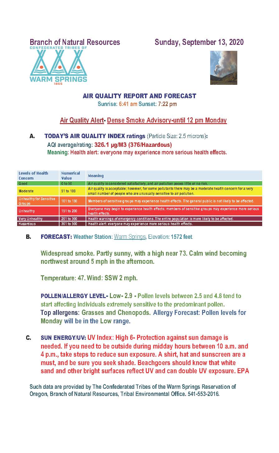
Daily Update for Sunday September 13 2020
Related Incident:
Publication Type: News
Start Date: 8/16/2020
Cause: Lightning
Incident Commander: Noel Livingston, Pacific Northwest Team 3
Approximate Size: 138,718 acres
Containment: 5%
Total Personnel: 1482
Approximate Distance: 20 miles west of Warm Springs
Resources on the Fire:
51 crews
62 engines
11 dozers
49 water tenders
10 helicopters
Cooperating Agencies:
Marion County Sheriff
Linn County Sheriff
Jefferson County Sheriff
Deschutes County Sheriff
Last night’s virtual community meeting can be found at: www.facebook.com/lionsheadfire
Weather and Fire Behavior: Heavy smoke will continue to cover the area, although winds aloft should begin to push smoke dispersement and begin to improve air quality throughout the week. Temperatures today will be cooler at 70-75 and humidity levels will range from 18-28 percent. Winds will be light and variable, on the fire aligning with terrain causing upslope, updrainage fire activity with group torching and spotting, becoming more active than we have seen the last couple of days. Interactive map of wildfires and forecasted smoke dispersement https://storymaps.esri.com/stories/usa-wildfires/
Current Situation: On the west side of the crest of the cascades, engine task forces continue to secure and protect infrastructure and property, engaging in ongoing damage assessments as fire activity, smoke and other hazards allow. Progress is being made with scouting and preparing containment lines. Torching and spotting kept crews busy on Saturday on the northern side of the fire. Late in the afternoon heavy group torching aligned with the terrain and winds causing the fire on the northeastern corner to pass through containment lines. The control lines in place to the east and south on the Warm Springs Reservation continue to hold and show low fire activity. Firefighters diligently patrol and mop-up areas that may compromise the established control lines.
Today’s Activities: Firefighters on the west side of the crest of the cascades continue today with many of the same assignments as they worked on yesterday. Scouting old fire scars, road systems, trails and other natural barriers to incorporate into the containment lines. The Oregon State Fire Marshal Task Forces will continue to diligently work within the areas with property and infrastructure, stabilizing the communities and continuing the property damage assessments. Wildfires have not burned in these areas for many decades, leaving heavy layers of fuels on the ground that firefighters must work through to secure the area, a very laborious and time-consuming process. Between the Olallie Lake area and the P-515 Fire, fire personnel will be assessing the terrain and potential natural barriers, old fire scars and road systems that can be used for containment lines. The eastern and southern portion of the fire will continue to be patrolled and the mop-up depth will increase as needed to ensure the fire stays within the existing perimeter.
Evacuations: A Level 1 Evacuation Notice has been issued for Sidwalter Flats area on the Warms Springs Reservation. Please monitor the local area sheriff’s department websites and Facebook for updates. The Oregon Office of Emergency Management has created an interactive database to help provide the most up to date information on evacuation statewide. https://www.oregon.gov/oem/emops/Pages/RAPTOR.aspx
Closures: For public and firefighter safety, roads and trails on the southwest portion of the Warm Springs Reservation near the fires are closed to the public. Forest closures are in place for Deschutes, Mt. Hood and Willamette National Forests. Deschutes NF Alerts Willamette NF Alerts Mt. Hood NF Alerts
FOR ADDITIONAL FIRE INFORMATION: Fire Information: 971-277-5075
TripCheck: https://www.tripcheck.com/
Inciweb: https://inciweb.nwcg.gov/incident/7049/
Facebook: www.facebook.com/LionsheadFire
Email: 2020.lionshead@firenet.gov
September 14 Sidwalter Flats Level 2 Evacuation Warning
Related Incident:
Publication Type: News
SID WALTER FLATS LEVEL 2: The Warm Springs Police Department issued a level 2 notice "Be Set", it indicates there is a significant risk to your area, and residents should either voluntarily relocate to a shelter or with family/friends outside of the area, or, be ready to leave at a moments notice.
The community of Simnasho is placed on a level one.