
Windy Fire Update September 24 2021 evening recap
Related Incident: Windy Fire
Publication Type: News
Current Situation: Friday evening, September 24, 2021 (also posted on Sequoia National Forest's Facebook page)
The #WindyFire is approximately 62,702 acres and 5 percent contained. The fire was very active today and grew by about 5,900 acres, primarily on the south and east sides. As a result, #TulareCountySheriff issued two additional evacuation orders for communities such as California Hot Springs, Pine Flats, and Sugarloaf.
The fire’s progression in some areas is being driven by large stands of beetle-killed trees that are standing and down on the ground. The dry grass among the dead, down trees ignites readily when embers blown ahead of the main fire front land in it. The spot fire becomes established, sending up its own embers that get carried by the wind, and the result is that the fire advanced today in that leap-frog fashion.
Structure-protection crews were actively engaged around homes and buildings in numerous communities and will remain on scene throughout the night.
Windy Fire Update October 1 2021 evening recap
Related Incident: Windy Fire
Publication Type: News
Current Situation: Friday evening, October 1, 2021 (also posted on Sequoia National Forest's Facebook page)
The #WindyFire is currently estimated to be 90,149 acres (a 345-acre increase from Friday morning’s reported acreage). Containment is 42 percent.
Around much of the fire perimeter—particularly the north, northeast, southwest, and northwest—crews are “mopping up and securing” the fireline. Mop-up is the time-consuming process of making the fire safe or reducing residual smoke by extinguishing or removing burning material near the firelines, felling snags, or moving logs so they won't roll downhill. Hand crews are working their way methodically along the fireline—in some places going into the burned area 100-200 feet—looking for and extinguishing all residual heat. At times they use their bare hands to detect heat that isn’t producing visible smoke. While it may seem as though there have been few accomplishments to report in this evening recap lately, the crews involved in this critical phase of the fire-suppression mission are making incremental, yet measurable and significant strides each day.
The southeast, south, and western sides of the fire remain the most active. The Windy Fire and the KNP Complex to the north are both continually producing smoke, and without significant dispersal, it continues to contribute to poor air quality. Limited visibility somewhat hampered air operations, but helicopters were able to fly periodically throughout the day. They conducted water drops on the southeast portion of the fire, holding the fire west of the M99 corridor as there are still no good options for ground crews to access the fire’s edge directly.
From Baker Point westward along the southern perimeter to the contained fireline, crews expect to complete construction of the network of direct handline by the end of the shift tonight. On the west side of the fire, they are still constructing handline in an effort to prevent the fire from spreading further westward. In the Tule River Indian Reservation, where the fire continues to advance slowly toward containment features, crews are preparing road systems that have been identified as good locations from which to conduct a strategic firing operation, possibly a couple days from now.
The fire-behavior analyst reports that with the prolonged period of dry, warm weather the area is experiencing, everything that is on fire will continue to burn and be completely consumed. If firefighters can keep the fire mostly within its current footprint—either through direct suppression action or with aircraft—the vegetation that is burning will lose its energy and ability to project that energy in the future. The intense heat detected during the overnight infrared flight a couple nights ago is steadily diminishing.
Windy Fire Update October 1 2021
Related Incident: Windy Fire
Publication Type: News
Resources: 2,500 personnel, 71 hand crews, 136 engines, 17 helicopters, 23 dozers, 12 water tenders
Structures Threatened: 2,000 Residences, 100 Commercial Buildings
Structures Destroyed: 14 Residences, 12 Outbuildings, 2 Commercial Buildings
Injuries: 4
TULARE COUNTY RESIDENT INFORMATIOn: 14 homes and 12 outbuildings have been reported destroyed. Residents requesting information on the status of their property can call the Tulare County Information Hotline at (559) 802-9790. Affected property owners should complete the September Lighting Fire Information Form online at: https://bit.ly/3ETdZjI. Forest Service staff have completed assessments of the White River and Spear Creek Summer Home Tracts on the Sequoia National Forest.
CURRENT SITUATION: The Windy Fire is 89,804, acres with 40% containment and is a full suppression fire. The fire is burning on the Tule River Indian Reservation and the Sequoia National Forest, including the Giant Sequoia National Monument. The fire perimeter increased 1,736 acres in the last 24 hours.
Early morning observations from the camera at Tobias Peak showed the fire burning actively. While it is October 1st, conditions in the forest are more like what you would observe in August, very dry with warm temperatures and low humidity. These conditions will increase fire behavior today, especially in the chamise and chaparral brush type in the Kern River Canyon.
The top priority continues to be the southwest side where crews continue to make good progress securing containment lines and providing structure defense around Sugarloaf and Sugarloaf Mountain Park north towards Pine Flat and California Hot Springs. Crews are constructing and improving indirect (away from the fire’s edge) containment lines from M 50 (at the switchbacks) northwest to Lone Pine Mountain and looking for opportunities to construct direct hand line at the fire’s edge.
On the northwest side, crews continue to construct direct and indirect containment lines from Wheatons south to Lone Pine Mountain on the Tule River Indian Reservation. If conditions permit, crews will continue a tactical firing operation to help improve containment lines. Tactical firing operations allow firefighters to remove vegetation along the indirect containment line which reduces the threat of the fire advancing.
On the east and southeast side, crews continue structure defense in the Vincent Meadow area along Sugarloaf Road (23S16). In the Kern River Canyon, the fire continues to hold on the upper west slope between Tobias Creek and Flynn Canyon. Helicopters and the Bombardier CL-515, (Super Scooper) will continue dropping water and retardant on the upper ridge to slow the fire’s movement east towards the Kern River. Crews will continue structure defense in Fairview.
On the south side, the fire is burning in the 2016 Cedar Fire burn scar and crews are building direct hand line at the fire’s edge west towards Sugarloaf. Pockets of dead and down trees are burning outside of the containment line and firefighters are working to put line around those spot fires.
WEATHER AND FIRE BEHAVIOR: Very dry and warm conditions will prevail through the weekend. The smoke inversion will disperse in late morning, early afternoon. Winds will be light except in the Kern Canyon which could see gusty afternoon winds.
EVACUATIONS ORDERS: The following information is from the Tulare County Sherriff’s Office. Evacuation orders and warnings can change suddenly, please refer to https://tularecounty.ca.gov/emergencies/ for the Windy Fire Evacuation Warning Area Map. For more information, please call 2-1-1.
- The communities of Sugarloaf, Sugarloaf Mountain Park, Sugarloaf Saw Mill, White River, Idlewild, Posey, Panorama Heights, Poso, Balance Rock, Spear Creek, from the existing Hot Springs Evacuation Order west to King George Peak, south to County M56, including Oak Flat, Twin Peak, to Vincent Ranch at the Tulare-Kern Counties Border, east to Portuguese Peak, and back north to Dunlap Meadow.
- California Hot Springs and Pine Flat areas. The evacuation order includes M-504 at Tyler Creek, Southeast to Pine Flat, West to M-56 and Fire Control Road, North up Tyler Creek Road. This includes structures, side roads, and attached roads.
- Mountain Aire and Rogers Camp.
- Johnsondale and Camp Whitsett, including M107 at Dome Rock, east to Lloyd Meadow Road (FS Road 22S82), south to M99 at Sherman Pass Road, west to M107 and M50.
- The area of McNally’s from Sherman Pass Road to Corral Creek.
- Both sides of the Kern River from the Gold Ledge Campground south to Riverkern, Tulare County, at the Tulare/Kern border. This warning will include all private properties, businesses, residences, structures, campsites, campgrounds, Forest Service roads, access roads, attached roads, and trails.
- Alpine Village, Camp Nelson, Cedar Slope, Coy Flat, Pierpoint, Quaking Aspen, Ponderosa, and Sequoia Crest.
- At Jack Ranch Road and Old Stage Road
- Quaking Aspen and M107
- MT99 at Gold Ledge Campground
- MT56 at Fountain Springs
EVACUATION CENTER: A evacuation center is in place at Porterville College on 100 E. College Ave. Older individuals (60+) who need assistance with evacuation may call the senior hotline at 1-800-321-2462. For more information, visit https://tularecounty.ca.gov/emergencies/ or call 2-1-1.
WINDY FIRE ANIMAL EVACUATION CENTER: Domestic animals and poultry are being accepted at the Tulare County Animal Service Shelter, 14131 Avenue 256, Visalia, CA 93292. Large animals and livestock can be taken to the International Agri-Center, 4500 S Laspina St, Tulare, CA 93274.
DAILY SMOKE OUTLOOK: https://wildlandfiresmoke.net/outlooks/SouthernSierra-Sequoia AirNow: Fire and Smoke Map: https://fire.airnow.gov/.
SEQUOIA NATIONAL FOREST CLOSURES: Please refer to https://www.fs.usda.gov/sequoia for more information and a map of the closed areas.
HUNTING IN SEQUOIA NATIONAL FOREST: Hunting is possible outside of Forest Closure areas. Please refer to the link above for areas closed to public access at this time.
Windy Fire Update September 30 2021 evening recap
Related Incident: Windy Fire
Publication Type: News
The #WindyFire is currently estimated to be 89,804 acres (a 1,736-acre increase from Thursday morning’s reported acreage). Containment is 37 percent. The acreage increase was primarily the result of (1) incremental growth on the eastern and southeastern perimeter, from Johnsondale south to Baker Point and slightly west along the southern perimeter and (2) a strategic firing operation on the western perimeter to prevent the fire from advancing further westward on the Tule River Indian Reservation.
Numerous aircraft—seventeen helicopters, one UAS (i.e., drone), two CL-415s (i.e., Super Scoopers), and a Cobra (an intelligence-gathering helicopter)—are assigned to the incident. Today’s clear skies made for a busy day for air operations. Helicopters conducted numerous water drops, particularly on the west side of the fire, as they supported the firing operation and other fire-suppression activities. The Super Scoopers were used on the southern two-thirds of the fire, primarily along the eastern side where the steep terrain above the M99 corridor and the Kern River is inaccessible to firefighters. The UAS, unlike the helicopters assigned to the incident, can detect heat sources through smoke. It surveils the perimeter, detecting isolated heat sources that the ground crews then locate and extinguish. It is also being used on this incident to fly over and assess the condition of the giant-sequoia groves.
On the southwestern side of the fire, crews are holding the fire within its current footprint and continuing to mop up hotspots in and around several small communities, such as Sugarloaf Mountain Park, Pine Flat, and California Hot Springs. There are 2,500 people assigned to the fire, the majority of whom are in the field, day and night, working hard to protect natural values and structures around the entire fire perimeter and attempting to suppress the fire as quickly and safely as possible.
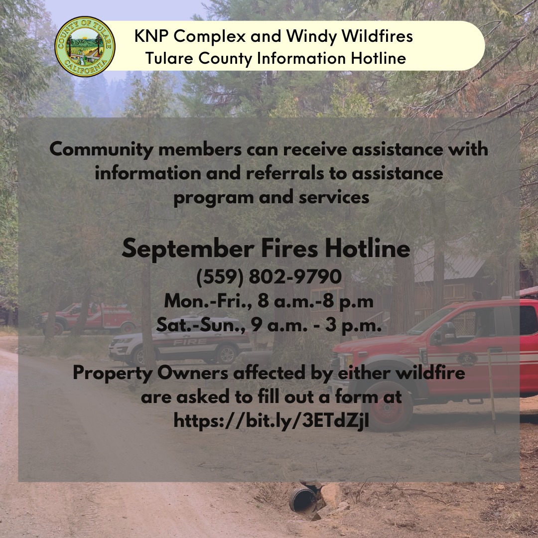
Tulare County Information Hotline for KNP Complex and Windy Wildfires
Related Incident: Windy Fire
Publication Type: Announcement
The following information is from Tulare County Health and Human Services Agency:
Community members impacted by the wildfires burning in Tulare County can call the Tulare County Information Hotline at (559) 802-9790.
Property owners affected by either wildfire should complete the September Lighting Fire Information Form Online at: https://bit.ly/3ETdZjI.
We understand the uncertainty, frustration, and concern for those who are directly affected by the KNP Complex and Windy Fires. As the fires continue to burn, there are many questions regarding next steps, damages, and recovery efforts once the fires are contained. Tulare County HHSA is here to provide ongoing support by way of providing an information hotline to speak with a live person and provide resources available to you.
What to expect when you call? You will be prompted to select which fire incident you are seeking information and be connected to a live person who can provide additional guidance and available resources.
Please call us at (559) 802-9790. Phone lines will be operational Monday – Friday from 8:00 a.m. – 8:00 p.m. and Weekends from 9:00 a.m. – 3:00 p.m. We are here to help and support anyway we can.
Know that your livelihood is of our upmost priority and although we may not have all the information, we are dedicated to helping you and to ensure all the up-to-date information is available to you. It may take time for us to get complete information from those on the frontlines fighting these fires, but know they are working hard to protect your properties. We ask for your patience and cooperation as we move through the coming days, but know that we are dedicated to getting through this difficult time alongside you.
Windy Fire Update September 30 2021
Related Incident: Windy Fire
Publication Type: News
Resources: 2,498 personnel, 68 hand crews, 148 engines, 16 helicopters, 32 dozers, 12 water tenders
Structures Threatened: 2,000 Residences, 100 Commercial Buildings
Structures Destroyed: 14 Residences, 12 Outbuildings, 2 Non-Commercial Buildings
Injuries: 3
EVACUATION ORDER REDUCED: Today at 12 noon, the Evacuation Order for the following areas will be downgrade to an Evacuation Warning: Alpine Village, Camp Nelson, Cedar Slope, Coy Flat, Pierpoint, Quaking Aspen, Ponderosa, and Sequoia Crest. Residents may return to their homes after showing proof of residence to law enforcement officers. Proper documentation must include the person’s name and address within the impacted area. At this time, only residents are permitted in the area. Mountain Aire and Rogers Camp will remain under Evacuation Order. All other evacuation orders and warnings will remain in effect.
TULARE COUNTY RESIDENT INFORMATION: 14 homes and 12 outbuildings have been reported destroyed. Residents requesting information on the status of their property can call the Tulare County Information Hotline at (559) 802-9790. Affected property owners should complete the September Lighting Fire Information Form online at: https://bit.ly/3ETdZjI. Today, Forest Service staff will be out assessing property damage in the White River and Spear Creek Summer Home Tracts on the Sequoia National Forest.
CURRENT SITUATION: The Windy Fire is 88,068, acres with 35% containment and is a full suppression fire. The fire is burning on the Tule River Indian Reservation and the Sequoia National Forest, including the Giant Sequoia National Monument. The fire perimeter increased 315 acres in the last 24 hours.
Another quite night, with minimal activity or growth in the fire’s perimeter. The top priority continues to be the southwest side where crews have made good progress securing containment lines and providing structure defense around Sugarloaf and Sugarloaf Mountain Park north towards Pine Flat and California Hot Springs. Crews are constructing and improving indirect (away from the fire’s edge) containment lines from Mt Road 50 (at the switchbacks) northwest to Lone Pine Mountain.
On the northwest side, crews continue to construct direct and indirect (away from the active fire) containment lines from Wheatons south to Corral Hill. If conditions permit, a tactical firing operation will be initiated to help improve containment lines.
On the north side, firefighters continue tactical patrols (extinguishing any burning vegetation, stumps, etc.) along the Coy Flat Road (FS Road 21S94) northeast to Coy Flat.
On the northeast side near Ponderosa, crews continue holding and improving containment lines east to the Lloyd Meadow Road (FS Road 22S28) and south to Johnsondale. Crews will continue tactical patrols extinguishing any burning stumps, trees and vegetation.
On the east and southeast side, Crews continue structure defense along Sugarloaf Road (23S16). In the Kern River Canyon, the fire has not moved much on the upper west slope between Tobias Creek and Flynn Canyon. Due to the steep, rocky terrain and the difficulty of getting firefighters into the area, Bombardier CL-415s, commonly known as water scoopers, may be used (after the smoke clears) to drop water on the active portions of the fire.
On the south side, the fire has backed into the 2016 Cedar Fire which has slowed the advancing fire front. Small spot fires, burning in pockets of dead and down trees, continue to burn and crews are constructing direct (at the fires edge) and indirect lines (away from the active fire) to contain them.
WEATHER AND FIRE BEHAVIOR: High pressure will strengthen over the area bringing warmer temperatures, lower humidity and weak diurnal winds. Expect poor smoke dispersion until this afternoon when the inversion should lift.
EVACUATIONS ORDERS: The following information is from the Tulare County Sherriff’s Office. Evacuation orders and warnings can change suddenly, please refer to https://tularecounty.ca.gov/emergencies/ for the Windy Fire Evacuation Warning Area Map. For more information, please call 2-1-1.
- The communities of Sugarloaf, Sugarloaf Mountain Park, Sugarloaf Saw Mill, White River, Idlewild, Posey, Panorama Heights, Poso, Balance Rock, Spear Creek, from the existing Hot Springs Evacuation Order west to King George Peak, south to County M56, including Oak Flat, Twin Peak, to Vincent Ranch at the Tulare-Kern Counties Border, east to Portuguese Peak, and back north to Dunlap Meadow.
- California Hot Springs and Pine Flat areas. The evacuation order includes M-504 at Tyler Creek, Southeast to Pine Flat, West to M-56 and Fire Control Road, North up Tyler Creek Road. This includes structures, side roads, and attached roads.
- Mountain Aire and Rogers Camp.
- Johnsondale and Camp Whitsett, including M107 at Dome Rock, east to Lloyd Meadow Road (FS Road 22S82), south to M99 at Sherman Pass Road, west to M107 and M50.
- The area of McNally’s from Sherman Pass Road to Corral Creek.
ROAD CLOSURES AND RESTRICTIONS:
- At Jack Ranch Road and Old Stage Road
- Quaking Aspen and M107
- MT99 at Gold Ledge Campground
- MT56 at Fountain Springs
EVACUATION CENTER: A evacuation center is in place at Porterville College on 100 E. College Ave. Older individuals (60+) who need assistance with evacuation may call the senior hotline at 1-800-321-2462. For more information, visit https://tularecounty.ca.gov/emergencies/ or call 2-1-1.
WINDY FIRE ANIMAL EVACUATION CENTER: Domestic animals and poultry are being accepted at the Tulare County Animal Service Shelter, 14131 Avenue 256, Visalia, CA 93292. Large animals and livestock can be taken to the International Agri-Center, 4500 S Laspina St, Tulare, CA 93274.
DAILY SMOKE OUTLOOK: https://wildlandfiresmoke.net/outlooks/SouthernSierra-Sequoia AirNow: Fire and Smoke Map: https://fire.airnow.gov/.
SEQUOIA NATIONAL FOREST CLOSURES: Please refer to https://www.fs.usda.gov/sequoia for more information and a map of the closed areas.
HUNTING IN SEQUOIA NATIONAL FOREST: Hunting is possible outside of Forest Closure areas. Please refer to the link above for areas closed to public access at this time.
Tulare County Downgrades an Evacuation Order to a Warning
Related Incident: Windy Fire
Publication Type: Announcement
September 29, 2021, 7:00 p.m.
(The following information was taken directly from Tulare County Sheriff's Office website or Facebook page.)
Sheriff To Downgrade Evacuation Orders Thursday For Affected Areas by Windy Fire
Effective at 12 noon on Thursday, September 30, 2021, Sheriff Boudreaux will downgrade the following areas from Evacuation Orders to Evacuation Warnings:
However, nearby Mountain Aire and Rogers Camp will remain closed under evacuation orders at this time.
Prior evacuation orders and warnings not addressed will remain in effect.
The Highway 190 corridor will open at noon Thursday and the roadblock will be pushed back to Aspen and M107.
Residents living in these areas may return to their homes after showing proof of residence to law enforcement officers. Proper documentation must include the person’s name and address within the impacted area. Examples include a driver’s license, utility bill or address documentation from the U.S. Post Office for people who use a post office box.
At this time, only residents are permitted to return.
Residents returning to evacuation warning areas should be ready to leave again at a moment’s notice, as the fire is still active in some areas. Conditions may change, which may cause officials to re-issue evacuation status, if necessary.
Tulare County advises residents returning to communities impacted by wildfires to take caution upon returning to their homes:
- Conduct a thorough inspection of structures, which may have been damaged, to prevent injury;
- Do not consume refrigerated or frozen food stored in appliances that may have lost electricity, and dispose of these items properly;
- Wear personal protective equipment, including long-sleeved shirts and pants, hard hats, safety glasses, leather gloves, and steel toe boots, to reduce risk of injury;
- Be aware of burnt or unstable trees on your route or on your property and hidden hotspots underground which may present hazards;
- Do not enter a confined space (for example, septic tanks, storage tanks, utility vaults, wells) without proper training and equipment;
- Avoid potential electrical hazards such as damaged power lines and electrical equipment that has been exposed to fire heat;
- Be cautious around hazardous and potentially dangerous materials such as propane tanks, gasoline tanks, and chemicals, and seek professional help in assessing or removing any hazardous waste;
- Use proper lifting techniques when removing debris and other items, and seek help from others when moving heavy or bulky items to reduce risk of musculoskeletal injuries;
- Wear personal protective equipment to avoid exposure to smoke and ash, dispose of ash using vacuums equipped with High Efficiency Particulate Air (HEPA) filters;
- During clean up, use a particulate respirator mask, either P95 or P100 (sold at pharmacies), to provide protection from smoke and ash inhalation
- Avoid burned items that may contain hazardous materials. Avoid ash from decks and fences treated with chromated copper arsenate (a wood preservative) as it may contain lethal amounts of arsenic;
- Do not consume any food, beverages, or medications that have been exposed to burn debris or ash;
- Seek support as needed for emotional stress and mental and physical fatigue resulting from evacuation from and return to your residence;
- Check your homeowner’s insurance policy for information about your home and property coverage; and,
- Always be aware of your surroundings and proceed cautiously to avoid hazards when returning to an area affected by wildfire. Seek professional help when assessing potential hazards and seek medical assistance when necessary.
Windy Fire Update September 29 2021 evening recap
Related Incident: Windy Fire
Publication Type: News
The #WindyFire is currently estimated to be 88,068 acres (a 167-acre increase from Wednesday morning’s reported acreage). Containment is 31 percent.
Fire behavior was moderate today. Along the eastern perimeter, firelines are holding from the Ponderosa south to Johnsondale. In the M99 corridor between Johnsondale and Baker Point, there are a few places where the fire continues to be more active, although it did not grow much. Crews are unable to directly suppress the fire there, so they are looking at various indirect fire-suppression options, for example, using helicopters to conduct bucket drops.
On the fire’s south side, where the numerous spot fires are, crews are constructing fireline around and suppressing the isolated fires individually. On the western side of the fire, crews are also able to directly suppress the fire in many places. Clear skies allowed numerous helicopters to assist firefighters on the ground with water drops.
The livestreamed public meeting today at 7 p.m, will be available to watch on the Sequoia National Forest's Facebook page at the meeting's conclusion if you were unable to watch it live.
Windy Fire Update September 29 2021
Related Incident: Windy Fire
Publication Type: News
RESOURCES: 2,393 personnel, 67 hand crews, 133 engines, 18 helicopters, 34 dozers, 9 water tenders
Structures Threatened: 2,000 Residences, 100 Commercial Buildings, Injuries: 3
PUBLIC MEETING: Tonight at 7 P.M., there will be virtual public meeting for the Windy Fire. The meeting will be livestreamed on the Sequoia National Forest Facebook page and on Zoom (meeting ID: 160 212 1141; passcode: J227!q; call-in phone number: 669-254-5252). If you have questions that you would like answered at the meeting, please send them to 2021.Windy@firenet.gov.
TULARE COUNTY RESIDENT INFORMATION: Tulare County is assessing the damage to homes and property in the Sugarloaf and Pine Flat Areas. Community members impacted by the Windy Fire can call the Tulare County Information Hotline at (559) 802-9790. Affected property owners should complete the September Lighting Fire Information Form online at: https://bit.ly/3ETdZjI. People who have cabins in Summer Home Tracts on the Forest will be contacted by the Sequoia National Forest.
CURRENT SITUATION: The Windy Fire is 87,901, acres with 25% containment and is a full suppression fire. The fire is burning on the Tule River Indian Reservation and the Sequoia National Forest, including the Giant Sequoia National Monument. The fire perimeter increased 583 acres in the last 24 hours.
Yesterday, gusty westerly winds tested containment lines, especially on the east side from Ponderosa south to Johnsondale. Overnight, no spot fires (spot fires can be ignited when winds carry hot embers across a fire line) were observed outside of the fire’s perimeter. This morning, Fire Managers are reporting 25 percent containment (lines are secure and fire will not spread further) of the fire’s perimeter. The new containment is on the northern perimeter from the Two and Quarter Road (On the Tule River Indian Reservation) east to Ponderosa and along a portion of the Lloyd Meadow Road (FS Road 22S28) north of Johnsondale.
Today, the priority continues to be protecting structures on the southwest perimeter near California Hot Springs, Sugarloaf and Pine Flat areas. Fire engines continue to engage in structure defense and extinguishing hotspots (burning tree stumps, downed logs, etc.) along the dozer and hand lines that extend into California Hot Springs. Crews are improving indirect containment lines from Mt Road 50 (at the switchbacks) west to Lone Pine Mountain.
On the northwest side, favorable winds yesterday allowed crews to conduct a tactical firing operation southward toward Wheatons. Today, firefighters will continue to hold and strengthen containment lines from Wheatons south to Corral Hill.
On the north side, crews continue tactical patrols (extinguishing any burning vegetation, stumps, etc.) along the Coy Flat Road (FS Road 21S94) northeast to Coy Flat. Their efforts have been successful in containing the fire and keeping it south of Camp Nelson.
On the northeast side near Ponderosa, crews continue holding and improving containment lines east to Lloyd Meadow Road (FS Road 22S28) and south to Johnsondale.
On the east and southeast side, the fire remains active from Flynn Canyon south to Tobias Peak. Crews continue to work along the Sugarloaf Road (23S1) towards the Spear Creek Summer Home Tract improving fire lines and providing structure defense. The fire is backing downslope east towards the Kern River, and crews will be looking to construct hand line from the Kern River southwest along the Tobias Creek Trail. Crews are also working to protect the Baker Point Lookout wrapping it with a protective shield to minimize damage from the advancing flames.
On the south side, the fire has backed into the 2016 Cedar Fire which has moderated activity. There are small spot fires, caused by the winds a few days ago, burning in pockets of dead and down trees. Due to safety concerns such as numerous standing dead trees, crews are establishing indirect lines, away from the fire’s edge, around the spot fires.
WEATHER AND FIRE BEHAVIOR: Warmer and drier conditions are forecast for the rest of the week with light winds across ridges and mountaintops.
EVACUATIONS ORDERS: The following information is from the Tulare County Sherriff’s Office. Evacuation orders and warnings can change suddenly, please refer to https://tularecounty.ca.gov/emergencies/ for the Windy Fire Evacuation Warning Area Map. For more information, please call 2-1-1.
-
The communities of Sugarloaf, Sugarloaf Mountain Park, Sugarloaf Saw Mill, White River, Idlewild, Posey, Panorama Heights, Poso, Balance Rock, Spear Creek, from the existing Hot Springs Evacuation Order west to King George Peak, south to County M56, including Oak Flat, Twin Peak, to Vincent Ranch at the Tulare-Kern Counties Border, east to Portuguese Peak, and back north to Dunlap Meadow.
-
California Hot Springs and Pine Flat areas. The evacuation order includes M-504 at Tyler Creek, Southeast to Pine Flat, West to M-56 and Fire Control Road, North up Tyler Creek Road. This includes structures, side roads, and attached roads.
-
Camp Nelson and surrounding communities.
-
Johnsondale and Camp Whitsett, including M107 at Dome Rock, east to Lloyd Meadow Road (FS Road 22S82), south to M99 at Sherman Pass Road, west to M107 and M50.
-
Ponderosa and Quaking Aspen. The warning area includes M107 at Dome Rock, north to Highway 190/M90 at North Road (FS Road 21S50), east to Route 21S05, at Needles Trail, south to Lloyd Meadow at Lower Peppermint Road (FS Road 22S82).
-
The areas of McNally’s. From Sherman Pass Road to Corral Creek.
EVACUATION WARNING:
-
Both sides of the Kern River from the Gold Ledge Campground south to Riverkern, Tulare County, at the Tulare/Kern border. This warning will include all private properties, businesses, residences, structures, campsites, campgrounds, Forest Service roads, access roads, attached roads, and trails.
ROAD CLOSURES AND RESTRICTIONS:
-
At Jack Ranch Road and Old Stage Road
-
Highway 190 and Rio Vista
-
MT99 at Gold Ledge Campground
-
MT56 at Fountain Springs
EMERGENCY NOTIFICATION ALERTS: Tulare County residents can sign up to receive county emergency notifications by registering at AlertTC.com.
EVACUATION CENTER: A evacuation center is in place at Porterville College on 100 E. College Ave. Older individuals (60+) who need assistance with evacuation may call the senior hotline at 1-800-321-2462. For more information, visit https://tularecounty.ca.gov/emergencies/ or call 2-1-1.
WINDY FIRE ANIMAL EVACUATION CENTER: Domestic animals and poultry are being accepted at the Tulare County Animal Service Shelter, 14131 Avenue 256, Visalia, CA 93292. Large animals and livestock can be taken to the International Agri-Center, 4500 S Laspina St, Tulare, CA 93274.
DAILY SMOKE OUTLOOK: https://wildlandfiresmoke.net/outlooks/SouthernSierra-Sequoia AirNow: Fire and Smoke Map: https://fire.airnow.gov/
SEQUOIA NATIONAL FOREST CLOSURES: Please refer to https://www.fs.usda.gov/sequoia for more information and a map of the closed areas.
HUNTING IN SEQUOIA NATIONAL FOREST: Hunting is possible outside of Forest Closure areas. Please refer to the link above for areas closed to public access at this time.
Windy Fire Update September 28 2021 evening recap
Related Incident: Windy Fire
Publication Type: News
Current Situation: Tuesday evening, September 28, 2021 (also posted on Sequoia National Forest's Facebook page)
The #WindyFire is currently estimated to be 87,709 acres (a 391-acre increase from Tuesday morning’s reported acreage). Containment is 6 percent.
There were no spot fires today along the eastern perimeter from Ponderosa to Johnsondale. Crews extinguished hotspots along the firelines, which held today despite being thoroughly tested by today’s strong winds. South of Johnsondale to Baker Point, the fire continues to move eastward, downslope toward the M99 corridor and the Kern River. Firefighters are scouting the hiking trail along Tobias Creek as a place to stop the fire’s eastward advance. Crews also finished wrapping the Baker Point Lookout.
South of Tobias Peak, the full-suppression strategy involves constructing indirect containment lines because the area is too steep and full of hazardous snags for crews to safely suppress the fire directly. However, on the southwest side of the fire, direct suppression is more feasible. Although indirect lines are constructed, they are there as a backup plan; firefighters are using direct-suppression tactics along much of the southwestern and western perimeter, getting in closer to the fire’s edge to minimize its footprint.
On the northwest side, conditions allowed crews to complete the multi-day firing operation between the Two and a Quarter Road and Wheatons.
Aircraft are available and ready to assist but have been hampered in many areas by thick smoke.