
Sawtell Peak Daily Updates 09072022
Related Incident: Sawtell Peak
Publication Type: News
Summary: The Sawtell Peak fire is under the command of Wyoming Type 3 Team 5. The Sawtell Peak Fire is currently 37 acres, with 60% containment and 92 personnel assigned to the incident.
Yesterday: Firefighters worked to build and strengthen containment lines. They addressed heat pockets and began mop-up. The fire’s acreage increased due to more accurate mapping of hot spots.
Today: Firefighters will continue to build and strengthen containment lines, and mop-up. Crews will begin backhauling hose lines via helicopter. The camp will continue to downsize, and several logistical resources will be available for reassignments.
Weather: A Fire Weather Watch is in effect through tomorrow evening. Weather conditions will continue to be unseasonably warm with low humidity. An approaching low-pressure system may bring increased winds making for near critical fire weather conditions.
Closure Order: A Forest Closure Order remains in effect to protect public health and safety from the effects of the Sawtell Peak Fire.
Safety Message: Please continue to be mindful of fire operations and adhere to the fire area closure order.
A temporary flight restriction remains place, NOTAM 2/1209.
Sawtell Peak Daily Updates 09062022
Related Incident: Sawtell Peak
Publication Type: News
Summary: The Sawtell Peak fire is under the command of Wyoming Type 3 Team 5. The Sawtell Peak Fire remains at 34 acres with 40% containment and 127 personnel assigned to the incident.
Weather: Weather conditions will continue to be unseasonably warm with light winds and low humidity. An approaching low-pressure system on Wednesday may bring increased winds making for near critical fire weather conditions.
Sawtell Peak Daily Updates 09052022
Related Incident: Sawtell Peak
Publication Type: News
Summary: The Sawtell Peak fire is under the command of Wyoming Type 3 Team 5. The Sawtell Peak Fire is currently 34 acres with 20% containment 174 personnel assigned to the incident.
Yesterday: With the use of aerial resources earlier this weekend and the abundance of nearby water, firefighters were able to get a handle on the majority of hot spots within the fire area. An estimate of 40,000 gallons of water were dumped on the fire during the operational period via water tenders, engines and hose lay. As a result, there was no growth despite the red flag warning issued.
Today: Due to heavy fuel loads in the area, the risk of existing/unknown spot fires still exists. Firefighters will continue to work hot spots and secure the fire line. They will be gridding the area and mapping hot spots. An emphasis is being placed on finding these potential hazards. With the combination of current weather conditions, embers, and the abundance of dry fuels the risk is still present. The structure protection group will continue to gather information to build a comprehensive structure map as a contingency. These proactive management tools are used to protect communities and other values from fire if the need should arise.
Weather: Weather conditions will be similar to yesterday with weaker winds predicted.
Closure Order: A Forest Closure Order was issued to protect public health and safety from the effects of the Sawtell Peak Fire. The area closure includes all National Forest System (NFS) land within the closed area depicted on the attached map, and Forest Website.
Safety Message: Please be mindful of fire operations and adhere to closures to the Sawtell area. With the holiday weekend ending, watch for increased traffic and congestion along with fire traffic. Remember, if you fly, we can’t, please use drones responsibly and stay away from fire area. A temporary flight restriction is in place, NOTAM 2/1209.
Forest Closure Order 041522304 Sawtell Peak Fire
Related Incident: Sawtell Peak
Publication Type: Closures
PURPOSE:The purpose of this Order is to protect public health and safety from the effects of the SawtellPeak Fire.
PROHIBITIONS:Pursuant to 16 U.S.C. § 551 and 36 CFR 261.50 (a) and (b), the following acts are prohibited on the National Forest System (NFS) lands, roads, and trails on the Ashton/Island Park Ranger District of the Caribou-Targhee National Forest described below and shown on the attached map incorporated into this Order as Exhibit A (the “Described Area” and “Described Roads and Trails”):1. Going into or being upon the Described Area, 36 CFR 261.52(e).2. Being on the Described Roads, 36 CFR 261.54(e).3. Being on the Described Trails, 36 CFR 261.55(a)
Sawtell Peak Daily Update 942022
Related Incident: Sawtell Peak
Publication Type: News
Summary: The Sawtell Peak fire is under the command of Wyoming Type 3 Team 5 .The Sawtell Peak Fire is currently 34 acres with 5 % containment and 143 personnel assigned to the incident.
Yesterday: Good progress was made, and the fire saw very little growth, however the fire has burned spotty and there are still interior fuel sources. Firefighters constructed an extensive hose lay around both the main fire and large spot fire to the north. The fire behavior was described as moderate, with some spotting and tree torching.
Today: Firefighters will continue to hold, secure and improve firelines. We will continue to identify and control spot fires. Aerial resources and a hose lay will be used to get water where it is needed on the ground. The structure protection group is starting to gather information to build a comprehensive structure map as a contingency. These proactive management tools are used to protect communities and other values from fire if the need should arise.
Weather: A red flag warning has been issued for today due to low humidity and gusty winds. The fire area will continue to see record heat and very dry conditions. The probability of finding additional spot fires is likely.
Closure Order: A Forest Closure Order was issued to protect public health and safety from the effects of the Sawtell Peak Fire. The area closure includes all National Forest System (NFS) land within the closed area depicted on the attached map, and Forest Website.
Safety Message: With the holiday weekend and events planned for Island Park expect increased traffic and congestion along with fire traffic. Please be mindful of fire operations and adhere to closures to the Sawtell area. Remember, if you fly we can’t, please use drones responsibly and stay away from fire area. A temporary flight restriction is in place, NOTAM 2/1209.
Boulder Mountain Fire Daily Update September 16 2022
Related Incident: Boulder Mountain Fire
Publication Type: News
Friday, September 16, 2022
Boulder Mountain Fire Information 509-508-3389 (8am-8pm) | 2022.bouldermountain@firenet.gov
Quick Facts
Fire Location: 9 miles NW of Cusick, WA in Tacoma Creek and Boulder Mtn.
Size: 2,305 acres
Containment: 59%
Start Date: 8/31/22
Cause: Under Investigation
Incident Commander: Mike Johnston, Great Basin Type 2 Incident Management Team #7
Personnel: 521
Online Links
InciWeb: inciweb.nwcg.gov/incident/8382/
Facebook: @NeWFireInfo
Summary: The Boulder Mountain Fire was detected on Wednesday August 31st, 2022, at approximately 6:00 pm. The fire is located in the Tacoma Creek and Boulder Mountain area, 9 miles Northwest of Cusick, Washington. A mix of State, Federal and Private land is impacted. The terrain is difficult, and the fire is burning in heavy timber, slash, and beetle infested trees. Cause of the fire remains under investigation.
Weather|Anticipated Fire Behavior: Higher humidity levels and low cloud cover helped reduce fire activity yesterday. The sun did come out and begin the drying process later in the day, but overnight temps and rising humidity took the edge off any gains. Today, expect windy conditions as a cold front approaches this evening. Winds will be out of the southwest again which will continue to push areas of heat further into the fire’s interior. Firefighters were able to employ infrared equipment to pinpoint and target hot spots, thus allowing for more direct firefighting efforts. Steady gains are being made daily as containment grew to 59%.
Actions: Extensive mop up of the fire’s edge, coupled with patrolling will continue to take place over the next several days. The interior of the fire still has several areas of heat as large fuels continue to burn. Fallers are working to remove hazards trees allowing hand crews to move closer to the hot edge and continue suppression efforts. Additional resources are beginning to implement suppression repair in areas where the fire is contained.
Important Information: Even with no, or limited smoke the Boulder Mountain Fire is far from ”out.” There are approximately 500 personnel still working on the fire and in the surrounding area, continuing to mop up the hot edges, cut hazard trees, and securing control lines. Not to mention all the heavy equipment repairing suppression dozer lines and roads used daily for various fire apparatus. The Colville National Forest still has a road and area closure in place to protect those responders still responding to this incident. Thank you to the public for adhering to this closure and their continued support of all the boots on the ground!
Boulder Mountain Fire Daily Update September 15 2022
Related Incident: Boulder Mountain Fire
Publication Type: News
Thursday, September 15, 2022
Boulder Mountain Fire Information 509-508-3389 (8am-8pm) | 2022.bouldermountain@firenet.gov
Quick Facts
Fire Location: 9 miles NW of Cusick, WA in Tacoma Creek and Boulder Mtn.
Size: 2,305 acres
Containment: 55%
Start Date: 8/31/22
Cause: Under Investigation
Incident Commander: Mike Johnston, Great Basin Type 2 Incident Management Team #7
Personnel: 552
Online Links
InciWeb: inciweb.nwcg.gov/incident/8382/
Facebook: @NeWFireInfo
Summary: The Boulder Mountain Fire was detected on Wednesday August 31st, 2022, at approximately 6:00 pm. The fire is located in the Tacoma Creek and Boulder Mountain area, 9 miles Northwest of Cusick, Washington. A mix of State, Federal and Private land is impacted. The terrain is difficult, and the fire is burning in heavy timber, slash, and beetle infested trees. Cause of the fire remains under investigation.
Weather|Anticipated Fire Behavior: Wednesday saw rain over most of the fire. The weather stations showed a tenth of an inch to over a half an inch in one area on the east side. However, with the heavy canopy of trees not all rain reaches the ground, meaning the fire behavior has slowed but still has the potential to be active in the right conditions. Thunderstorms across the ridge did produce lighting strikes and observation for potential new starts is active. There remains a chance for additional moisture tomorrow as a cooling trend continues into the weekend.
Actions: Despite the weather, crews did make more progress and containment is now registering at 55%. Firefighters are redistributing hose and directing water onto areas that they hadn’t been able to access earlier. As edges are marked as contained, the team will begin suppression repair efforts on many areas of the fire. Resources will shift around the fire as plans are put in place.
Important Information: What is “suppression repair?” During the course of fighting any fire, resources will disturb a lot of ground through their actions. This can be small areas like hand line or fixing a culvert to layers of contingency line put in by dozers. Suppression repair is the term for repairing all those impacts as they no longer serve their original purpose. It is important to note that repair is different than rehabilitation and does not include replanting or seeding.
Boulder Mountain Fire Daily Update September 14 2022
Related Incident: Boulder Mountain Fire
Publication Type: News
Wednesday, September 14, 2022
Boulder Mountain Fire Information 509-508-3389 (8am-8pm) | 2022.bouldermountain@firenet.gov
Quick Facts
Fire Location: 9 miles NW of Cusick, WA in Tacoma Creek and Boulder Mtn.
Size: 2,305 acres
Containment: 50%
Start Date: 8/31/22
Cause: Under Investigation
Incident Commander: Mike Johnston, Great Basin Type 2 Incident Management Team #7
Personnel: 541
Online Links
InciWeb: inciweb.nwcg.gov/incident/8382/
Facebook: @NeWFireInfo
Washington State Department of Natural Resources: www.dnr.wa.gov/wildfires
Colville National Forest: www.fs.usda.gov/colville
Air Quality Informational: https://www.airnow.gov/
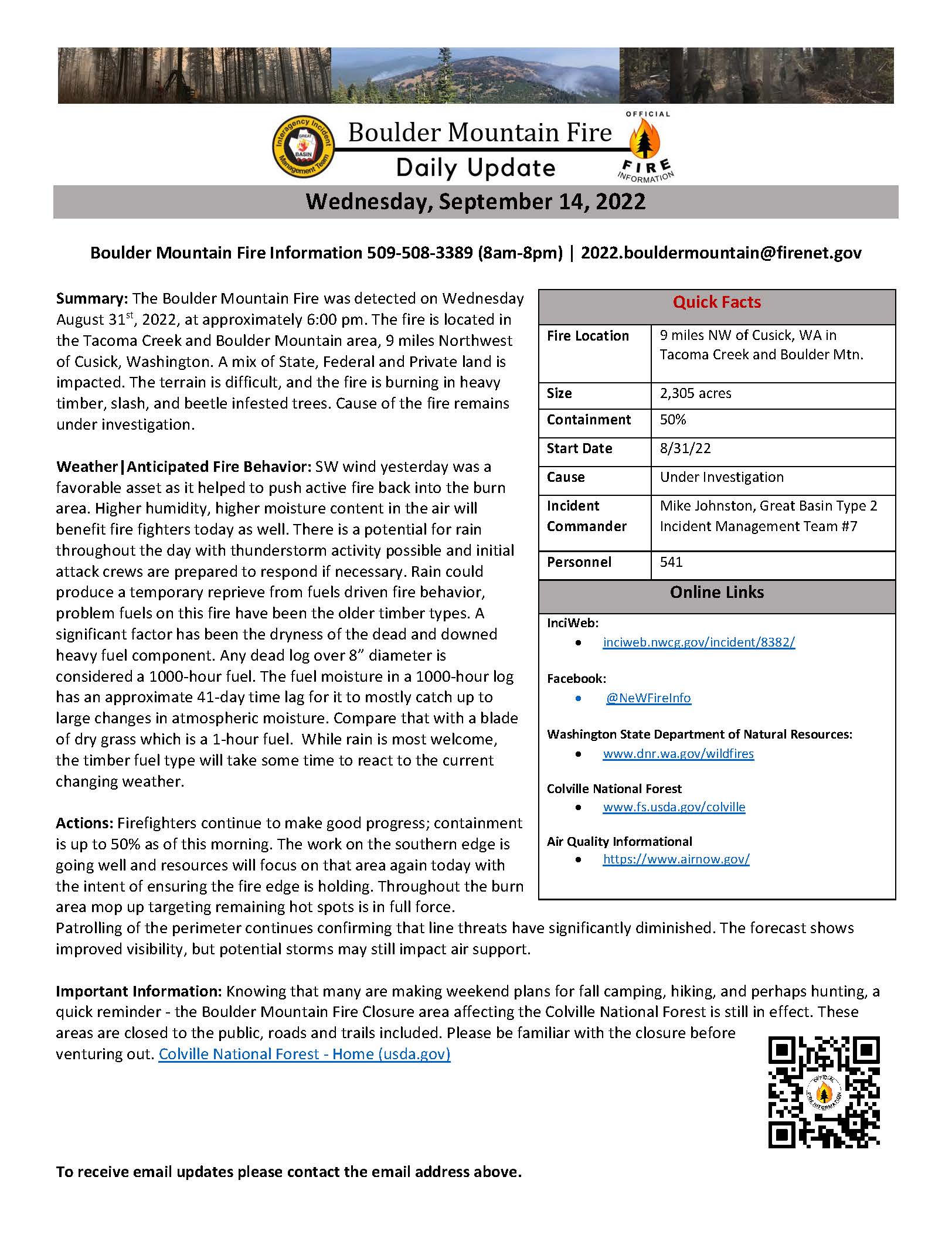
Summary: The Boulder Mountain Fire was detected on Wednesday August 31st, 2022, at approximately 6:00 pm. The fire is located in the Tacoma Creek and Boulder Mountain area, 9 miles Northwest of Cusick, Washington. A mix of State, Federal and Private land is impacted. The terrain is difficult, and the fire is burning in heavy timber, slash, and beetle infested trees. Cause of the fire remains under investigation.
Weather|Anticipated Fire Behavior: SW wind yesterday was a favorable asset as it helped to push active fire back into the burn area. Higher humidity, higher moisture content in the air will benefit fire fighters today as well. There is a potential for rain throughout the day with thunderstorm activity possible and initial attack crews are prepared to respond if necessary. Rain could produce a temporary reprieve from fuels driven fire behavior, problem fuels on this fire have been the older timber types. A significant factor has been the dryness of the dead and downed heavy fuel component. Any dead log over 8” diameter is considered a 1000-hour fuel. The fuel moisture in a 1000-hour log has an approximate 41-day time lag for it to mostly catch up to large changes in atmospheric moisture. Compare that with a blade of dry grass which is a 1-hour fuel. While rain is most welcome, the timber fuel type will take some time to react to the current changing weather.
Actions: Firefighters continue to make good progress; containment is up to 50% as of this morning. The work on the southern edge is going well and resources will focus on that area again today with the intent of ensuring the fire edge is holding. Throughout the burn area mop up targeting remaining hot spots is in full force. Patrolling of the perimeter continues confirming that line threats have significantly diminished. The forecast shows improved visibility, but potential storms may still impact air support.
Important Information: Knowing that many are making weekend plans for fall camping, hiking, and perhaps hunting, a quick reminder - the Boulder Mountain Fire Closure area affecting the Colville National Forest is still in effect. These areas are closed to the public, roads and trails included. Please be familiar with the closure before venturing out. Colville National Forest - Home (usda.gov)
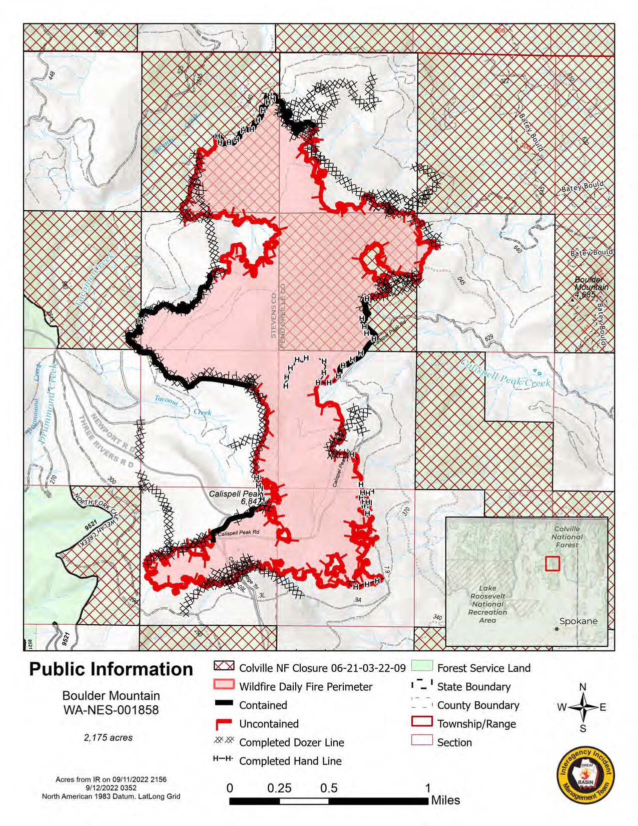
Boulder Mountain Fire Daily Update September 13 2022
Related Incident: Boulder Mountain Fire
Publication Type: News
Tuesday, September 13, 2022
Boulder Mountain Fire Information 509-508-3389 (8am-8pm) | 2022.bouldermountain@firenet.gov
Quick Facts
Fire Location: 9 miles NW of Cusick, WA in Tacoma Creek and Boulder Mtn.
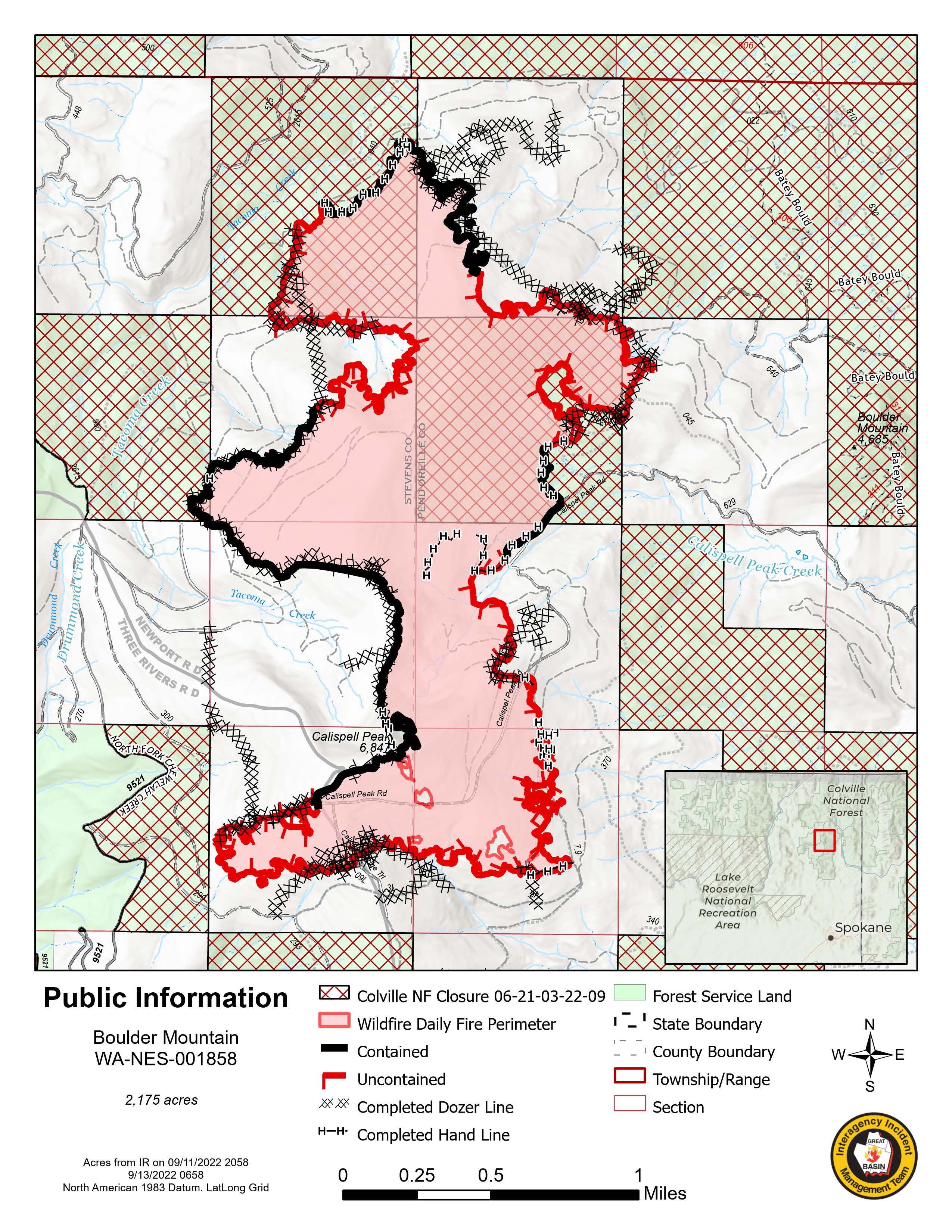
Size: 2,175 acres
Containment: 34%
Start Date: 8/31/22
Cause: Under Investigation
Incident Commander: Mike Johnston, Great Basin Type 2 Incident Management Team #7
Personnel: 542
Online Links
InciWeb: inciweb.nwcg.gov/incident/8382/
Facebook: @NeWFireInfo
Washington State Department of Natural Resources: www.dnr.wa.gov/wildfires
Colville National Forest: www.fs.usda.gov/colville
Air Quality Informational: https://www.airnow.gov/
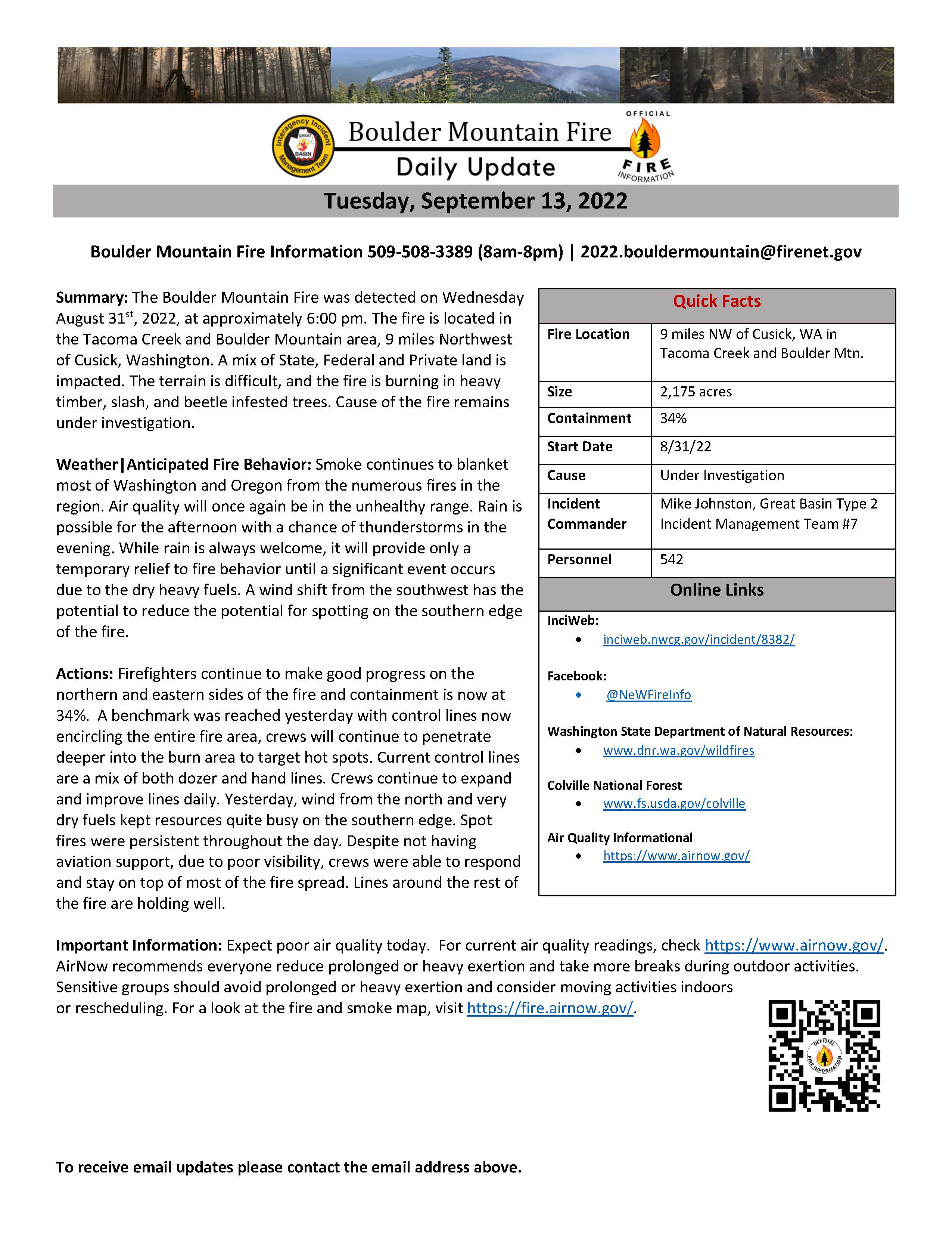
Summary: The Boulder Mountain Fire was detected on Wednesday August 31st, 2022, at approximately 6:00 pm. The fire is located in the Tacoma Creek and Boulder Mountain area, 9 miles Northwest of Cusick, Washington. A mix of State, Federal and Private land is impacted. The terrain is difficult, and the fire is burning in heavy timber, slash, and beetle infested trees. Cause of the fire remains under investigation.
Weather|Anticipated Fire Behavior: Smoke continues to blanket most of Washington and Oregon from the numerous fires in the region. Air quality will once again be in the unhealthy range. Rain is possible for the afternoon with a chance of thunderstorms in the evening. While rain is always welcome, it will provide only a temporary relief to fire behavior until a significant event occurs due to the dry heavy fuels. A wind shift from the southwest has the potential to reduce the potential for spotting on the southern edge of the fire.
Actions: Firefighters continue to make good progress on the northern and eastern sides of the fire and containment is now at 34%. A benchmark was reached yesterday with control lines now encircling the entire fire area, crews will continue to penetrate deeper into the burn area to target hot spots. Current control lines are a mix of both dozer and hand lines. Crews continue to expand and improve lines daily. Yesterday, wind from the north and very dry fuels kept resources quite busy on the southern edge. Spot fires were persistent throughout the day. Despite not having aviation support, due to poor visibility, crews were able to respond and stay on top of most of the fire spread. Lines around the rest of the fire are holding well.
Important Information: Expect poor air quality today. For current air quality readings, check https://www.airnow.gov/. AirNow recommends everyone reduce prolonged or heavy exertion and take more breaks during outdoor activities. Sensitive groups should avoid prolonged or heavy exertion and consider moving activities indoors or rescheduling. For a look at the fire and smoke map, visit https://fire.airnow.gov/.
Boulder Mountain Fire Daily Update September 12 2022
Related Incident: Boulder Mountain Fire
Publication Type: News
Monday, September 12, 2022
Boulder Mountain Fire Information 509-508-3389 (8am-8pm) | 2022.bouldermountain@firenet.gov
Quick Facts
Fire Location: 9 miles NW of Cusick, WA in Tacoma Creek and Boulder Mtn.
Size: 2,175 acres
Containment: 21%
Start Date: 8/31/22
Cause: Under Investigation
Incident Commander: Mike Johnston, Great Basin Type 2 Incident Management Team #7
Personnel: 505
Online Links
InciWeb:
inciweb.nwcg.gov/incident/8382/
Facebook:
Washington State Department of Natural Resources:
Colville National Forest
Air Quality Informational
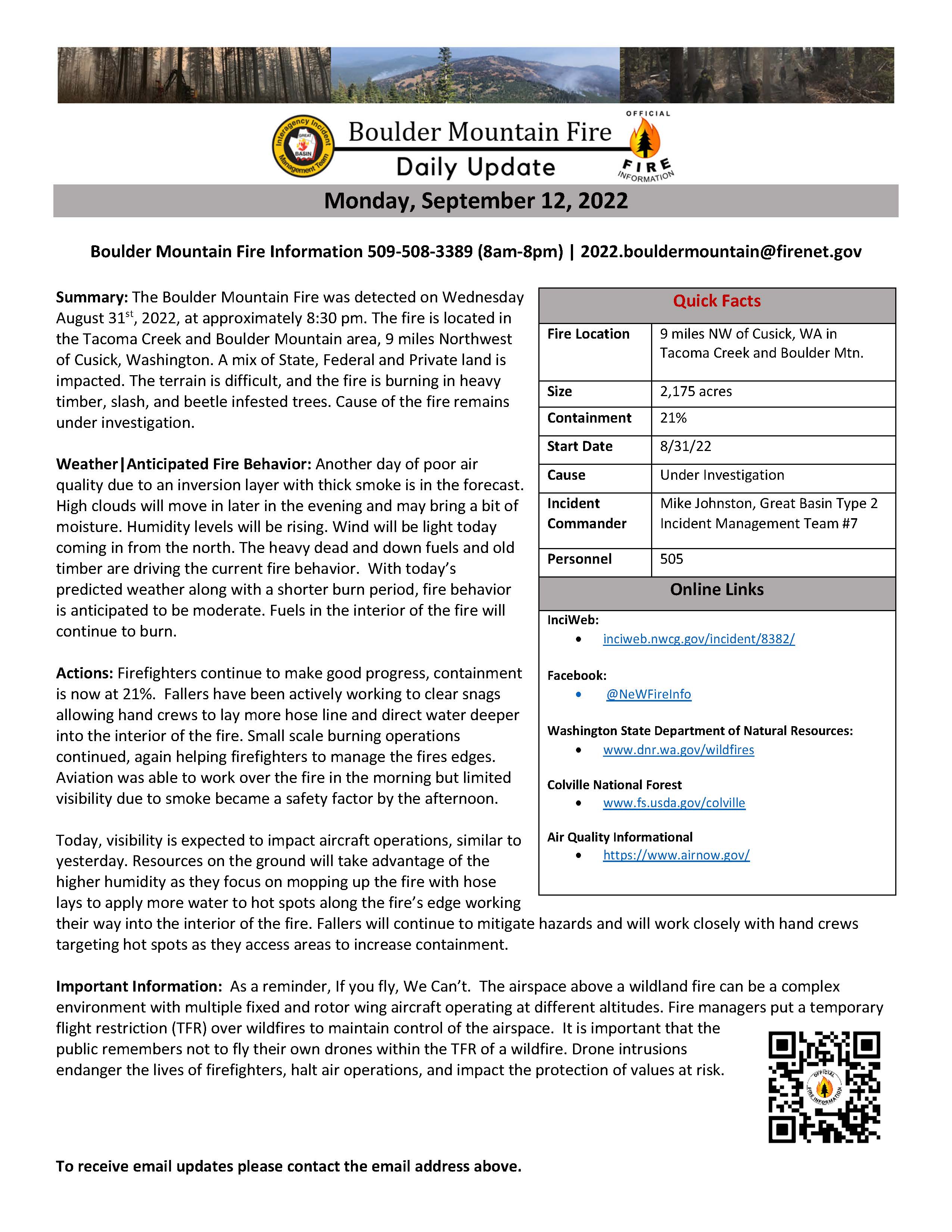
Summary: The Boulder Mountain Fire was detected on Wednesday August 31st, 2022, at approximately 8:30 pm. The fire is located in the Tacoma Creek and Boulder Mountain area, 9 miles Northwest of Cusick, Washington. A mix of State, Federal and Private land is impacted. The terrain is difficult, and the fire is burning in heavy timber, slash, and beetle infested trees. Cause of the fire remains under investigation.
Weather|Anticipated Fire Behavior: Another day of poor air quality due to an inversion layer with thick smoke is in the forecast. High clouds will move in later in the evening and may bring a bit of moisture. Humidity levels will be rising. Wind will be light today coming in from the north. The heavy dead and down fuels and old timber are driving the current fire behavior. With today’s predicted weather along with a shorter burn period, fire behavior is anticipated to be moderate. Fuels in the interior of the fire will continue to burn.
Actions: Firefighters continue to make good progress, containment is now at 21%. Fallers have been actively working to clear snags allowing hand crews to lay more hose line and direct water deeper into the interior of the fire. Small scale burning operations continued, again helping firefighters to manage the fires edges. Aviation was able to work over the fire in the morning but limited visibility due to smoke became a safety factor by the afternoon.
Today, visibility is expected to impact aircraft operations, similar to yesterday. Resources on the ground will take advantage of the higher humidity as they focus on mopping up the fire with hose lays to apply more water to hot spots along the fire’s edge working their way into the interior of the fire. Fallers will continue to mitigate hazards and will work closely with hand crews targeting hot spots as they access areas to increase containment.
Important Information: As a reminder, If you fly, We Can’t. The airspace above a wildland fire can be a complex environment with multiple fixed and rotor wing aircraft operating at different altitudes. Fire managers put a temporary flight restriction (TFR) over wildfires to maintain control of the airspace. It is important that the public remembers not to fly their own drones within the TFR of a wildfire. Drone intrusions endanger the lives of firefighters, halt air operations, and impact the protection of values at risk.