
Incident Media Photographs
Could not determine your location.
 Wildfire
 Prescribed Fire
 Burned Area
Response
Burned Area
Response Other
Other
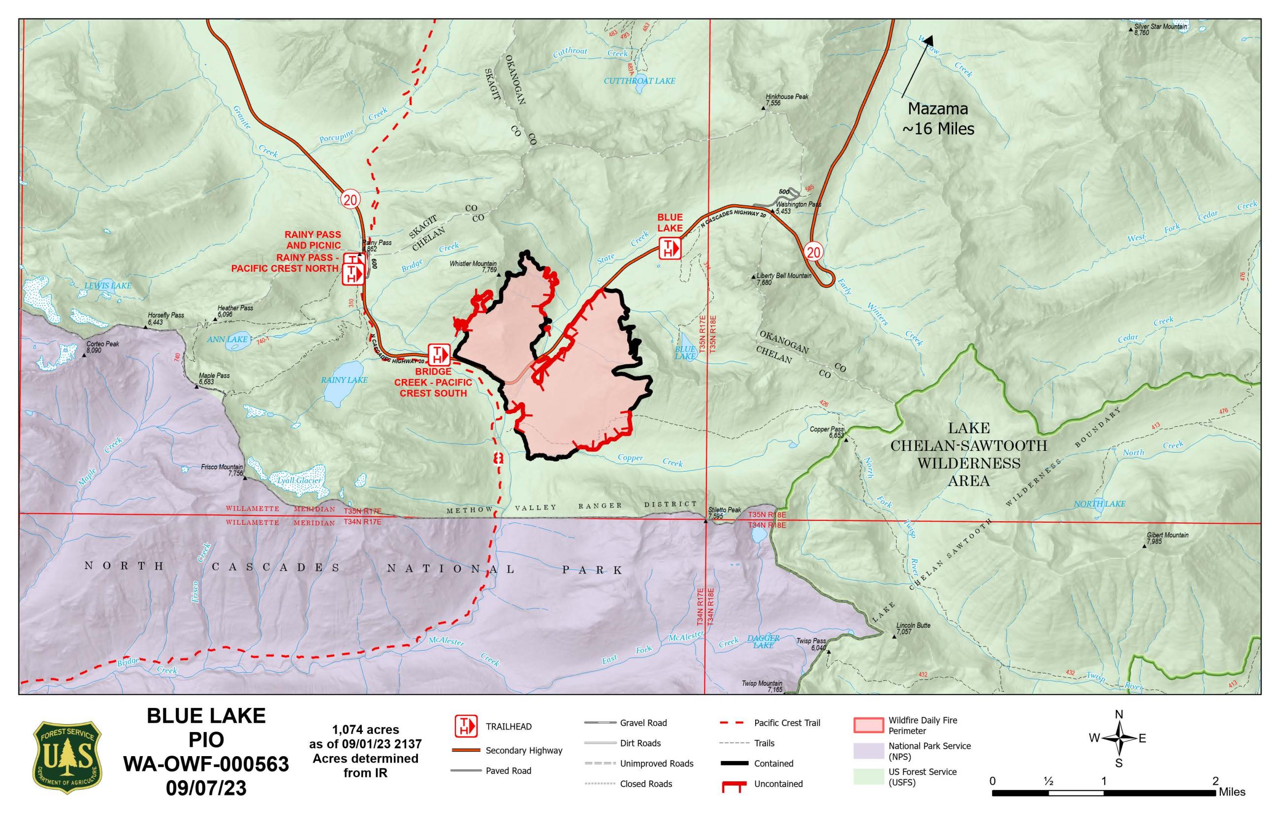
Blue Lake Fire
Unit Information
Incident Contacts
- Methow Valley Ranger DistrictPhone:509-996-4000Hours:8 a.m.Extension:4:30 p.m.
Photographs Gallery
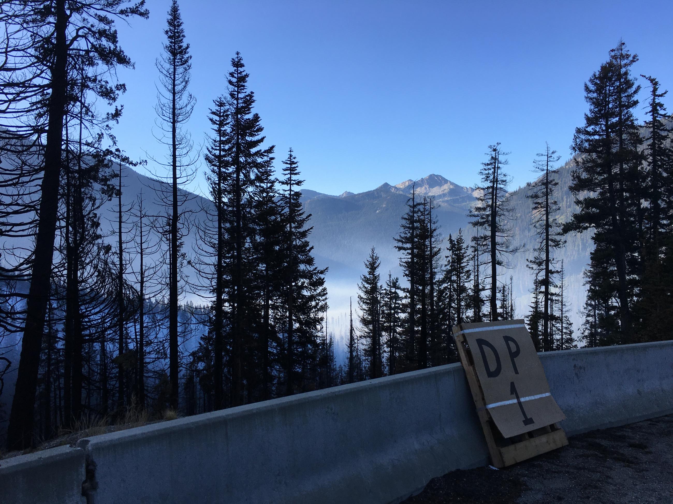
View of Blue Lake Fire from Drop Point 1 along State Route 20 looking back towards Bridge Creek drainage.
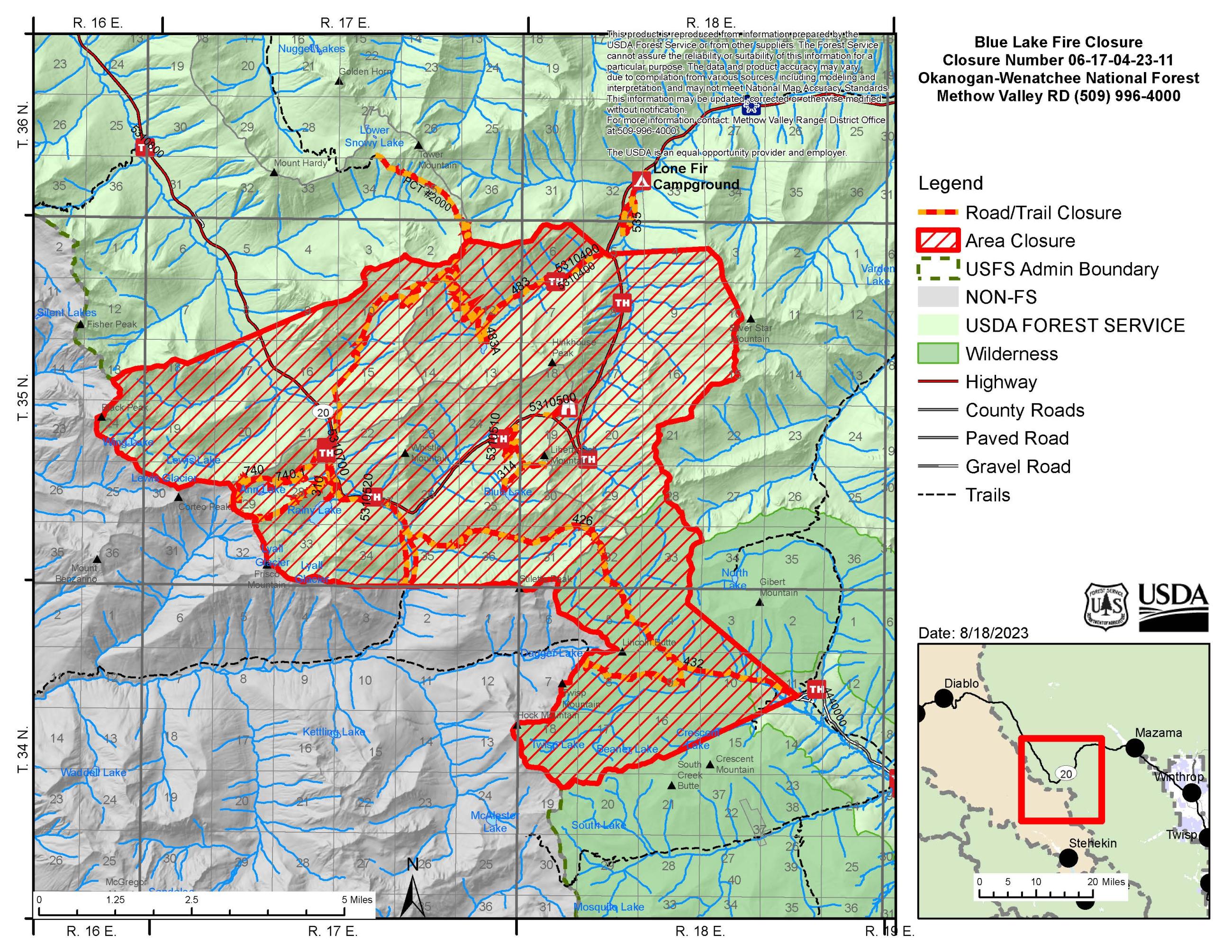
Closures:
Closed trails and all associated trailheads:
• Trail No. 2000 Pacific Crest Trail, from boundary of North Cascades National Park north
to the junction with Trail No. 728 Snowy Lakes
• Trail No. 310 Rainy Lake
• Trail No. 314 Blue Lake
• Trail No. 426 Copper Pass
• Trail No. 432 Twisp Pass
• Trail No. 483 Cutthroat Pass
• Trail No. 483A Cutthroat Lake
• Trail No. 535 Lone Fir
• Trail No. 585 Washington Pass Overlook
• Trail No. 740 Maple Pass
• Trail No. 740.1 Lake Ann
• Trail No. 727 Liberty Bell
• Trail No. 727A Beckey Spur
• Trail No. 727B N Early Winters Spur
• Trail No. 2172 Stiletto Spur
Developed Campgrounds Closed
• Lone Fir
Closures are also in effect for areas of North Cascades National Park due to the Blue Lake Fire. See https://www.nps.gov/noca/planyourvisit/fire-closures.htm for more information. State Route 20 is closed from Silver Star Sno Park (milepost 171) to Newhalem (milepost 120). Check WSDOT for highway closures https://www.facebook.com/WSDOT. The Pacific Crest Trail is closed through this area. Check PCTA for closure information https://www.pcta.org/discover-the-trail/closures/washington/
Aerial image of Blue Lake Fire, looking northwest over the ridge near Copper Creek, showing SR20 and the Bridge Creek Trailhead in the middle of the photo.
Thursday, August 14, 2023

Aerial suppression on Blue Lake Fire - August 26, 2023
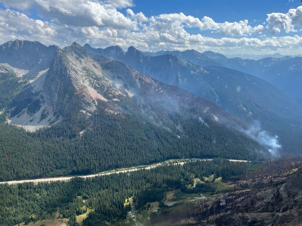
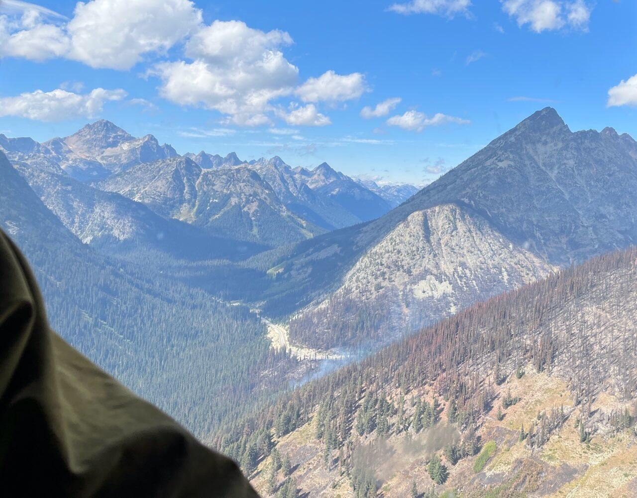
Blue Lake Fire aerial image from near Whistler Peak, looking southwest over SR20 and Bridge Creek drainage.
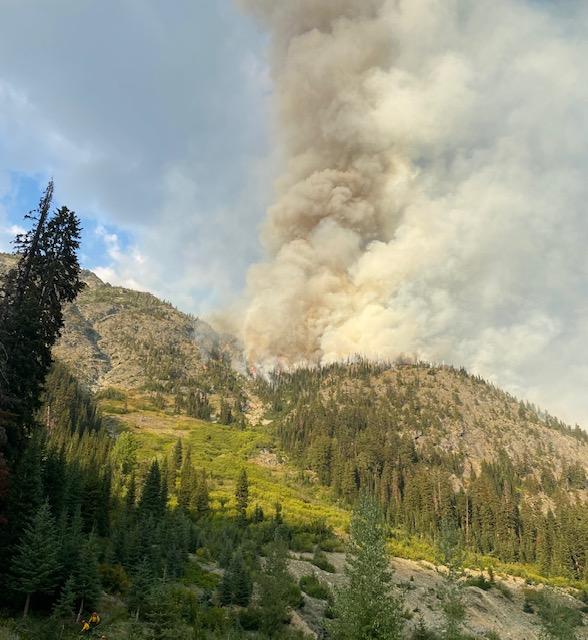
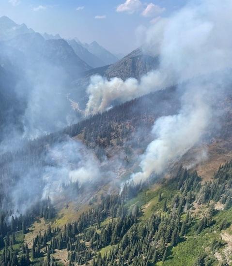
Smoke column from Blue Lake Fire - August 29, 2023
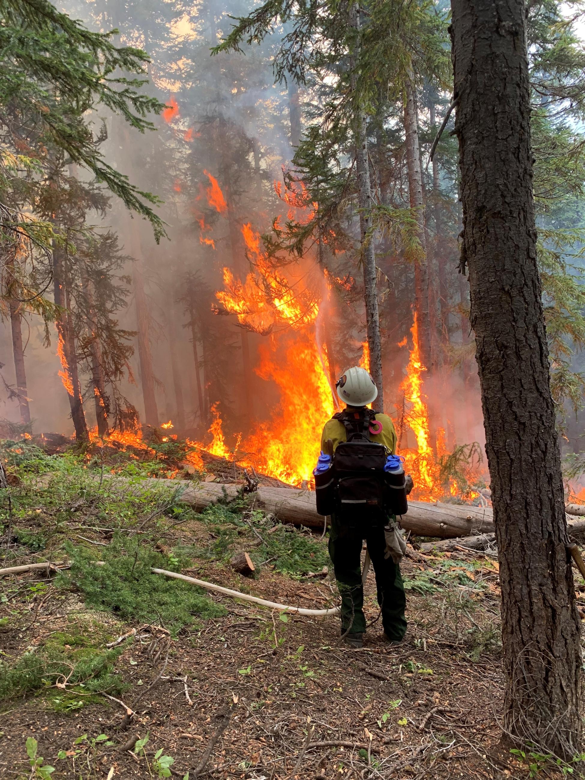
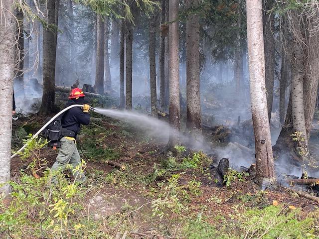
Wildland firefighters using hose to actively suppress Blue Lake Fire.
Aerial image of Blue Lake Fire and spot fire - August 26, 2023
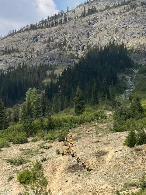
Crew hiking near Blue Lake Fire
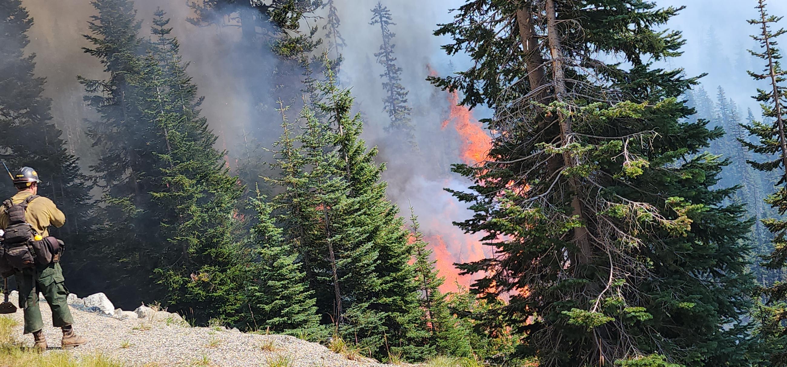
Active fire near SR 20