Incident Media Photographs
Could not determine your location.
2023 Airplane Lake OWF
Unit Information
Incident Contacts
- Okanogan-Wenatchee National ForestPhone:(509) 664-9200
Photographs Gallery
![White smoke from the Airplane Lake Fire seen on September 2, 2023.](https://inciweb-prod-media-bucket.s3.us-gov-west-1.amazonaws.com/s3fs-public/styles/max_2600x2600/public/2023-09/AirplaneLakeFire_WRRD_OkaWenNF_White%20Pass%20area%20of%20PCT%20byDanHildenFS_2023-09-02%20%282%29.jpg?VersionId=T0J2t066FOOq0FjRES5FU40S4XzDOcQ8&itok=_UE6LWsq)
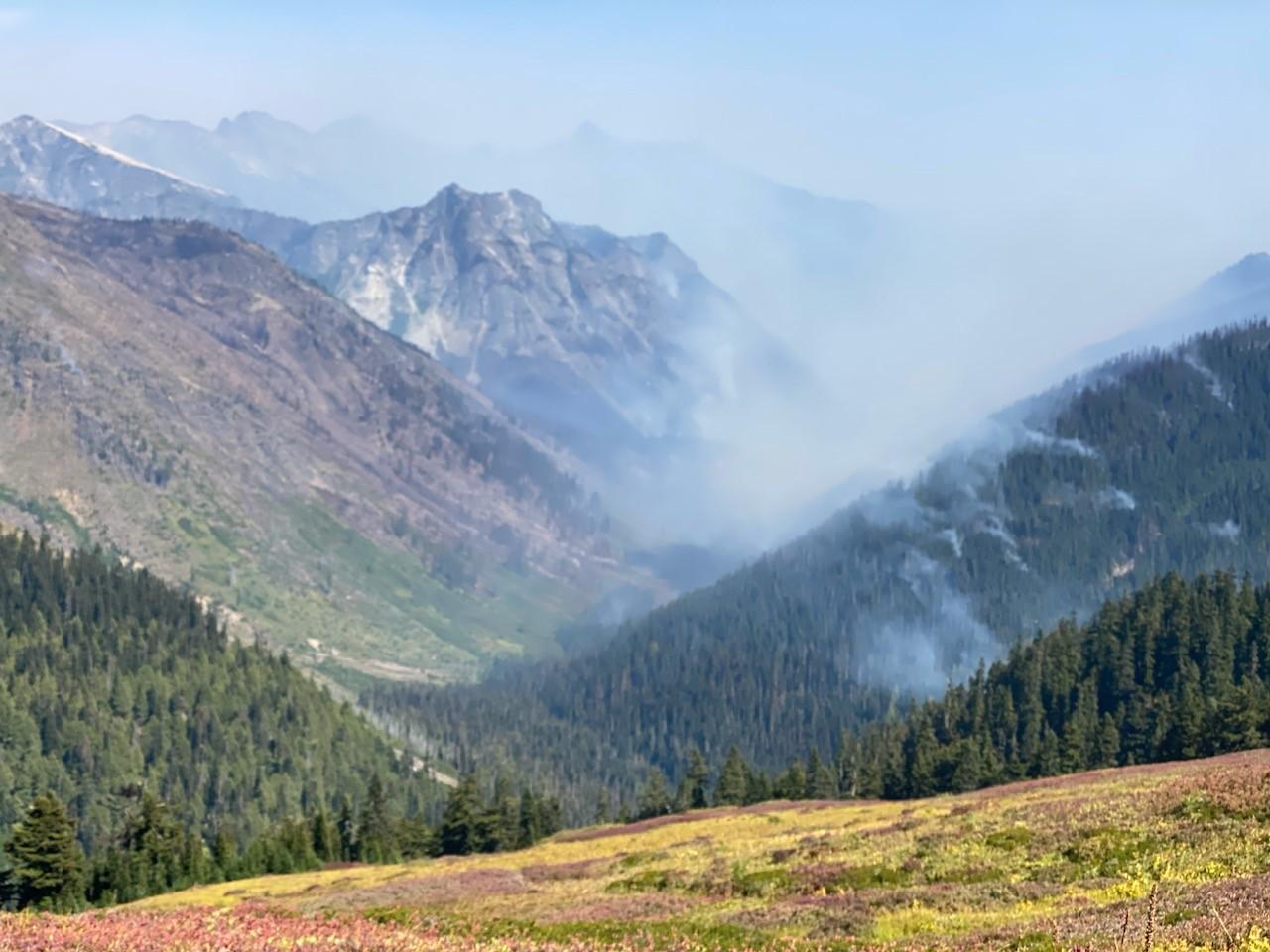
Smoke from the Airplane Lake Fire viewed from the White Pass area of the Pacific Crest Trail in the Glacier Peak Wilderness Area on September 2, 2023.
![Wispy white smoke from the Airplane Lake Fire is visible from the Pacific Crest Trail near White Pass in the Glacier Peak Wilderness Area.](https://inciweb-prod-media-bucket.s3.us-gov-west-1.amazonaws.com/s3fs-public/styles/max_2600x2600/public/2023-09/AirplaneLakeFire_WRRD_OkaWenNF_White%20Pass%20area%20of%20PCT%20byDanHildenFS_2023-09-02%20%281%29.jpg?VersionId=pOb_s1YrZHvdM6OoU25VTh2TYdUTtsWN&itok=C5-UIMuN)
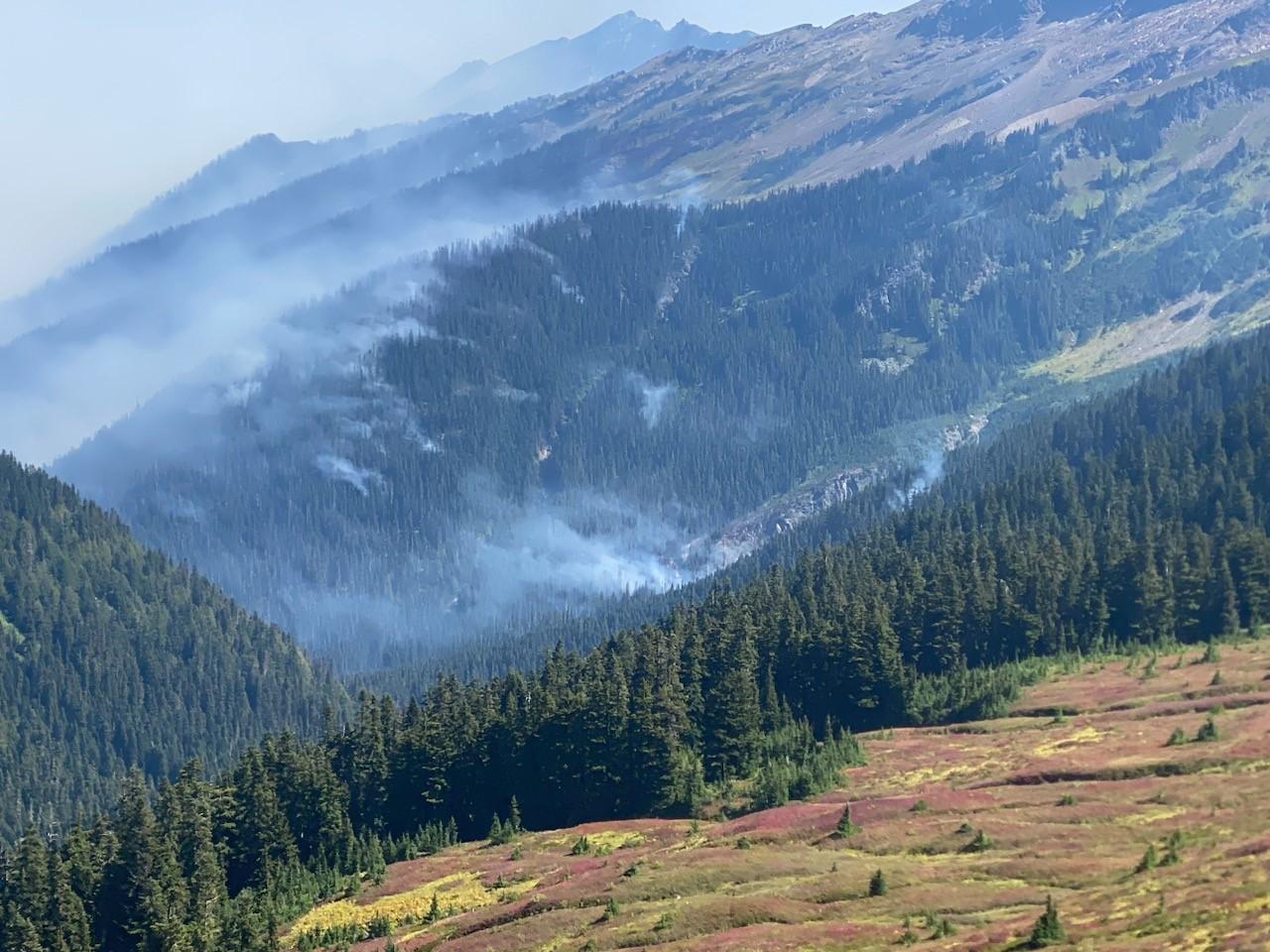
Pockets of wispy white smoke from the Airplane Lake Fire in the White Pass area of the Glacier Peak Wilderness as seen from the Pacific Crest Trail on September 2, 2023.
![Smoke rising from the Airplane Lake Fire on August 22, 2023 as viewed from a helicopter flying nearby.](https://inciweb-prod-media-bucket.s3.us-gov-west-1.amazonaws.com/s3fs-public/styles/max_2600x2600/public/2023-08/Smoke_2023-08-22_AirplaneLake_OkaWenNF_view%20from%20heli_r1.jpg?VersionId=jcLU.c1ErxWq5ap257JaPD4d03qCF0vQ&itok=xeTj-_4f)
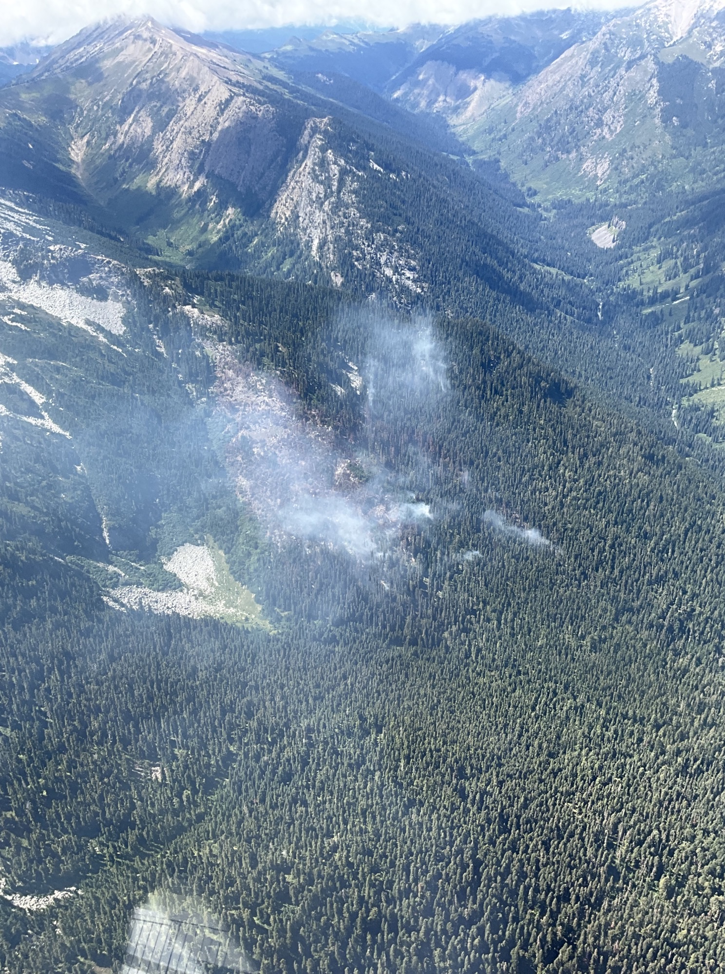
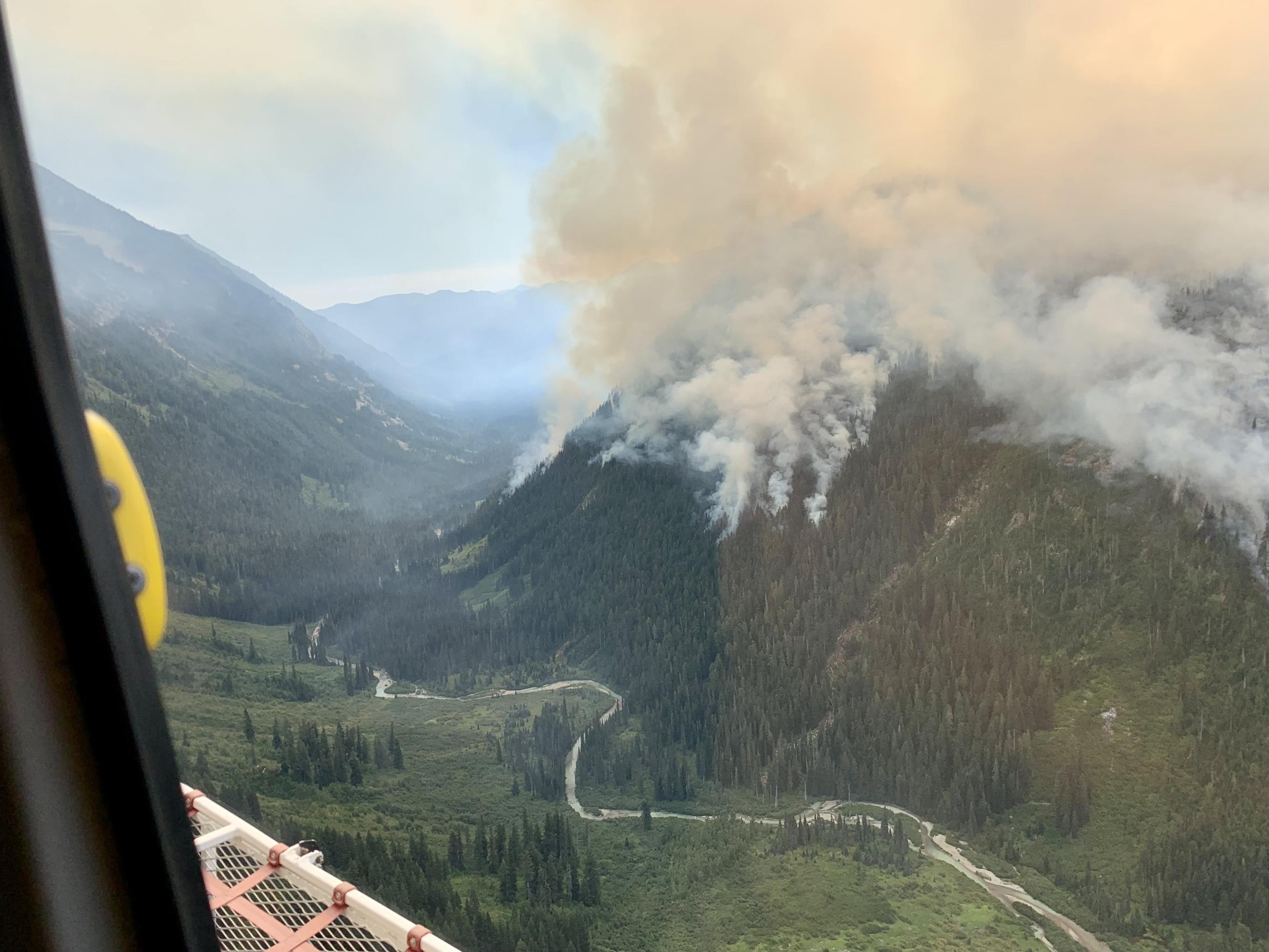
Smoke rising from the Airplane Lake Fire on August 22, 2023.
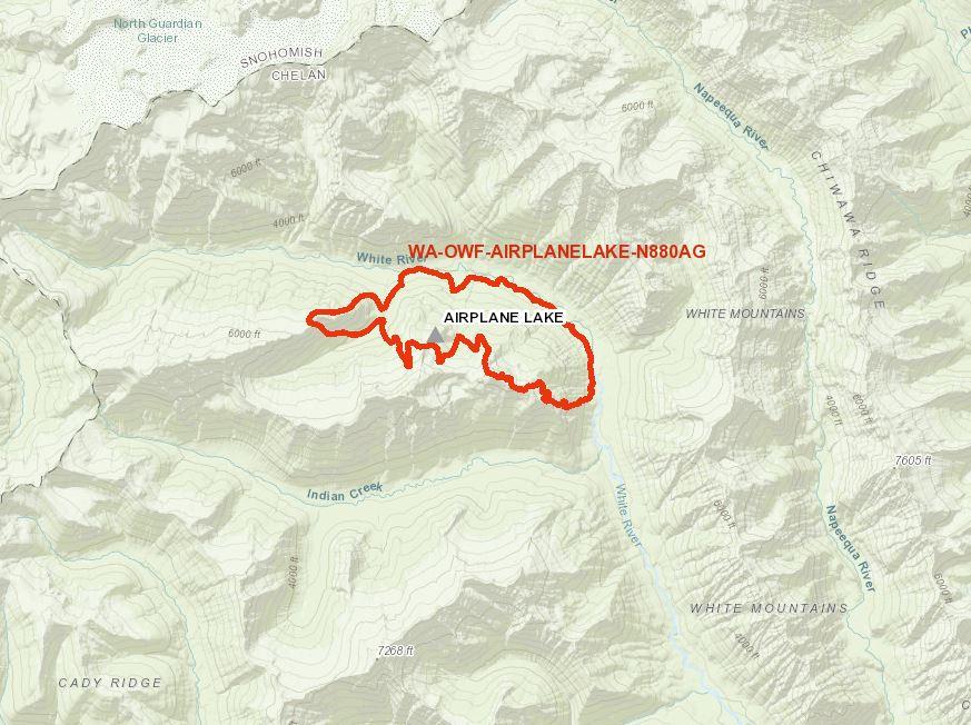
A simple map showing the perimeter of the Airplane Lake Fire on August 23, 2023.
![Smoke covers a heavily treed hillside where the Airplane Lake Fire is burning. A river is seen in the lower third of the photo.](https://inciweb-prod-media-bucket.s3.us-gov-west-1.amazonaws.com/s3fs-public/styles/max_2600x2600/public/2023-08/Smoke_2023-08-22_AirplaneLake_OkaWenNF_view%20of%20fire%20and%20river%20from%20heli_r1.jpg?VersionId=TlplZ_cWpj_KgTqV.S7rZYbnJl4INchg&itok=9MW_RMvt)
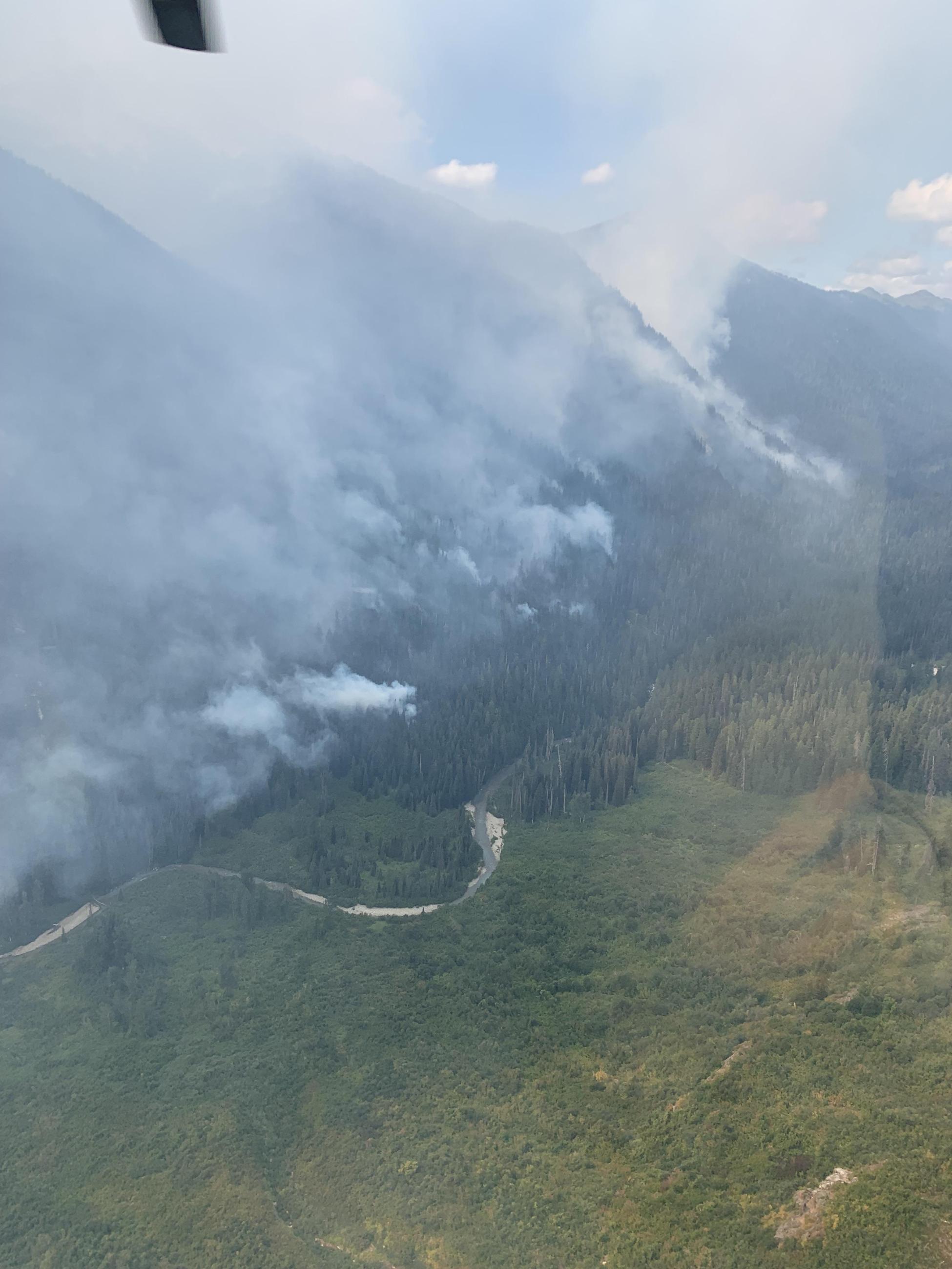
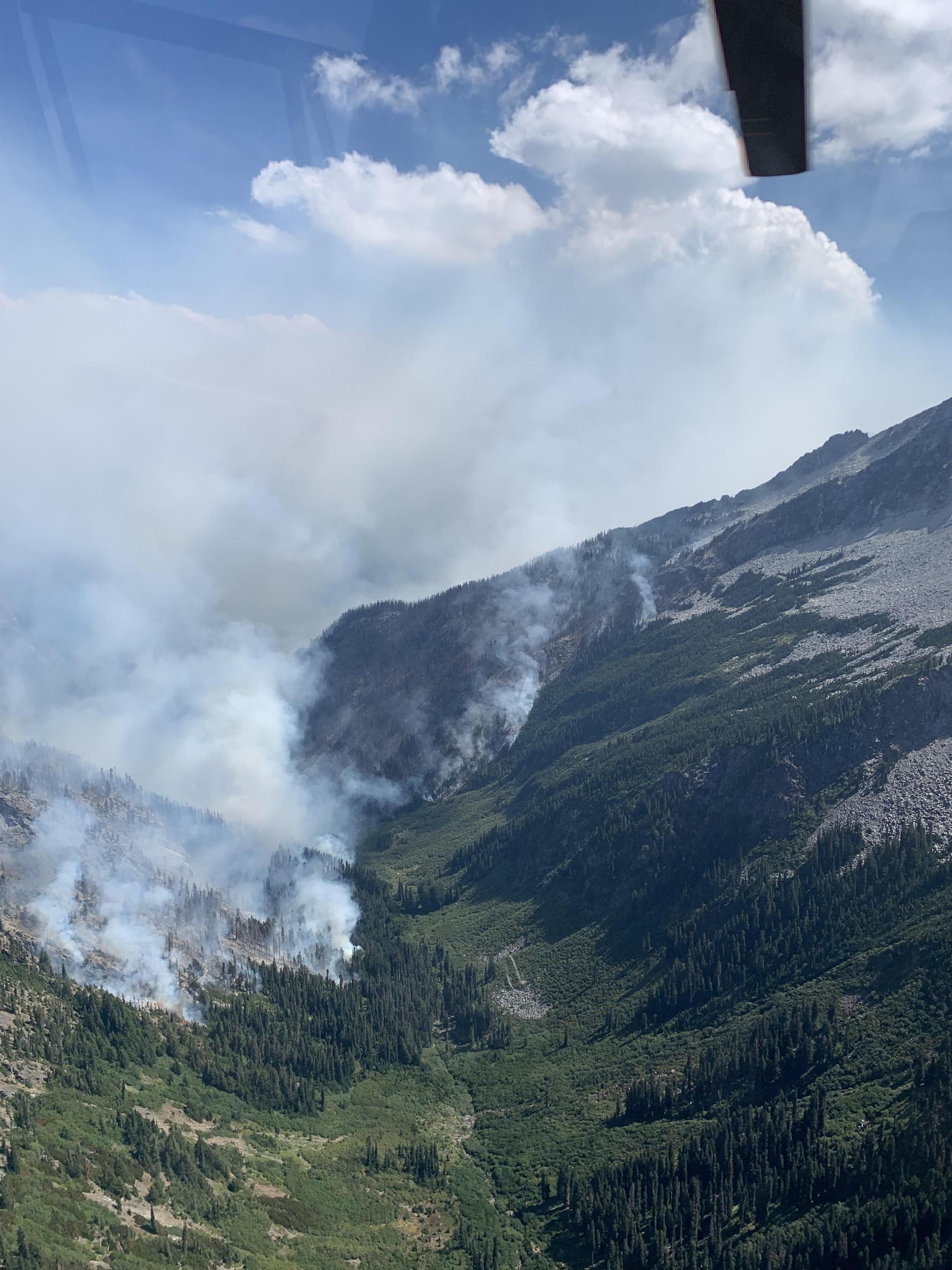
Smoke blankets a hillside where the Airplane Lake Fire is burning in the Glacier Peak Wilderness Area on August 22, 2023.
![Tendrils of white smoke are visible in three avalanche chutes on a hillside in the Glacier Peak Wilderness Area where the Airplane Lake Fire is burning.](https://inciweb-prod-media-bucket.s3.us-gov-west-1.amazonaws.com/s3fs-public/styles/max_2600x2600/public/2023-08/Smoke_2023-08-22_AirplaneLake_OkaWenNF_avalanche%20chutes.jpg?VersionId=6sBogQXDU6rhkmTEoeg6eg7zjmRwwotP&itok=IQenge6y)
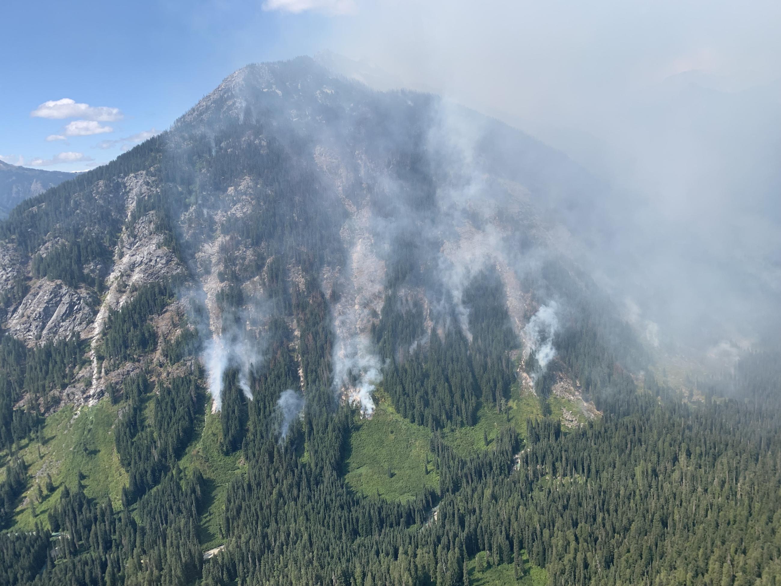
Smoke from the Airplane Lake Fire is visible in avalanche chutes in the Glacier Peak Wilderness Area.
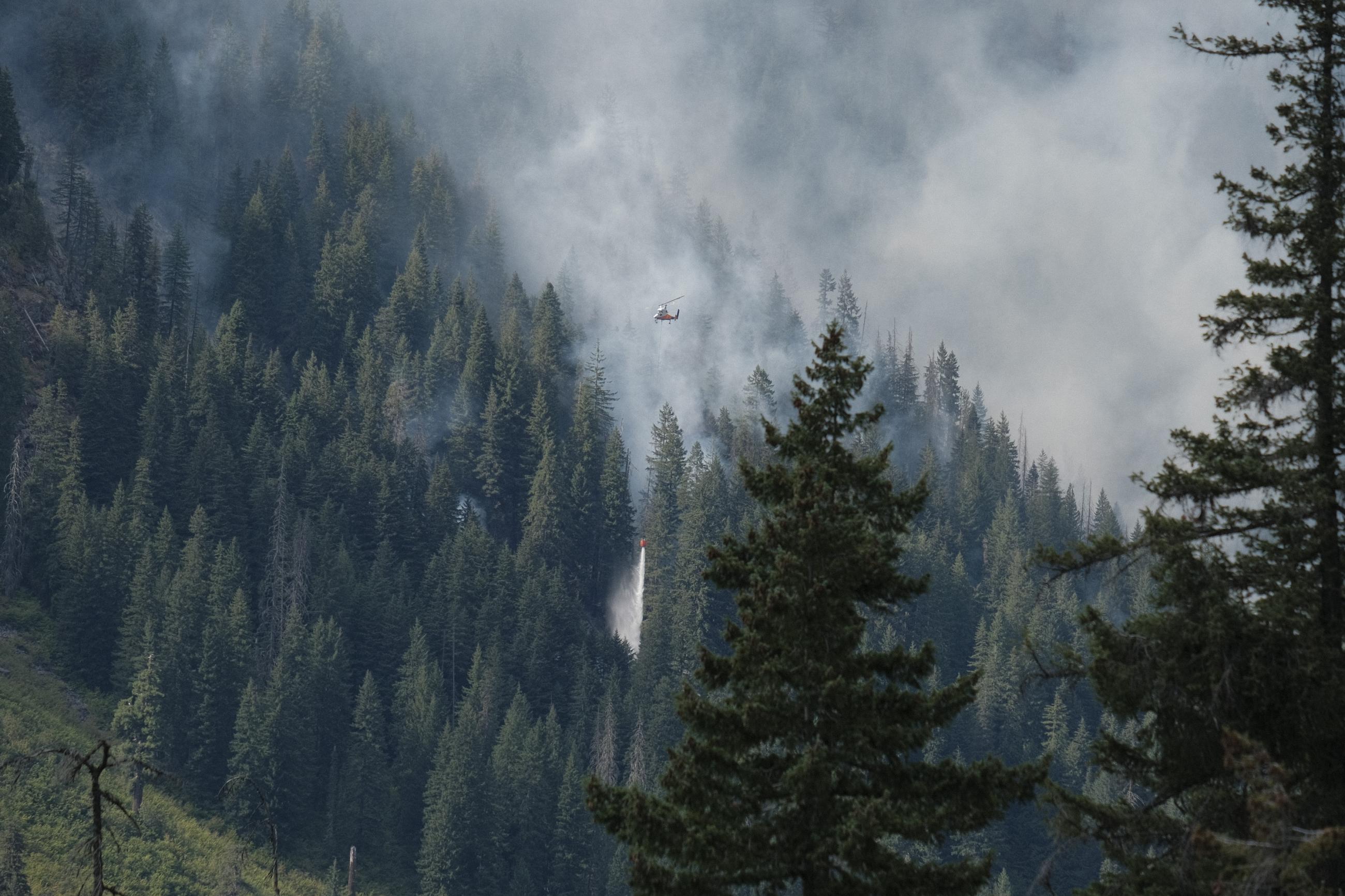
A large helicopter drops water on the south flank of the Airplane Lake Fire on August 22, 2023.
![An aerial view of the smoke from the Airplane Lake Fire seen on the upper portion of a tree-covered hillside.](https://inciweb-prod-media-bucket.s3.us-gov-west-1.amazonaws.com/s3fs-public/styles/max_2600x2600/public/2023-08/AirplaneLakeFire_WRRD_OkaWenNF_2023-08-16_from%20air2.jpg?VersionId=XyPPV0aO2YQSnhj5fyebx5Zqlf99u8VT&itok=J-KOO1av)
Smoke rises from the Airplane Lake Fire on August 16, 2023.