Incident Media Maps
Settings - change map background and toggle additional layers
Filter - control incident types displayed on map.
Zoom to your location
Reset map zoom and position
Could not determine your location.
Show Legend
 Wildfire
 Prescribed Fire
 Burned Area
Response
Burned Area
Response Other
Other
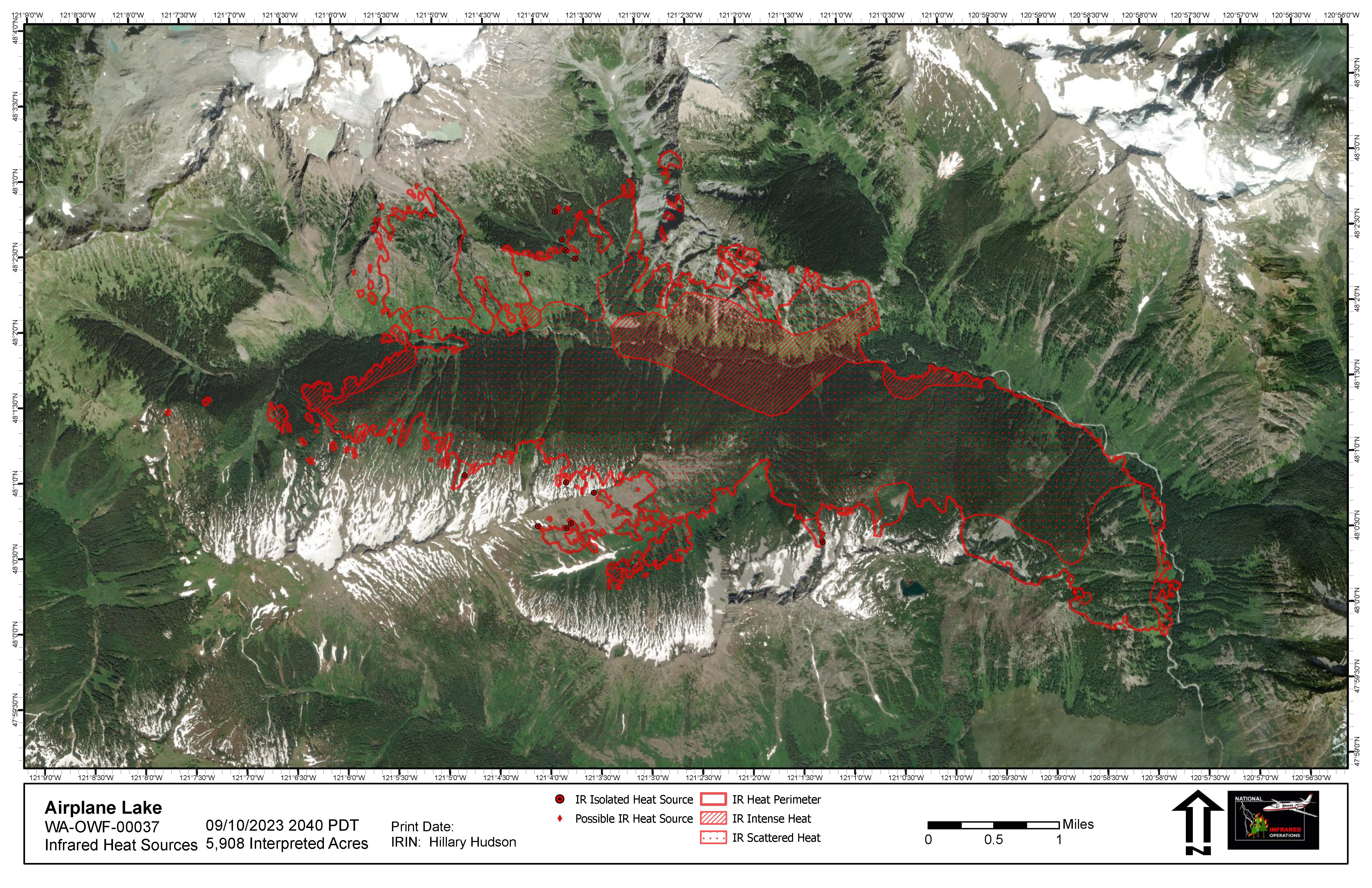
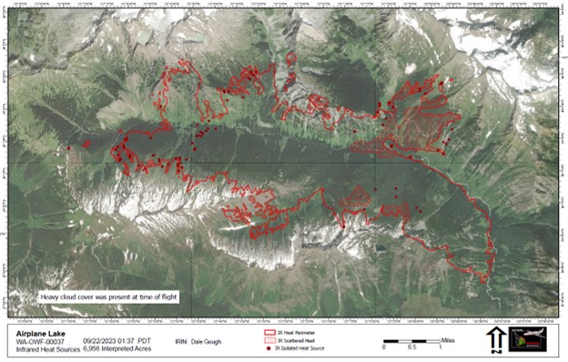
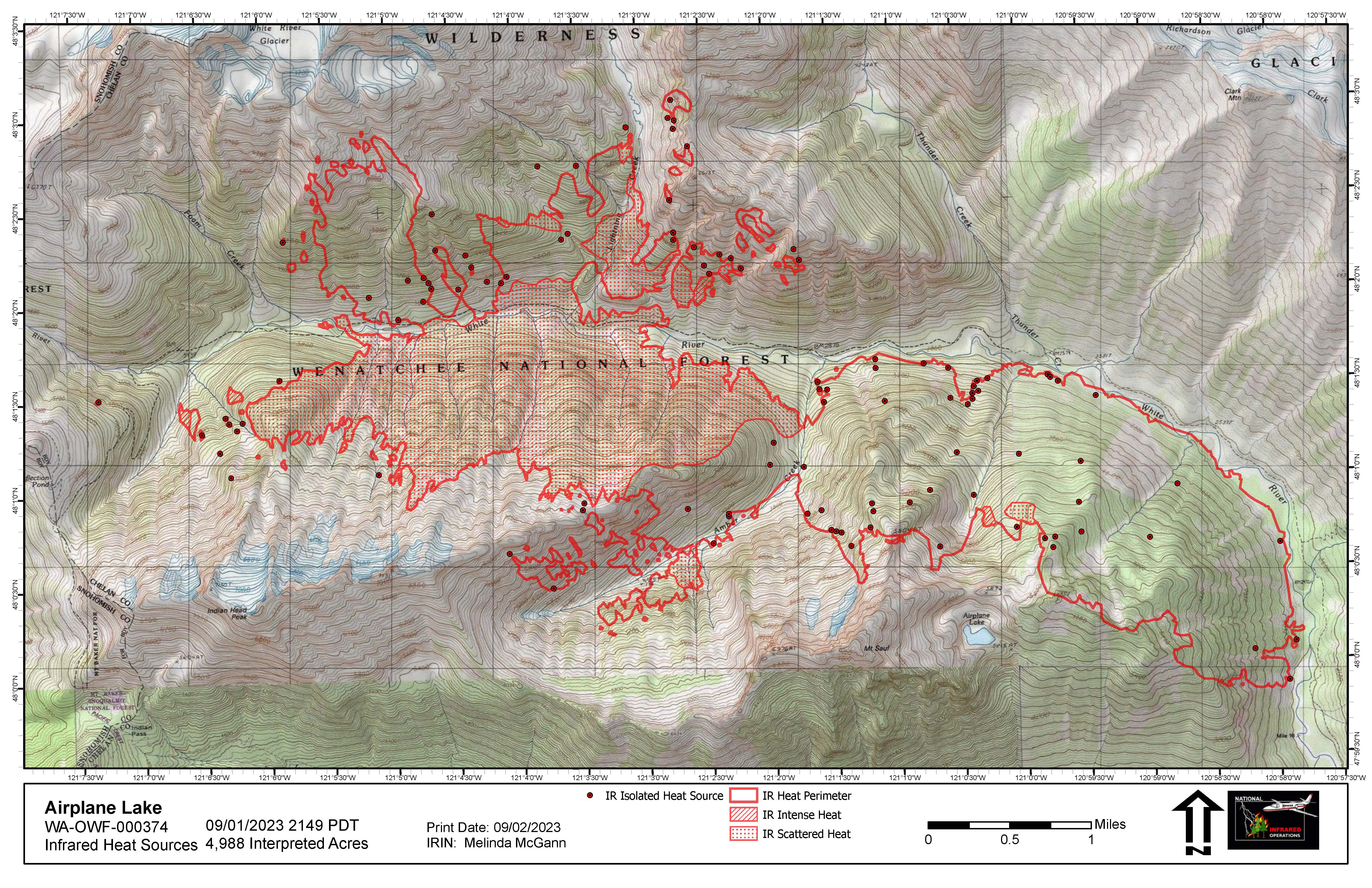
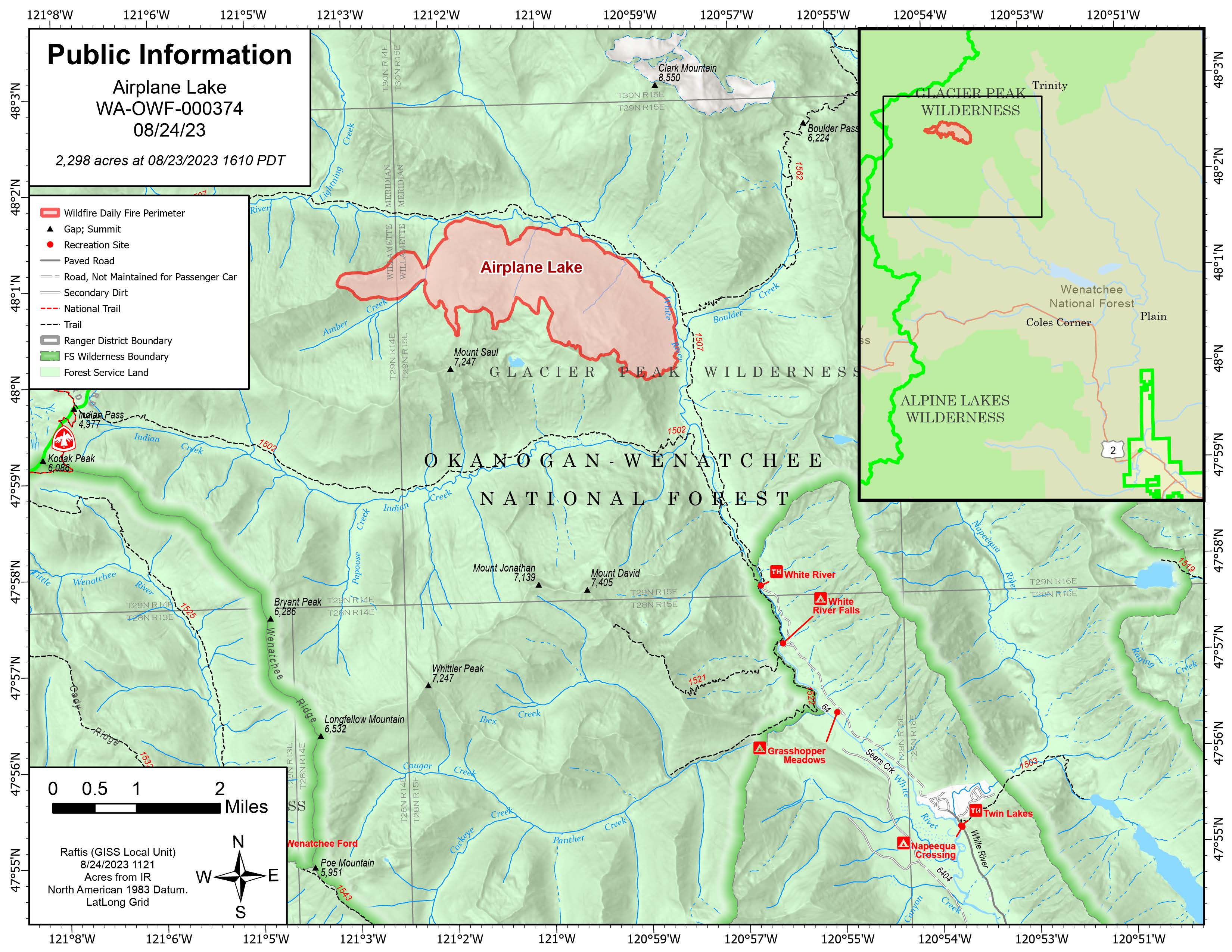
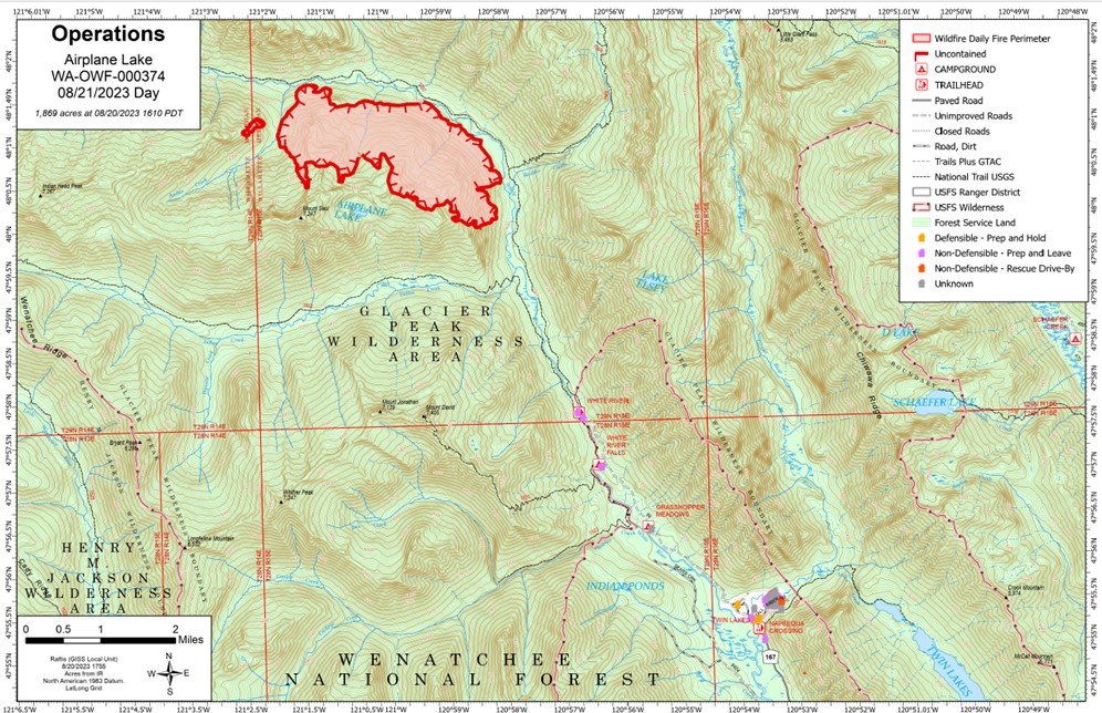
2023 Airplane Lake OWF
Unit Information
Washington
0
Agency Name: U.S. Forest Service
Agency Abbreviation
FS
Washington
0
Agency Name: U.S. Forest Service
Agency Abbreviation
FS
Incident Contacts
- Okanogan-Wenatchee National ForestPhone:(509) 664-9200