
Incident Media Photographs
Could not determine your location.
 Wildfire
 Prescribed Fire
 Burned Area
Response
Burned Area
Response Other
Other
South Fork and Salt Fires Burned Area Emergency Response
Unit Information
Agency Name: Bureau of Indian Affairs
Agency Name: Bureau of Indian Affairs
Incident Contacts
- Elaina LaPaz, Mescalero Apache Tribe PIO
- Amanda Fry, Lincoln National Forest PAOEmail:
Photographs Gallery
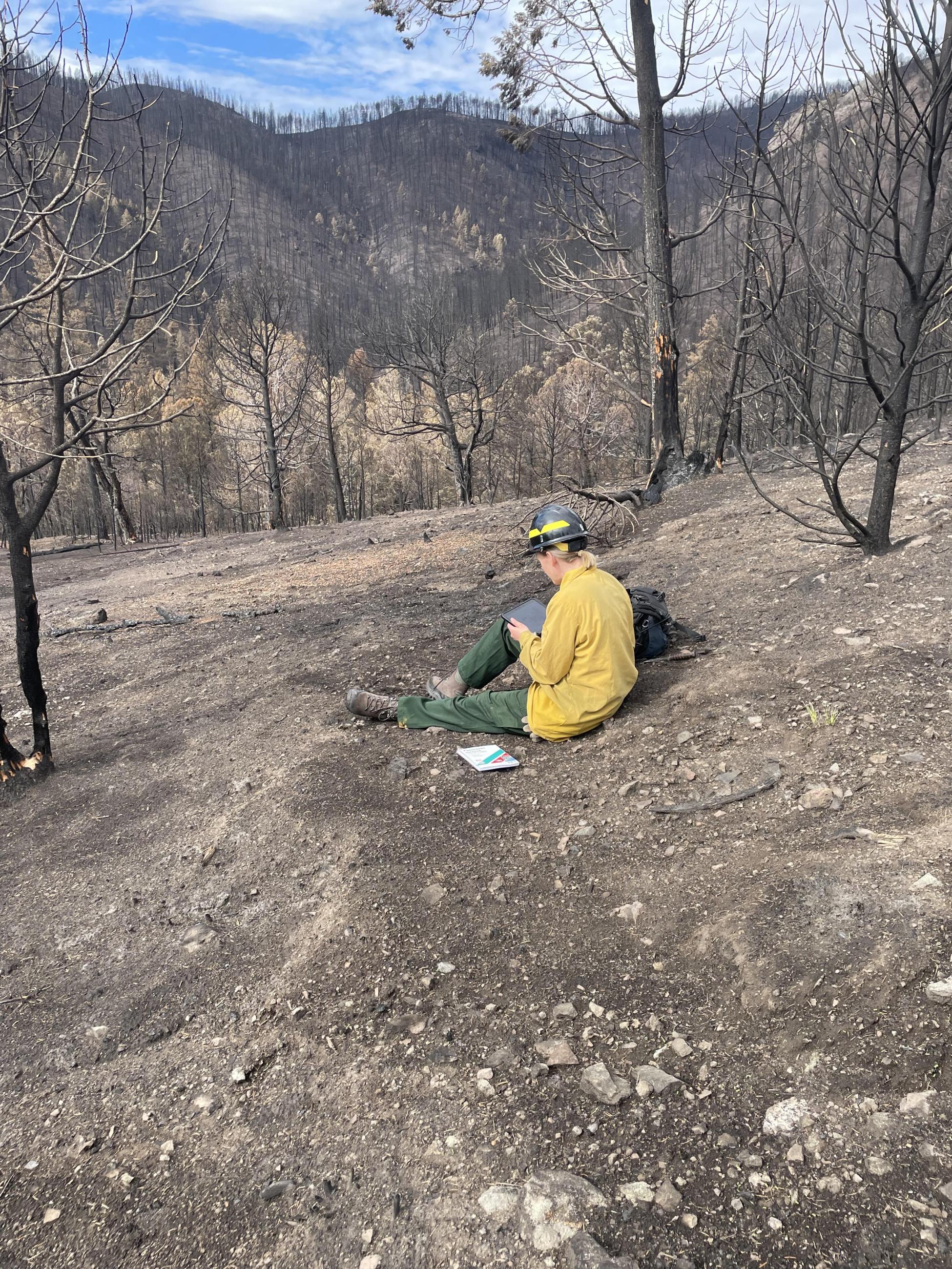
BAER Soil Scientist recording field notes for soil burn severity in the South Fork burned area
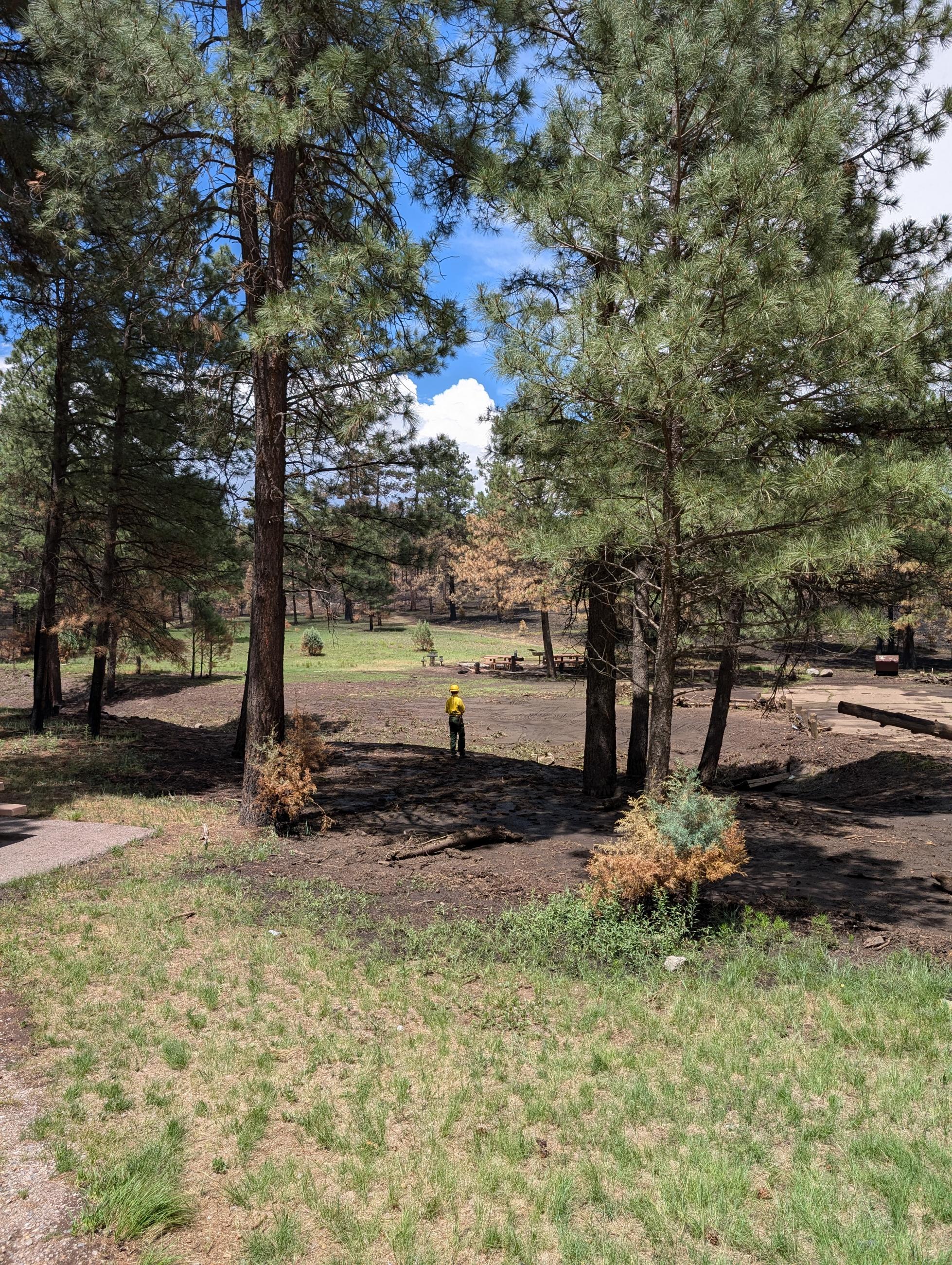
BAER Hydrologist Evaluating burned recreation site in the South Fork burned area
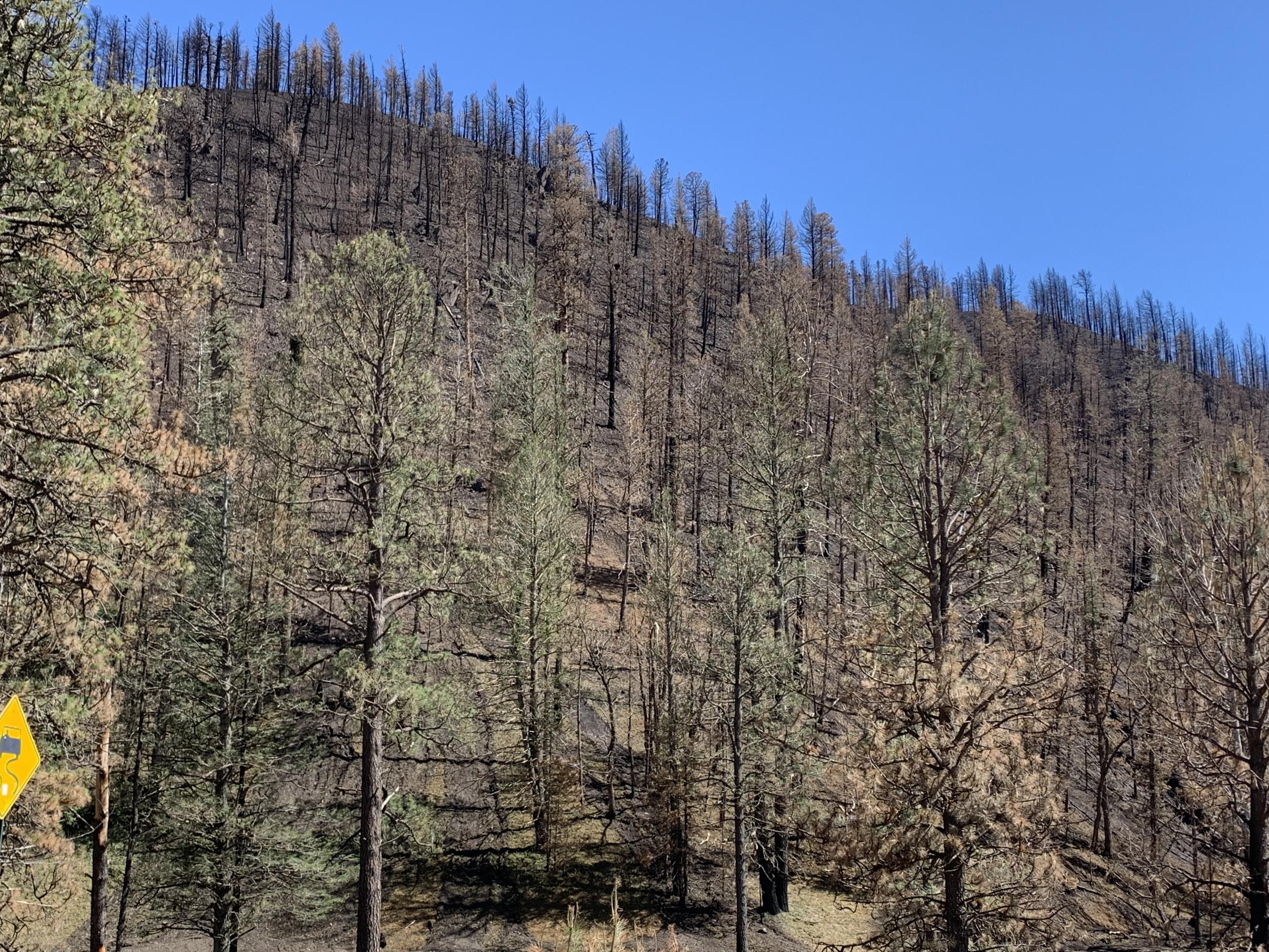
View of South Fork Post-Fire Slope Rilling Conditions in Eagle Canyon
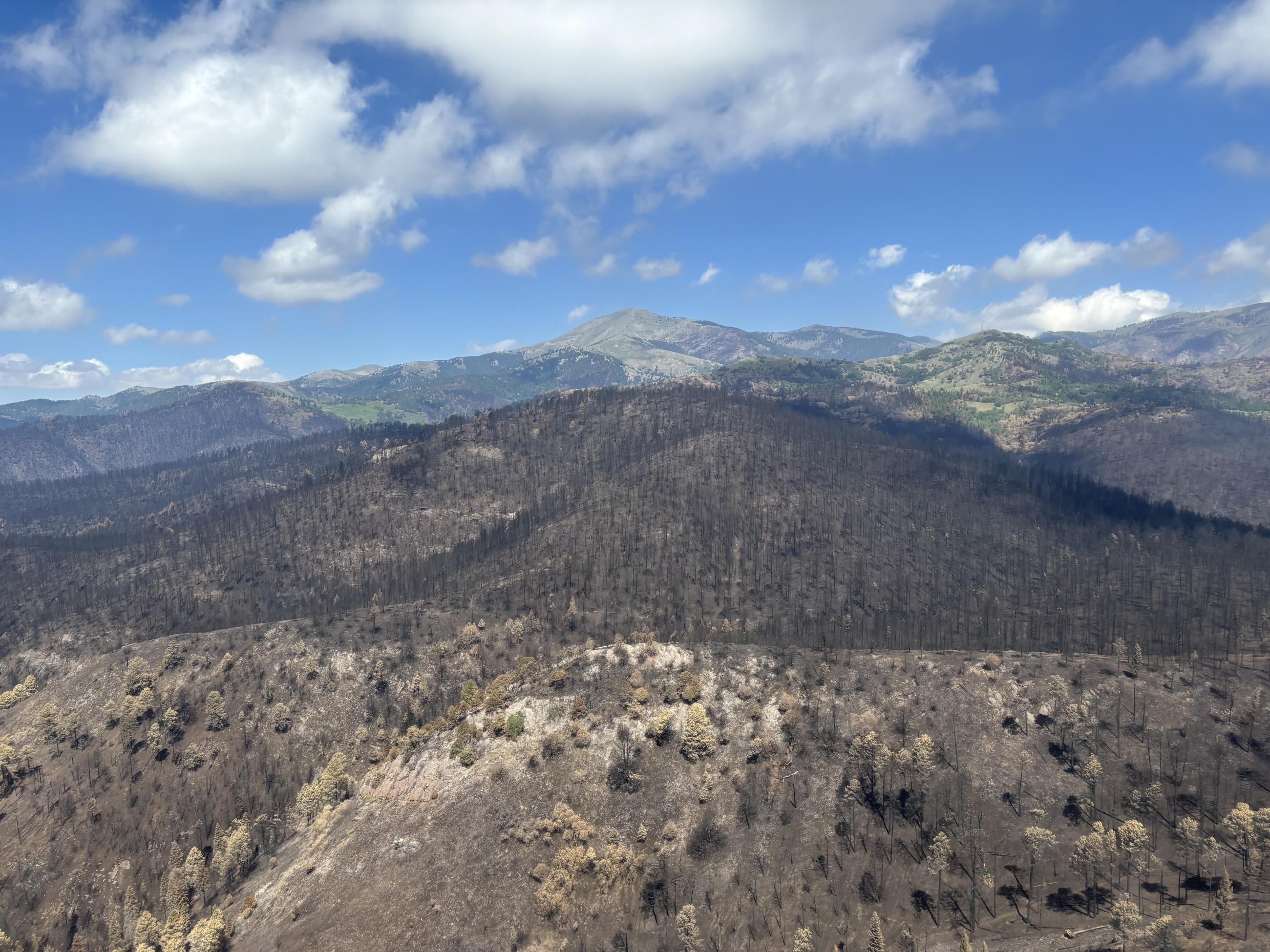
Soil Burn Severity Overview Looking at Sierra Blanca in the South Fork Burned Area
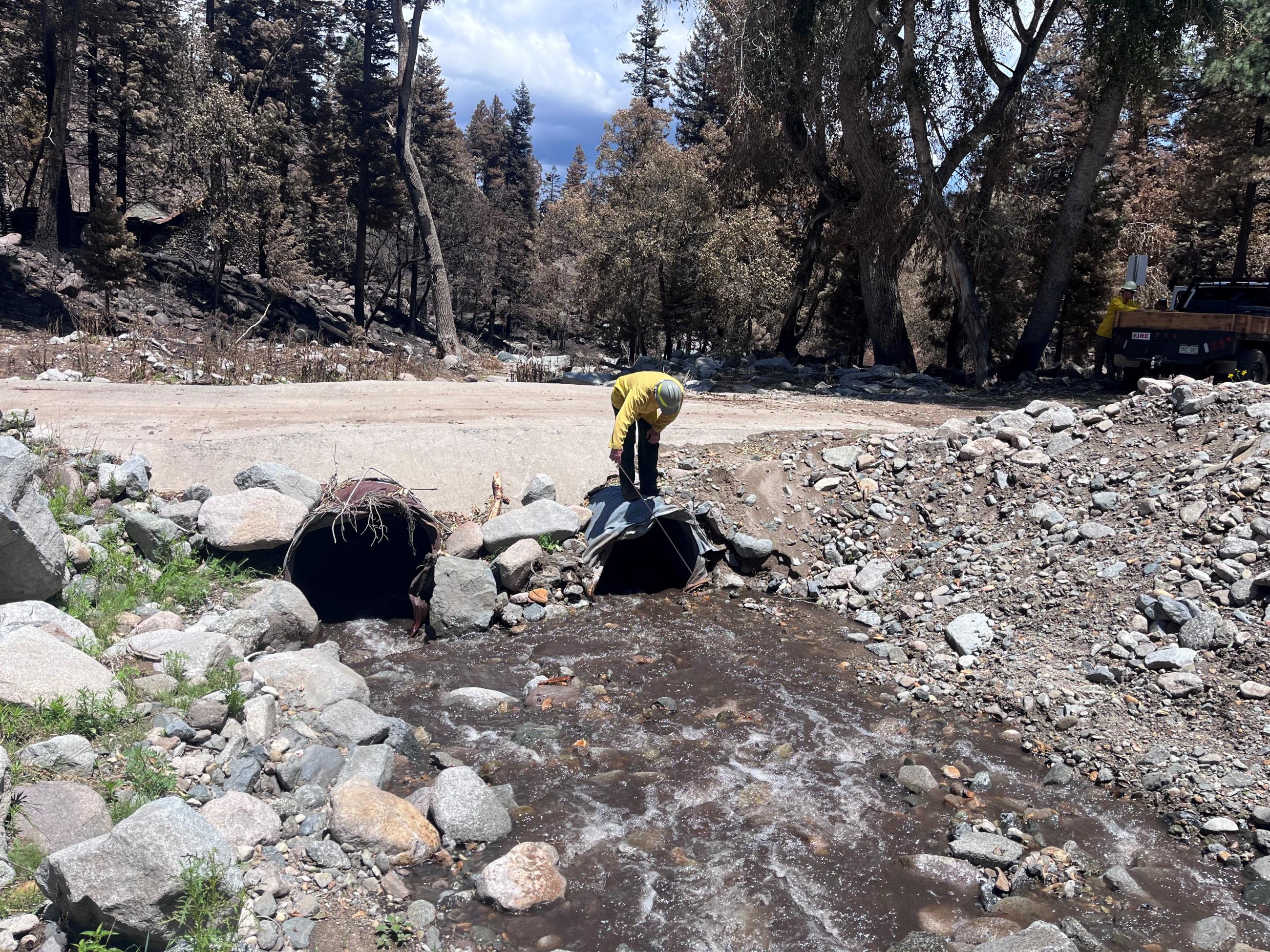
BAER Team Soil Scientist measures culvert openings downstream from the South Fork Fire burned area along Upper Canyon Road on the Mescalero Apache Reservation in New Mexico. Photo credit: Kevin Hyatt, Bureau of Land Management
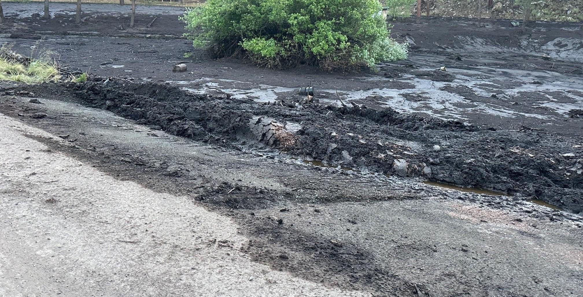
Ash and sediment flow visible from Hull Road and Paradise Canyon Drive in Ruidoso on June 24, 2024
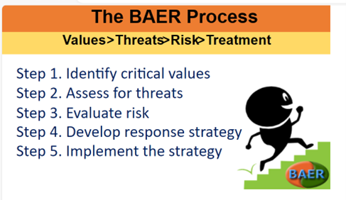
5 Steps of the Burned Area Emergency Response (BAER) Assessment Process
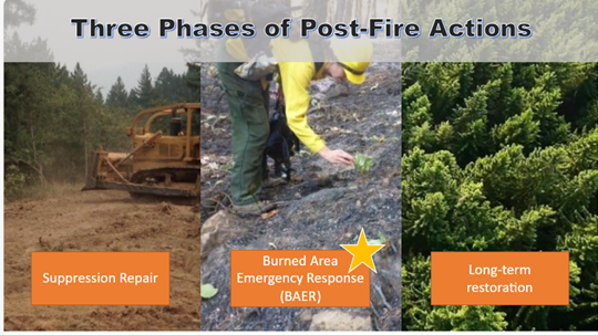
Graph image shows the 3 phases of wildfire recovery: Fire Suppression Repair, Burned Area Emergency Response (BAER), Longterm Restoration
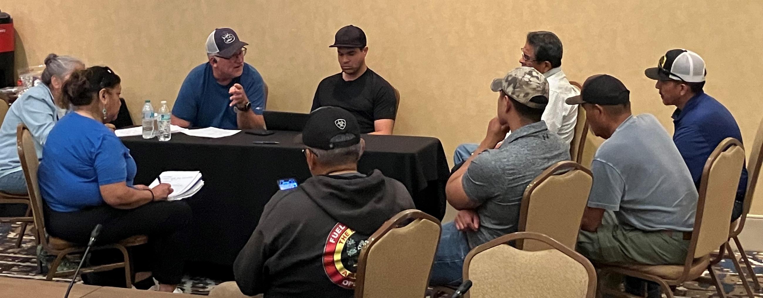
Burned Area Emergency Response (BAER) forestry specialist Eric Rhodenbaugh and Chris LaCroix (center) meet with Mescalero Apache Tribe leadership and natural resources staff to gather information about post-fire concerns on tribal and allotment lands. June 26, 2024.