Incident Media Photographs
Could not determine your location.
 Wildfire
 Prescribed Fire
 Burned Area
Response
Burned Area
Response Other
Other
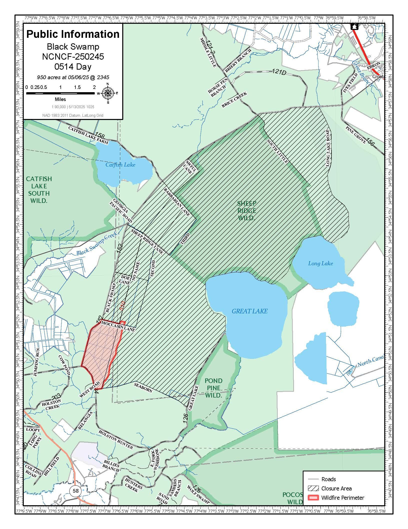
Black Swamp Fire
Unit Information
Agency Name: U.S. Forest Service
Agency Name: U.S. Forest Service
Incident Contacts
- Dana HoddeEmail:Phone:828-712-5017
Photographs Gallery
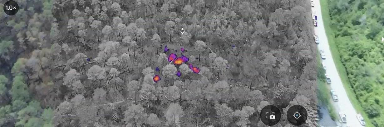
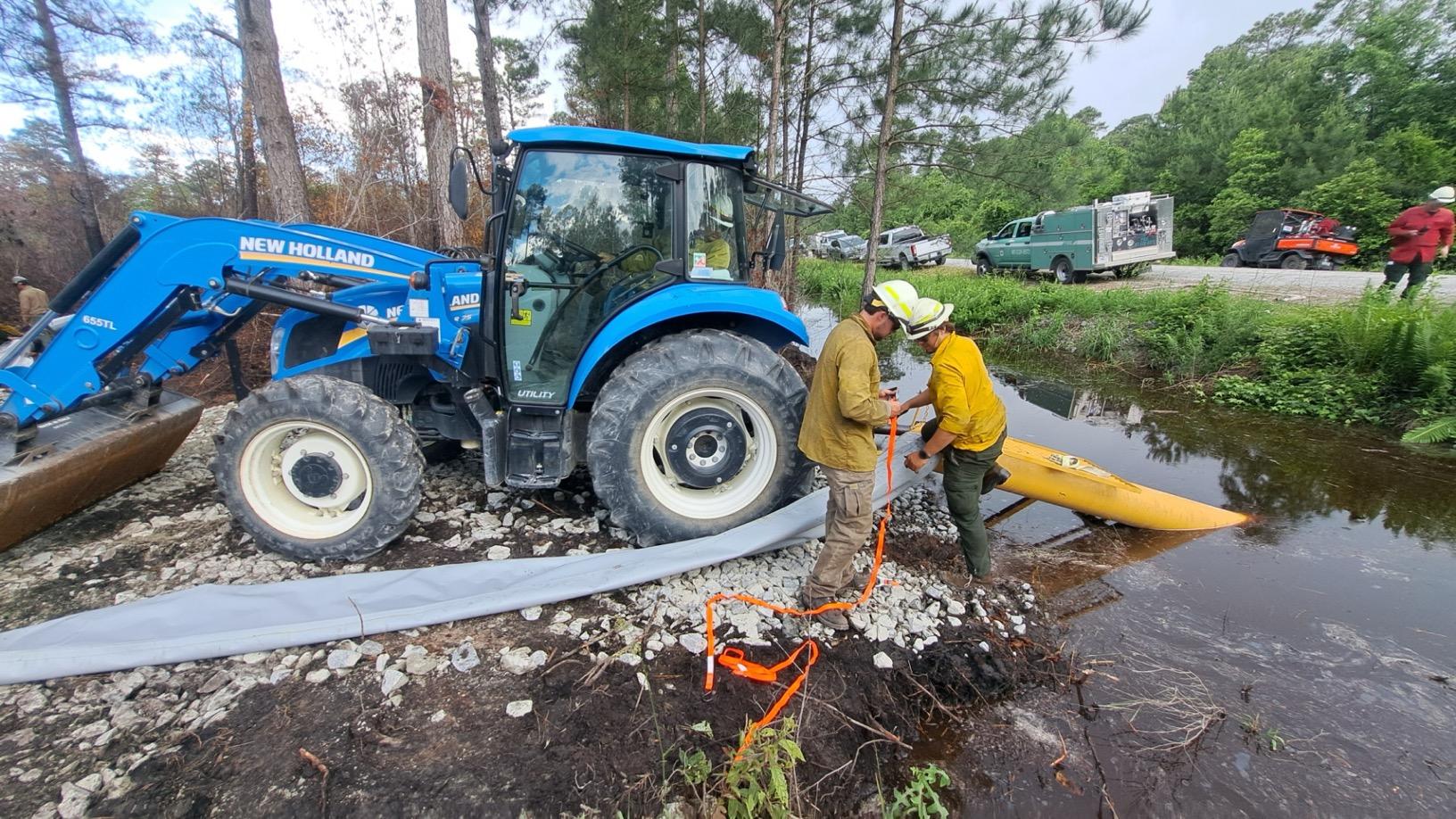
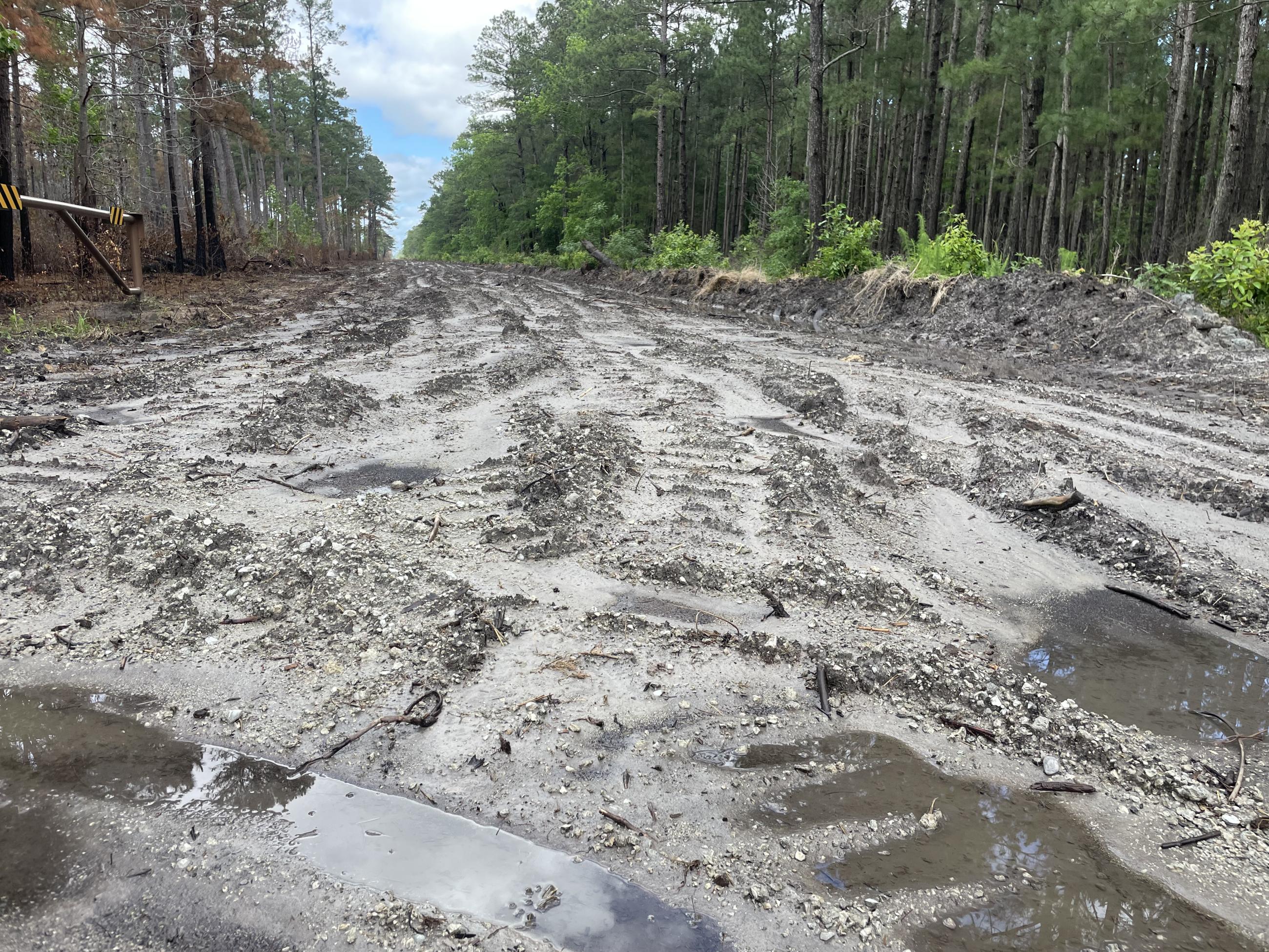
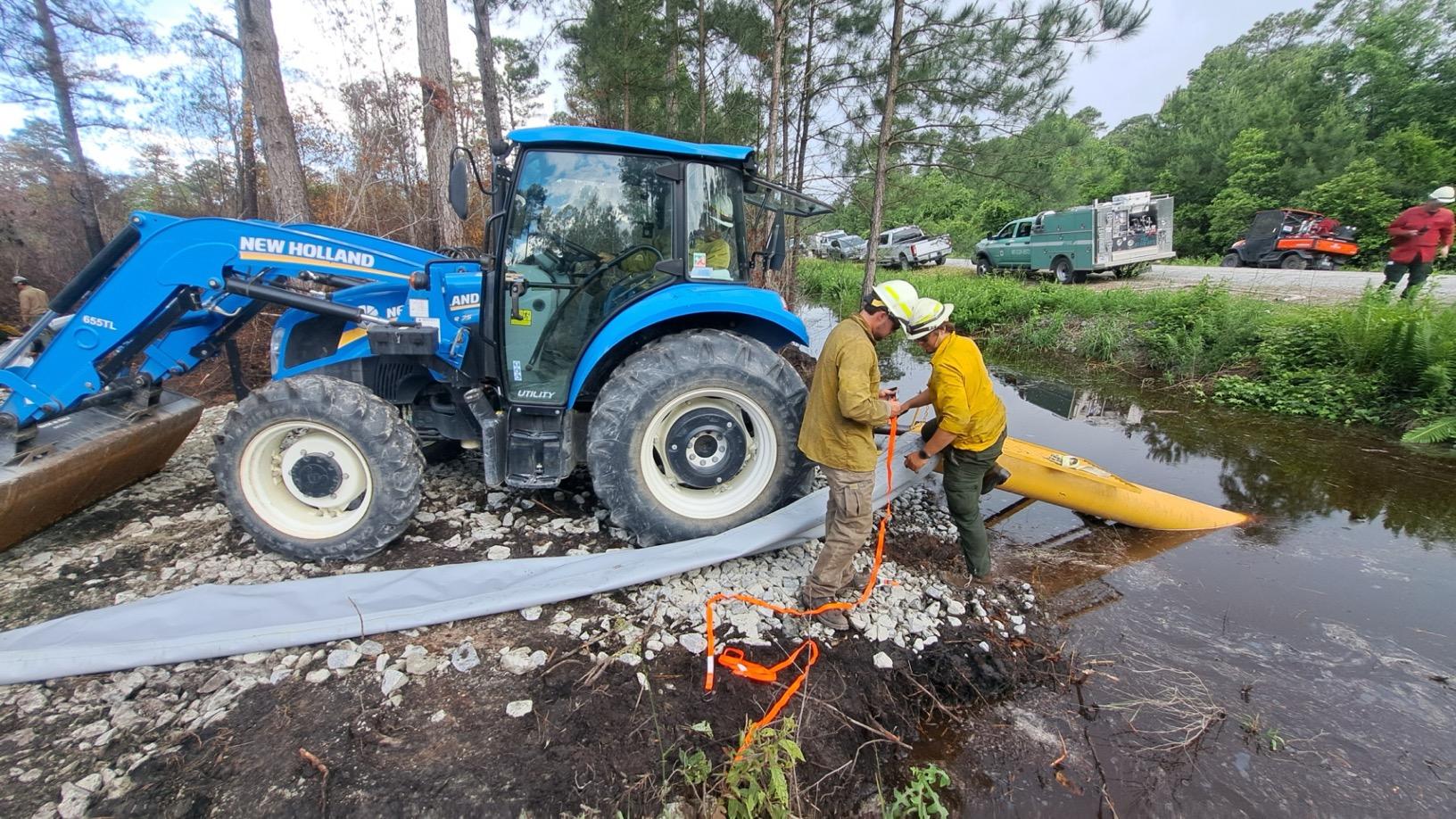
Firefighters have begun the process of hiking in to and identifying the hot spots, using the coordinates provided by the drone’s heat maps. High volume pumps, used previously to fill up the canals alongside the fire, now help send the water out into the center of the fire.
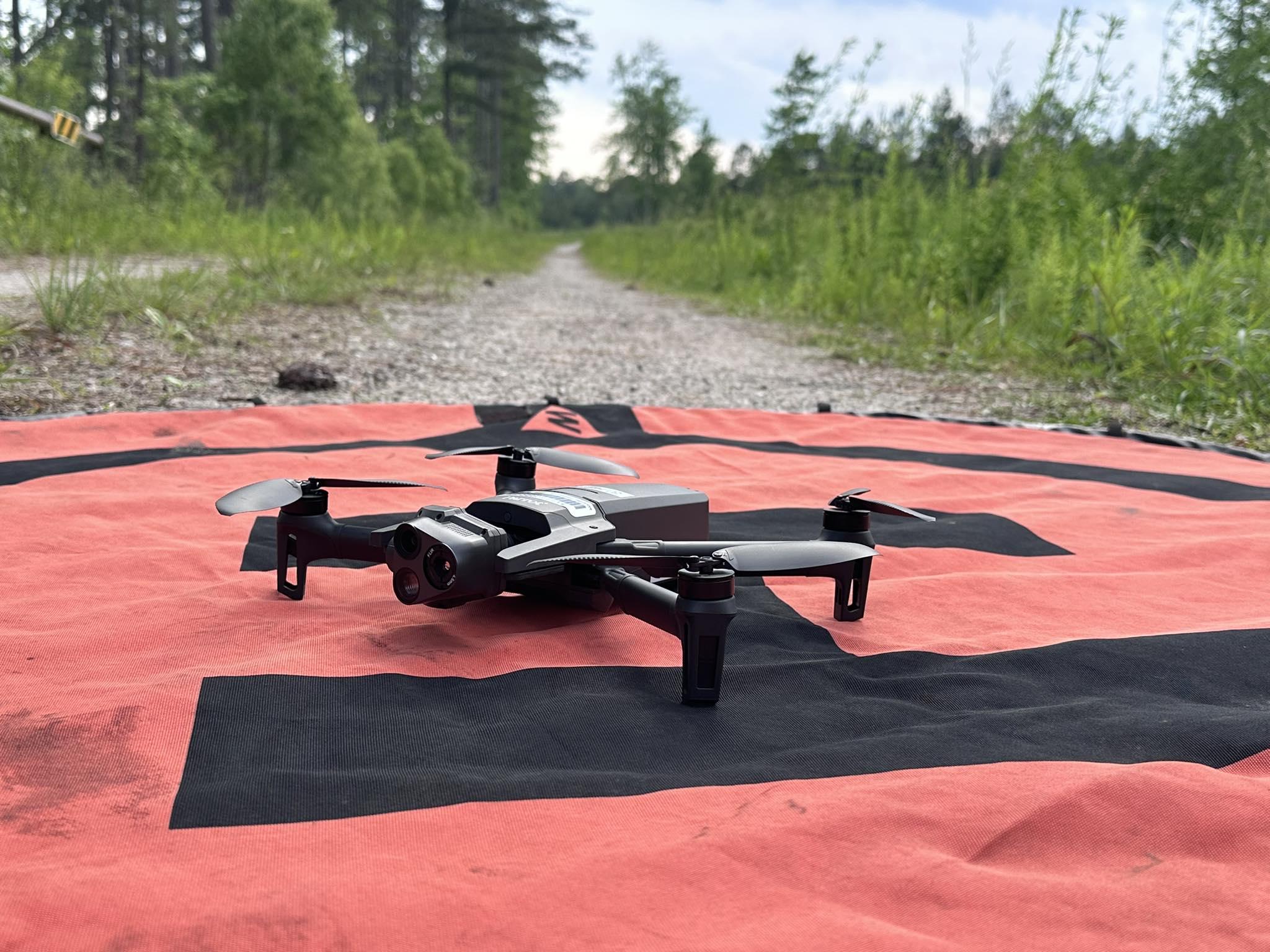
The UAS used to gather infrared and imagery data may be small, but it’s provided critical and timely information to firefighters on the Black Swamp Fire.
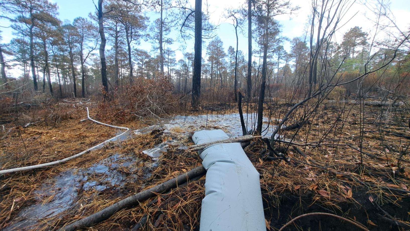
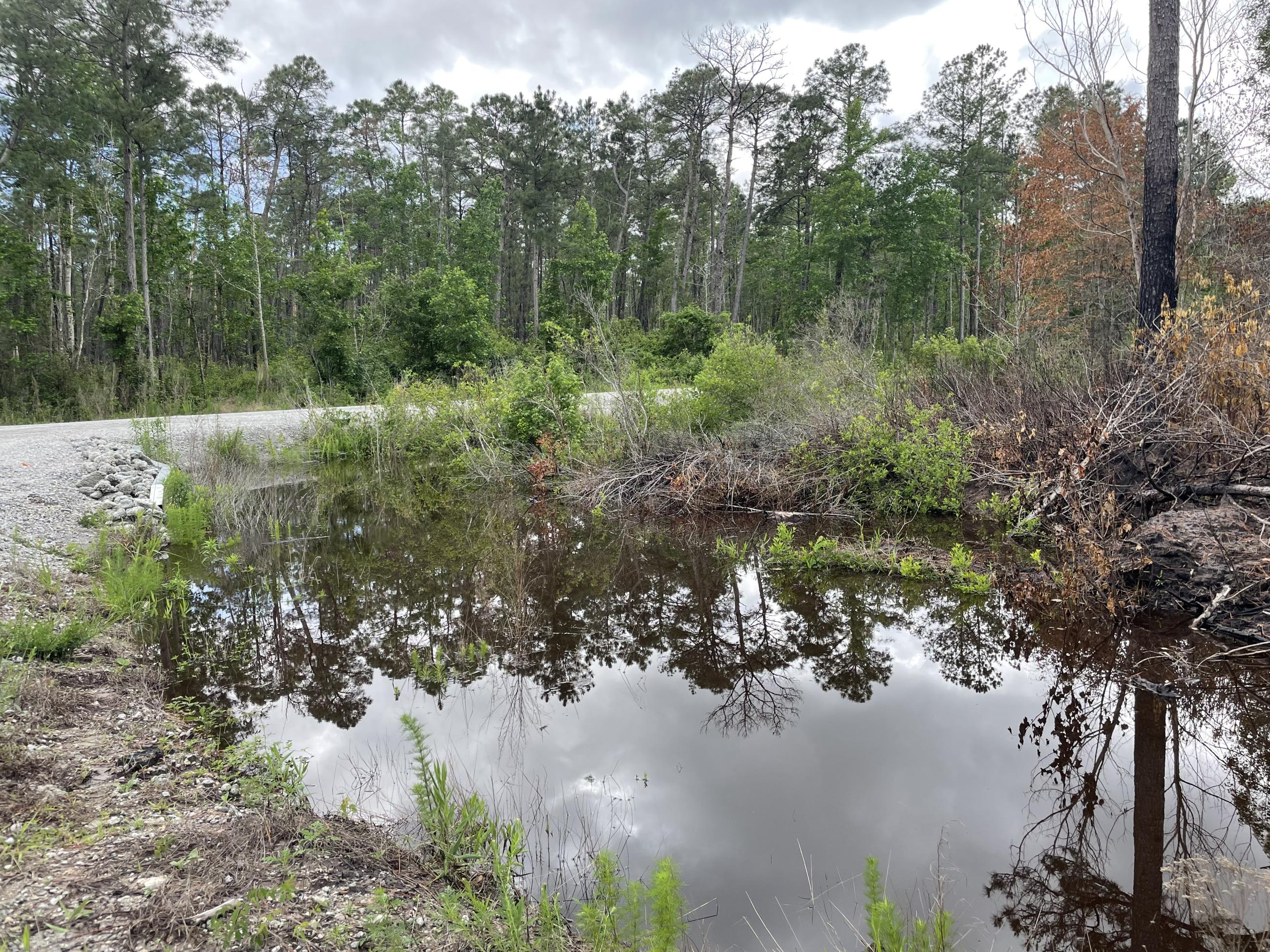
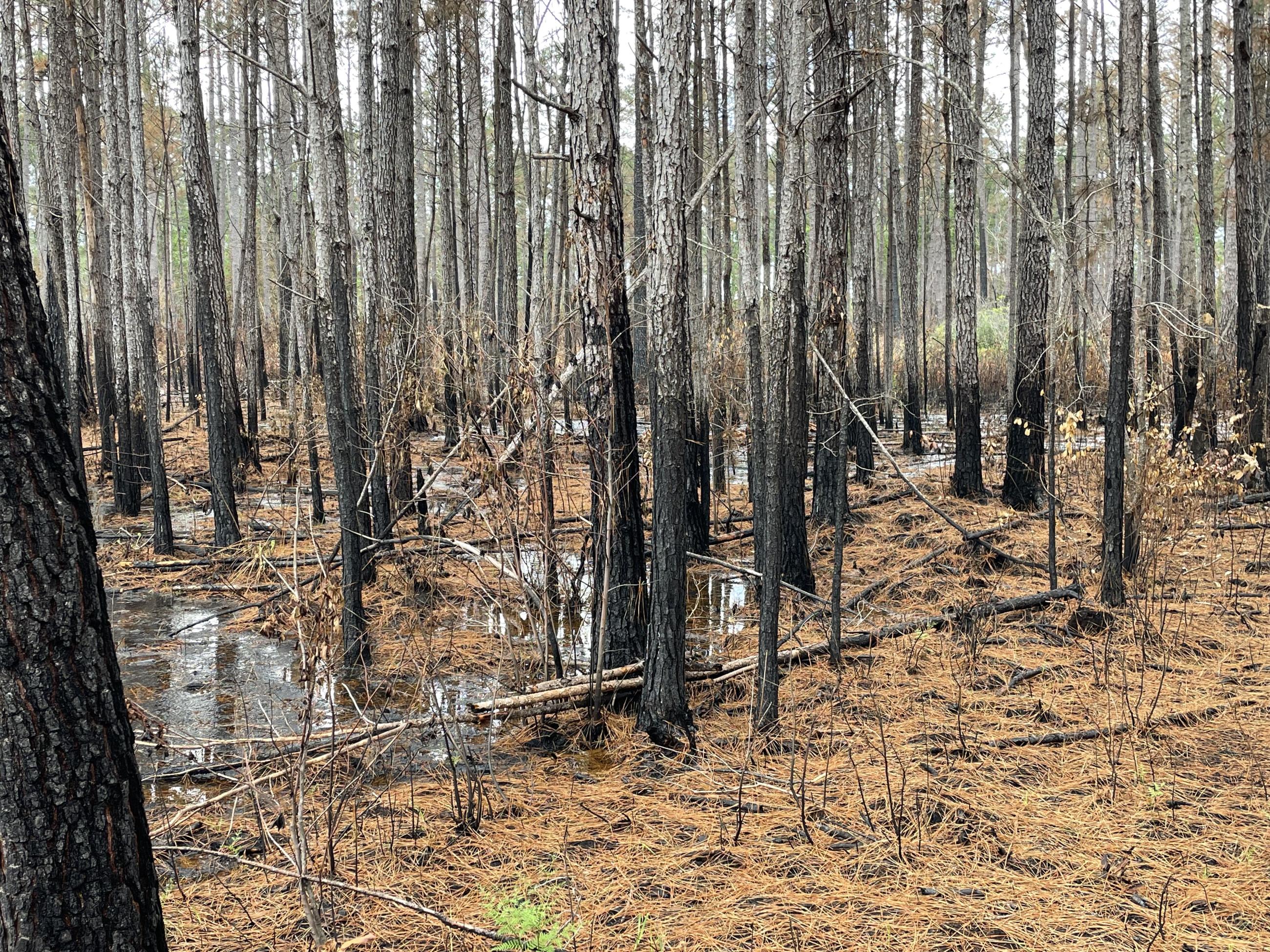
These tubes allow for targeted flooding of the remaining ground fire hot spots. Our infrared imagery shows that this week's rains have extinguished about 90% of the ground fire on the Black Swamp Fire, but the remaining 10% poses a risk of continue to smolder as nearby fuels dry.
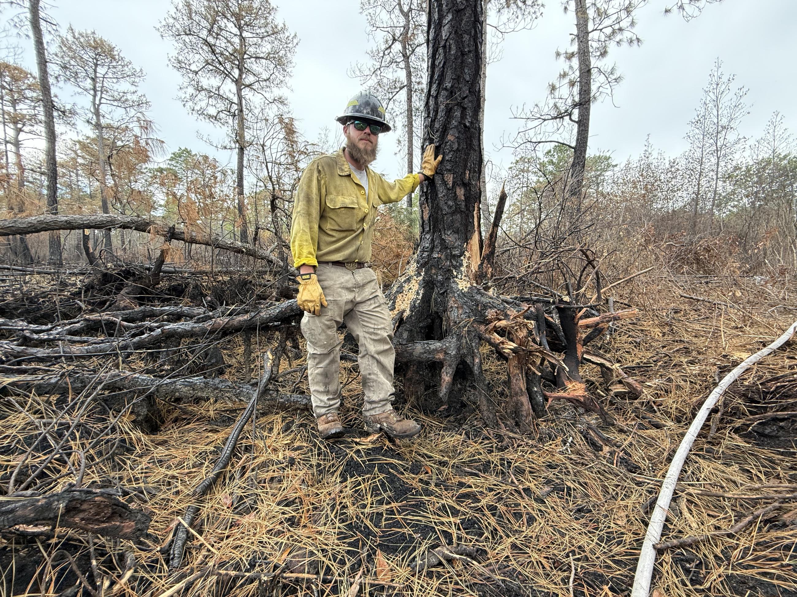
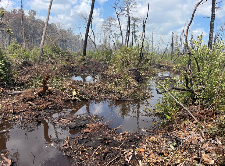
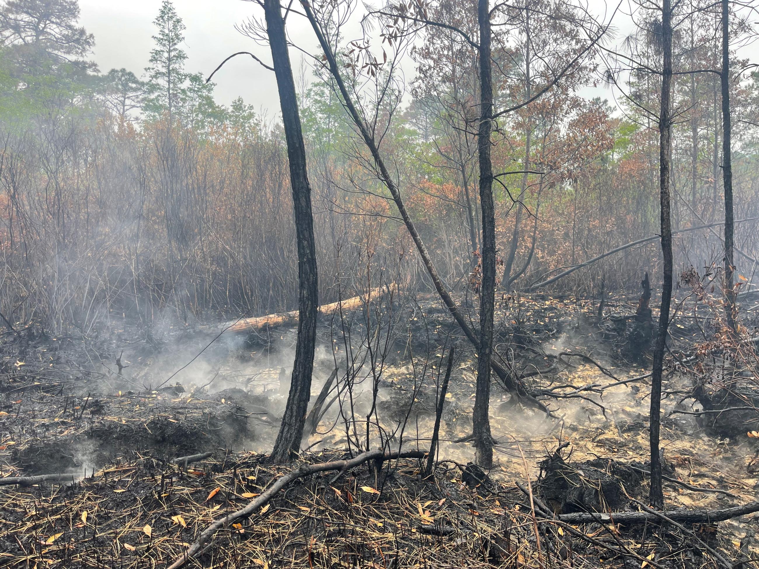
In this photo, you can see how much of the pocosin organic soil has burned in the Black Swamp Fire. Previously, if you looked at this tree it would look like a normal tree, with its roots firmly underground. Now, about 2 feet of the roots have been exposed as the soil beneath them burned. Extinguishing remaining heat in the fire area is critical to ensuring it doesn't smolder and burn deeper into the ground.