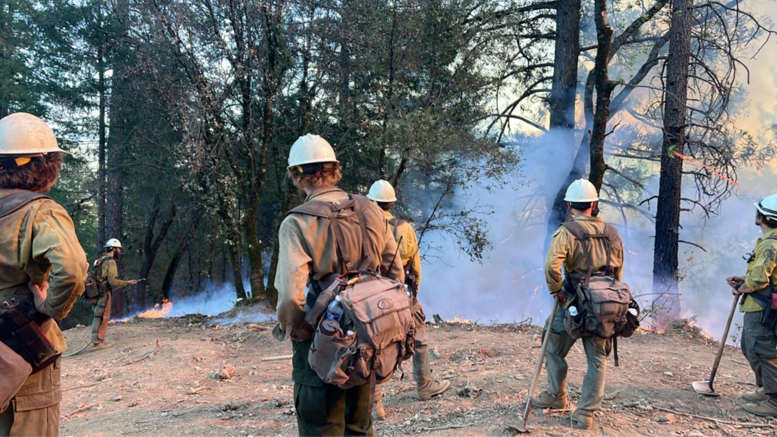
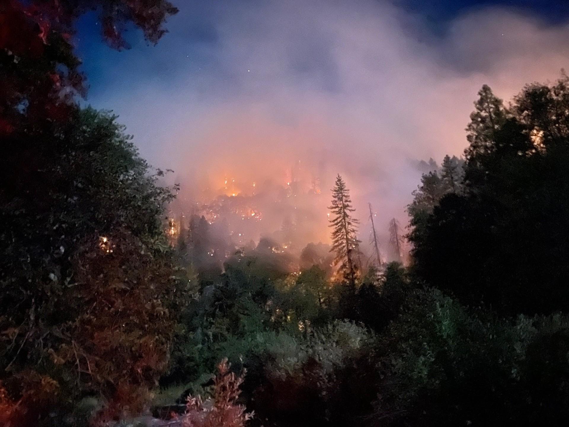
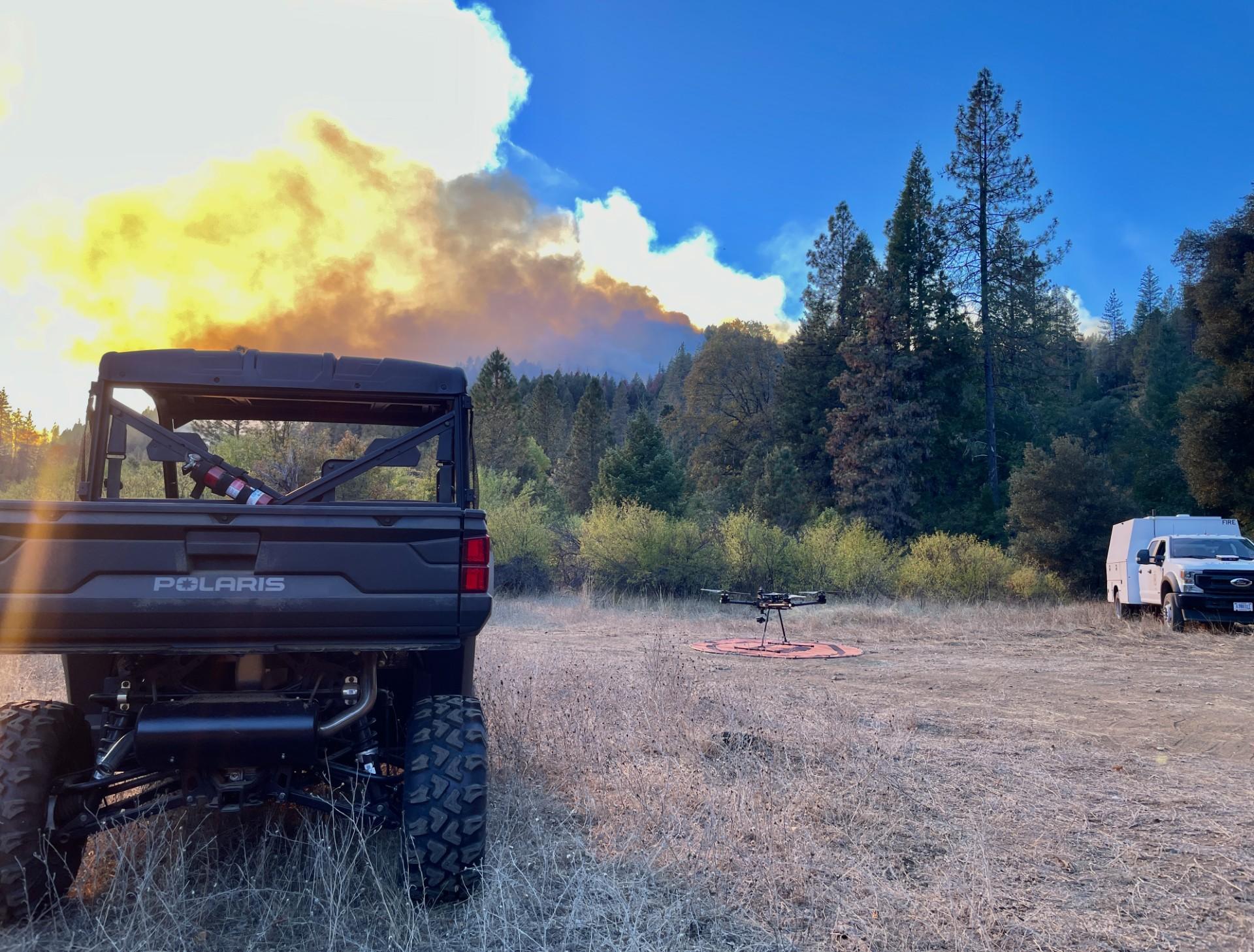
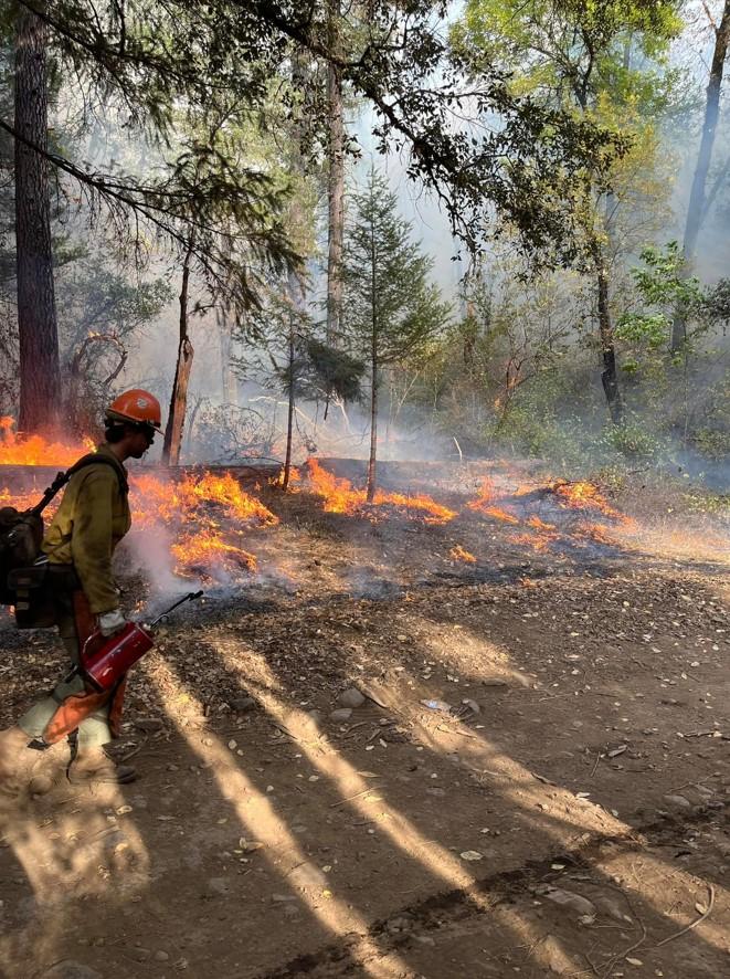
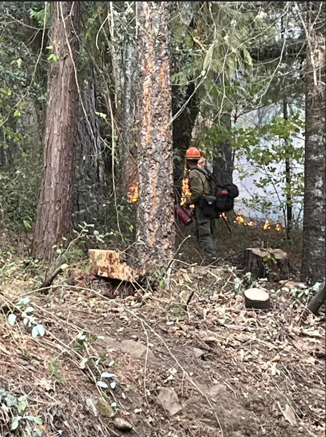
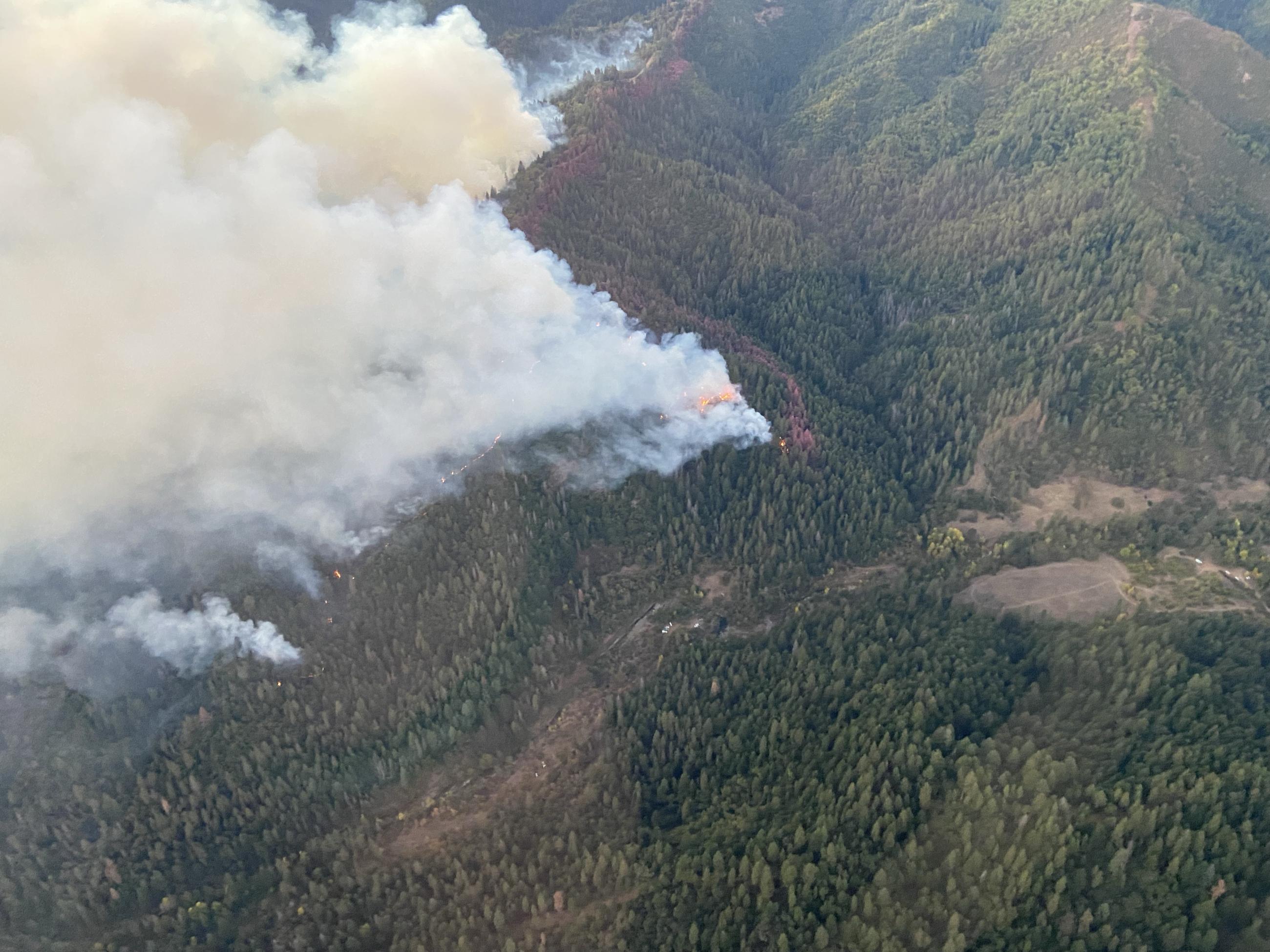
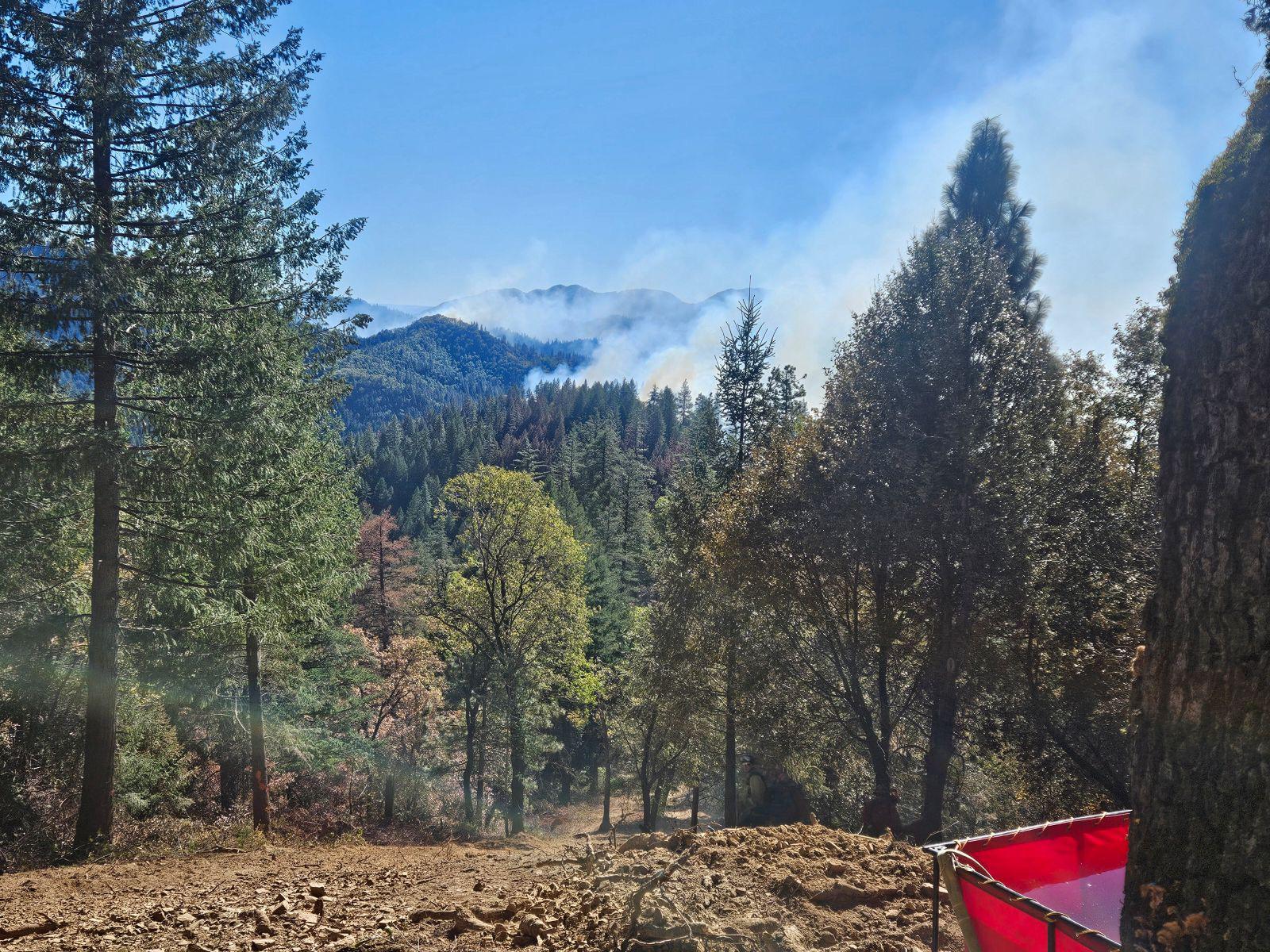
Incident Media Photographs
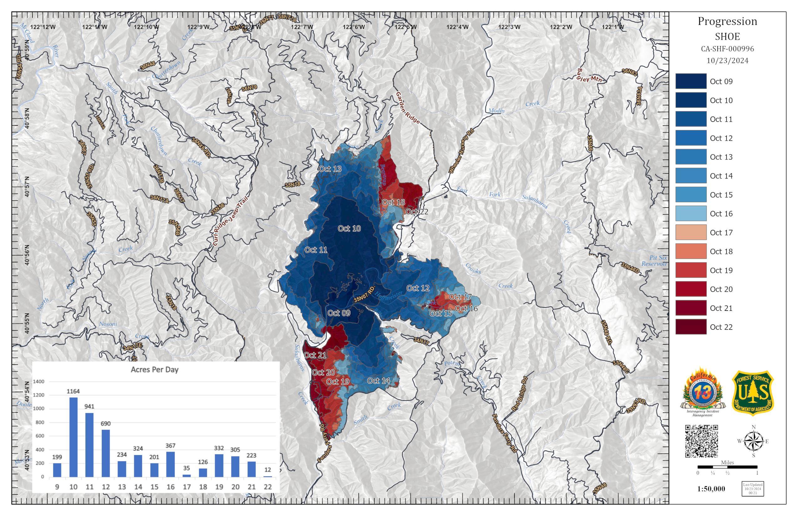
Settings - change map background and toggle additional layers
Filter - control incident types displayed on map.
Zoom to your location
Reset map zoom and position
Could not determine your location.
Show Legend
 Wildfire
 Prescribed Fire
 Burned Area
Response
Burned Area
Response Other
Other
Photographs Gallery

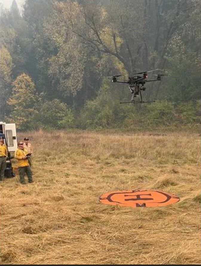
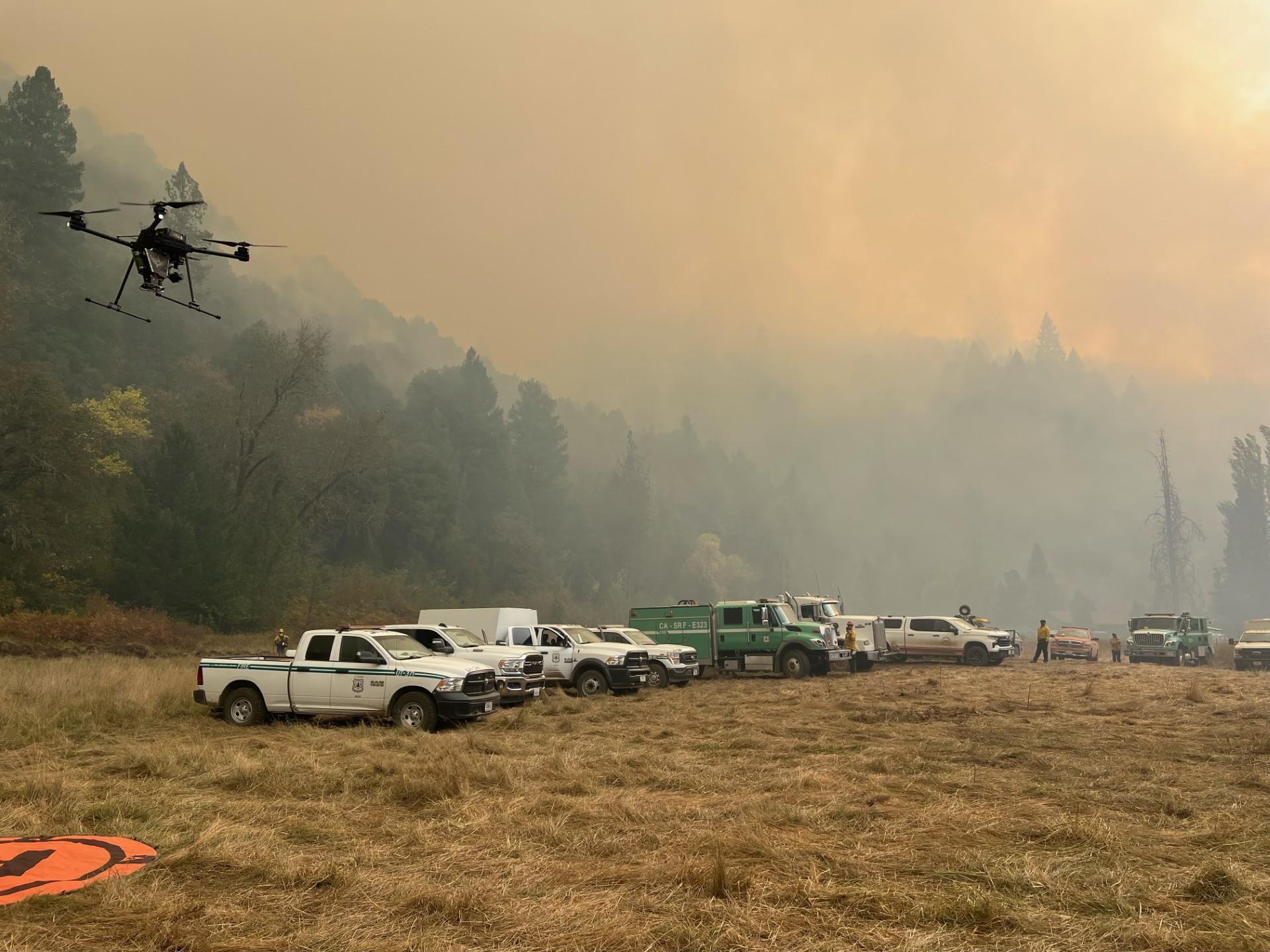
UAS - or Unmanned Aerial Systems are used for igniting slow, methodical burning to create control lines on the Shoe Fire.