Incident Media Photographs
Could not determine your location.
Photographs Gallery
![Map of the Three Lakes Fire area for 7/13.](https://inciweb-prod-media-bucket.s3.us-gov-west-1.amazonaws.com/s3fs-public/styles/max_2600x2600/public/2023-07/pio_8.5x11_port_20230712_2025_Three_Lakes_AZKNF000391_0713.jpg?VersionId=7YpNiBq7ZtseA3uwUeAaz1fJfjtmnFXU&itok=J7rZF4V_)
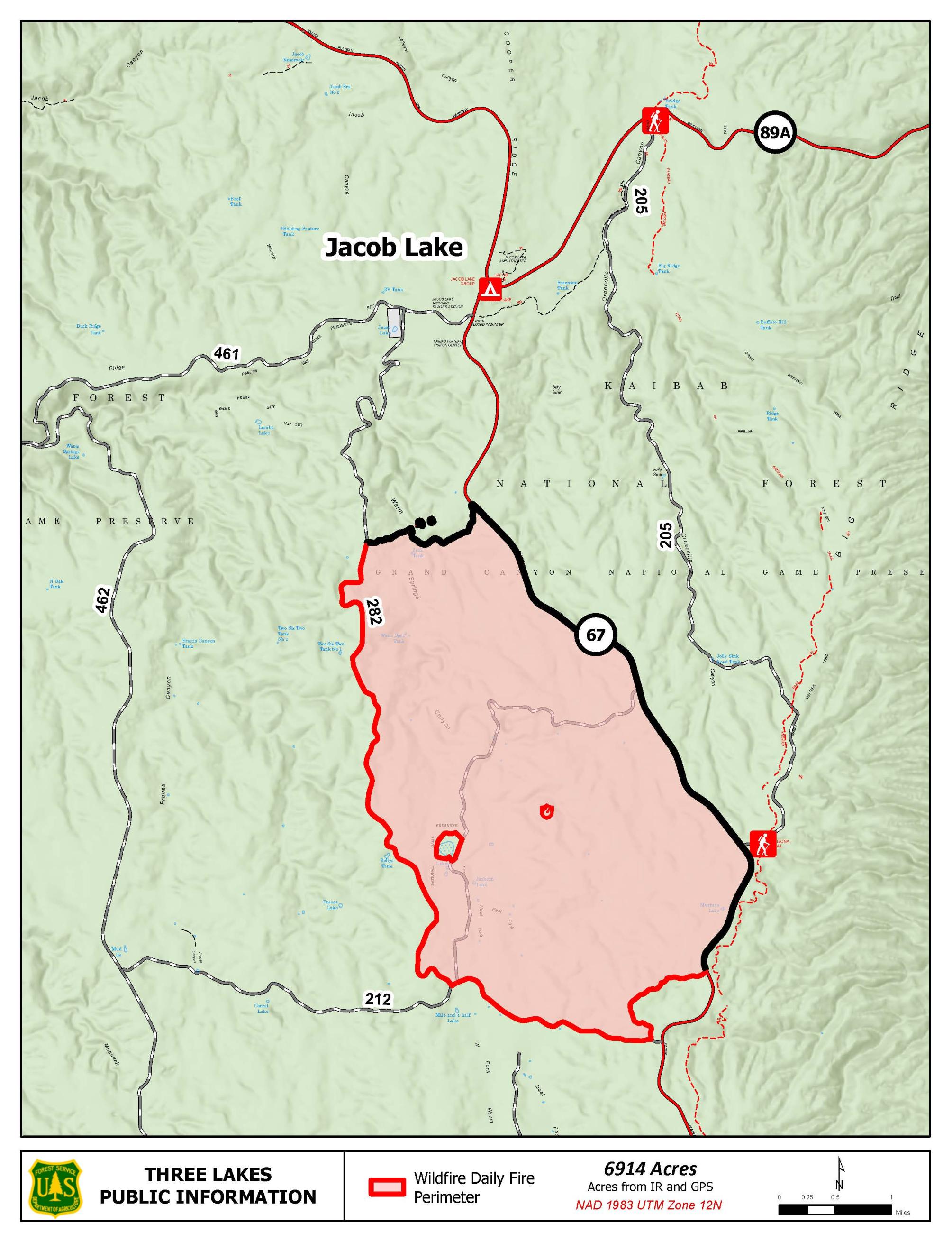
Three Lakes Fire map 7/13
![Map of the Three Lakes Fire area on 7/16.](https://inciweb-prod-media-bucket.s3.us-gov-west-1.amazonaws.com/s3fs-public/styles/max_2600x2600/public/2023-07/pio_8.5x11_port_20230715_1850_Three_Lakes_AZKNF000391_0716.jpg?VersionId=LOoDOFylXQM0rBMkqVQy0h2BvGiQETTy&itok=t6xrqIaF)
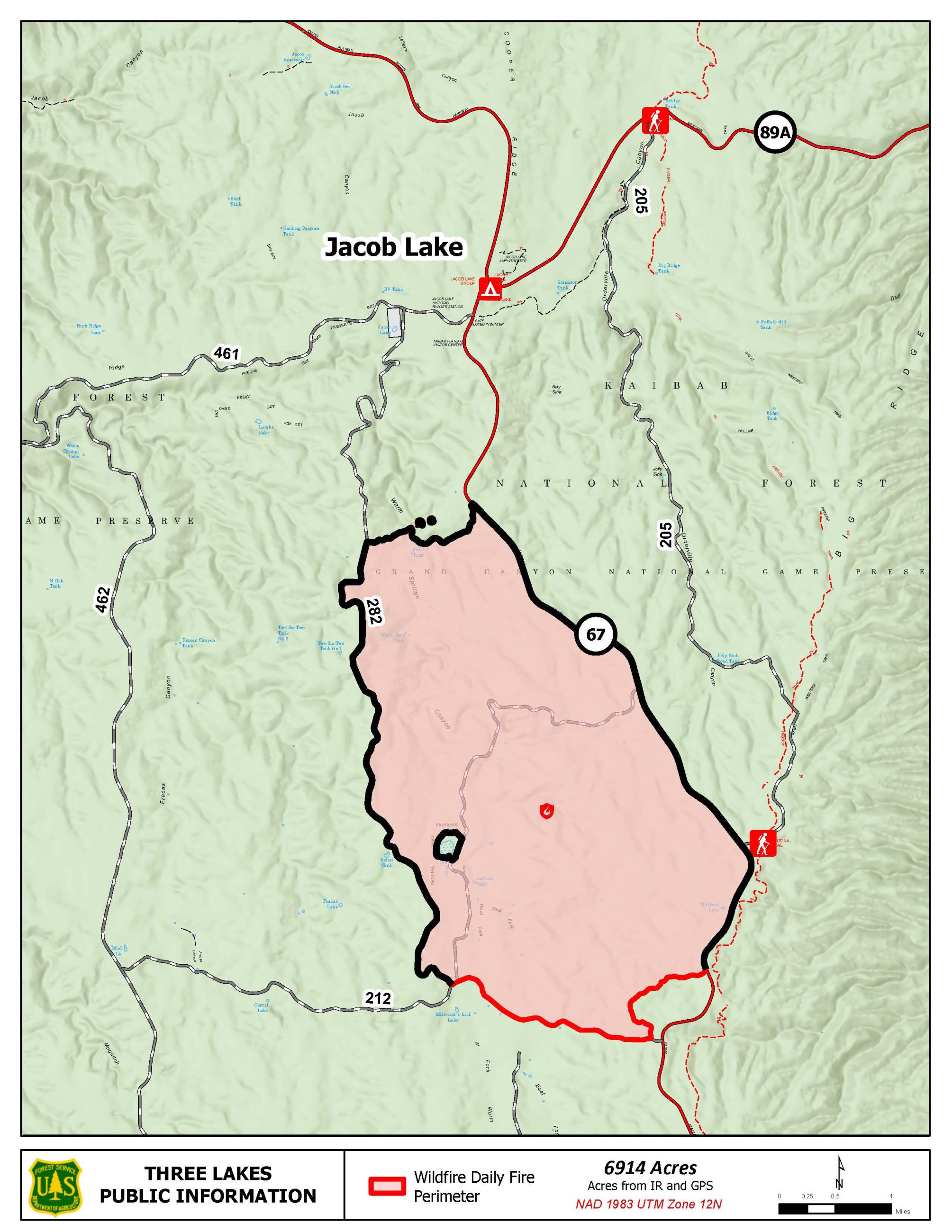
Three Lakes Fire map 7/16
![Map of the Three Lakes Fire area as of 7/9](https://inciweb-prod-media-bucket.s3.us-gov-west-1.amazonaws.com/s3fs-public/styles/max_2600x2600/public/2023-07/pio_8.5x11_port_20230708_2230_Three_Lakes_AZKNF000391_0709%20%28002%29_0.jpg?VersionId=BqWzWGysKcMlImNMLN.vFNZtUMxzTjlX&itok=6POD0GJe)
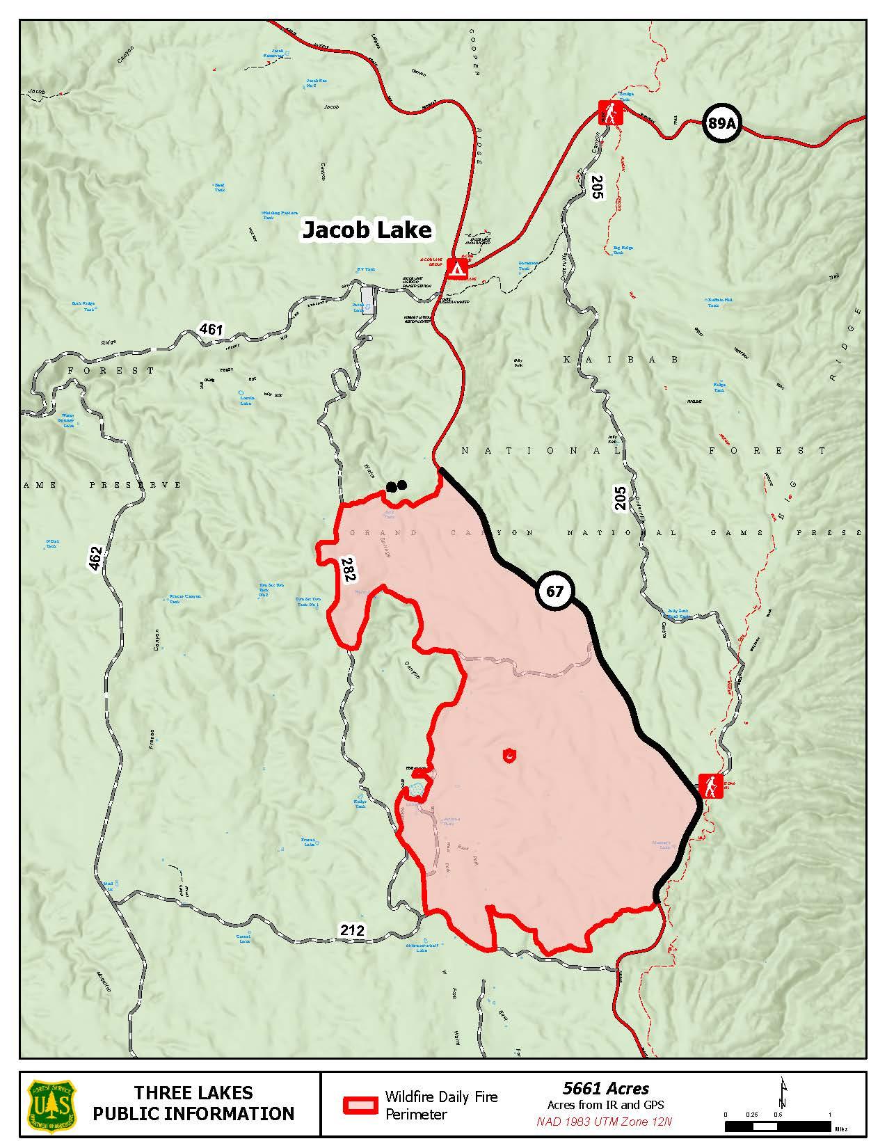
Three Lakes Fire map 7/9
![Map of the Three Lakes Fire area as of 7/6](https://inciweb-prod-media-bucket.s3.us-gov-west-1.amazonaws.com/s3fs-public/styles/max_2600x2600/public/2023-07/pio_8.5x11_port_20230705_2045_Three_Lakes_AZKNF000391_0706.jpg?VersionId=2PK99_B9lk_t.mNWDSMFABENTyXj4Mov&itok=FgAzRhBM)
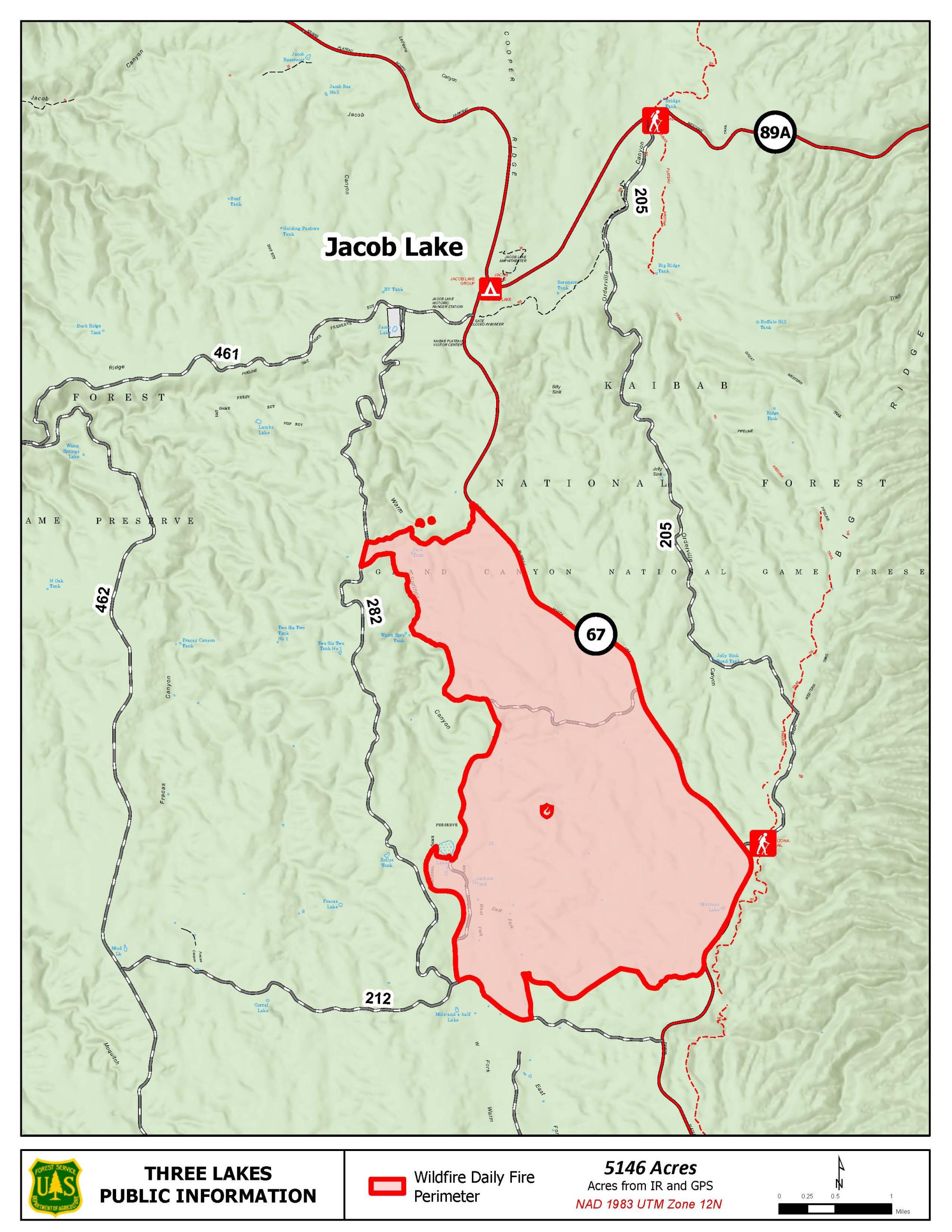
Three Lakes Fire map 7/6
![Map of the Three Lakes Fire area as of 7/5.](https://inciweb-prod-media-bucket.s3.us-gov-west-1.amazonaws.com/s3fs-public/styles/max_2600x2600/public/2023-07/pio_8.5x11_port_20230705_8x11_Three_Lakes_AZKNF000391_0705.jpg?VersionId=68gayN53OK8ED.E1L4DhHbUpA6UNdBj.&itok=KHVk6ady)
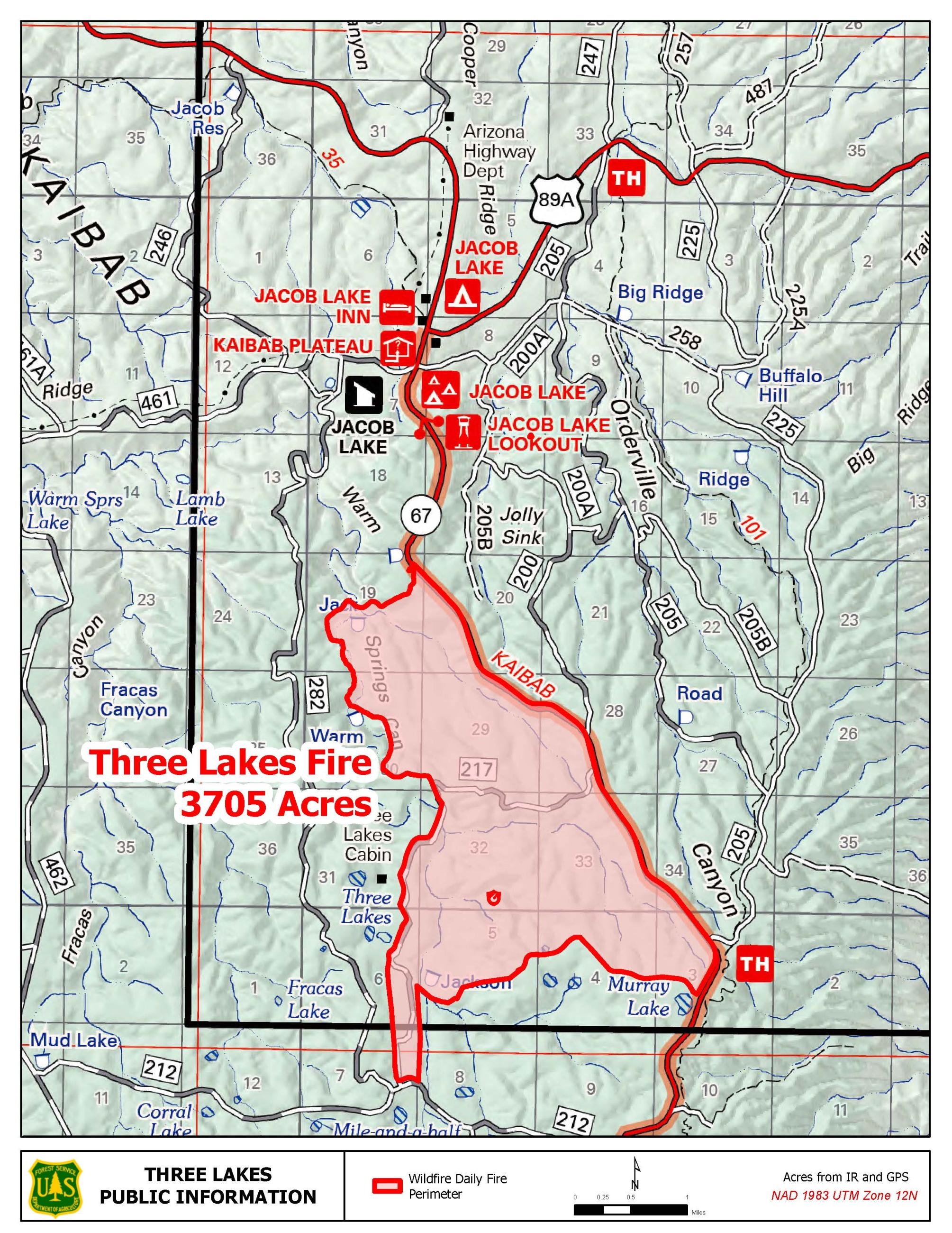
Three Lakes Fire map 7/5
![Map communicating the location of the Three Lakes Fire in relation to the Jacob Lake area.](https://inciweb-prod-media-bucket.s3.us-gov-west-1.amazonaws.com/s3fs-public/styles/max_2600x2600/public/2023-07/pio_ThreeLakes_0703.jpg?VersionId=22pzMfW3vWW8xgQDJc2zCU1vrsXIxzNo&itok=c_XNJgzU)
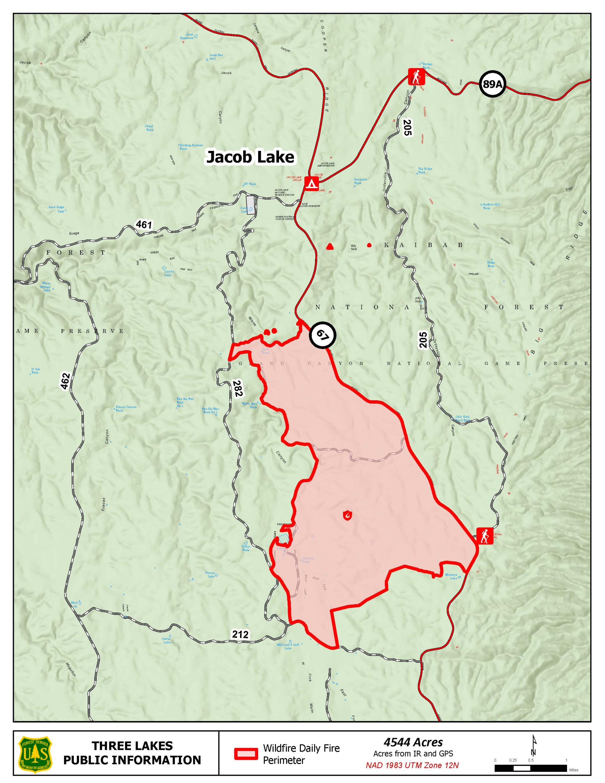
Three Lakes Fire map 7/3
![Map of the Three Lakes Fire area.](https://inciweb-prod-media-bucket.s3.us-gov-west-1.amazonaws.com/s3fs-public/styles/max_2600x2600/public/2023-06/pio_8.5x11_Three_Lakes_0627day.jpg?VersionId=Q.9PnkD2Zlc6NWgM6wvoU5KMpdULuoSy&itok=7Jtg2r_Q)
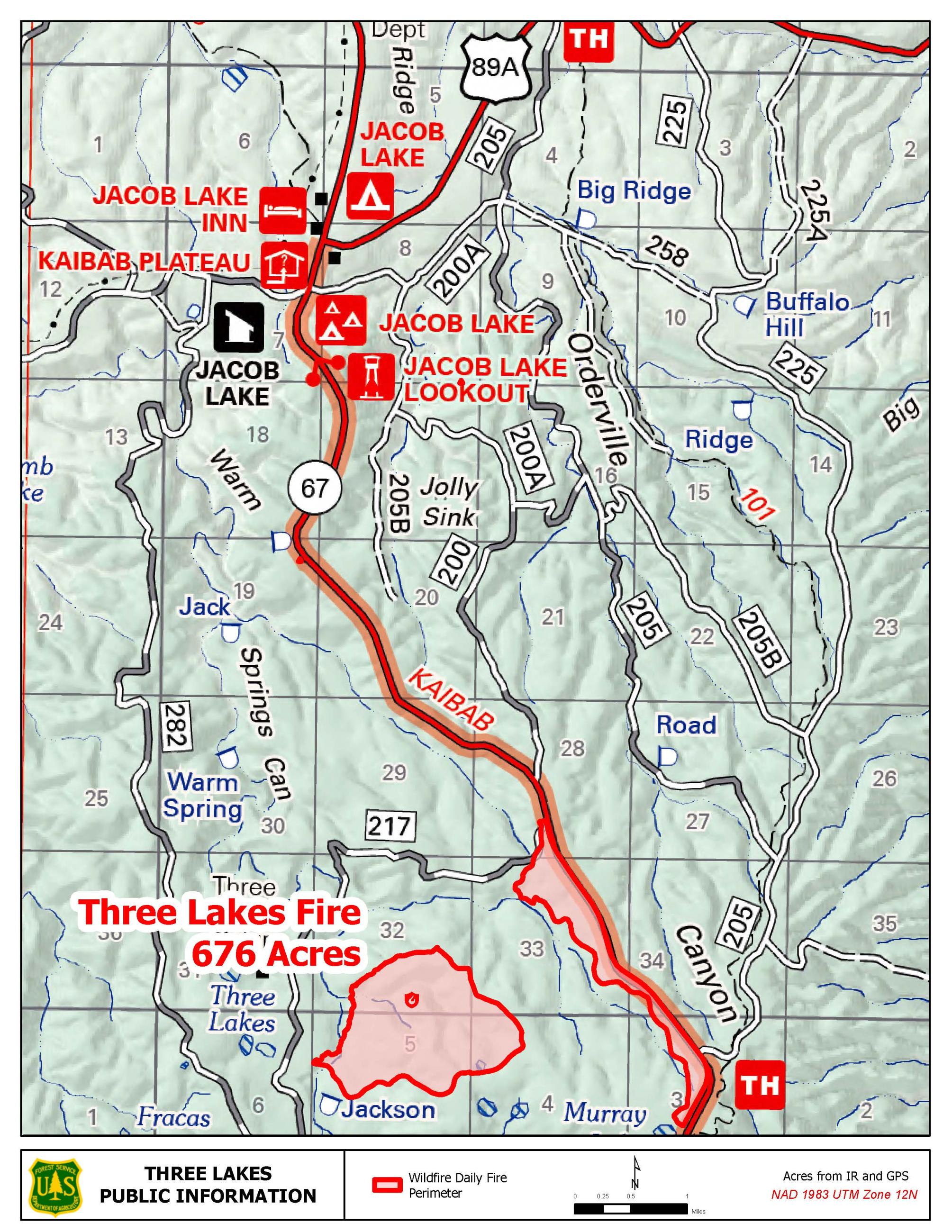
Map of the Three Lakes Fire - 6/27
![Map of the vicinity of the Three Lakes Fire on the North Kaibab Ranger District](https://inciweb-prod-media-bucket.s3.us-gov-west-1.amazonaws.com/s3fs-public/styles/max_2600x2600/public/2023-06/Three_Lakes_Vicinity.jpg?VersionId=R25ch5088XNLLNTSrbFIe5TEp3X.M6sh&itok=rYs3k74G)
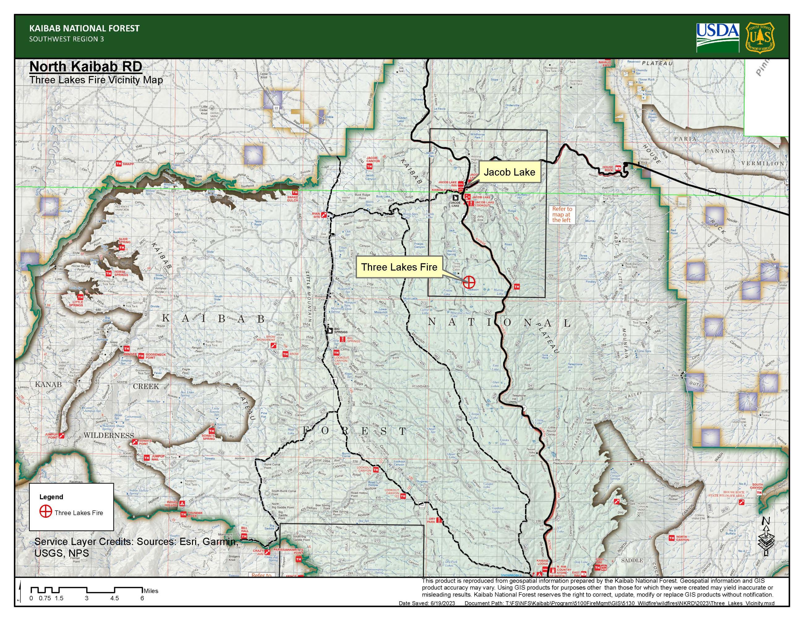
Map of the vicinity of the Three Lakes Fire on the North Kaibab Ranger District.
![Fire burning in pine needles and small trees and shrubs, the trees in the background partially obscured by smoke.](https://inciweb-prod-media-bucket.s3.us-gov-west-1.amazonaws.com/s3fs-public/styles/max_2600x2600/public/2023-06/Three%20Lakes%20WF%20%281%29%20-%2022%20Jun%202023.jpg?VersionId=pUpq3xiLNLuc2YnVgCqNL_fcR5ibfFS1&itok=BUA_MFj0)
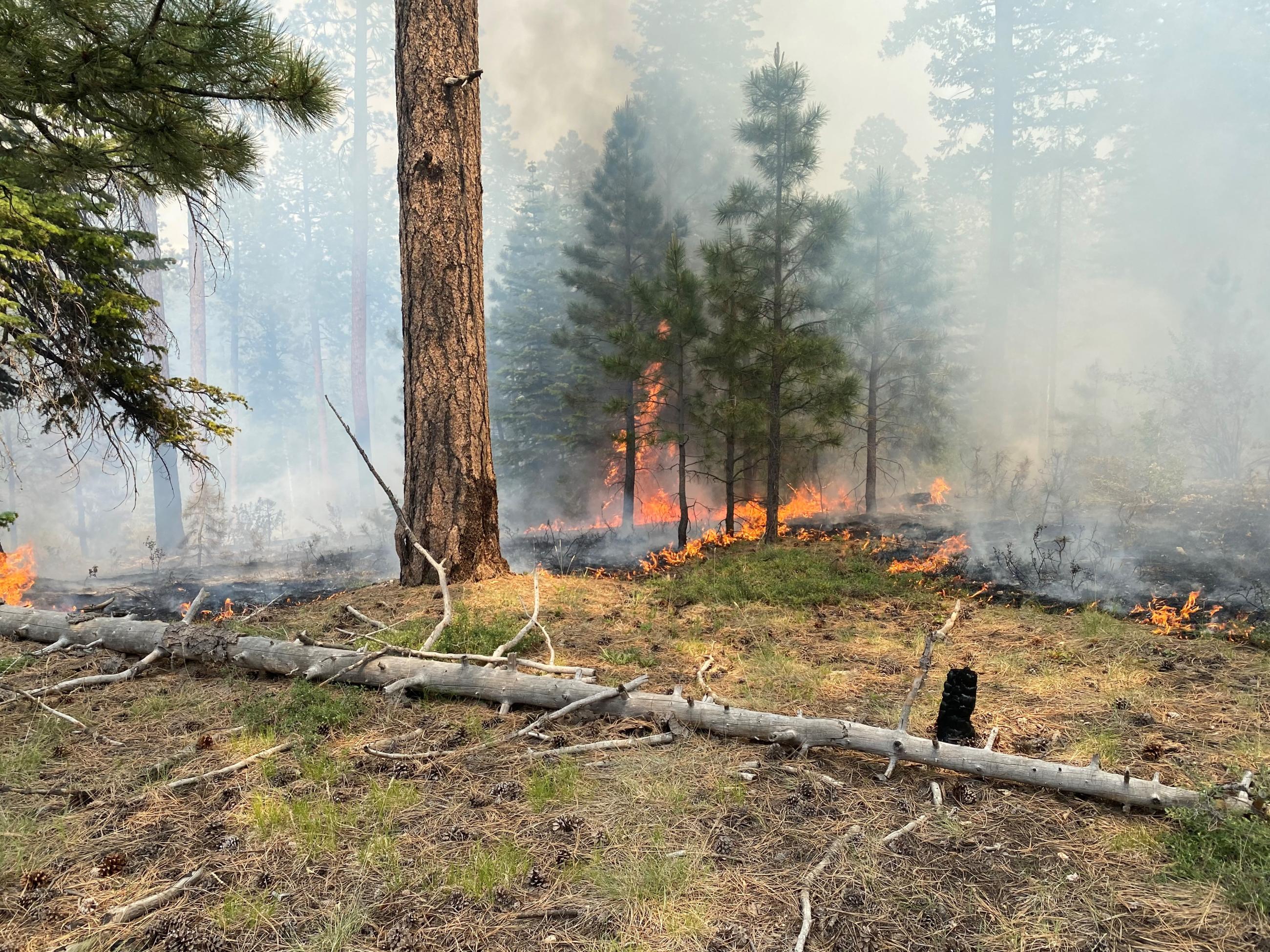
Flames from the lightning-caused Three Lakes Fire consume forest floor litter, such as pine cones, pine needle duff, and dead-and-downed trees and branches, and small trees and shrubs which, in more hazardous fire conditions, could become ladder fuels leading to a highly destructive fire.
![A line of fire creeping through pine needles on the forest floor with light smoke in the background and small pine trees and green grasses in the foreground.](https://inciweb-prod-media-bucket.s3.us-gov-west-1.amazonaws.com/s3fs-public/styles/max_2600x2600/public/2023-06/Three%20Lakes%20WF%20-%2019%20Jun%202023%282%29_0.jpg?VersionId=T1XiJwuPwAfm.uZaA6vB1bZjXR3tCFs0&itok=cgiGQPrq)
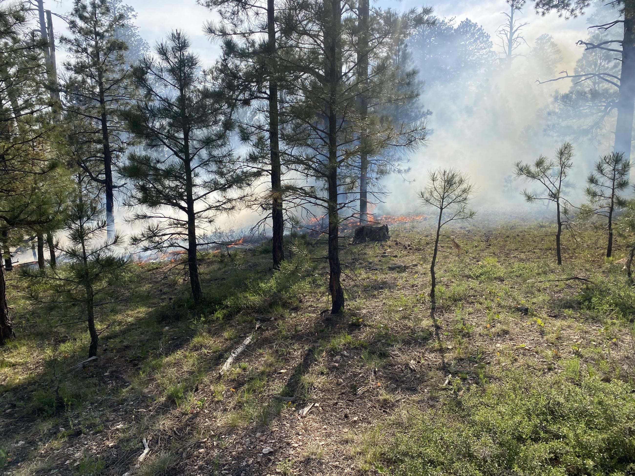
Fire creeps through pine needles on the forest floor.