Incident Media Maps
Could not determine your location.
 Wildfire
 Prescribed Fire
 Burned Area
Response
Burned Area
Response Other
Other
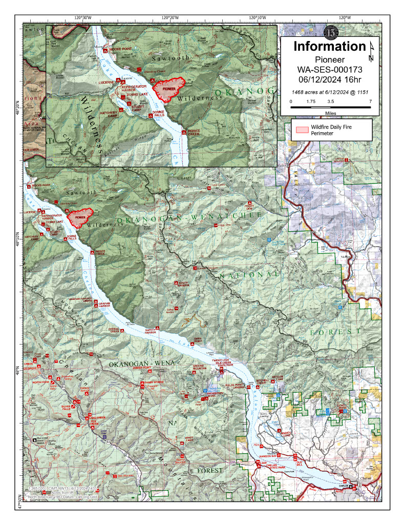
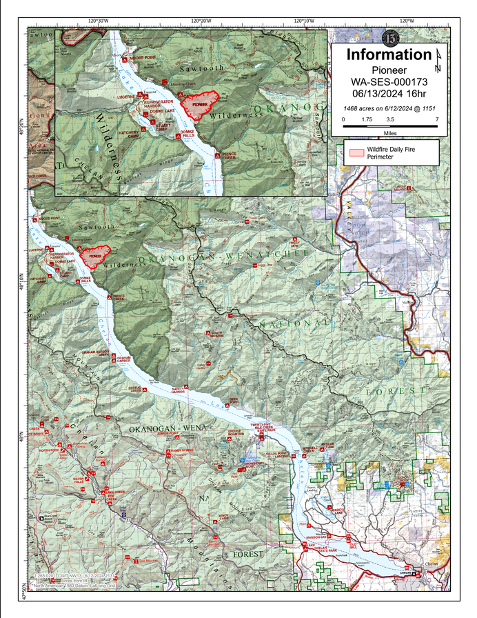
Pioneer
Unit Information
Incident Contacts
- Pioneer Fire InformationEmail:2024.pioneer@firenet.govPhone:509-210-2926Hours:8 a.m. - 8 p.m.
Maps Gallery
Pioneer Fire map for 6-17-24, showing the fire location plus the general vicinity of Lake Chelan.
The Chelan County Emergency Management evacuation levels are shown on the map, with Level 3 (Go Now) in red, Level 2 (Get set) in yellow, and Level 1 (Get Ready) in green.
The Okanogan-Wenatchee National Forest closures are also marked on the map with red dots or hatching.
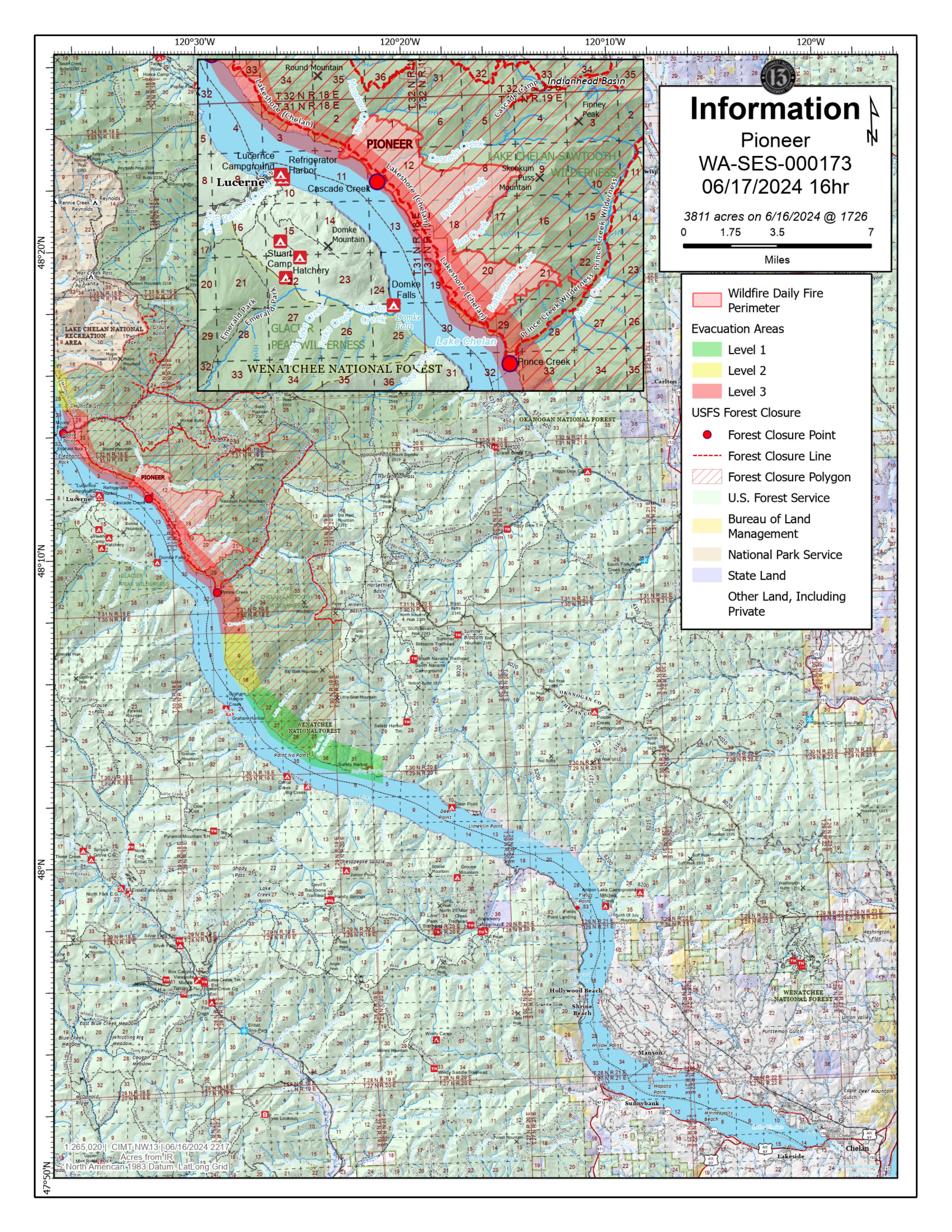
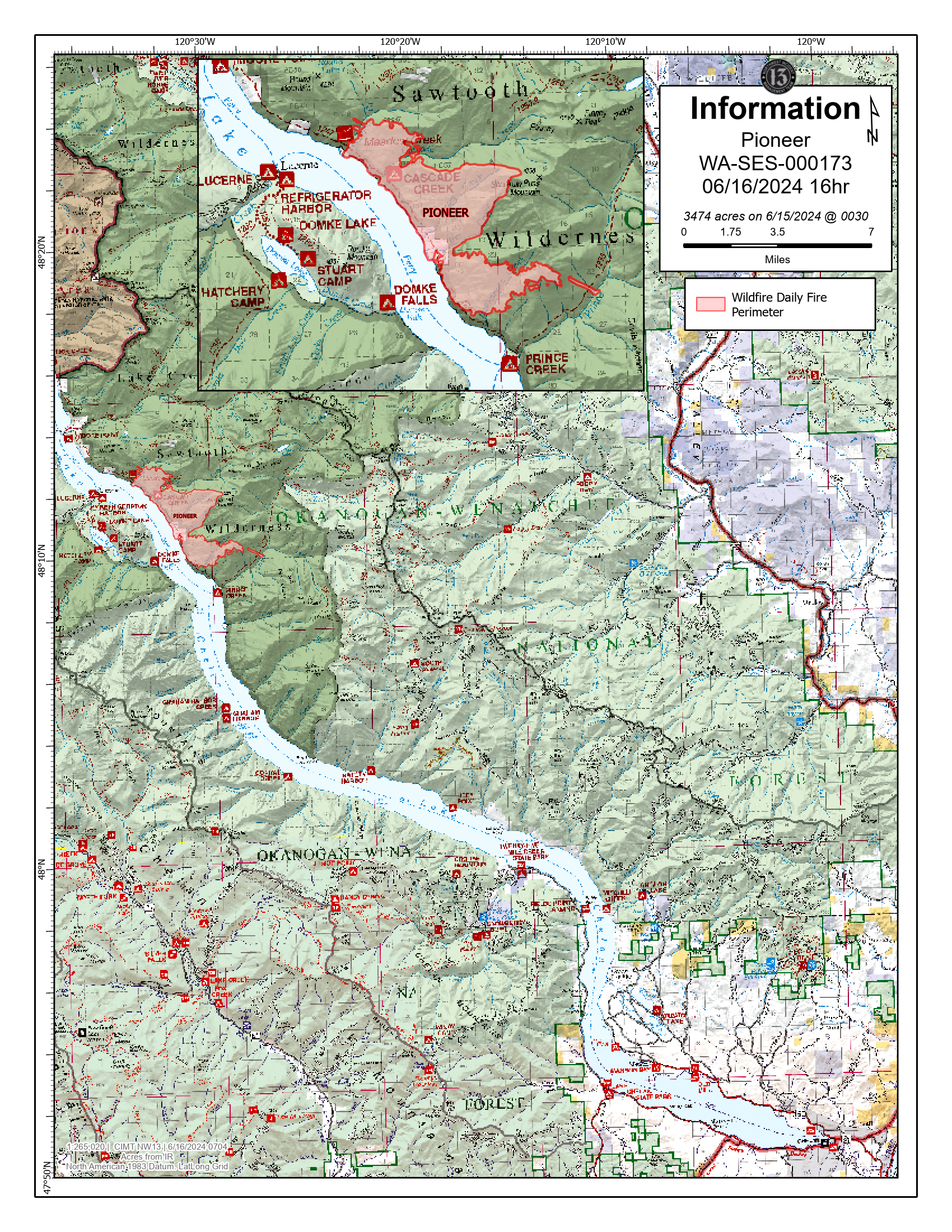
Pioneer Fire map for 6-16-24, showing the fire location plus the general vicinity of Lake Chelan.
The Chelan County Emergency Management evacuation levels are shown on the map, with Level 3 (Go Now) in red, Level 2 (Get set) in yellow, and Level 1 (Get Ready) in green.
The Okanogan-Wenatchee National Forest closures are also marked on the map with red dots or hatching.
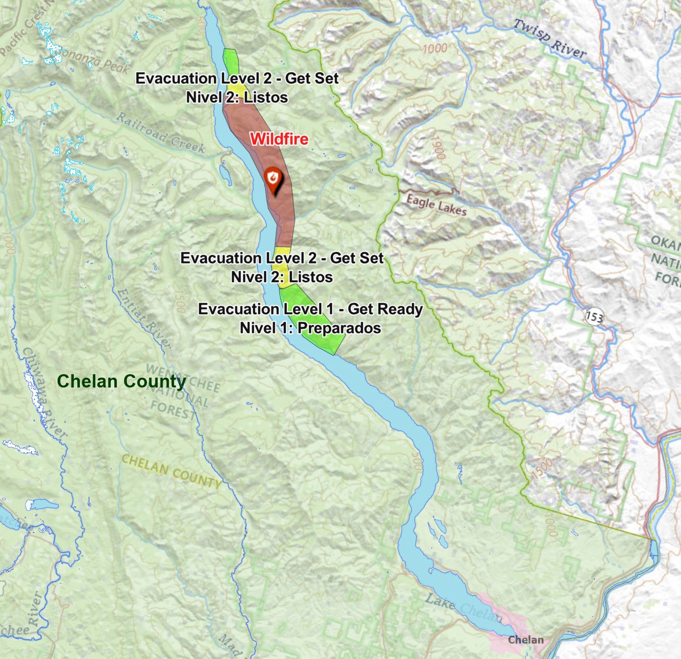
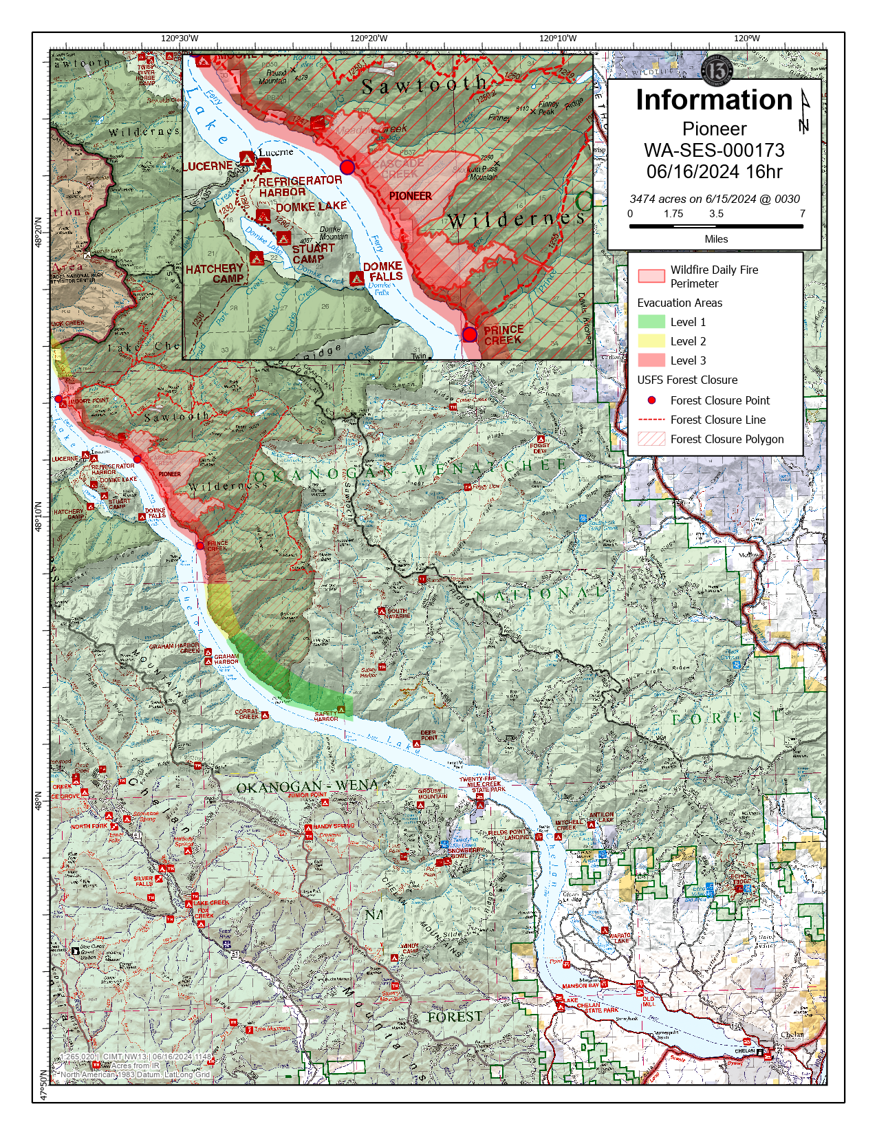
Evacuation level map reflecting the changes made 6-15-24 by Chelan County Emergency Management. For more details, see the Chelan County Emergency Management Facebook page
Areas in red are at Level 3 - Go Now!
Areas in yellow are at Level 2 - Get Set
Green areas are at Level 1 - Get Ready
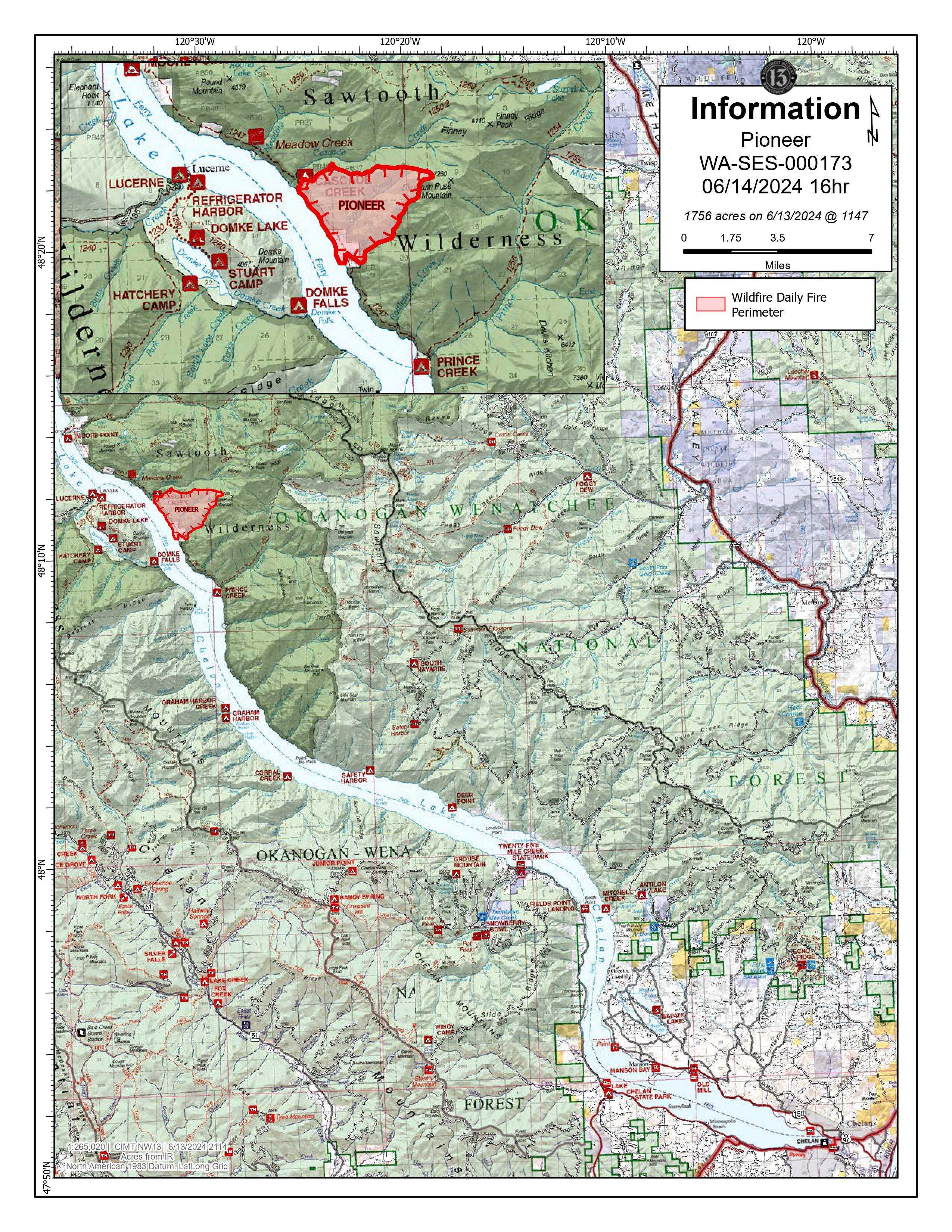
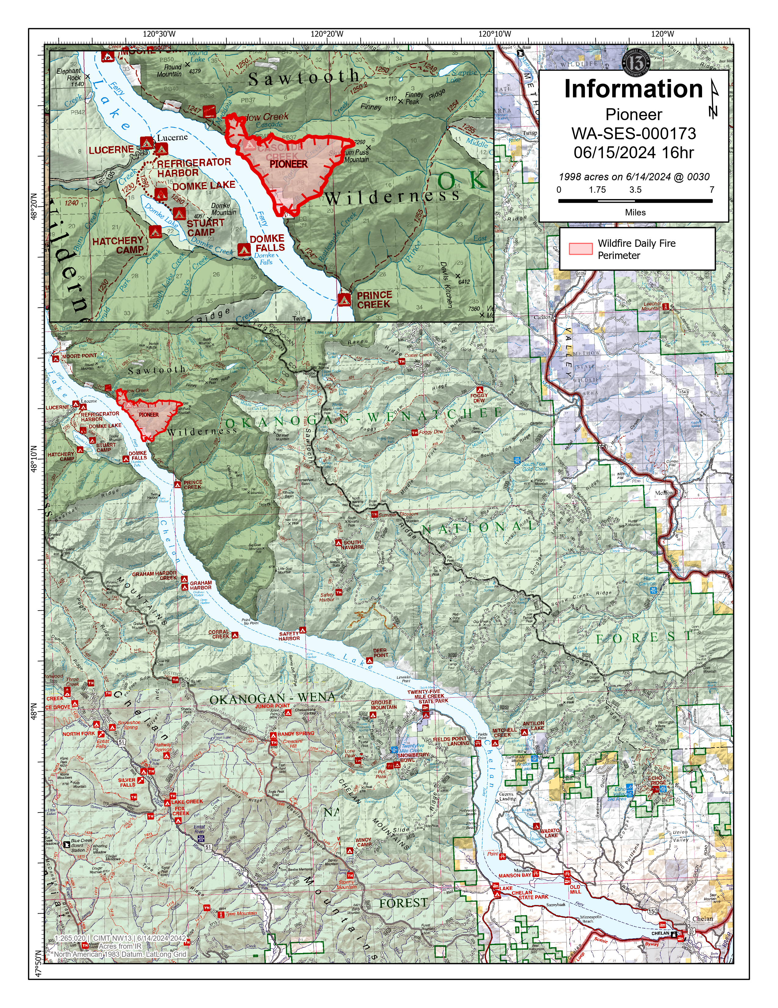
Evacuation level map reflecting the changes made 6-14-24 by Chelan County Emergency Management. For more details, see the Chelan County Emergency Management Facebook page
Areas in red are at Level 3 - Go Now!.
Areas in yellow are at Level 2 - Get Set.
Green areas are at Level 1 - Get Ready
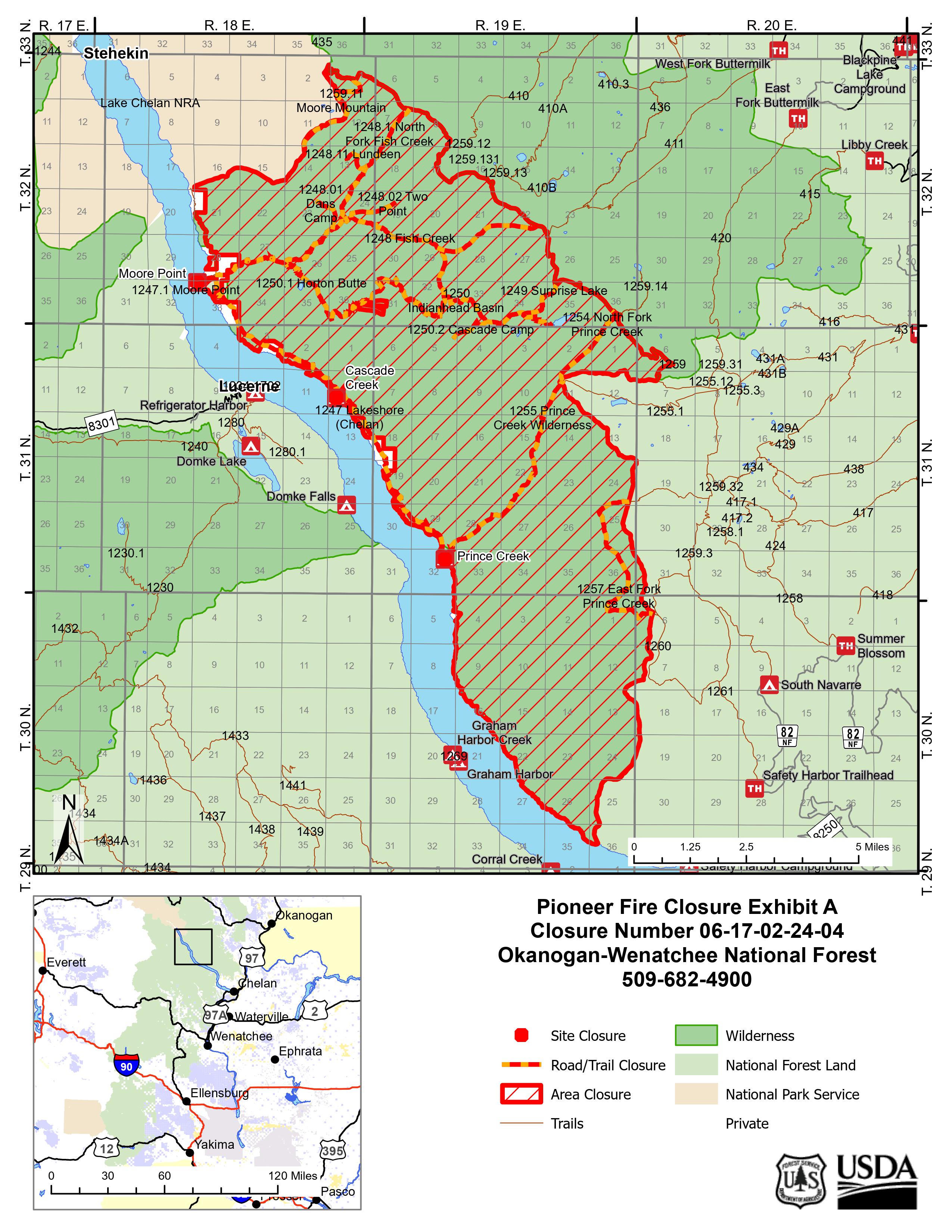
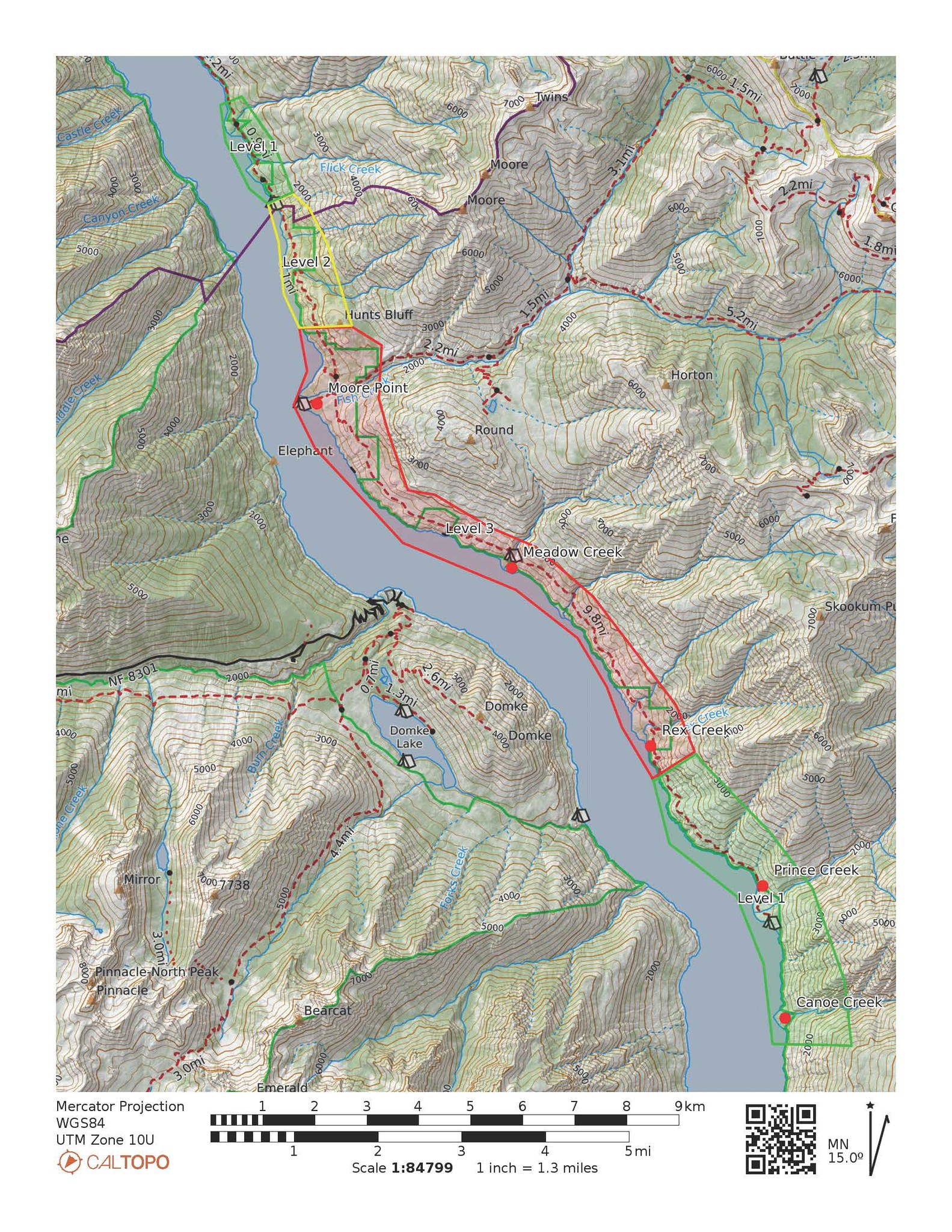
Pioneer Fire Closure Area map showing the area closed around the fire.