Incident Media Maps
Could not determine your location.
Maps Gallery
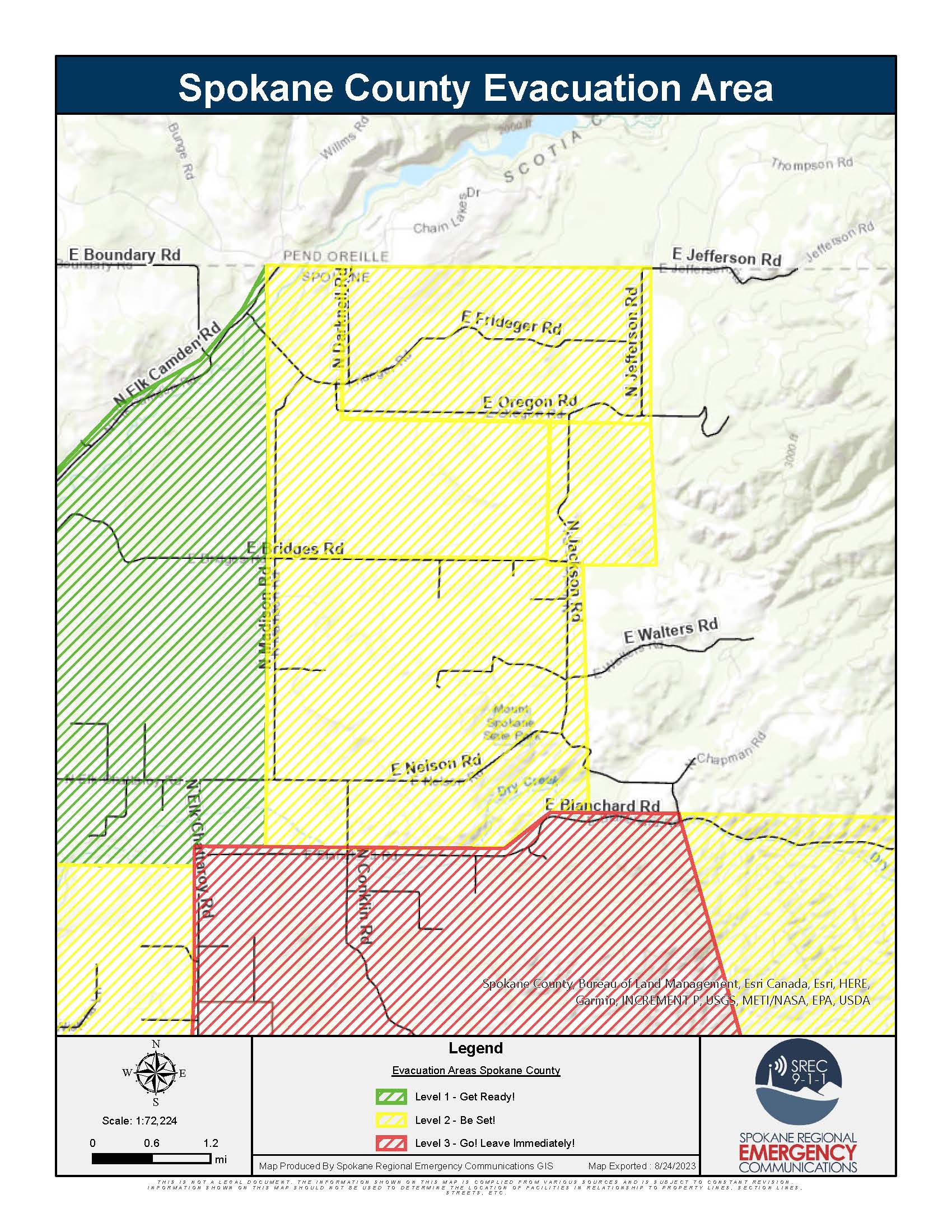
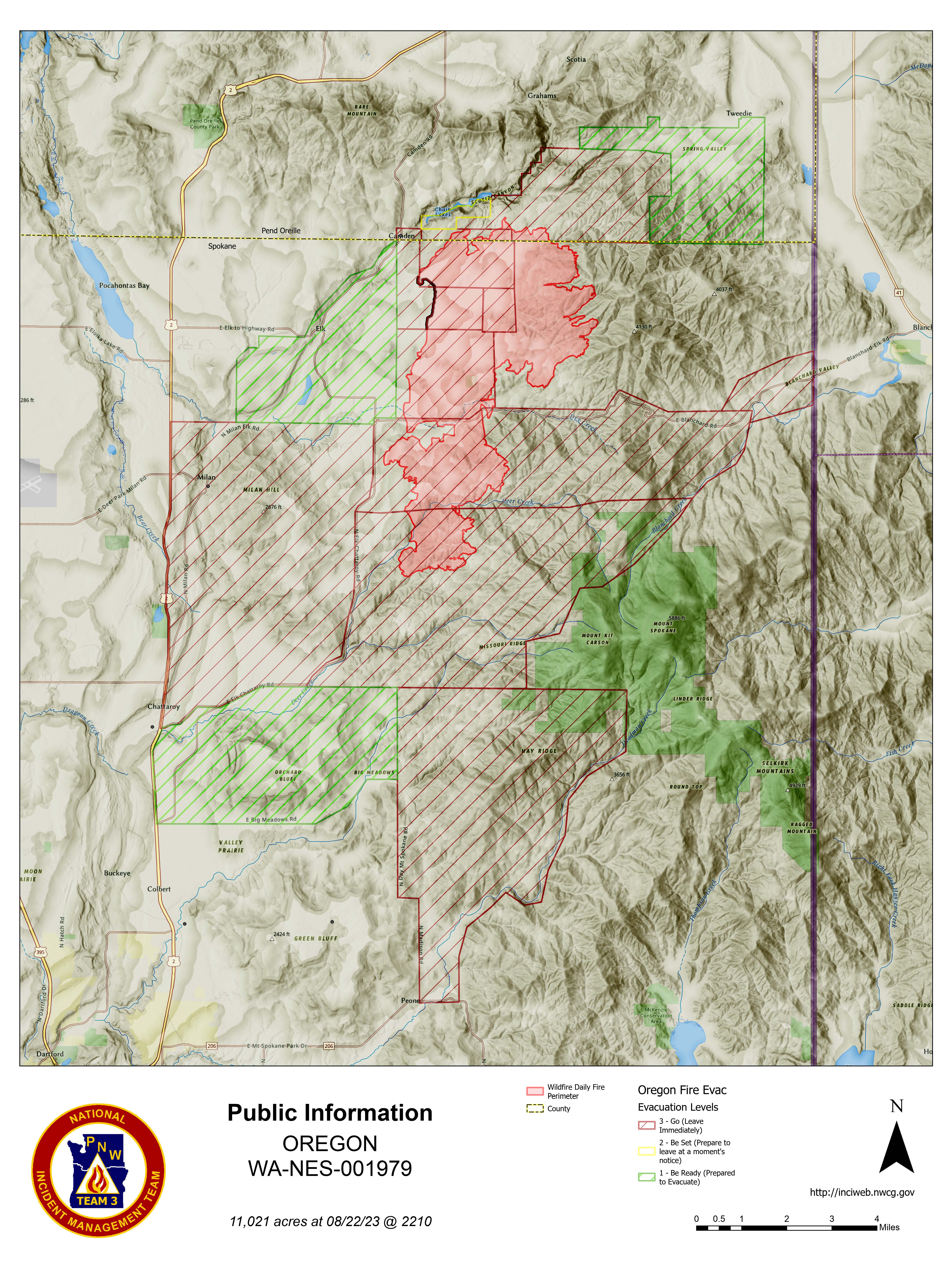
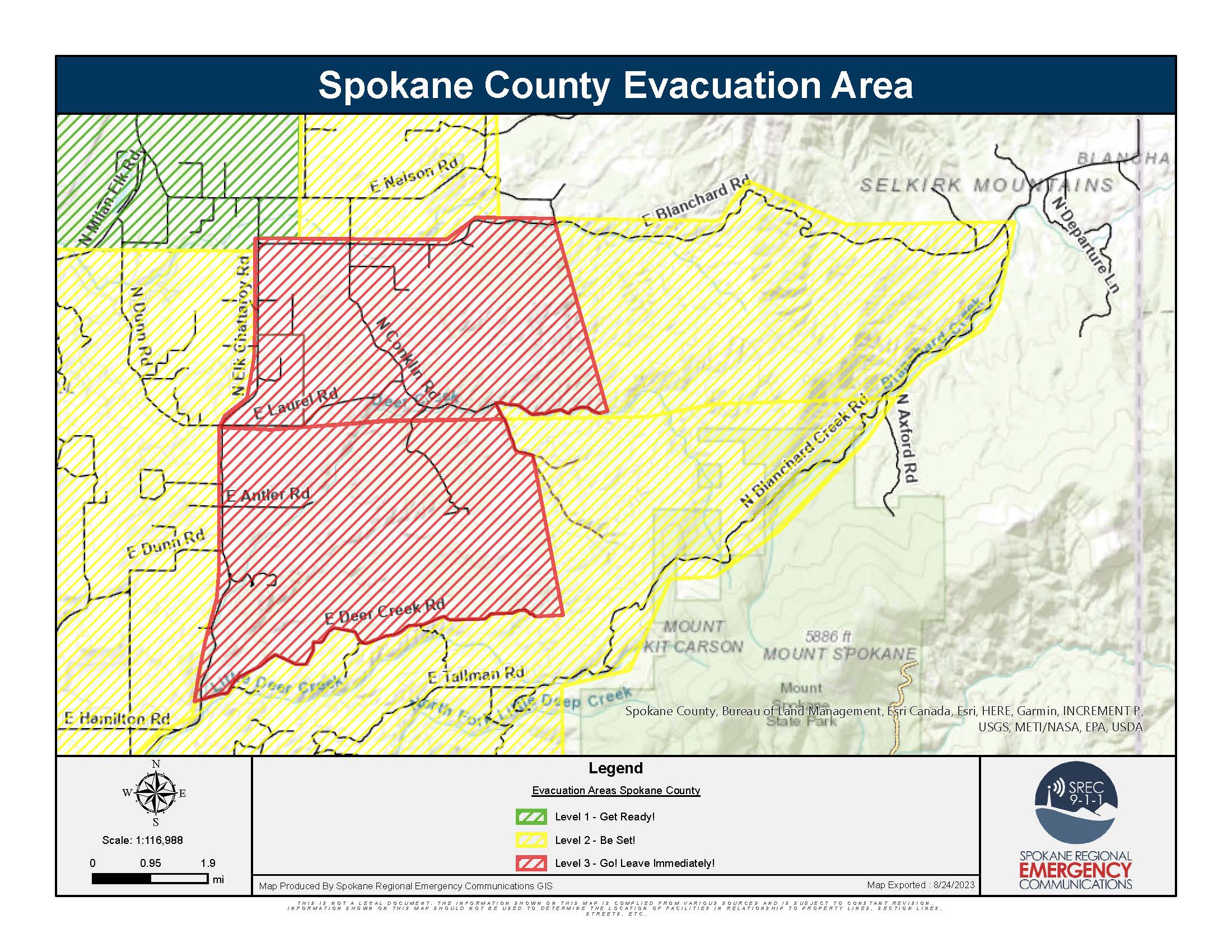
Spokane County Evacuation Levels Changes as of 8/24/2023 https://bit.ly/SRECOfficialEvac
Downgrading to Level 2:
- Darknell on the West. Jefferson on the East. Oregon Rd on the South. Spokane County Line on the North.
- Madison Rd on the West, Spokane County Border on the North, Jackson Rd on the East, Bridges Rd on the South.
- West to Jackson. East to Jefferson. North to Oregon. South to Bridges.
- Madison on the West. Jackson on the East. Blanchard on the South. Bridges on the North.
- Chapman Rd and the end of Laurel on the West. Blanchard Creek on the East. Laurel on the South. Blanchard on the North.
- Jackson, end of Deer Creek, and Elk Chattaroy on the West. Blanchard Creek on the East. Laurel and Deer Creek on the North. Tallman on the South
Remaining Level 3:
- Elk Chattaroy on the West. East end of Laurel Rd on the East. Laurel on the South. Blanchard on the North
- Elk Chattaroy on the West. Jackson and the end of Deer Creek Rd on the East. Laurel on the North. Deer Creek on the South.
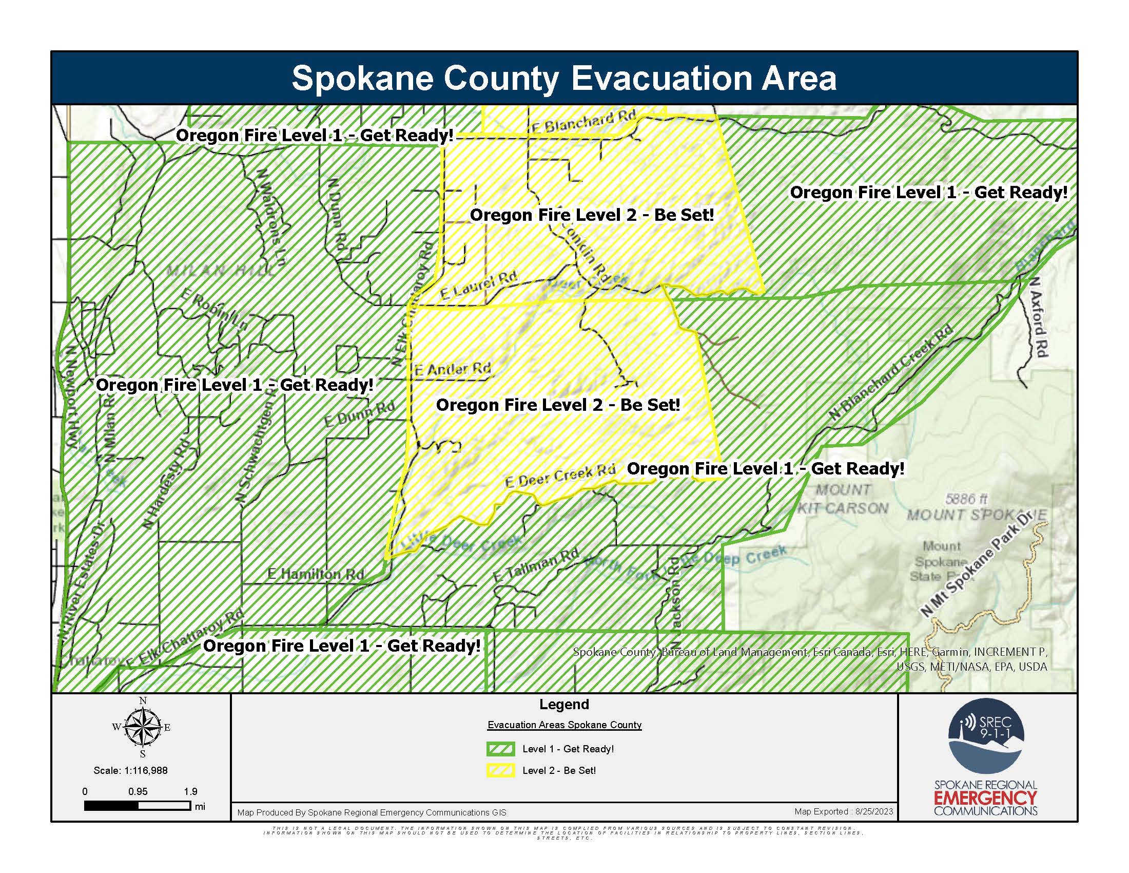
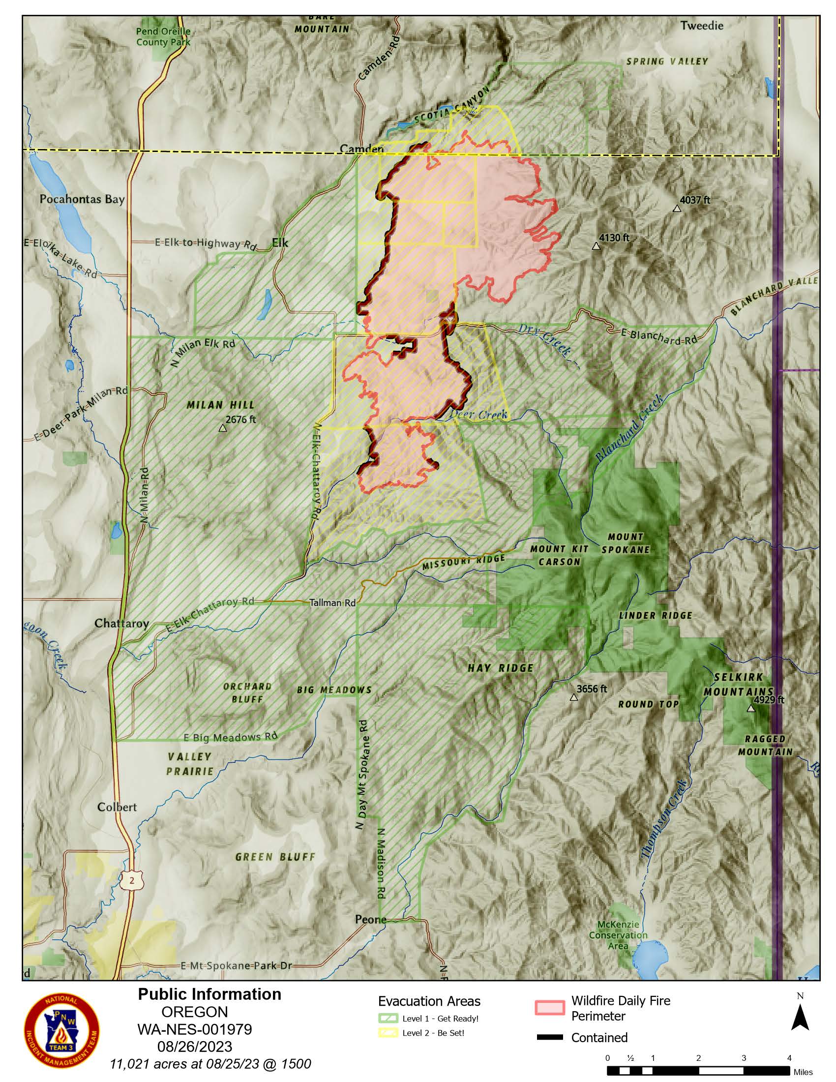
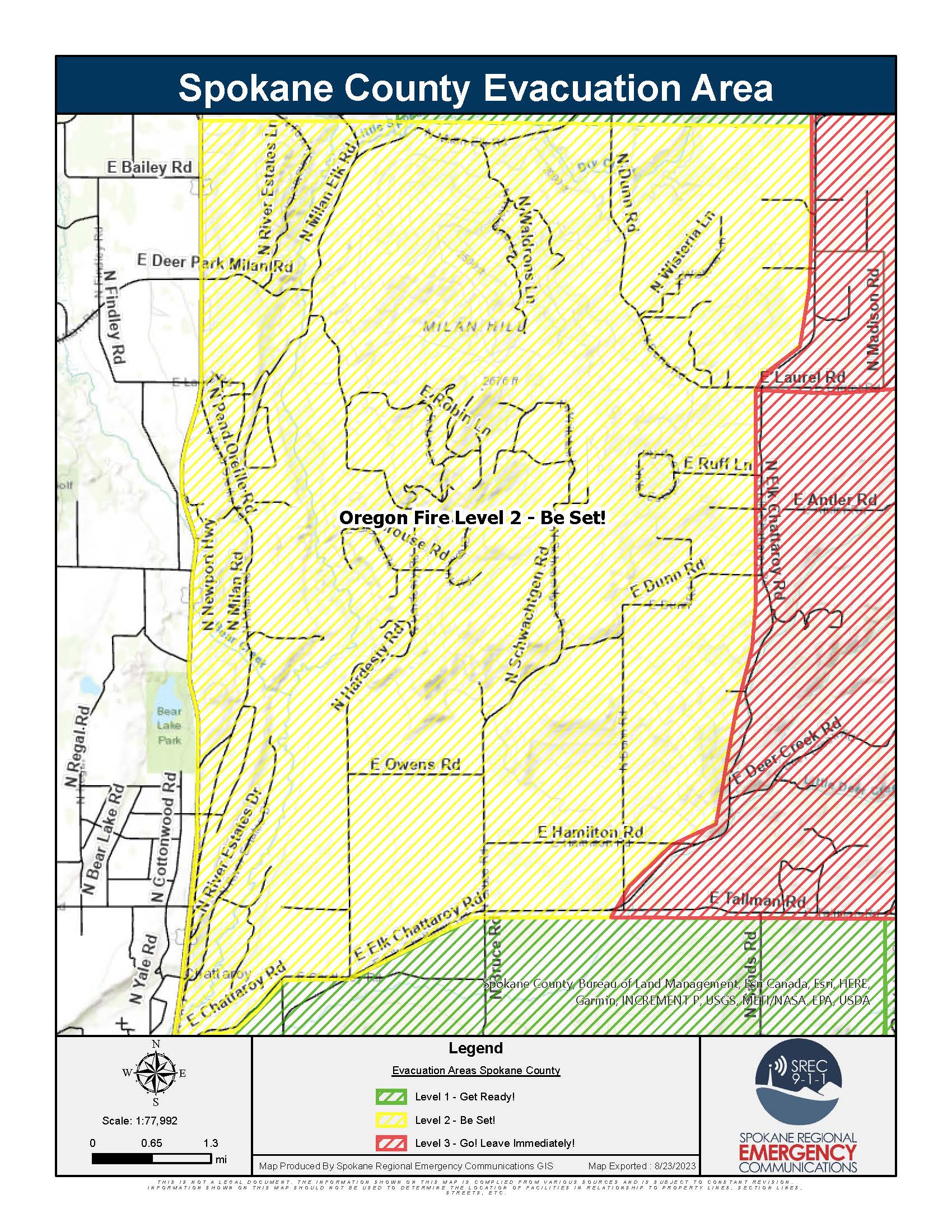
Spokane County Evacuation Levels Changes as of 8/25/2023 https://bit.ly/SRECOfficialEvac
Downgrade to Level 2:
- Elk Chattaroy on the West. East end of Laurel Rd on the East. Laurel on the South. Blanchard on the North
- Elk Chattaroy on the West. Jackson and the end of Deer Creek Rd on the East. Laurel on the North. Deer Creek on the South.
Downgrade to Level 1:
- Newport Hwy on the West. Elk Chattaroy on the East. Chattaroy on the South. Milan Elk on the North.
- Chapman Rd and the end of Laurel on the West. Blanchard Creek on the East. Laurel on the South. Blanchard on the North.
- Jackson, end of Deer Creek, and Elk Chattaroy on the West. Blanchard Creek on the East. Laurel and Deer Creek on the North. Tallman on the South.
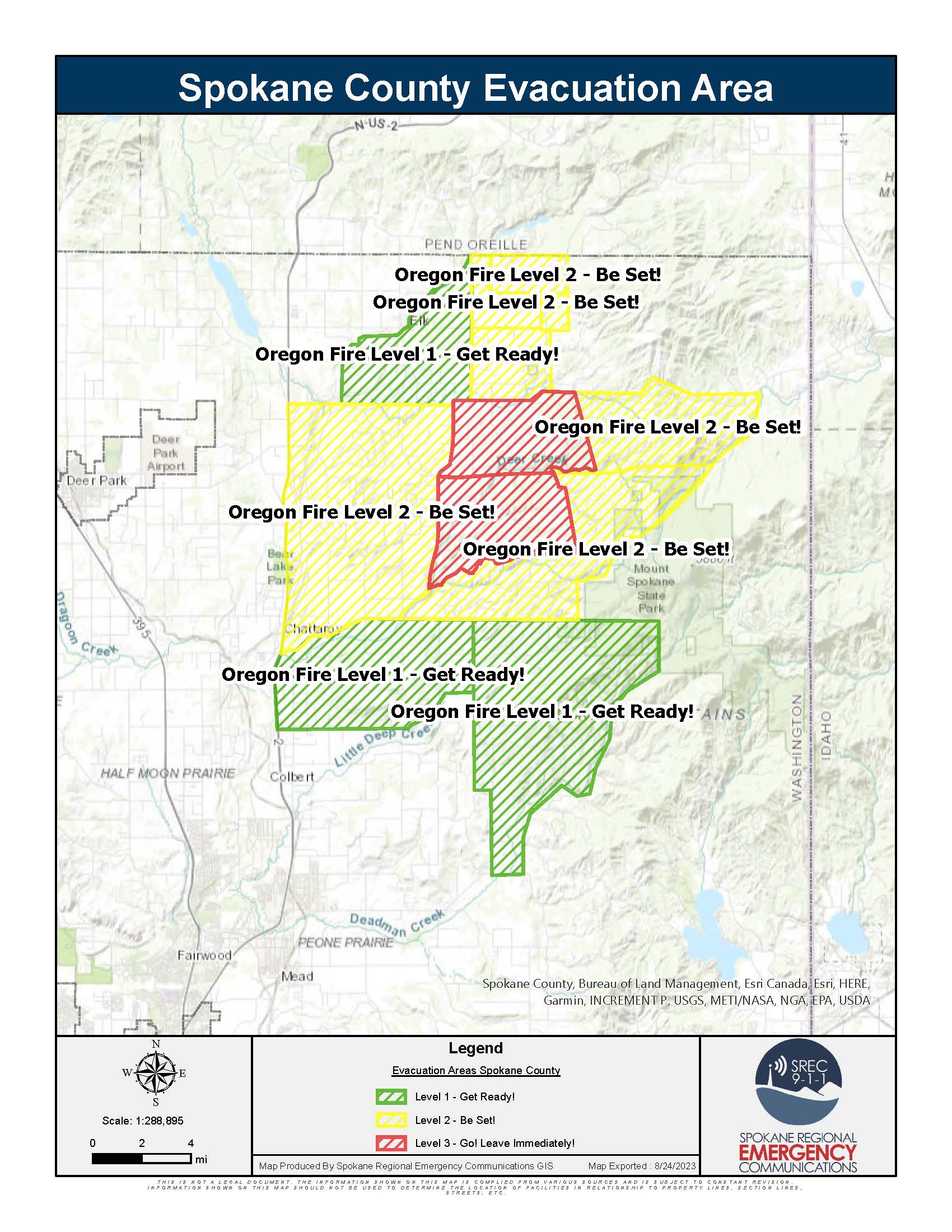
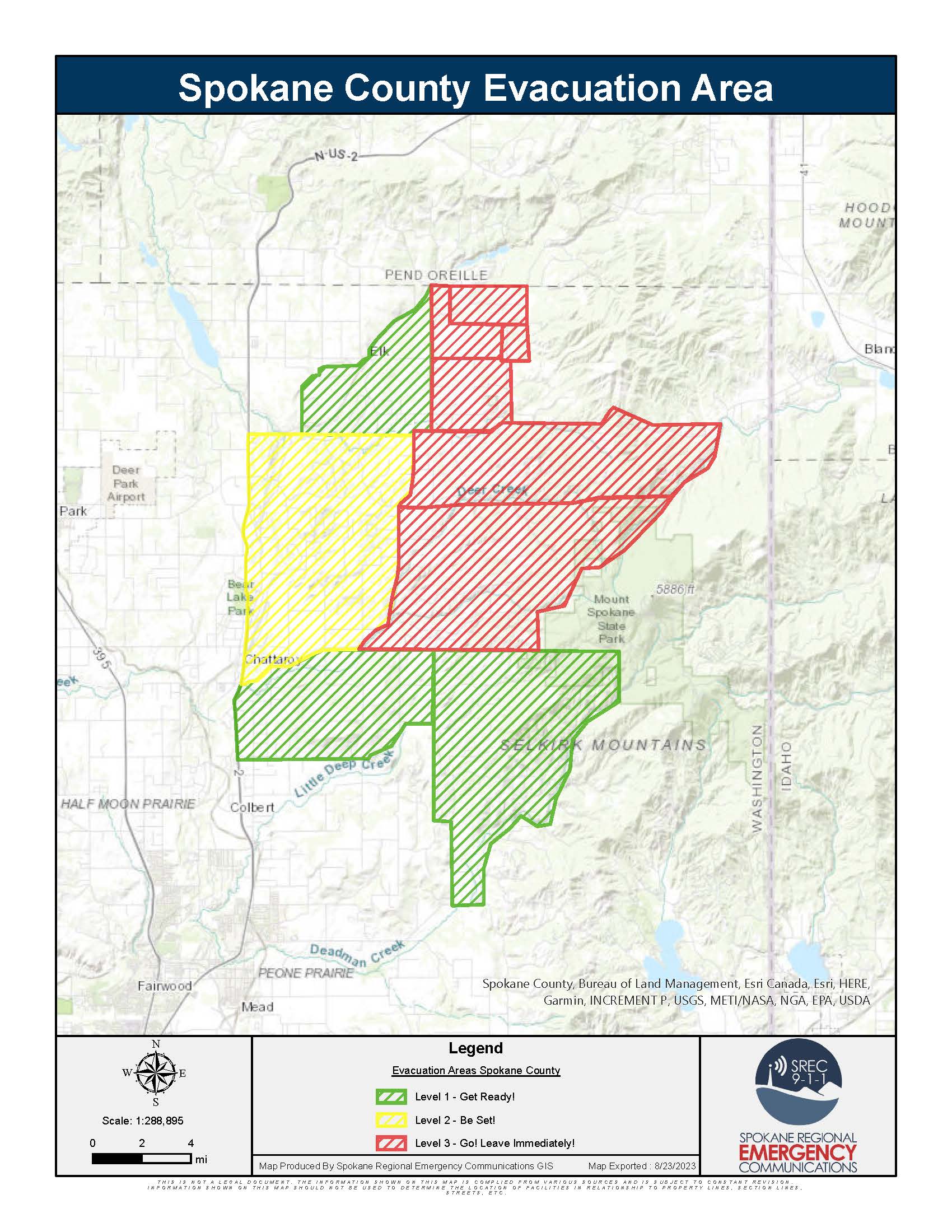
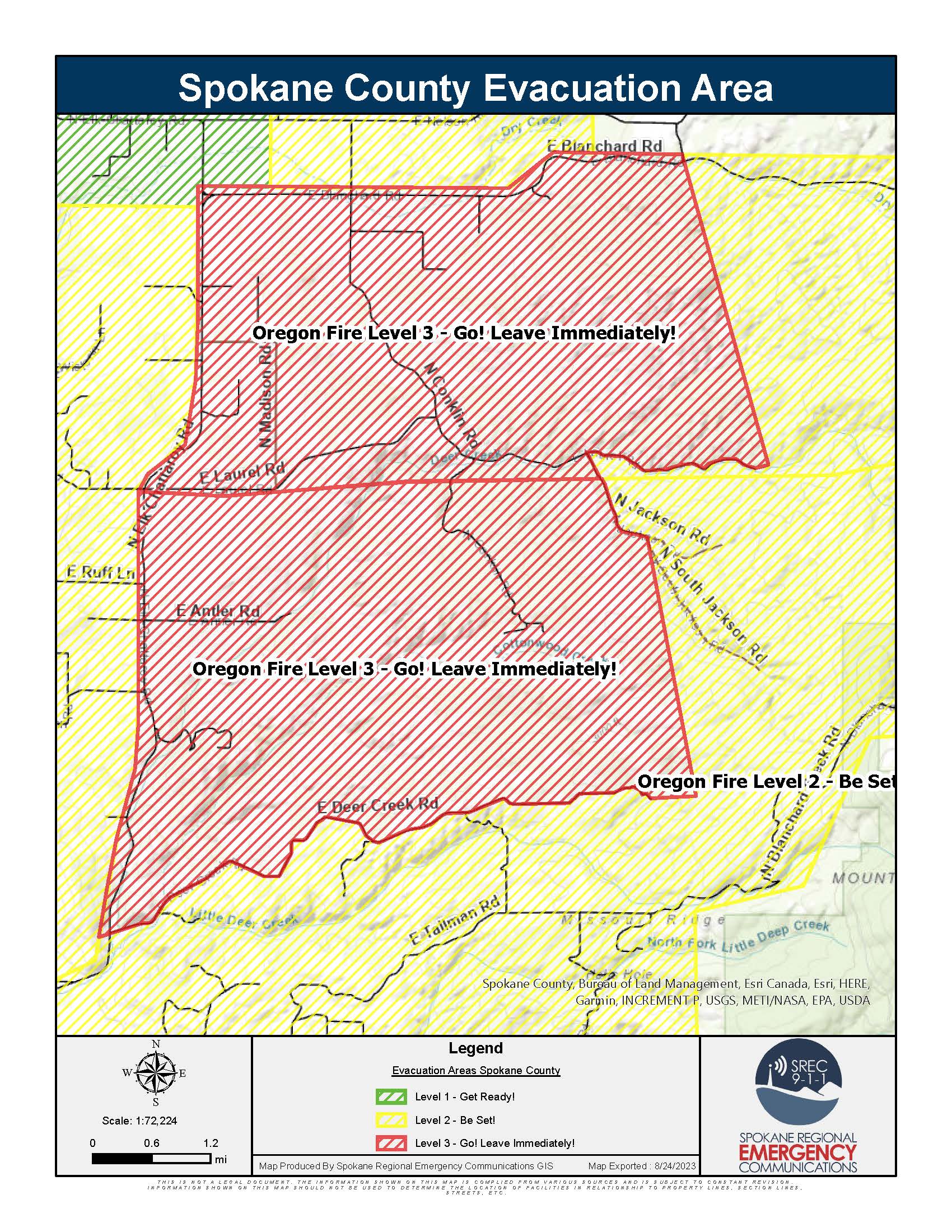
Spokane County Evacuation Levels Changes as of 8/24/2023 https://bit.ly/SRECOfficialEvac
Downgrading to Level 2:
- Darknell on the West. Jefferson on the East. Oregon Rd on the South. Spokane County Line on the North.
- Madison Rd on the West, Spokane County Border on the North, Jackson Rd on the East, Bridges Rd on the South.
- West to Jackson. East to Jefferson. North to Oregon. South to Bridges.
- Madison on the West. Jackson on the East. Blanchard on the South. Bridges on the North.
- Chapman Rd and the end of Laurel on the West. Blanchard Creek on the East. Laurel on the South. Blanchard on the North.
- Jackson, end of Deer Creek, and Elk Chattaroy on the West. Blanchard Creek on the East. Laurel and Deer Creek on the North. Tallman on the South
Remaining Level 3:
- Elk Chattaroy on the West. East end of Laurel Rd on the East. Laurel on the South. Blanchard on the North
- Elk Chattaroy on the West. Jackson and the end of Deer Creek Rd on the East. Laurel on the North. Deer Creek on the South.

 InciWeb