Incident Media Maps
Could not determine your location.
 Wildfire
 Prescribed Fire
 Burned Area
Response
Burned Area
Response Other
Other
Maps Gallery


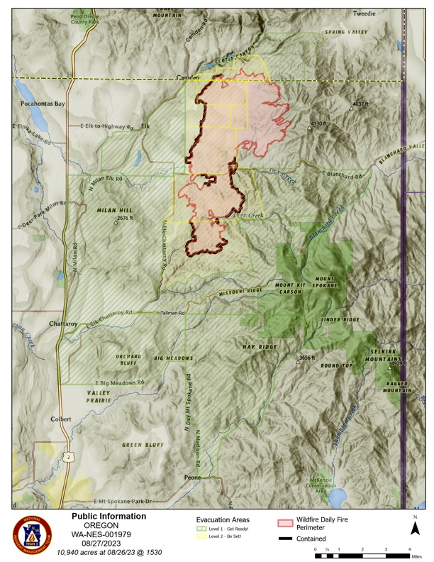
Updates for Oregon Road Fire are as follows:
ALL CLEAR:
• Madison on the East. Elk Camden and Valley on the West. Spokane County line on the North. Blanchard on the South.
• Newport Hwy on the West. Elk Chattaroy on the East. Chattaroy on the South. Milan Elk on the North.
• Elk Chattaroy on the North. Madison on the East. Newport Highway on the West. Big Meadows on the South.
• Madison and Day Mt Spokane on the West. Mt Spokane Park Dr on the South and East. Tallman on the North.
• Chapman Rd and the end of Laurel on the West. Blanchard Creek on the East. Laurel on the South. Blanchard on the North.
• Jackson, end of Deer Creek, and Elk Chattaroy on the West. Blanchard Creek on the East. Laurel and Deer Creek on the North. Tallman on the South
Downgrade to LEVEL 1:
• Elk Chattaroy on the West. Jackson and the end of Deer Creek Rd on the East. Laurel on the North. Deer Creek on the South.
• Elk Chattaroy on the West. East end of Laurel Rd on the East. Laurel on the South. Blanchard on the North.
• Madison on the West. Jackson on the East. Blanchard on the South. Bridges on the North.
• Madison Rd on the West, Spokane County Border on the North, Jackson Rd on the East, Bridges Rd on the South.
• West to Jackson. East to Jefferson. North to Oregon. South to Bridges.
• Darknell on the West. Jefferson on the East. Oregon Rd on the South. Spokane County Line on the North.

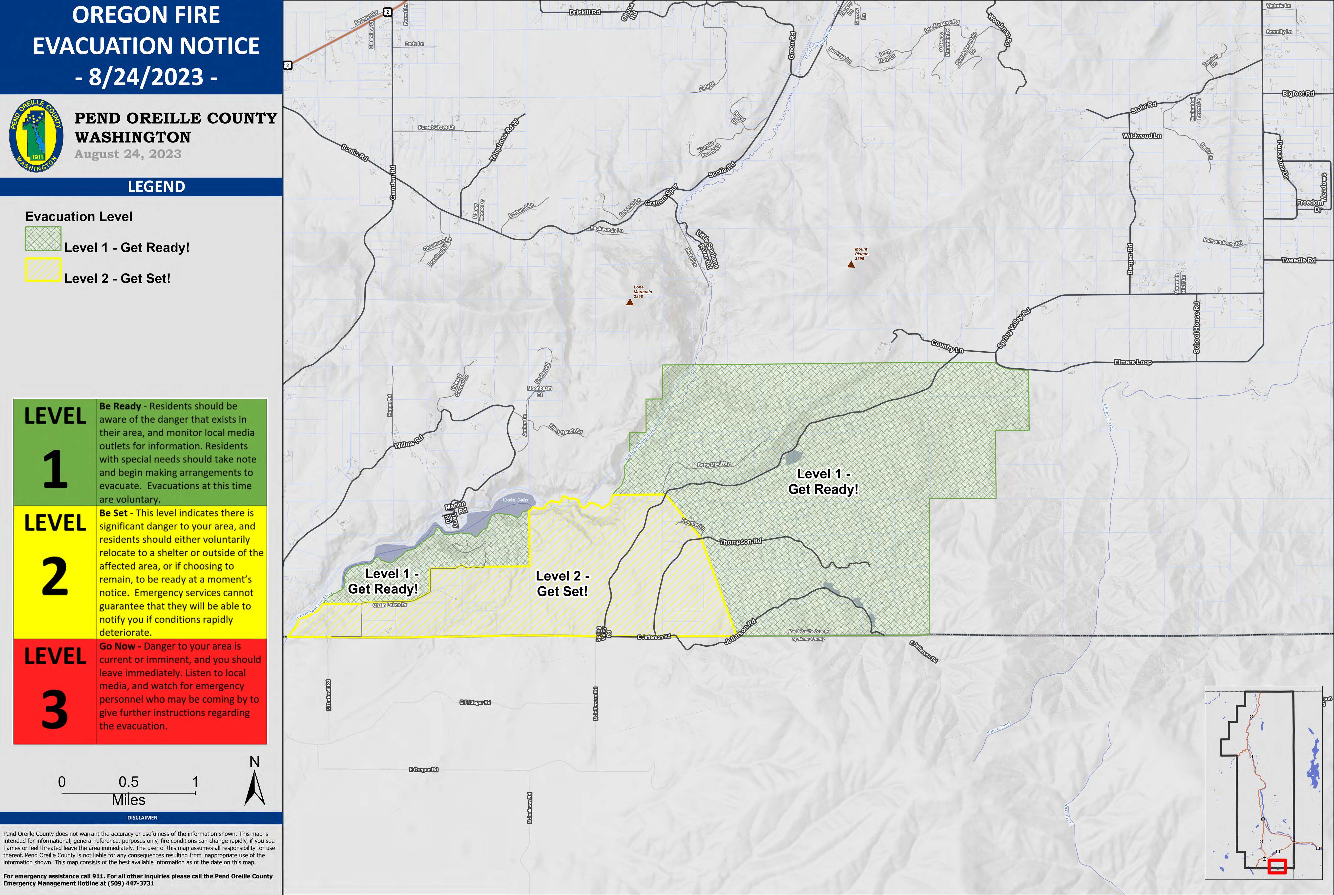
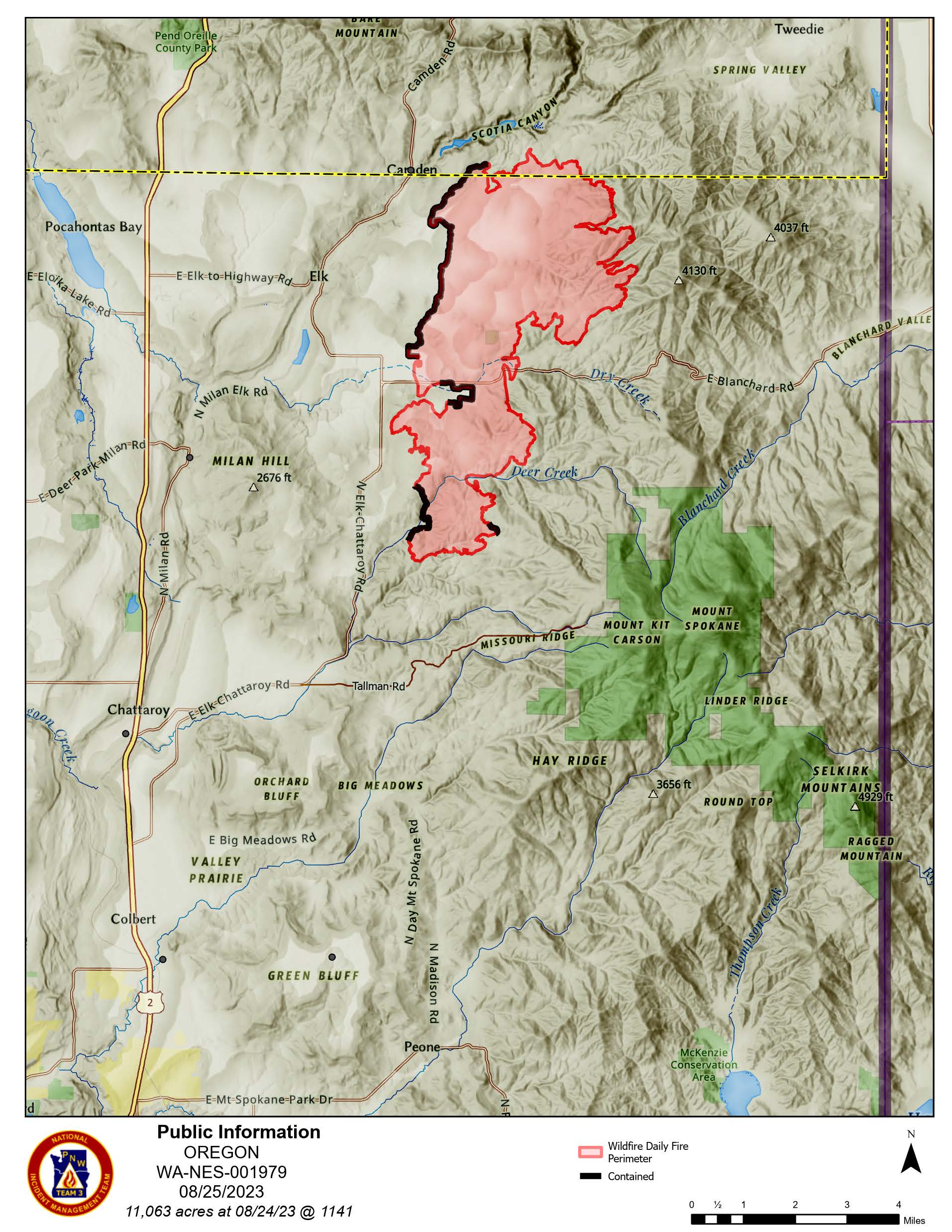
The evacuation levels in Pend Oreille County have been updated as shown on the attached map and detailed descriptions of the areas are described as:
On the northeast side of the fire, the single Level 1 is removed.
The two Level 2 blocks reduce to Level 1.
To the south of the above areas, the entire block around Elk in both counties reduces from Level 3 to Level 2.
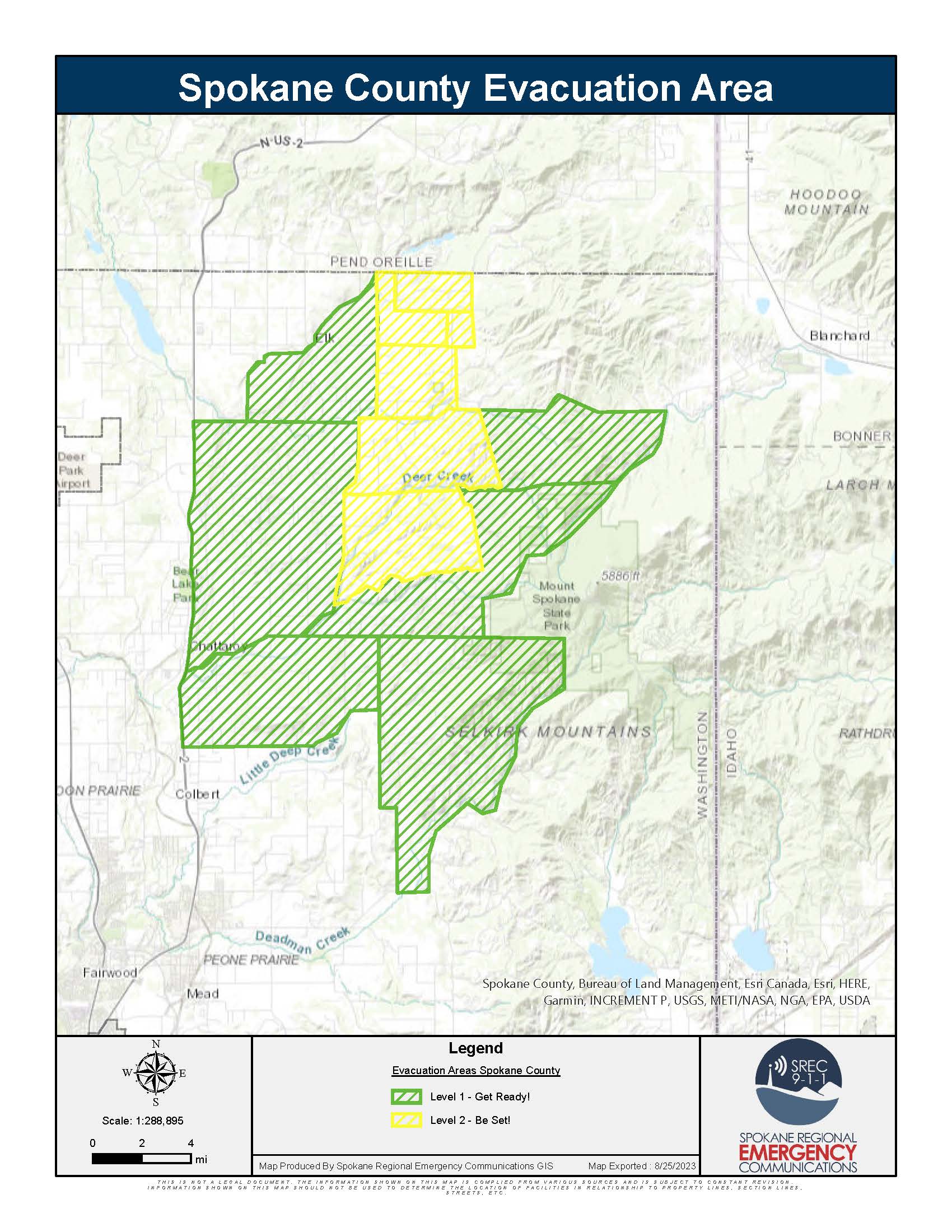
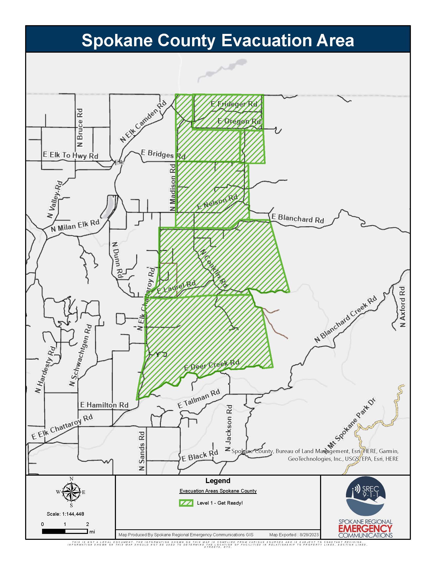
Spokane County Evacuation Levels Changes as of 8/25/2023 https://bit.ly/SRECOfficialEvac
Downgrade to Level 2:
- Elk Chattaroy on the West. East end of Laurel Rd on the East. Laurel on the South. Blanchard on the North
- Elk Chattaroy on the West. Jackson and the end of Deer Creek Rd on the East. Laurel on the North. Deer Creek on the South.
Downgrade to Level 1:
- Newport Hwy on the West. Elk Chattaroy on the East. Chattaroy on the South. Milan Elk on the North.
- Chapman Rd and the end of Laurel on the West. Blanchard Creek on the East. Laurel on the South. Blanchard on the North.
- Jackson, end of Deer Creek, and Elk Chattaroy on the West. Blanchard Creek on the East. Laurel and Deer Creek on the North. Tallman on the South.