
Incident Media Maps
Settings - change map background and toggle additional layers
Filter - control incident types displayed on map.
Zoom to your location
Reset map zoom and position
Could not determine your location.
Show Legend
 Wildfire
 Prescribed Fire
 Burned Area
Response
Burned Area
Response Other
Other
Maps Gallery
Image options: [ Full Size ] -
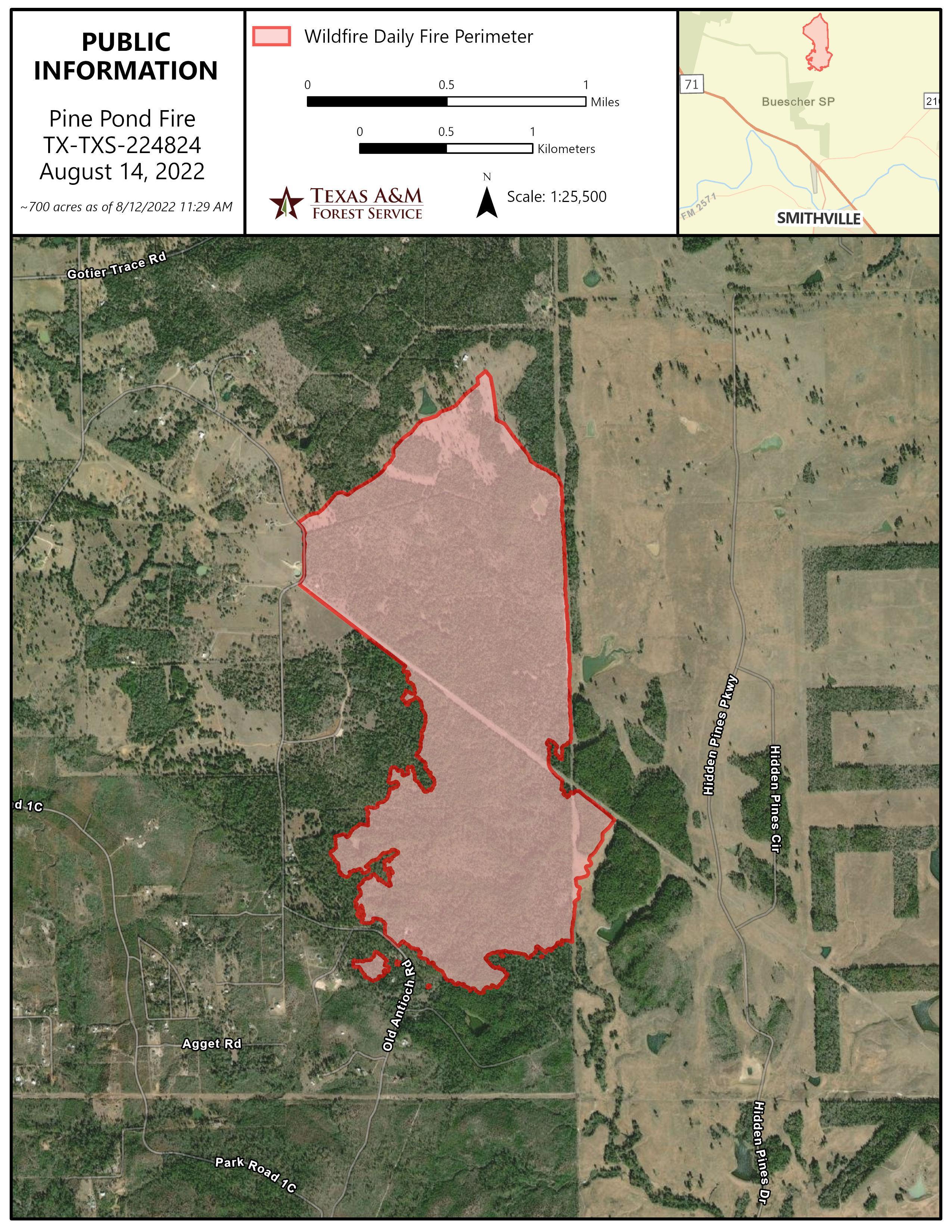
Public Information map shows the mapped perimeter of the Pine Pond fire as of August 14
Image options: [ Full Size ] -
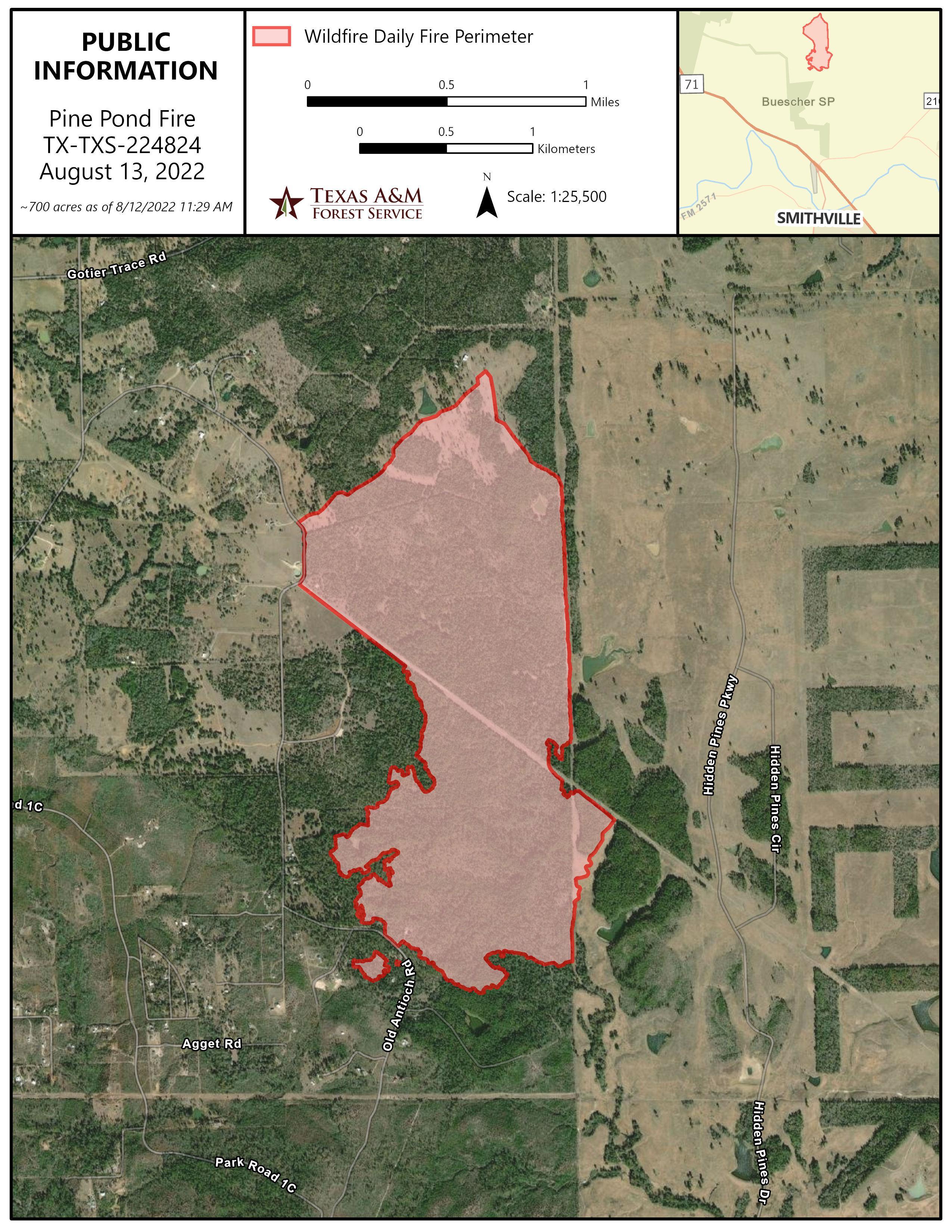
Public Information map shows the mapped perimeter of the Pine Pond fire as of August 13
Image options: [ Full Size ] -
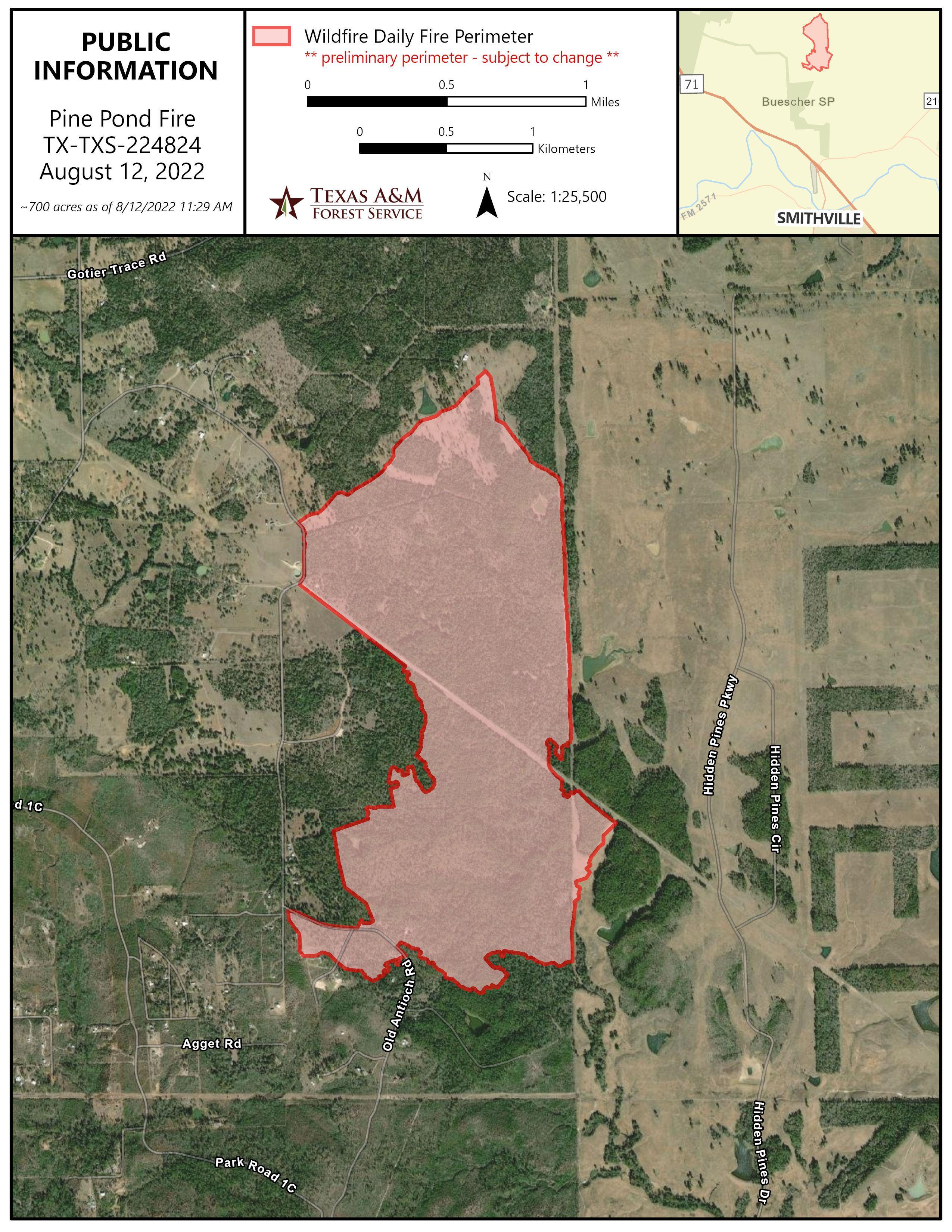
Public Information map shows the mapped perimeter of the Pine Pond fire as of August 12
Image options: [ Full Size ] -
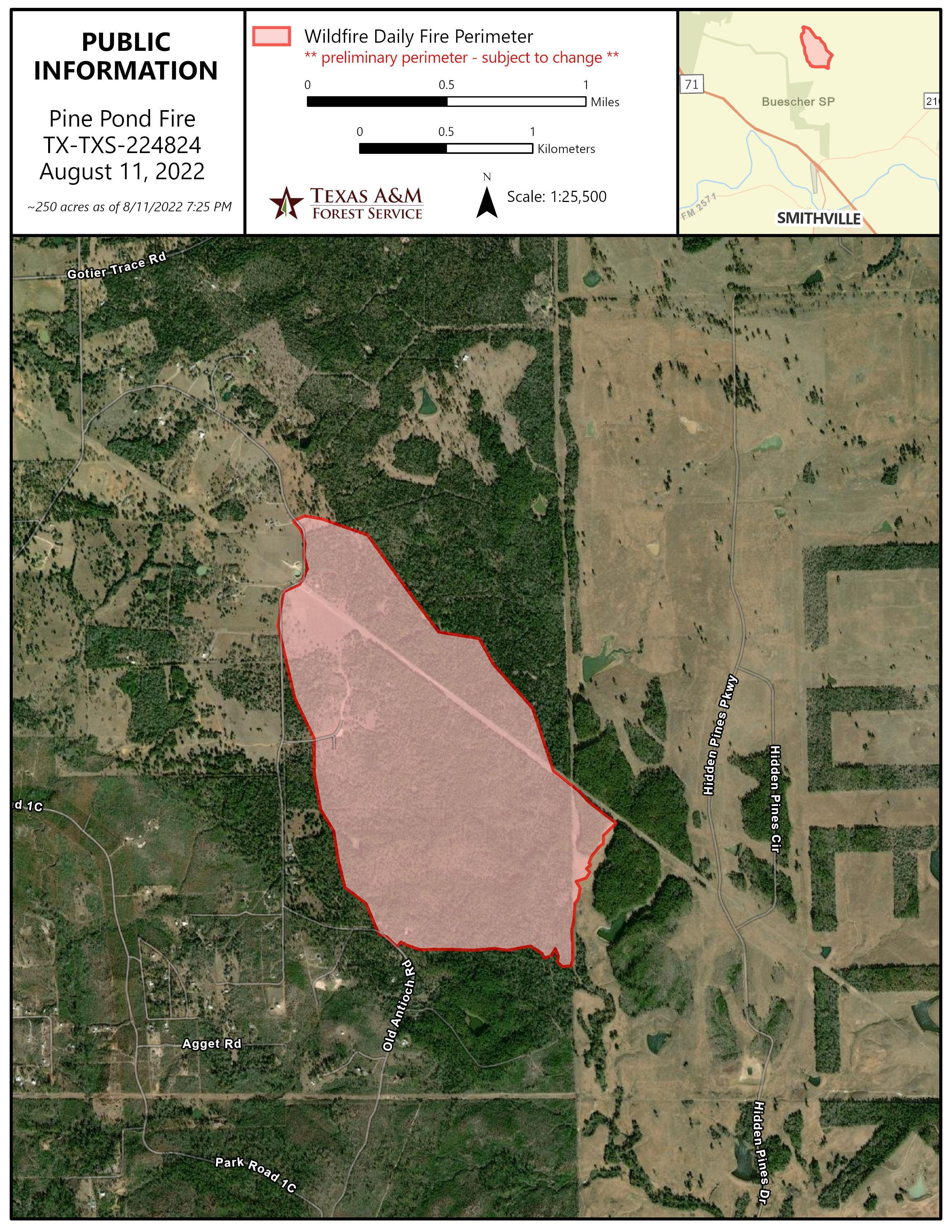
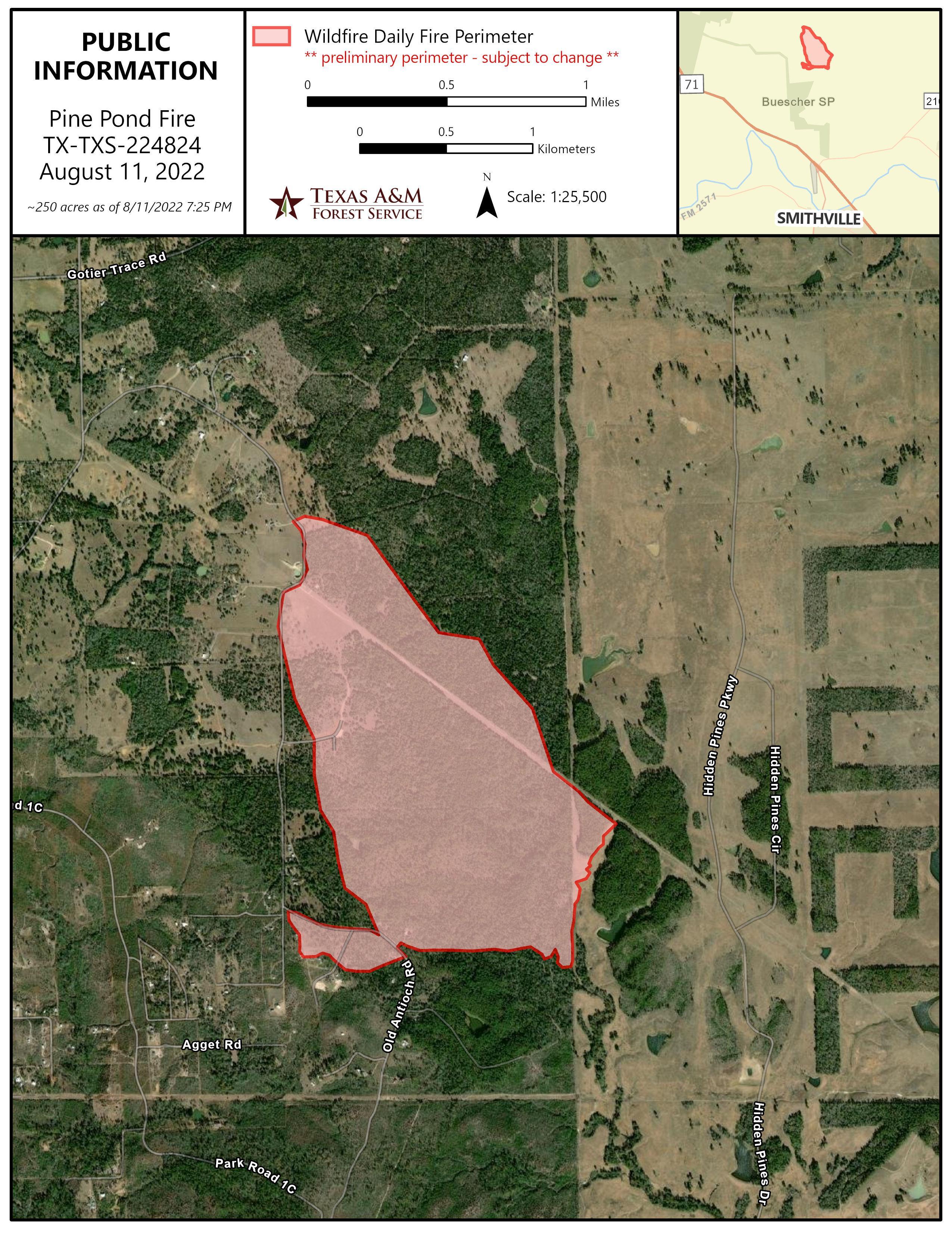
Preliminary public information map for the Pine Pond Fire as of August 11, 2022. This is subject to change.
Image options: [ Full Size ] -
Preliminary public information map more accurately reflects movement on the southern portion of the fire on August 11. This a preliminary perimeter and is subject to change.