Incident Media Maps
Settings - change map background and toggle additional layers
Filter - control incident types displayed on map.
Zoom to your location
Reset map zoom and position
Could not determine your location.
Show Legend
 Wildfire
 Prescribed Fire
 Burned Area
Response
Burned Area
Response Other
Other
Maps Gallery

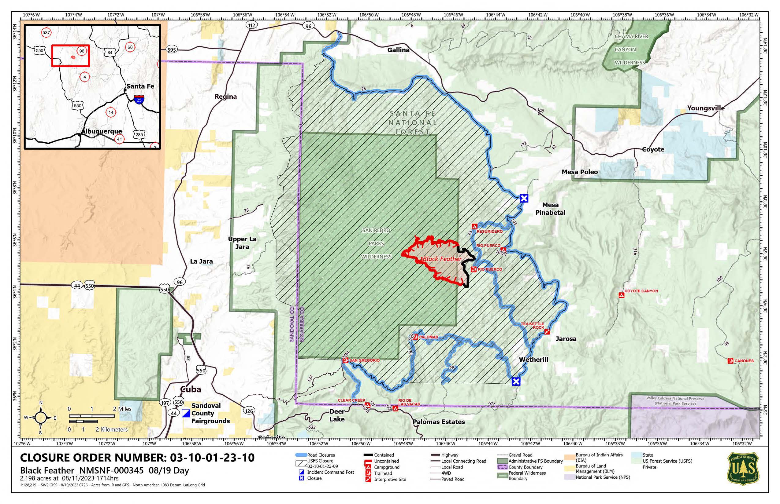


Image options: [ Full Size ] -

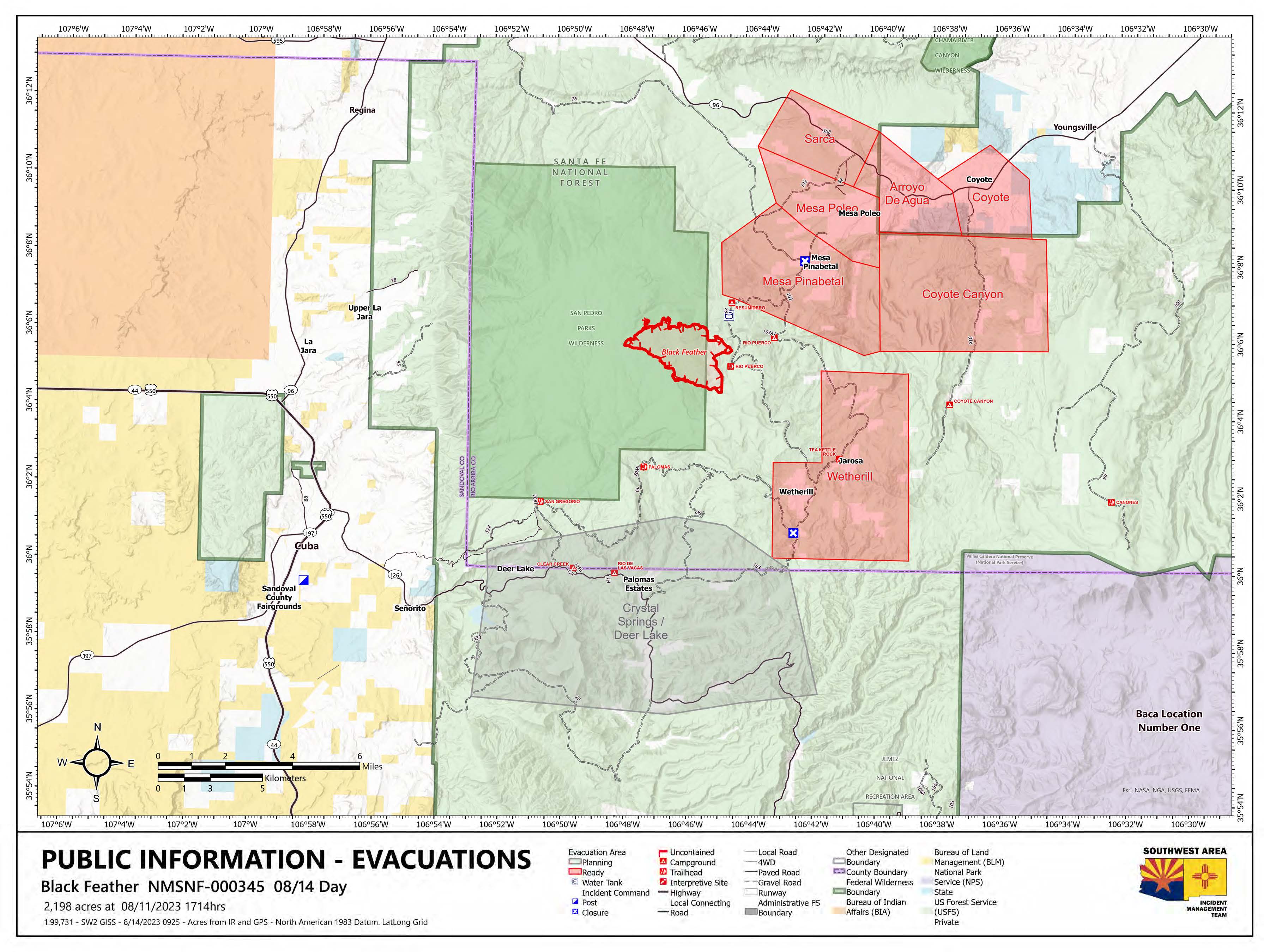
Evacuation orders remain the same as yesterday. The following areas are set to 'Ready": Mesa Pinabetal, Mesa Poleo, Sarca, Arroyo De Agua, Coyote, Coyote Canyon, and Wetherill.