Incident Media Maps
Settings - change map background and toggle additional layers
Filter - control incident types displayed on map.
Zoom to your location
Reset map zoom and position
Could not determine your location.
Show Legend
 Wildfire
 Prescribed Fire
 Burned Area
Response
Burned Area
Response Other
Other
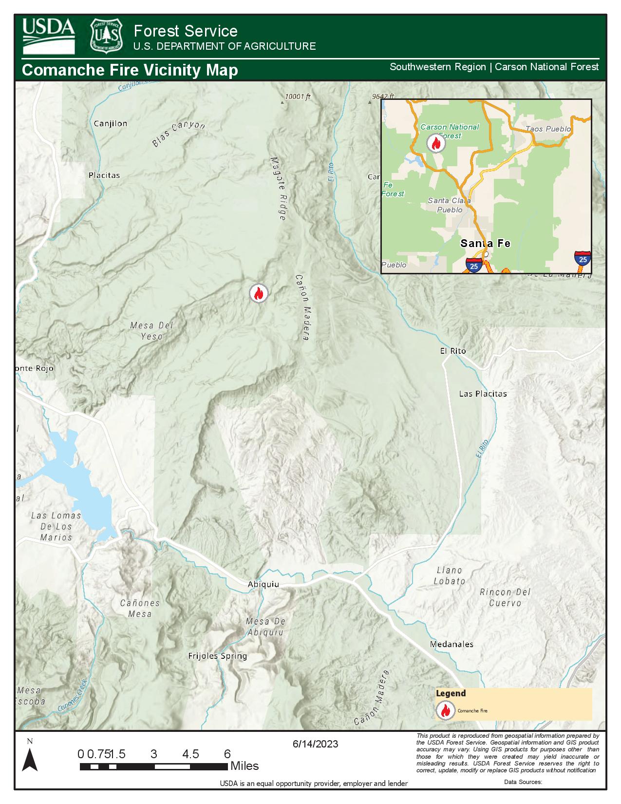
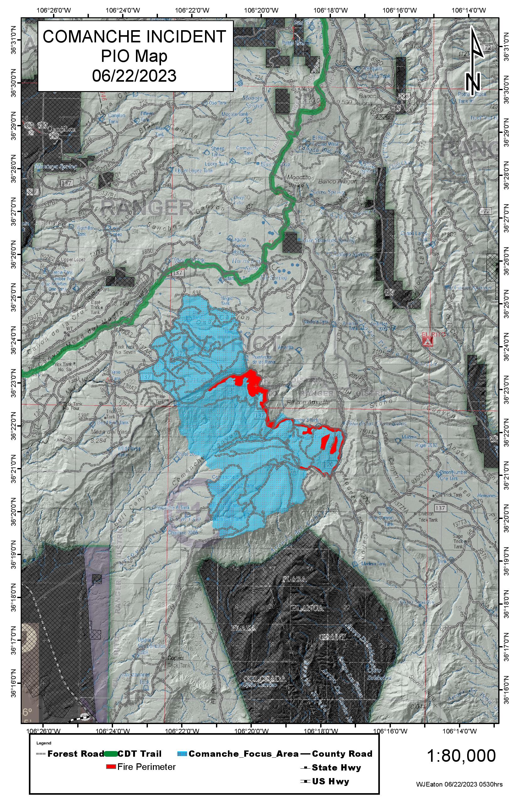
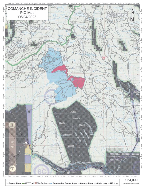
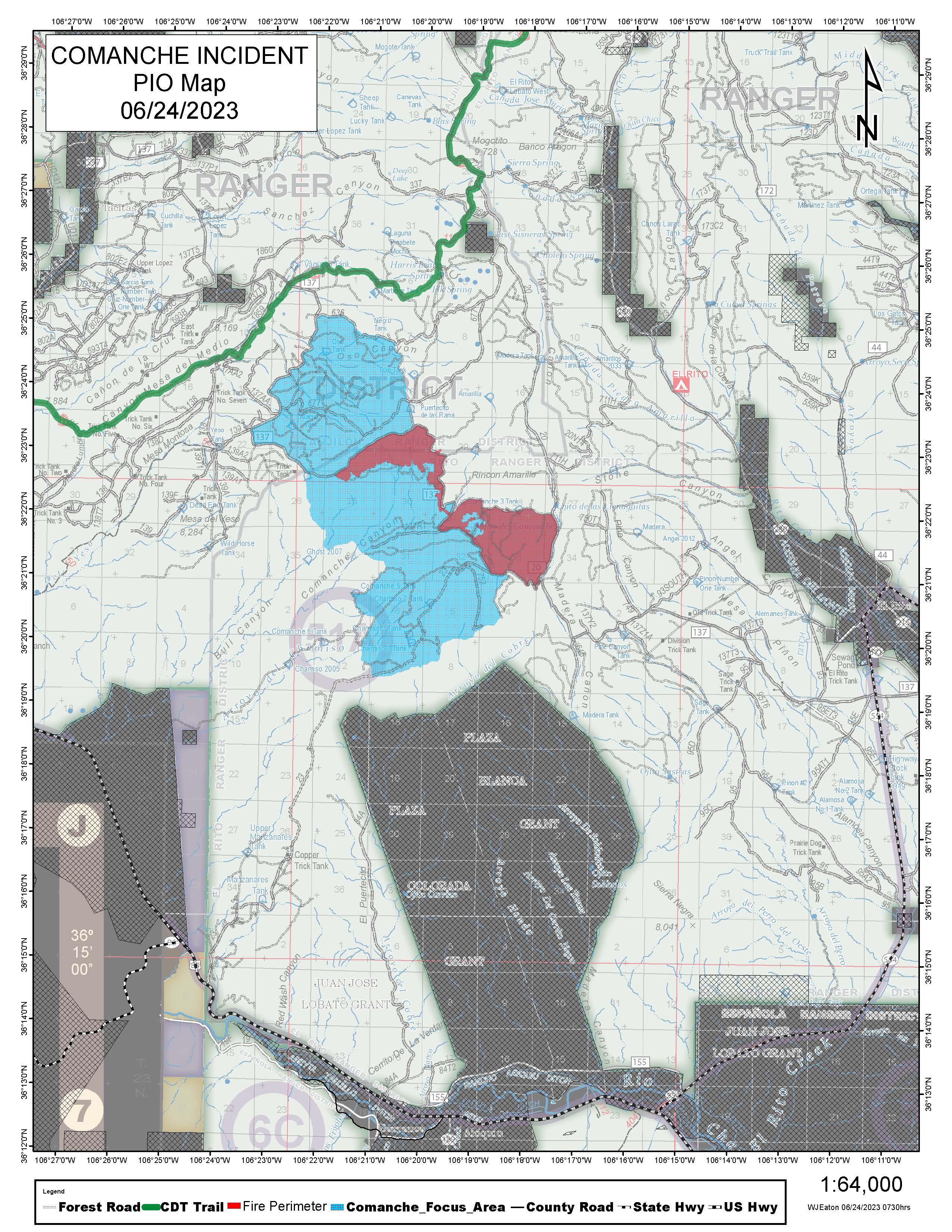
Maps Gallery
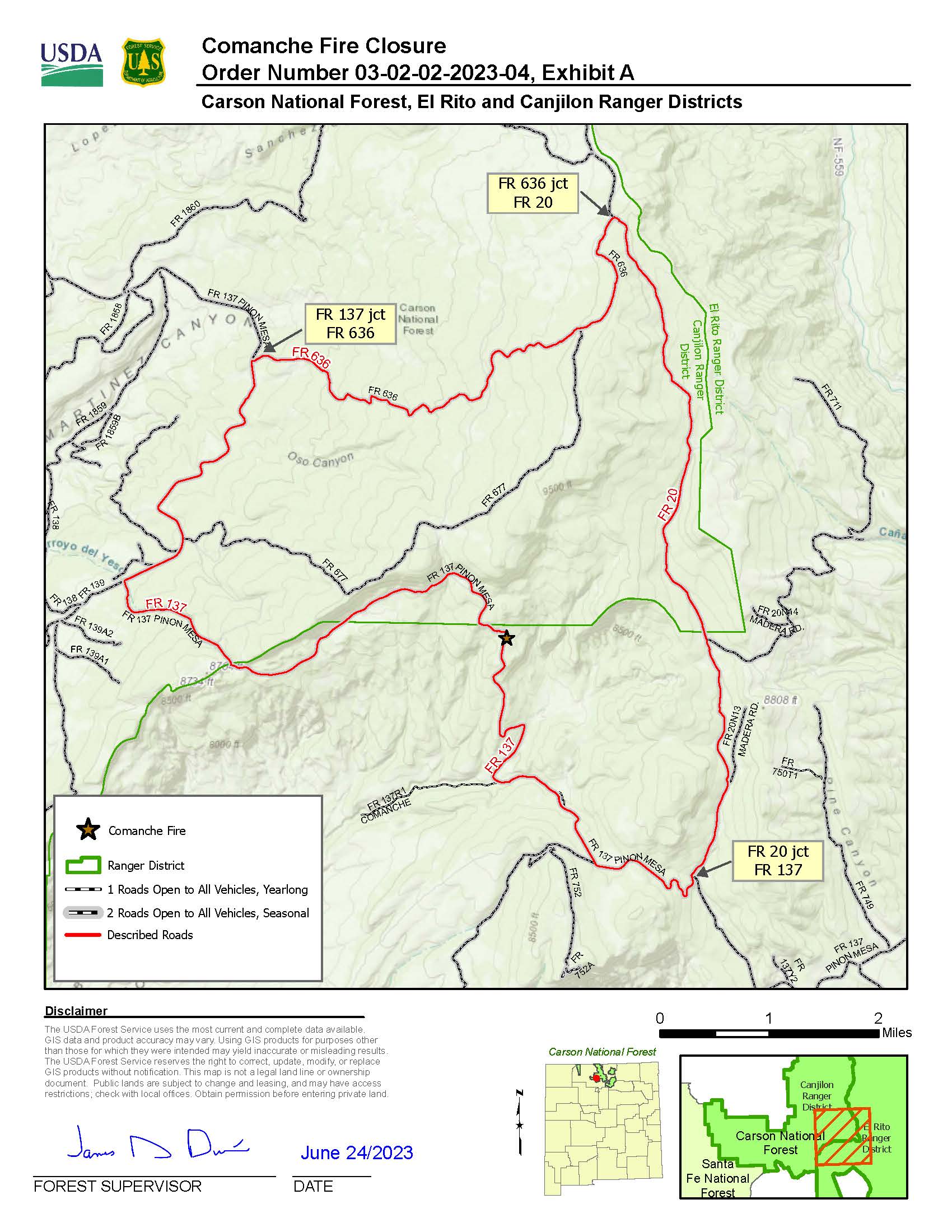
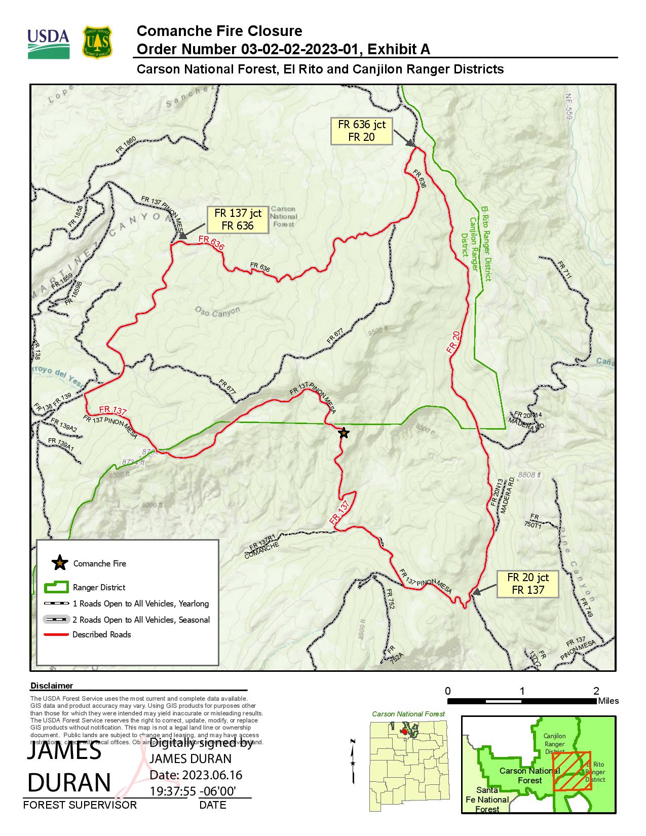
The following NFS Roads are closed to through traffic:
National Forest System Roads (FR) 137 and FR 20, as depicted in Exhibit A. Starting at points to
the north and west of the intersection of National Forest System Road (FR) 137 and FR 20 (Township
25N, Range 6E, Section 33), points to the south of the intersection of FR 20 and FR 636 (Township
26N, Range 6E, Section 33), and points to the south of the intersection of FR 137 and FR 636 (
Township 25N, Range 5E, Section
11).