Incident Media Maps
Settings - change map background and toggle additional layers
Filter - control incident types displayed on map.
Zoom to your location
Reset map zoom and position
Could not determine your location.
Show Legend
 Wildfire
 Prescribed Fire
 Burned Area
Response
Burned Area
Response Other
Other
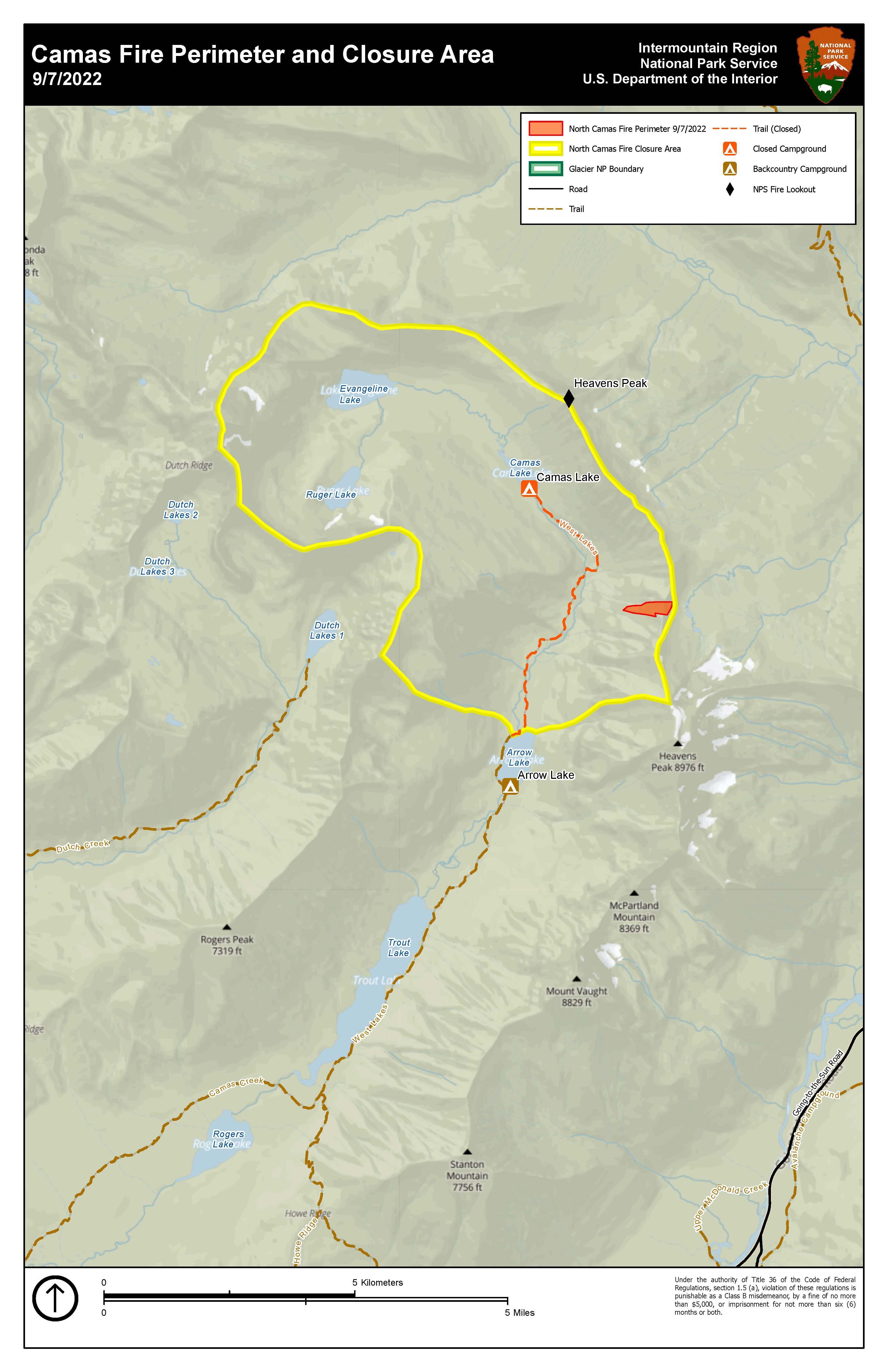
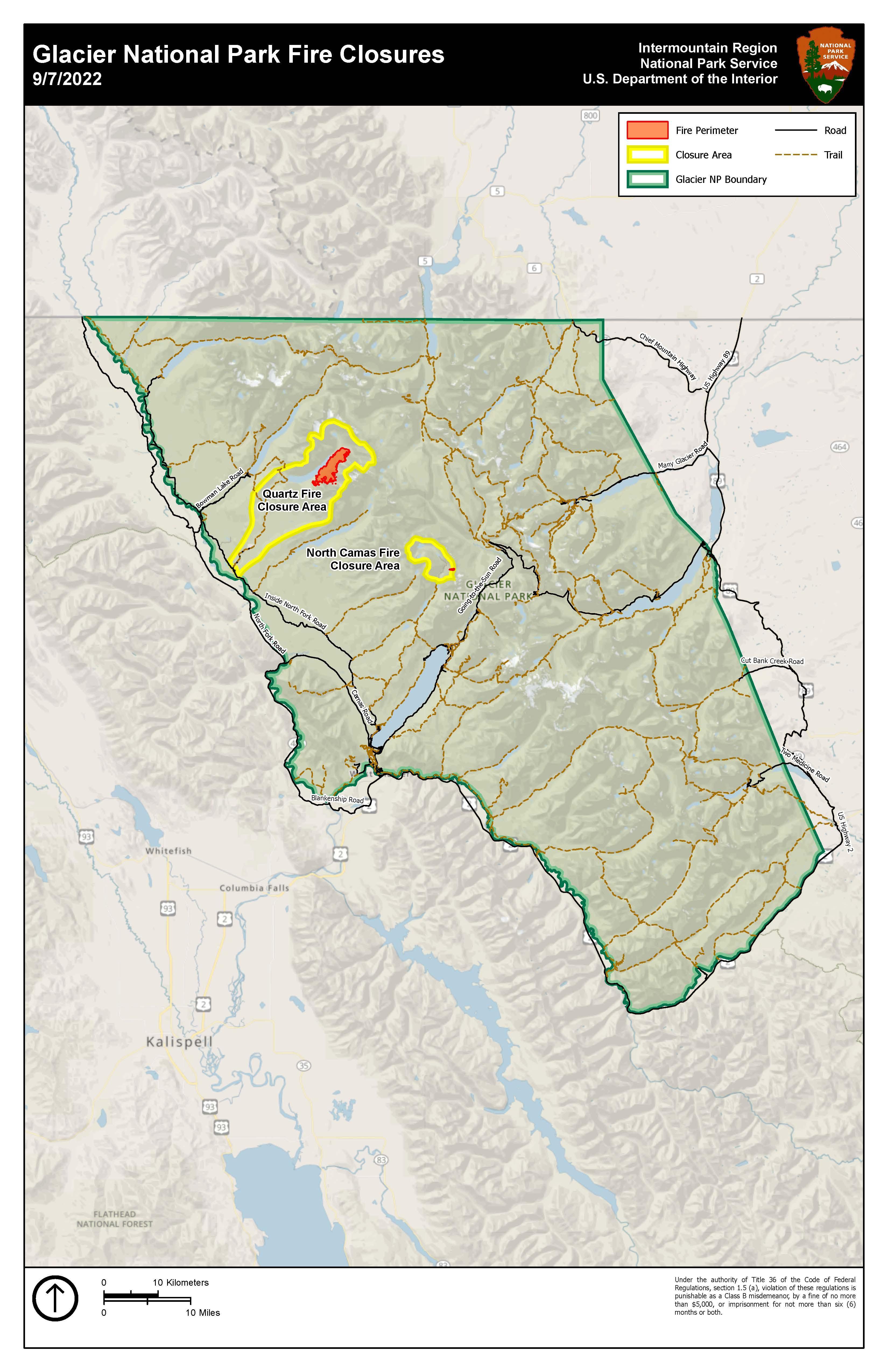
North Camas Fire
Unit Information
Incident Contacts
- Gina KerzmanPhone:406-888-5838
Maps Gallery
Image options: [ Full Size ] -
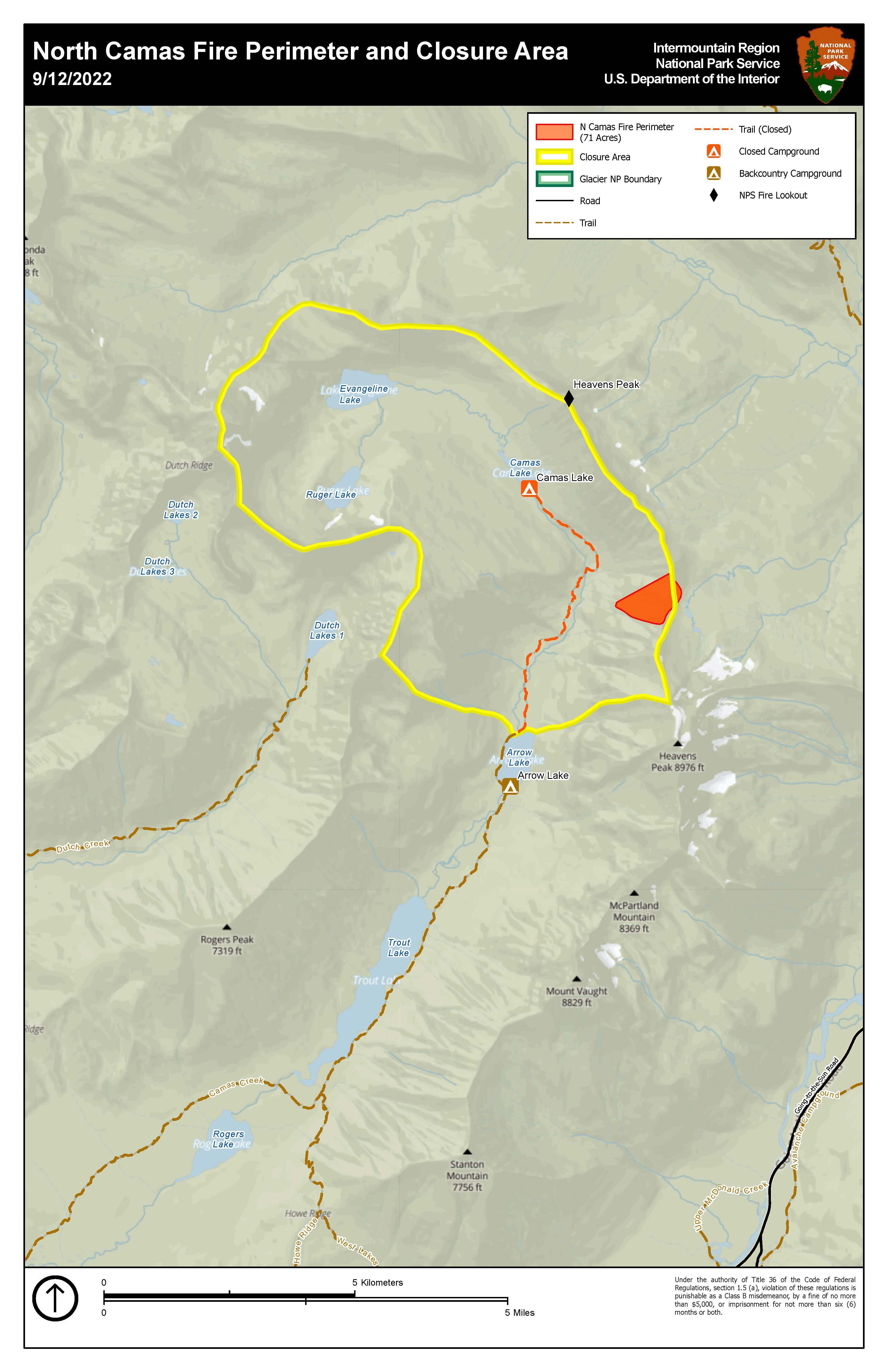
Map showing the North Camas Fire perimeter and closure area as of Sept 12.