
Incident Media Maps
Could not determine your location.
 Wildfire
 Prescribed Fire
 Burned Area
Response
Burned Area
Response Other
Other
Jenkins Creek Fire
Unit Information
Incident Contacts
- Fire InformationEmail:Phone:(218) 453-8650-Laurentian Ranger District OfficeHours:8:00am to 4:30pm, M-F-Closed federal holidays.
Maps Gallery
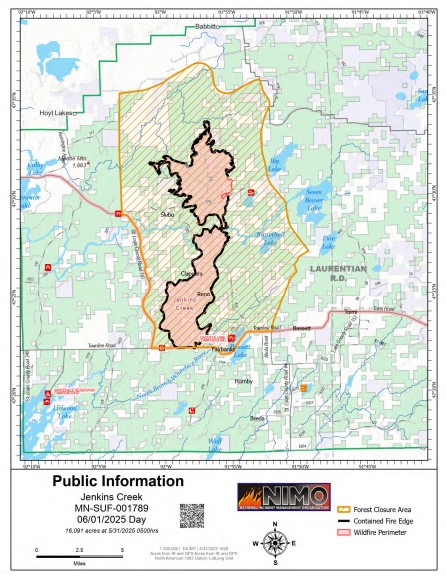
This map shows the current perimeter and containment of the Jenkins Creek Fire in northeastern Minnesota. As of May 23, the fire has burned approximately 16,089 acres. A forest closure area is in effect, and containment lines continue to be established. The National Incident Management Organization (NIMO) Team is coordinating suppression efforts and public safety operations.

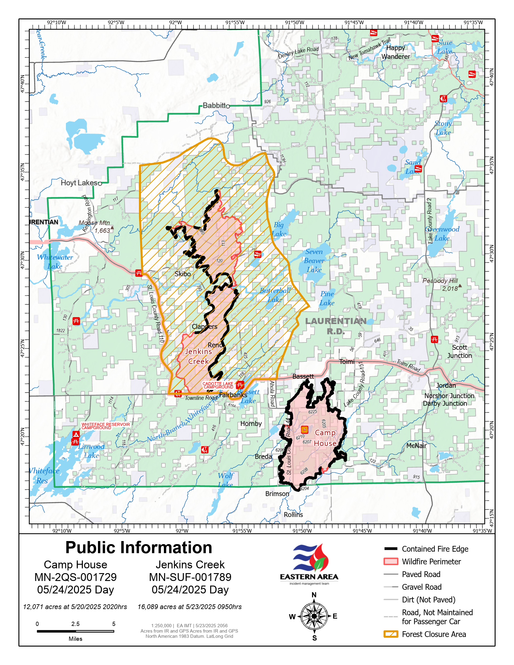
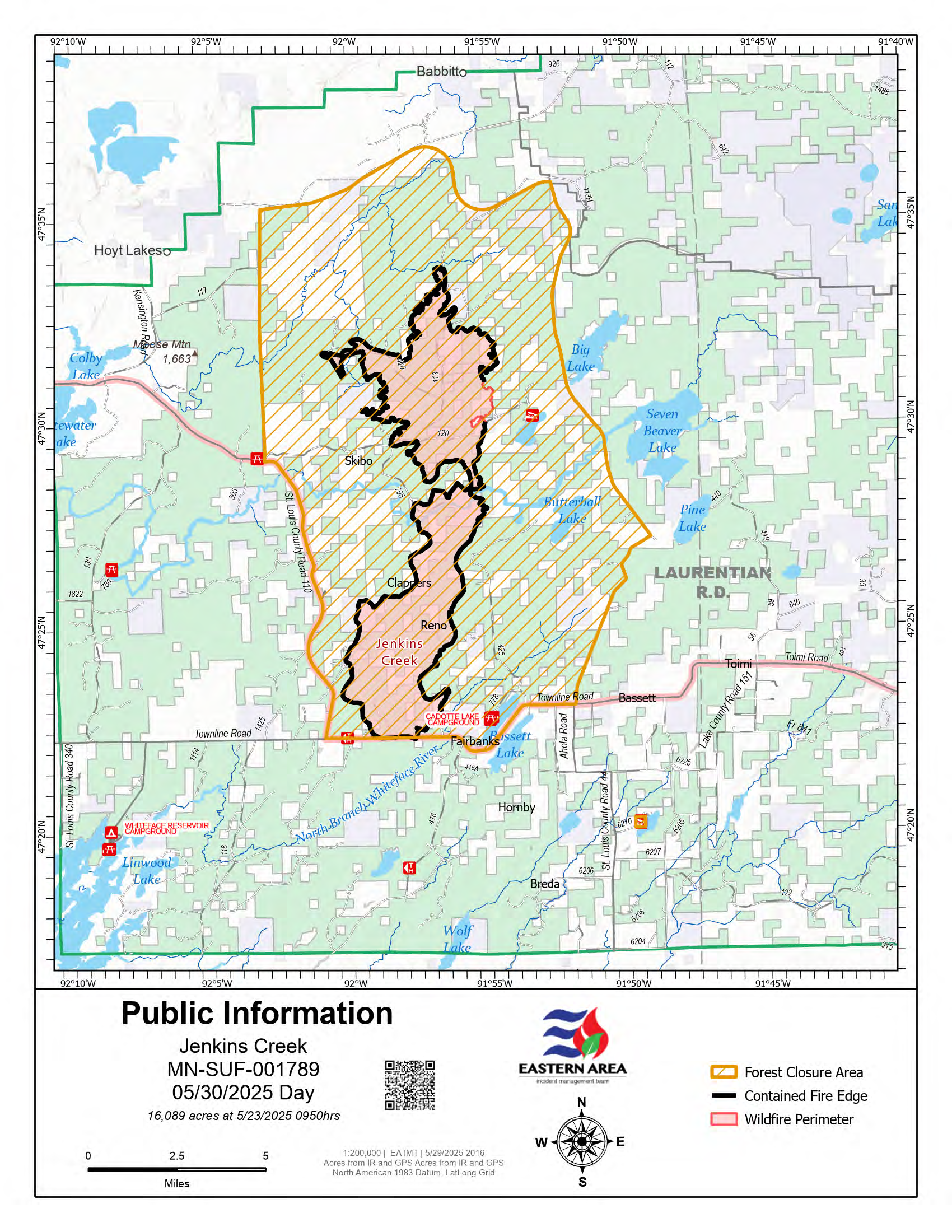
Map of the Camp House and Jenkins Creek Fires for May 24, 2025. The Jenkins Creek Fire (16,089 acres) and Camp House Fire (12,071 acres) are shown with updated perimeters. Forest closure areas are indicated in yellow hatching. Fire containment efforts are ongoing, with crews continuing mop-up, patrol, and suppression repair.
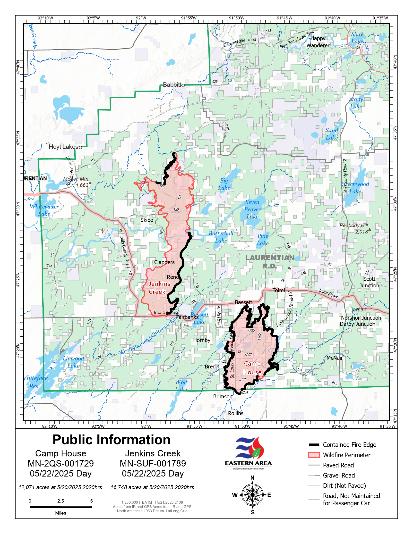
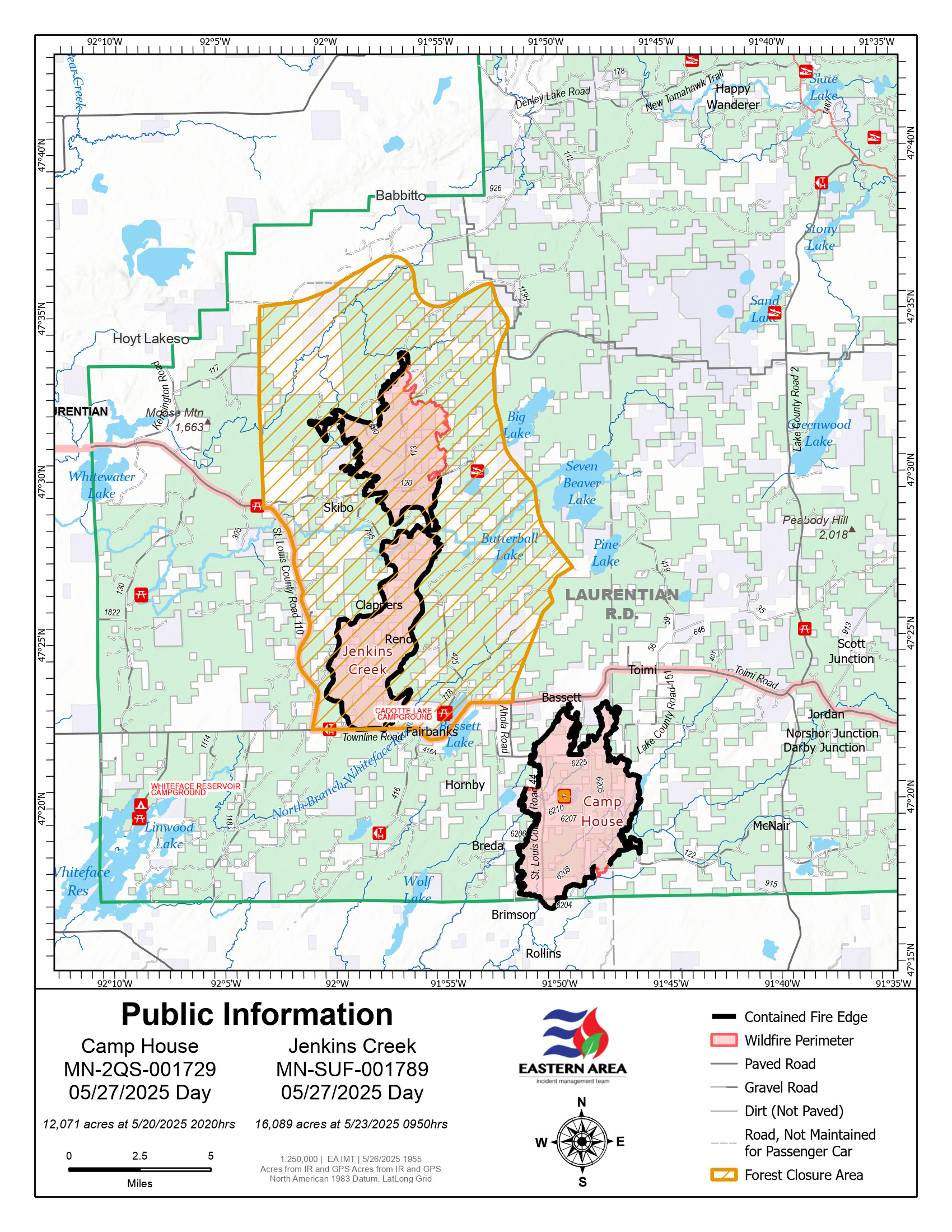
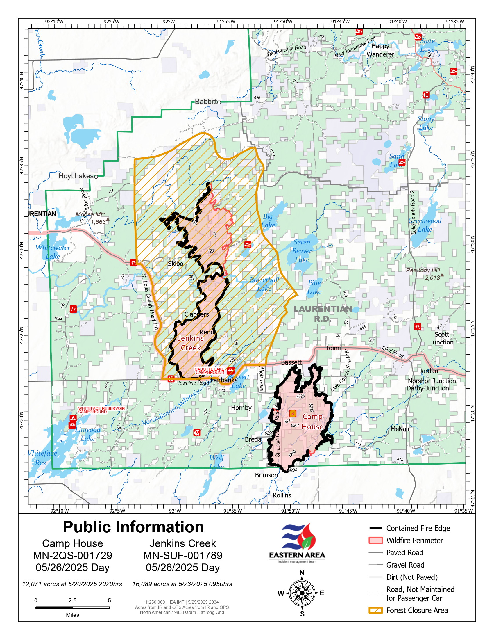
This incident map provides an overview of the Camp House and Jenkins Creek wildfires in northern Minnesota as of May 21, 2025. The Jenkins Creek Fire is located north of Skibo and Clappers and has reached 16,748 acres, while the Camp House Fire, near Brimson and Breda roads, has burned 12,071 acres. The map displays active wildfire perimeters outlined in red, with solid black lines indicating contained edges. Closure areas are marked with orange hatching. Local features include paved and gravel roads, lakes, and nearby communities such as Hoyt Lakes, Babbitt, and Rollins. The map helps communicate fire locations, access restrictions, and the scale of ongoing suppression efforts.
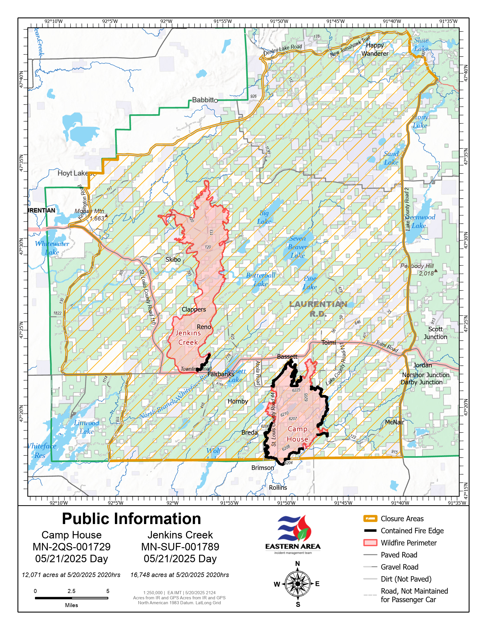
This incident map provides an overview of the Camp House and Jenkins Creek wildfires in northern Minnesota as of May 21, 2025. The Jenkins Creek Fire is located north of Skibo and Clappers and has reached 16,748 acres, while the Camp House Fire, near Brimson and Breda roads, has burned 12,071 acres. The map displays active wildfire perimeters outlined in red, with solid black lines indicating contained edges. Closure areas are marked with orange hatching. Local features include paved and gravel roads, lakes, and nearby communities such as Hoyt Lakes, Babbitt, and Rollins. The map helps communicate fire locations, access restrictions, and the scale of ongoing suppression efforts.
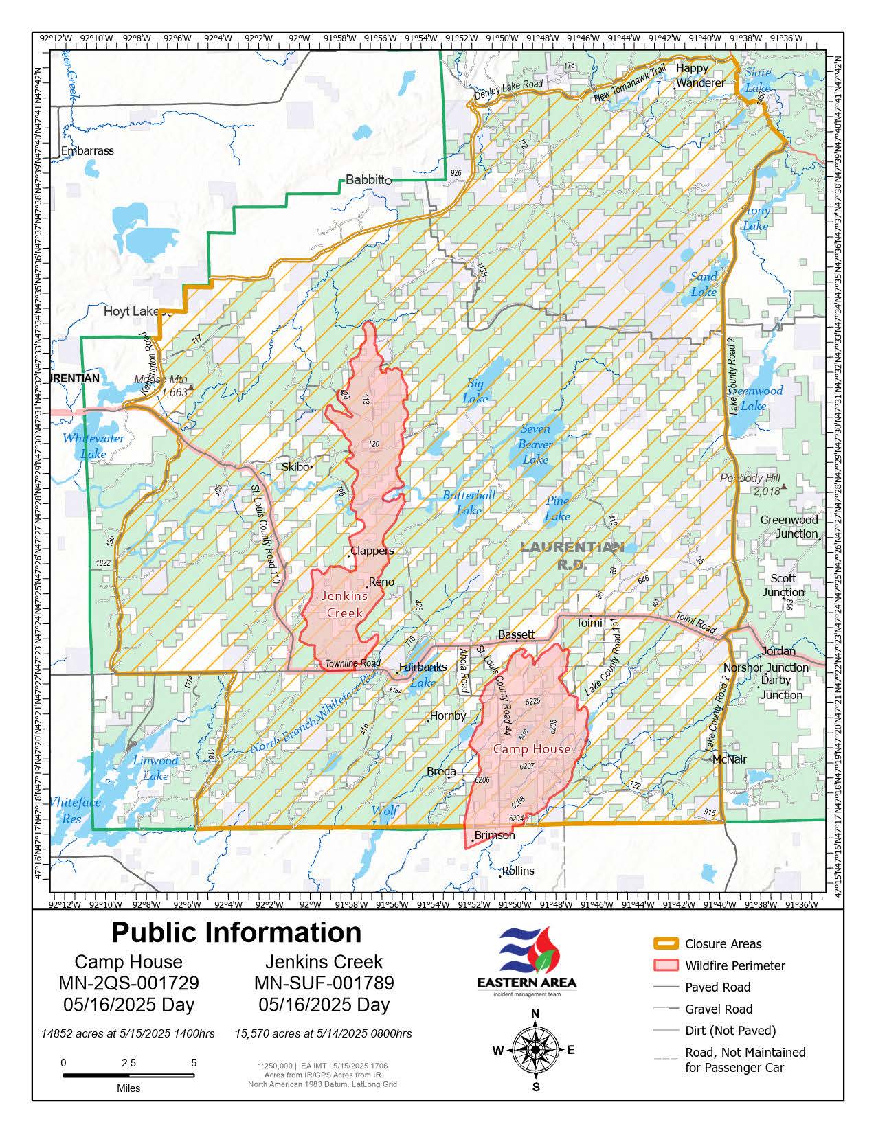
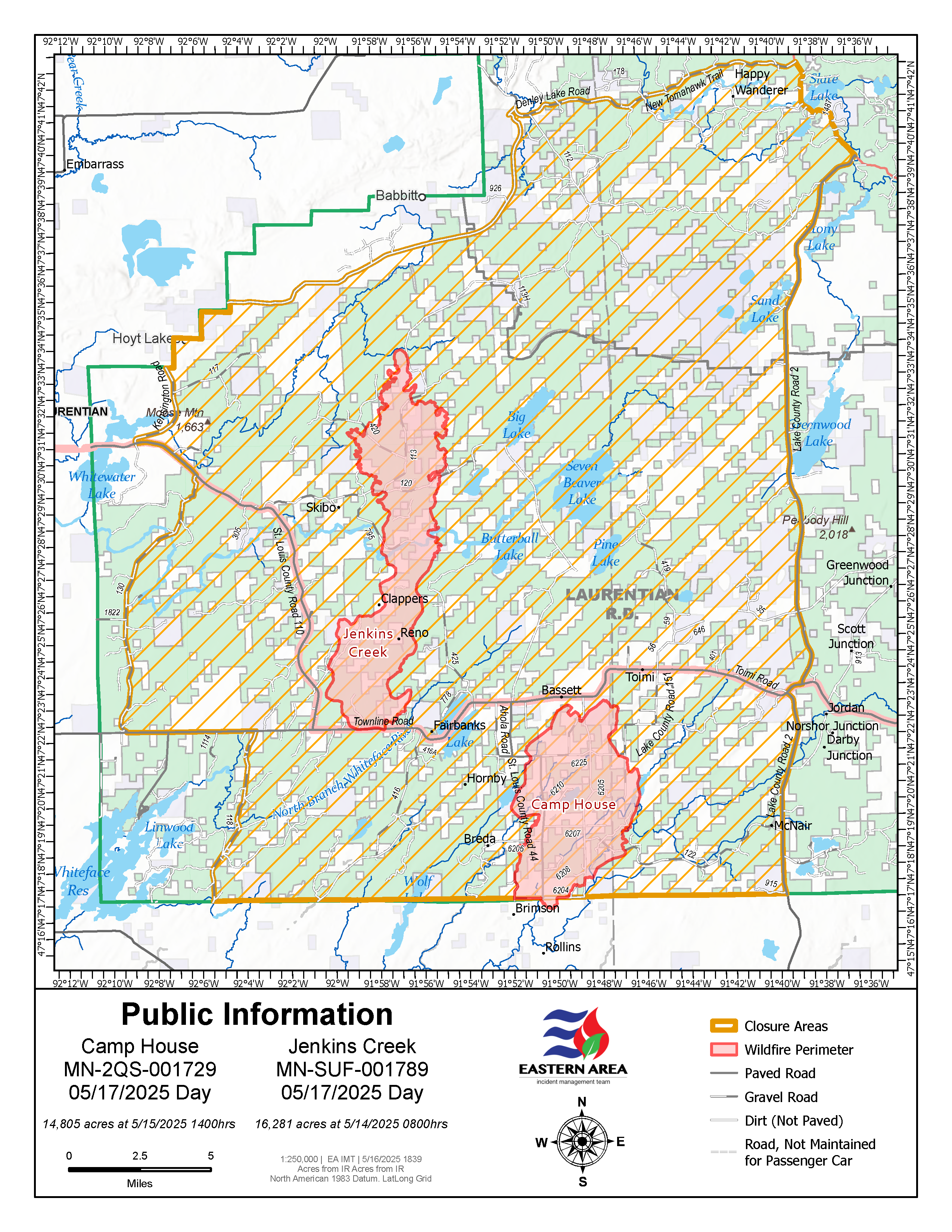
Map of the Camp House & Jenkins Creek Fires as of May 15, 2025 with the FOrest Closure Area also identified.
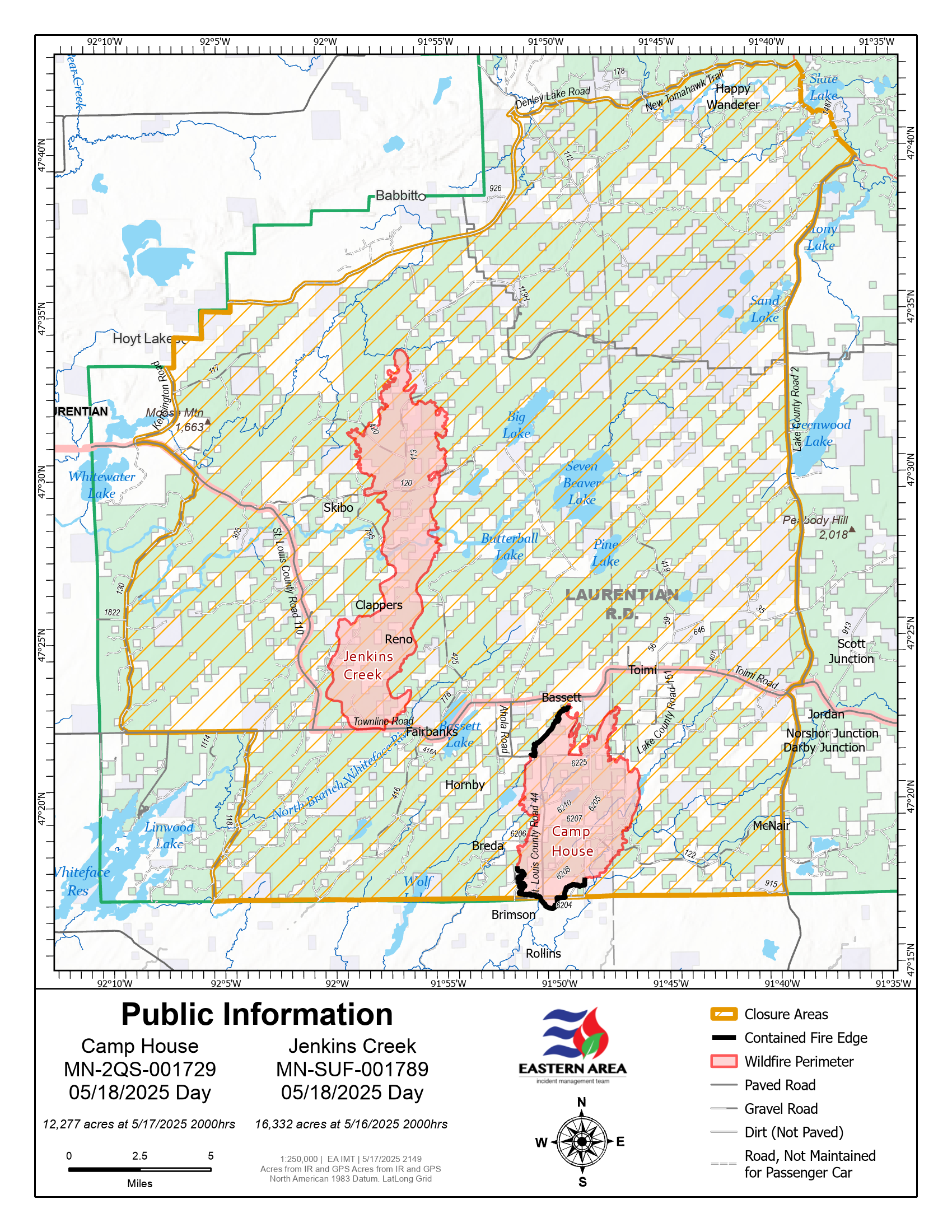
Jenkins Creek & Camp House Fires Public Information Map for May 17, 2025.
