
Incident Media Maps
Could not determine your location.
 Wildfire
 Prescribed Fire
 Burned Area
Response
Burned Area
Response Other
Other
Trail Springs Fire
Unit Information
Incident Contacts
- Public InformationPhone:(970) 426-5370Hours:8 a.m.-8 p.m.
Maps Gallery


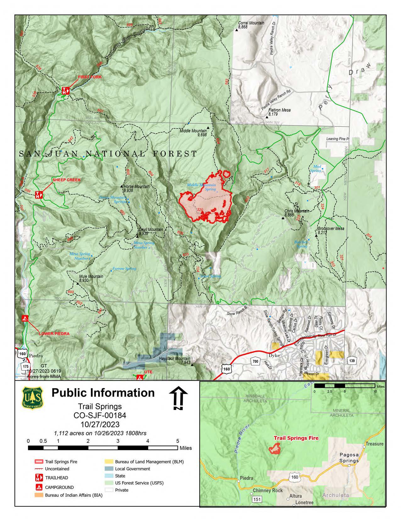
The black on the edge of the fire perimeter on this map is "contained" fire line. The fire is not out but fire managers do not believe the fire will, under current conditions, progress beyond the contained edges. A drying trend is in the forecast and residents can expect to see smoke, daily, until sufficient moisture falls on the fire area.
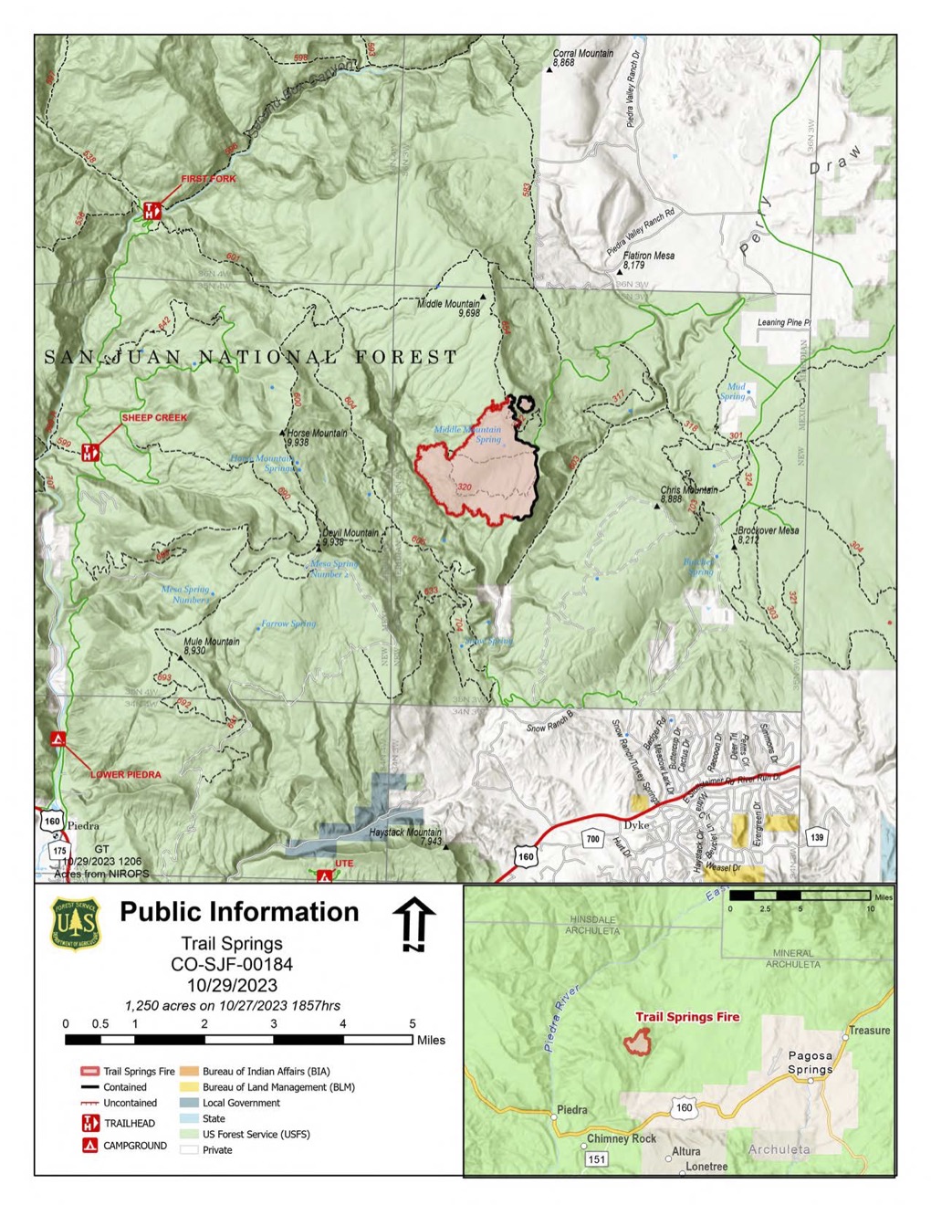
This map shows the current perimeter of the Trail Springs Fire as of the evening of October 27, 2023. While the perimeter spans an area of approximately 1250 acres, not all of that acreage has burned and what has, has burned with different degrees of severity. Because fire managers expect very low levels of fire activity in the coming days, this map will no longer be updated on a daily basis.
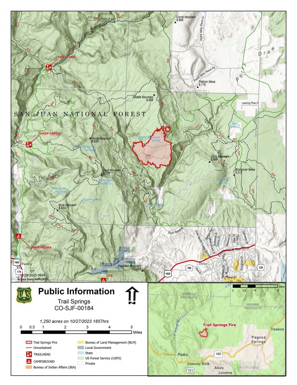
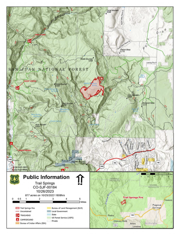
Infrared survey of the Trail Springs Fire done on the evening of October 26, 2023. Much of the growth in acreage since the last infrared mapping flight was due to planned "burnouts" done to create strong fire lines on the north and east sides of the fire perimeter.
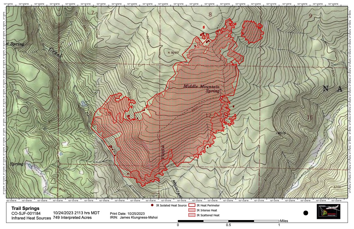
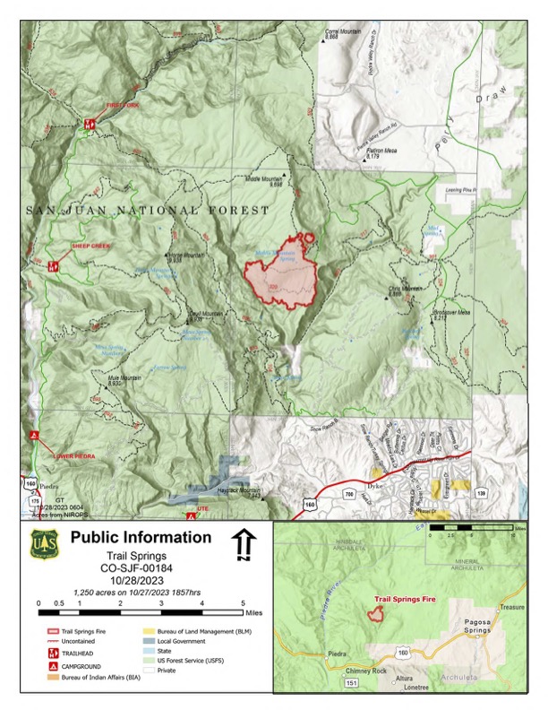
This map shows the results of infrared photography taken overnight of the Trail Springs Fire. A plane, outfitted with an infrared camera, flies over wildfires at night, when ambient temperatures are lower, so heat sources stand out. According to the interpreter, the perimeter of the fire grew only about 24 acres yesterday, with the most active area being on the northeast corner of the fire. Firefighters will be working to "lock off" that corner of the fire, using forest roads and trails to contain the fire when/if, the fire extends that far. While the entire fire area is shaded in red, this does not mean all the vegetation within that area has burned. As with any fire, there will be varying degrees of burn severity.

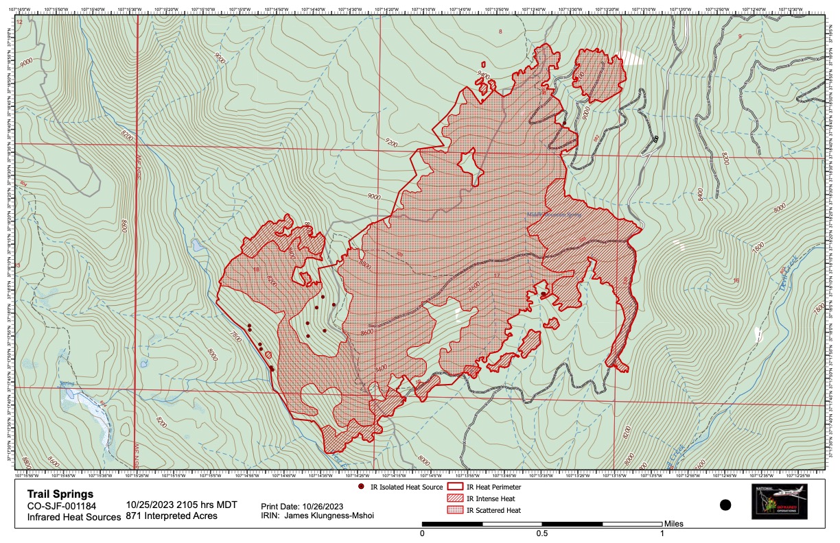
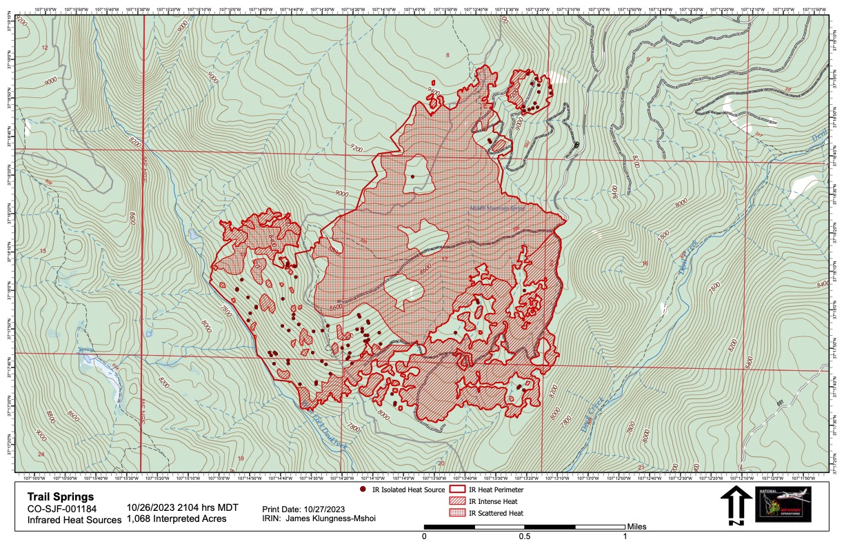
This map image shows current areas of fire activity on the Trail Springs Fire. On the right side you'll see a long finger of red along the right side. That's where firefighters “walked fire” down a road above Devil Creek on Wednesday. Other circular areas of red to the left are where a helicopter dropped incendiary devices, about the size of ping pong balls. The naturally occurring fire did also grow yesterday, moving slowly, mostly along the eastern flank to the left of where the helicopter was working. If winds should now push that fire to the northeast, it will run into the areas now being burned out and would decrease in intensity and be easy to control. This image was created after a plane with an infrared camera flew over the area at about 11p.m. on 10-25.
