U.S. flag

An official website of the United States government

Here's how you know

Incident Media Maps

Zoom to your location
Reset map zoom and position

Could not determine your location.

Trail Springs Fire

Unit Information

15 Burnett Court 
Durango, 
81301 
15 Burnett Court 
Durango, 
81301 

Incident Contacts

  • Public Information
    Email:
    2023.TrailSprings@firenet.gov
    Phone:
    ‪(970) 426-5370‬
    Hours:
    8 a.m.-8 p.m.

Maps Gallery

Image options: [ Full Size ] - [ PDF ]

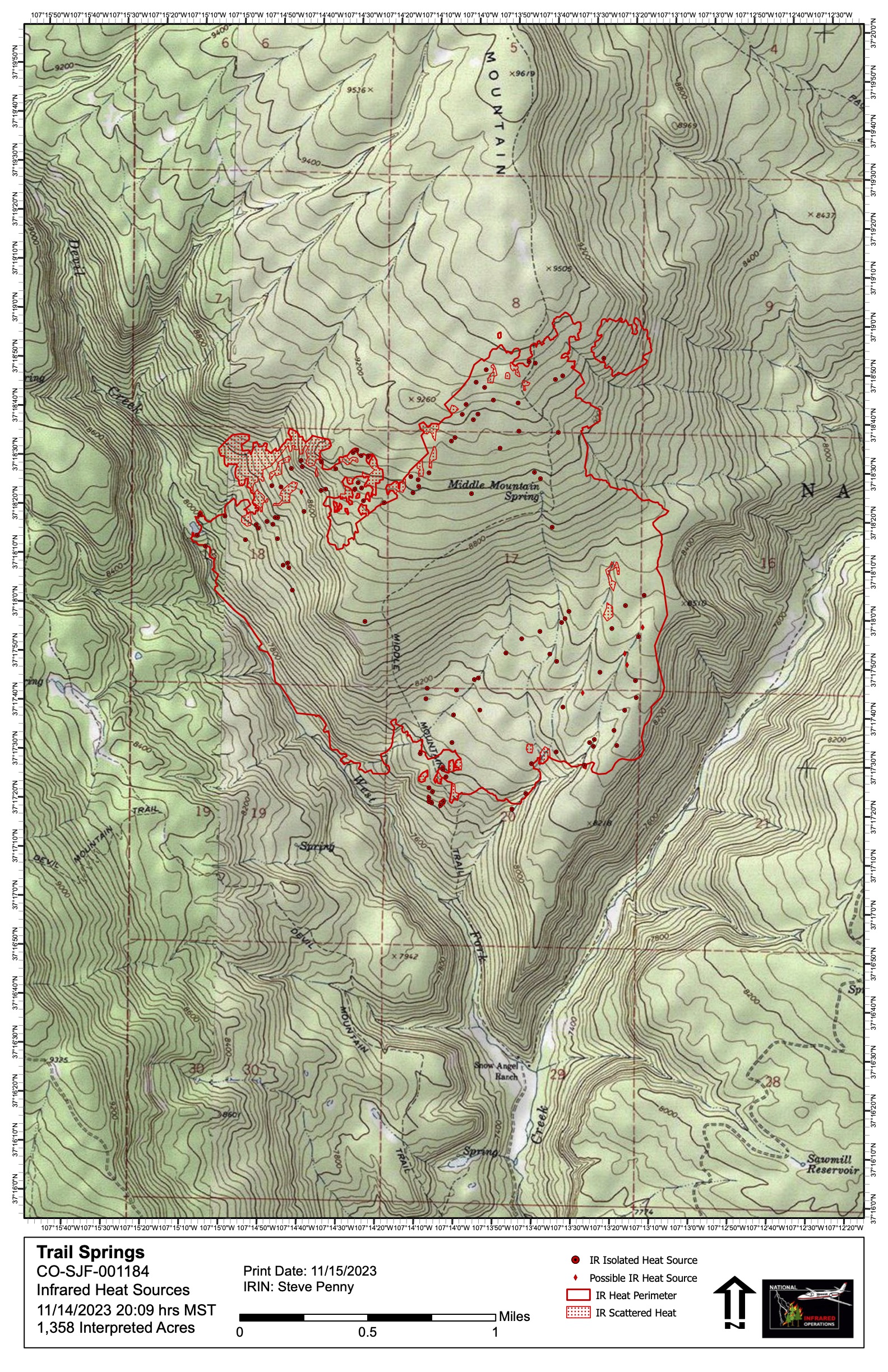
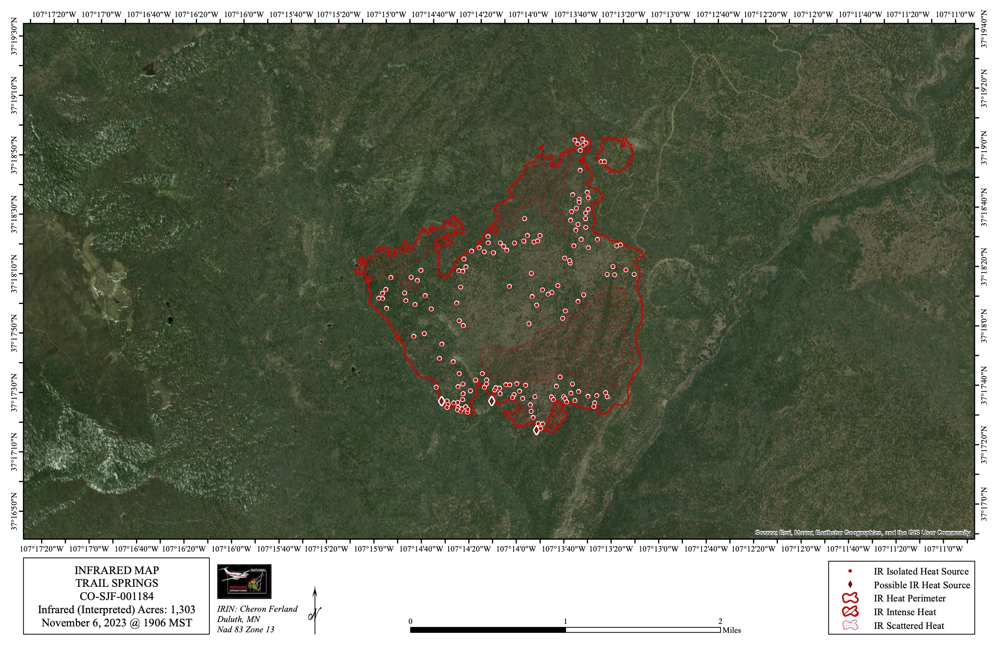
Map shows fire area with indicators showing areas of heat from fire activity.  This satellite mapping using infrared technology for heat detection.


Image options: [ Full Size ] - [ PDF ]

Image options: [ Full Size ] - [ PDF ]

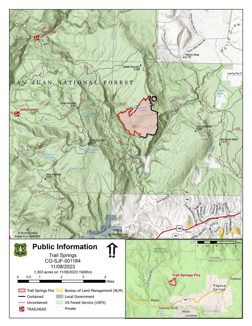
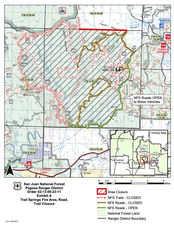
See CLOSURES tab here on Inciweb for the full closure order

Image options: [ Full Size ] - [ PDF ]

Image options: [ Full Size ] - [ PDF ]

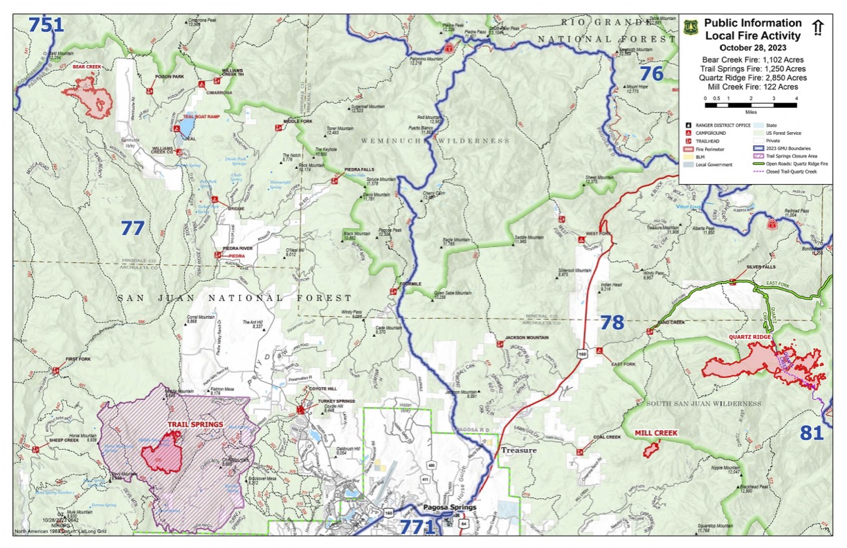
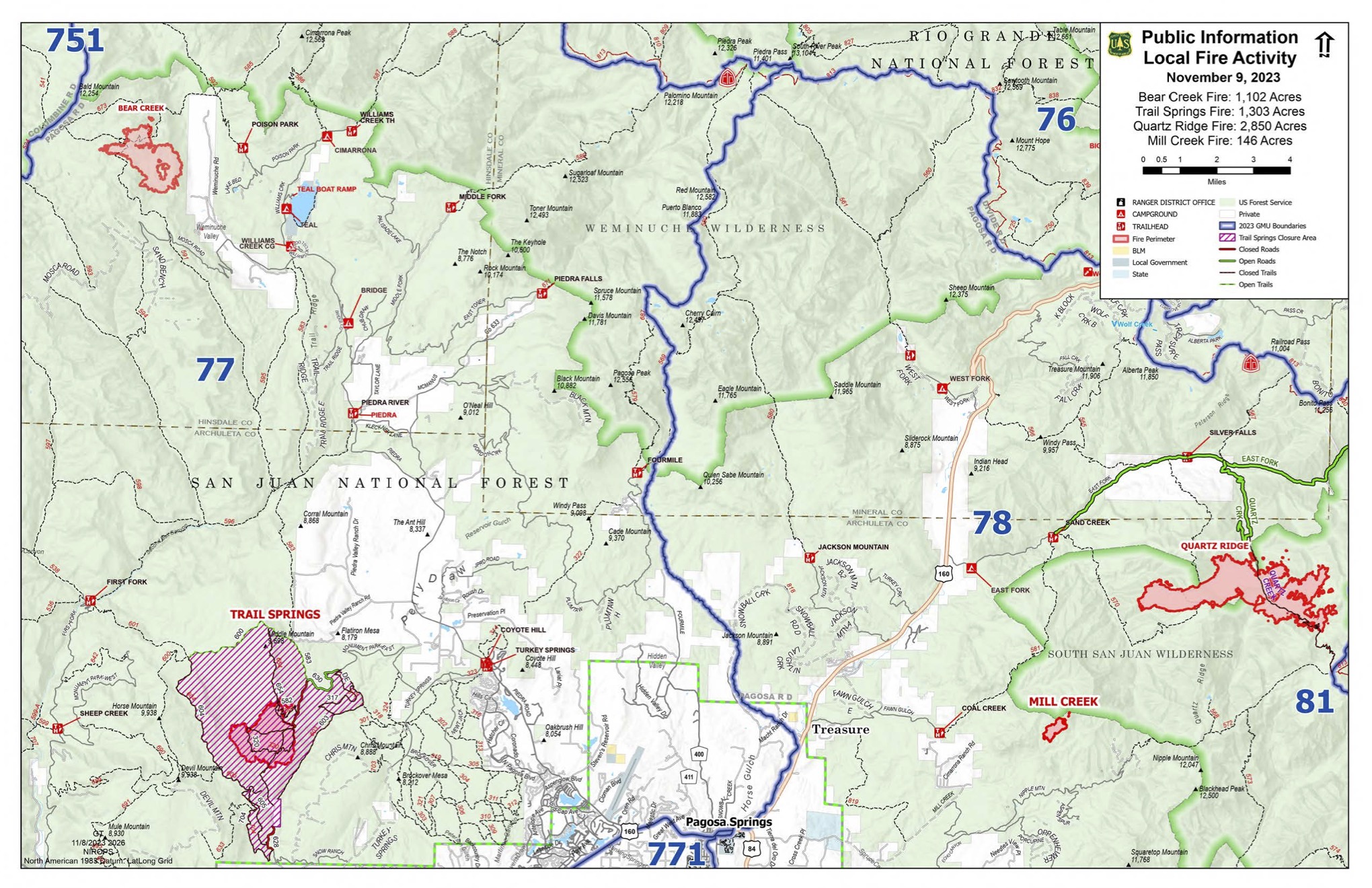
This map shows game management numbers in blue and the four fires on the Pagosa Ranger District, as well as the area closure of forest lands around the Trail Springs Fire. Two trails, Little Sand and Shaw Creek, remain closed due to the Bear Creek Fire.

Image options: [ Full Size ] - [ PDF ]

A map of the Pagosa Ranger District showing the location of Trail Springs, Mill Creek 2, Quartz Ridge, and Bear Creek Fires with hunting units overlaid.

Image options: [ Full Size ] - [ PDF ]

Image options: [ Full Size ] - [ PDF ]

Image options: [ Full Size ] - [ PDF ]

Image options: [ Full Size ] - [ PDF ]

Image options: [ Full Size ] - [ PDF ]

A portion of the San Juan National forest has been closed due to the Trail Springs Fire. Please download the complete closure order from the closures tab on this site for detailed information.

Image options: [ Full Size ] - [ PDF ]