
Incident Media Maps
Could not determine your location.
 Wildfire
 Prescribed Fire
 Burned Area
Response
Burned Area
Response Other
Other
Maps Gallery
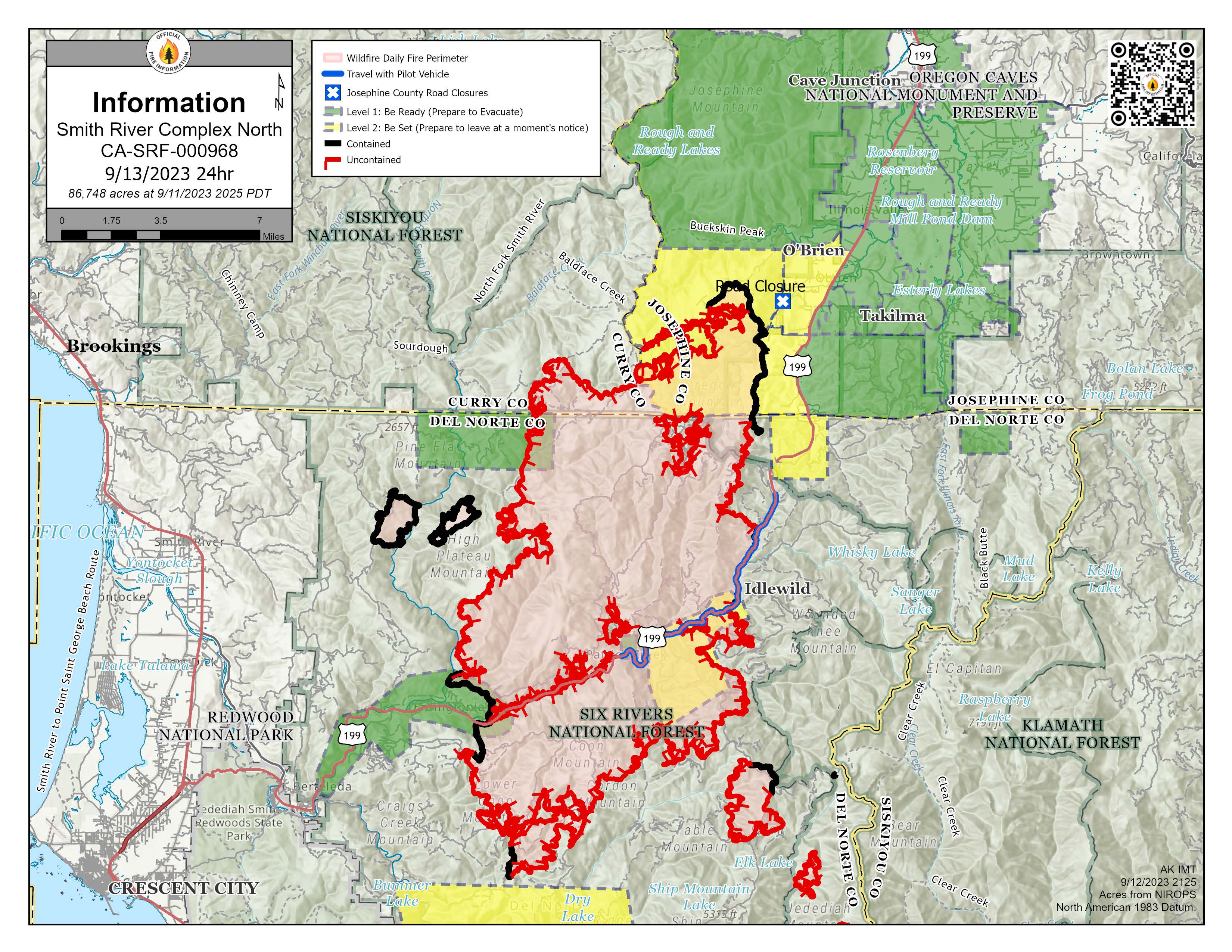
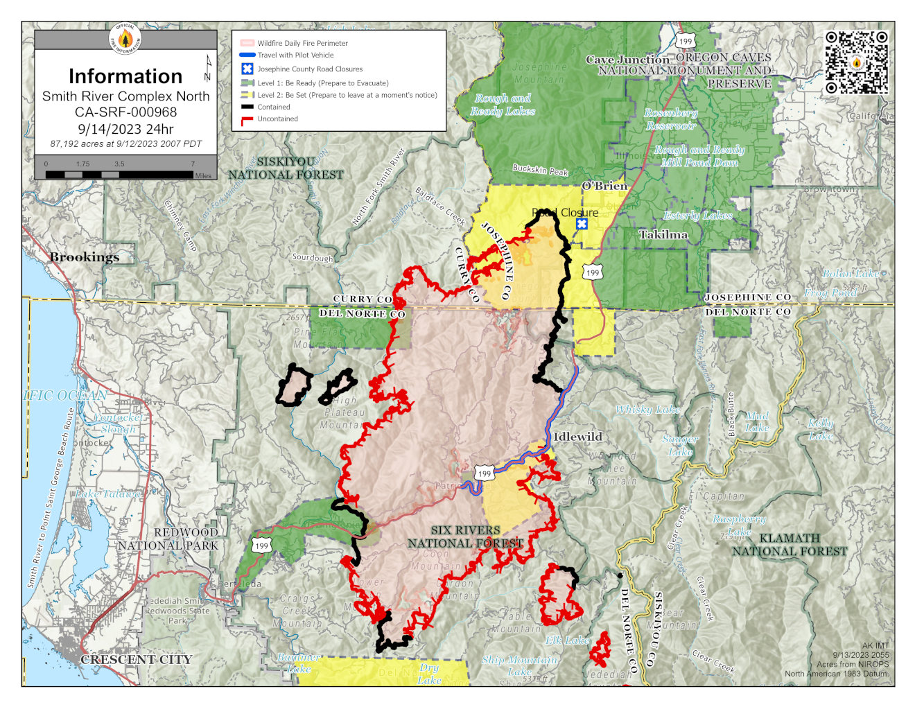
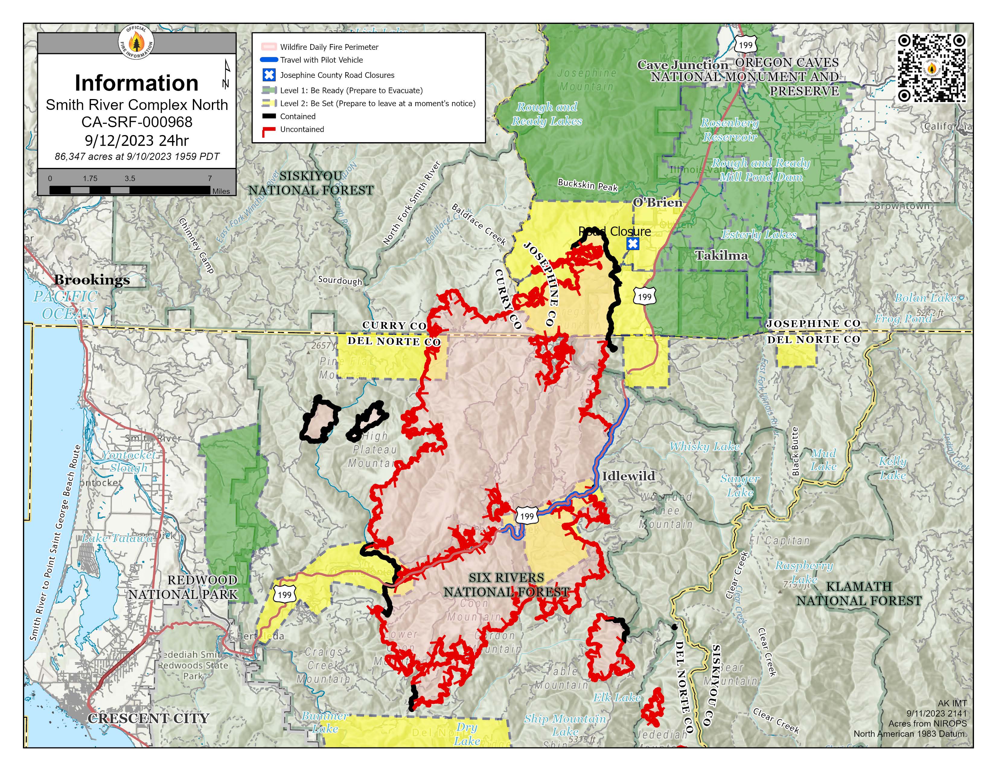
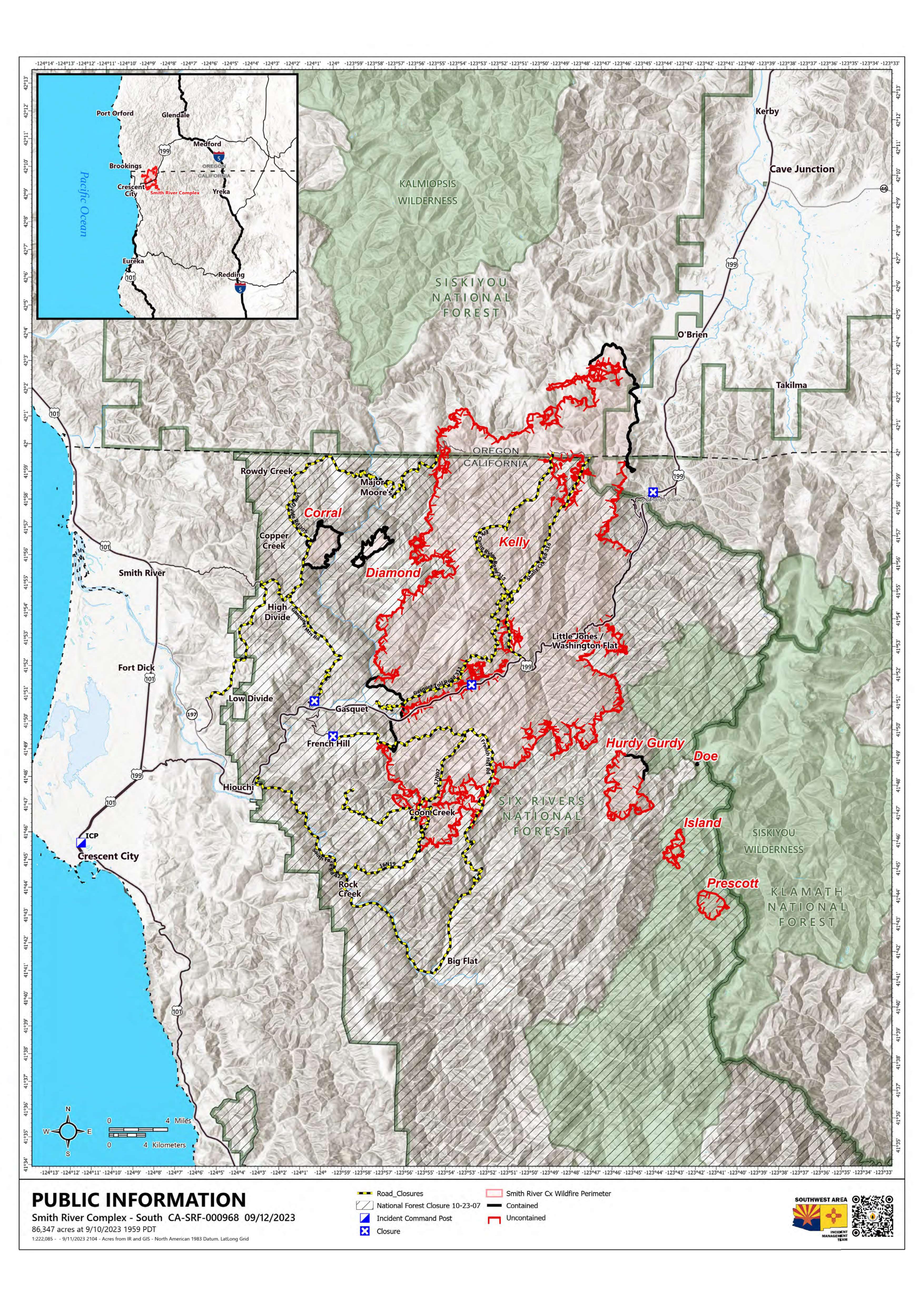
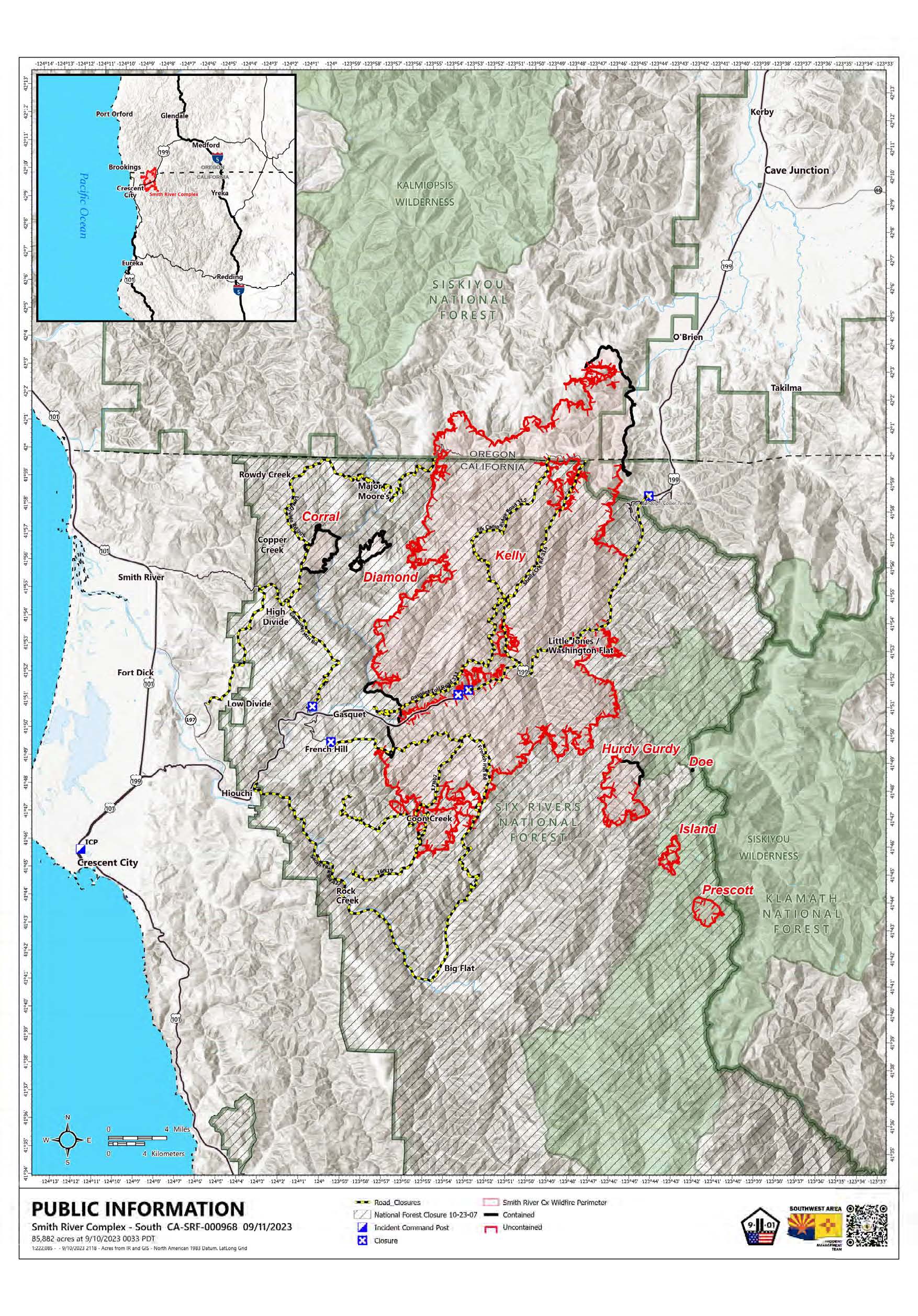

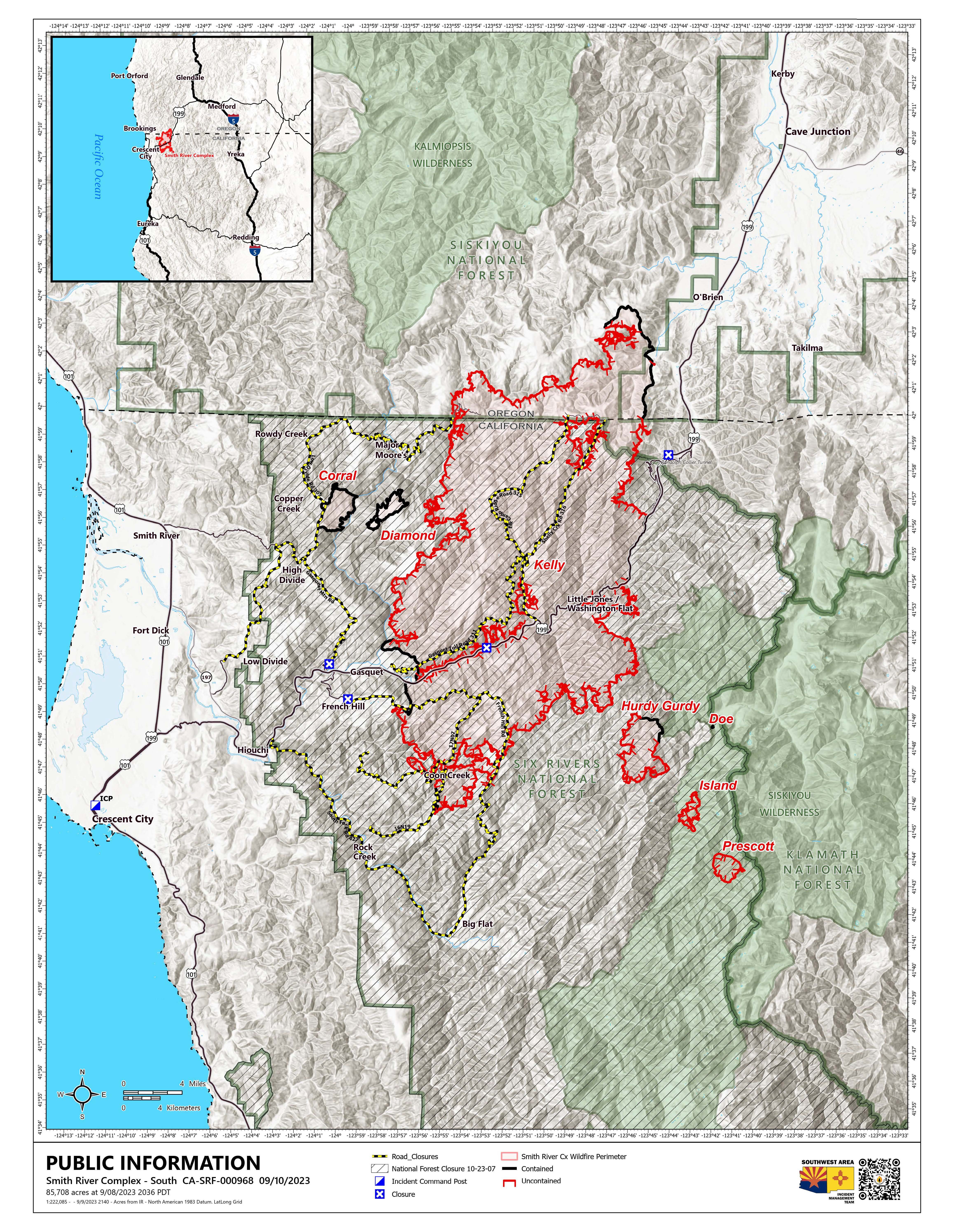

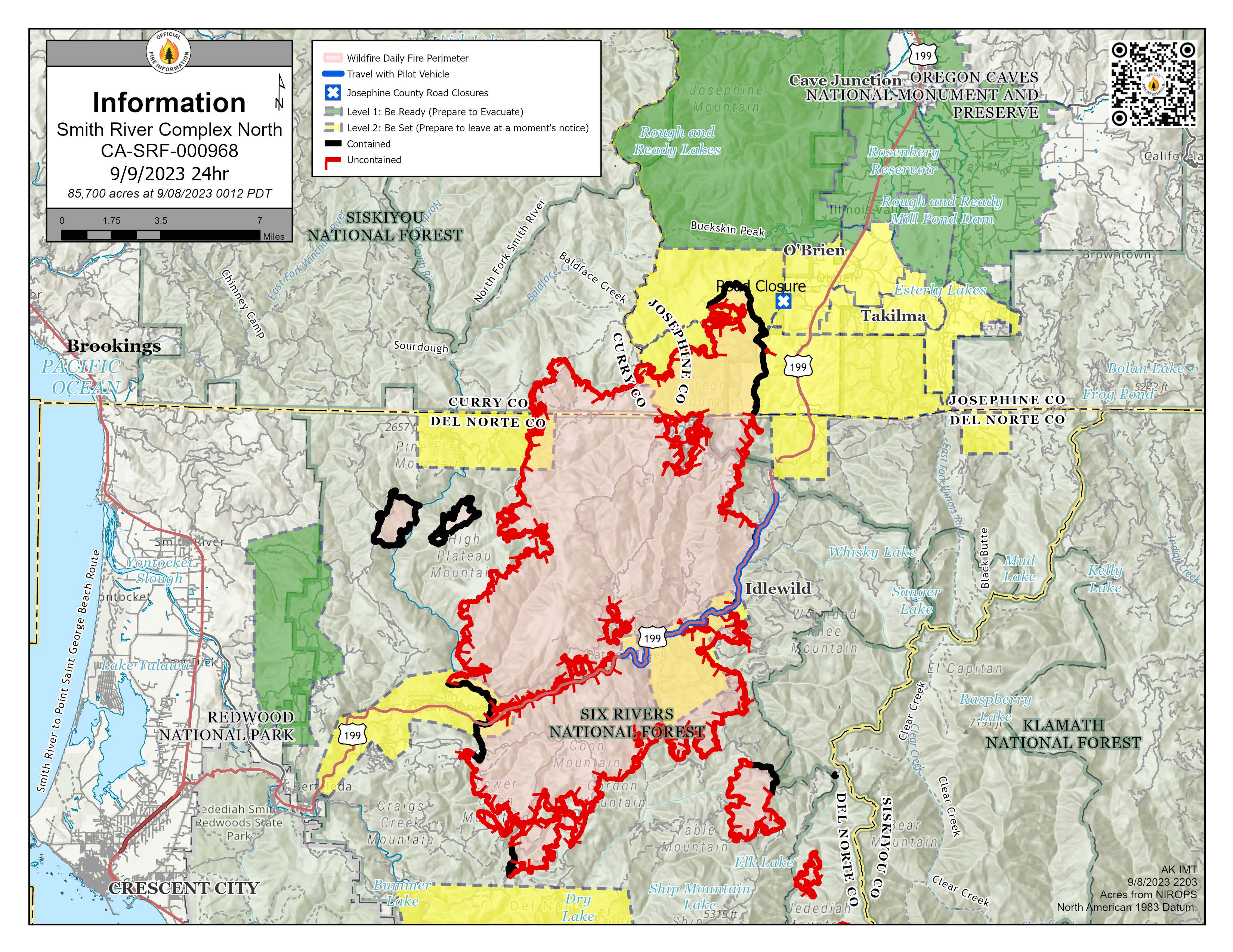

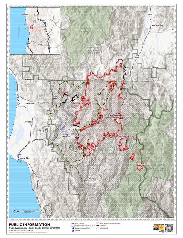
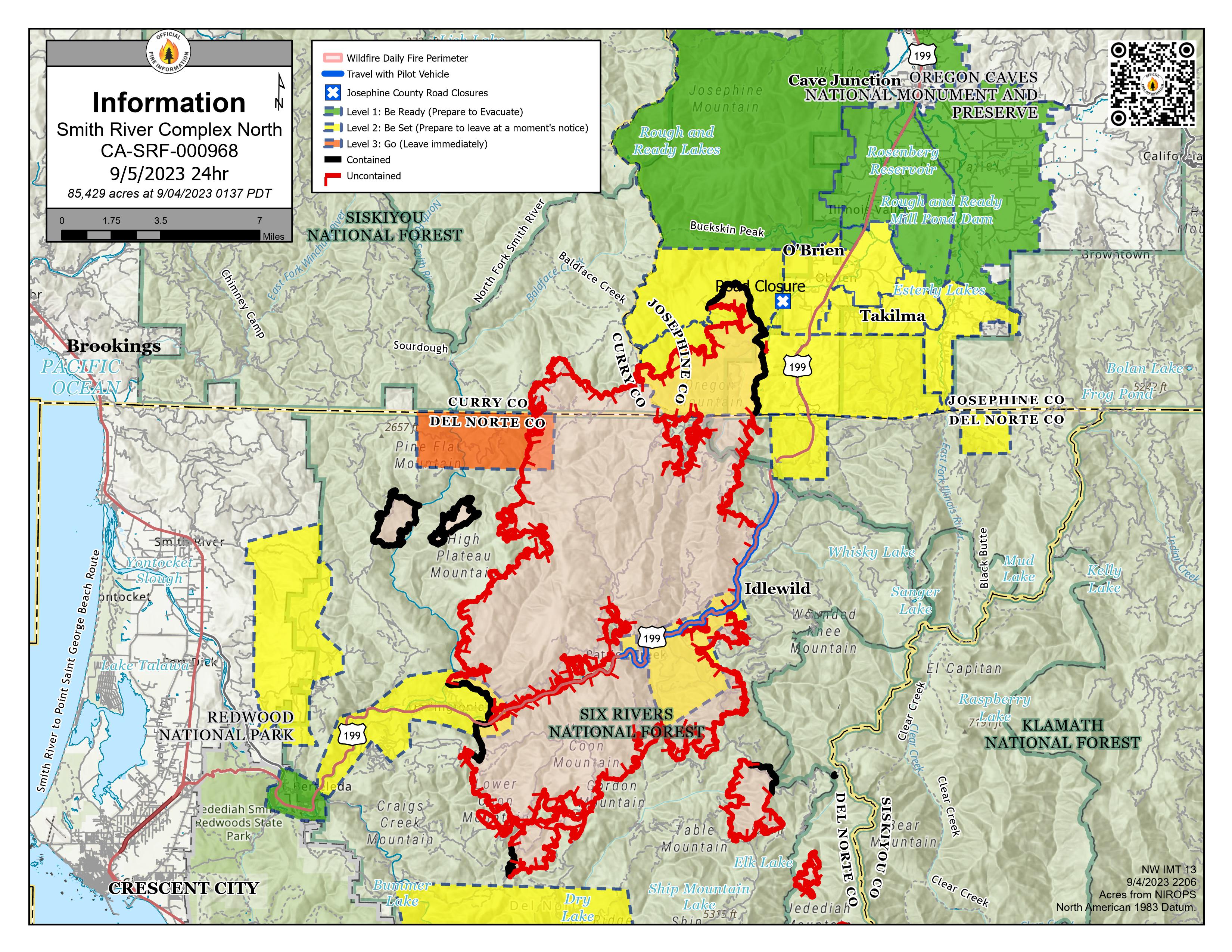
Smith River Complex North PIO Map 9/5/2023 with evacuations and Hwy 199 restrictions. Solid black lines on the fire edges indicate containment.
Hwy 199 is open, with pilot cars escorting traffic through a one-lane section of the highway impacted by the Smith River Complex. Expect a 30-minute delay. For the latest information on road conditions, please see the Caltrans site and Oregon Department of Transportation's TripCheck site
.
NOTE: Del Norte County Sheriff's Office has changed some evacuations. For the latest evacuation levels please check the Fire First Response Map found at https://www.rvem.org/
or visit the Del Norte County Office of Emergency Services Facebook page at https://www.facebook.com/DelNorteOfficeOfEmergencyServices/.