U.S. flag

An official website of the United States government

Here's how you know

Incident Media Maps

Zoom to your location
Reset map zoom and position

Could not determine your location.

Sequoia National Forest Emergency Flood Response

Unit Information

220 E. Morton Ave 
Porterville, 
93257 
220 E. Morton Ave 
Porterville, 
93257 

Incident Contacts

  • Kern River Ranger District
    Email:
    SM.FS.SequoiaNF@usda.gov
    Phone:
    760-376-3781
    Hours:
    8 am - 4:30 pm
  • Hume Lake Ranger District
    Email:
    SM.FS.SequoiaNF@usda.gov
    Phone:
    559-338-2251
    Hours:
    8 am - 4:30 pm
  • Western Divide Ranger District
    Email:
    SM.FS.SequoiaNF@usda.gov
    Phone:
    559-539-2607
    Hours:
    8 am - 4:30 pm

Maps Gallery

Image options: [ Full Size ] - [ PDF ]

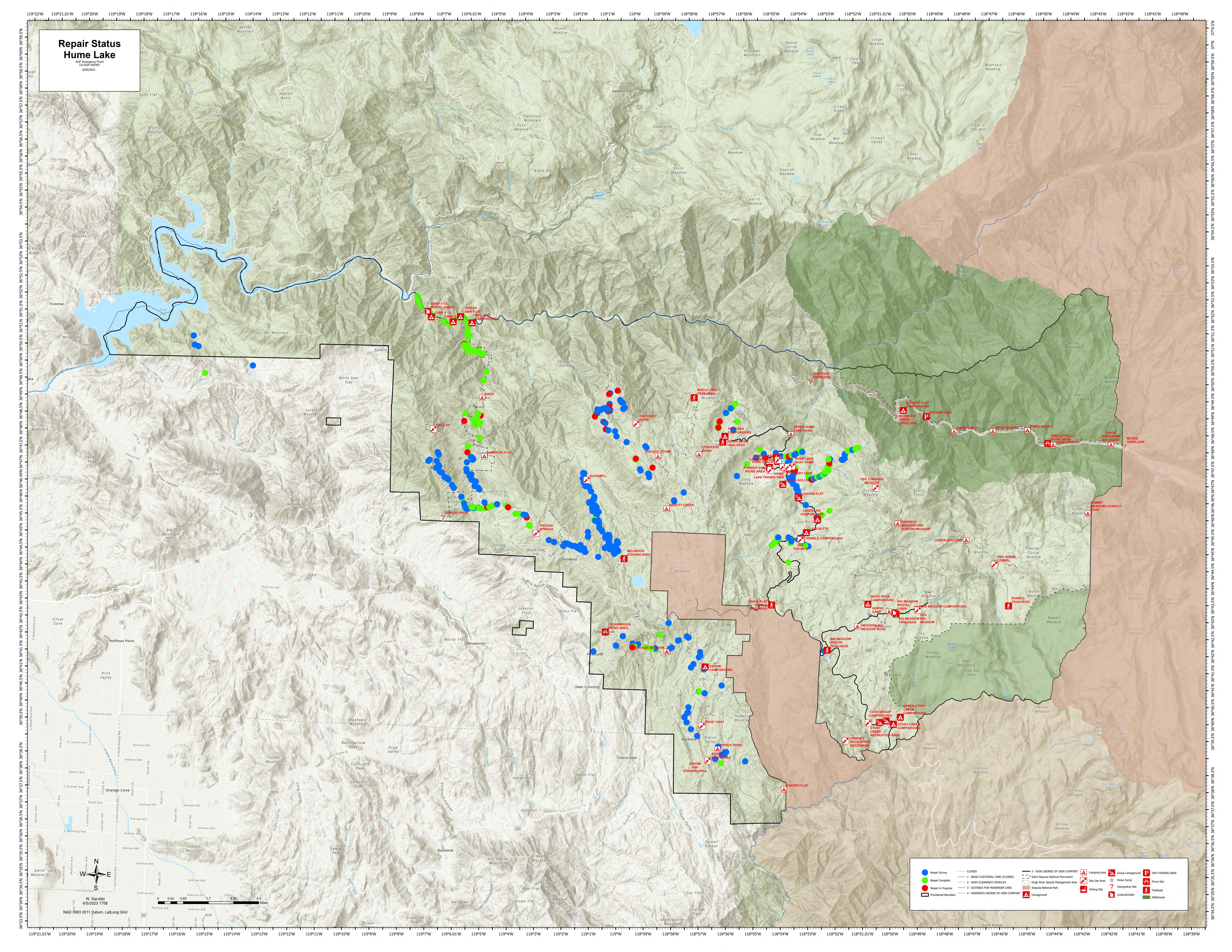
This map shows the Hume Lake District - Road Damage Status Map.  Not all roads may have been surveyed due to snow.

Image options: [ Full Size ] - [ PDF ]

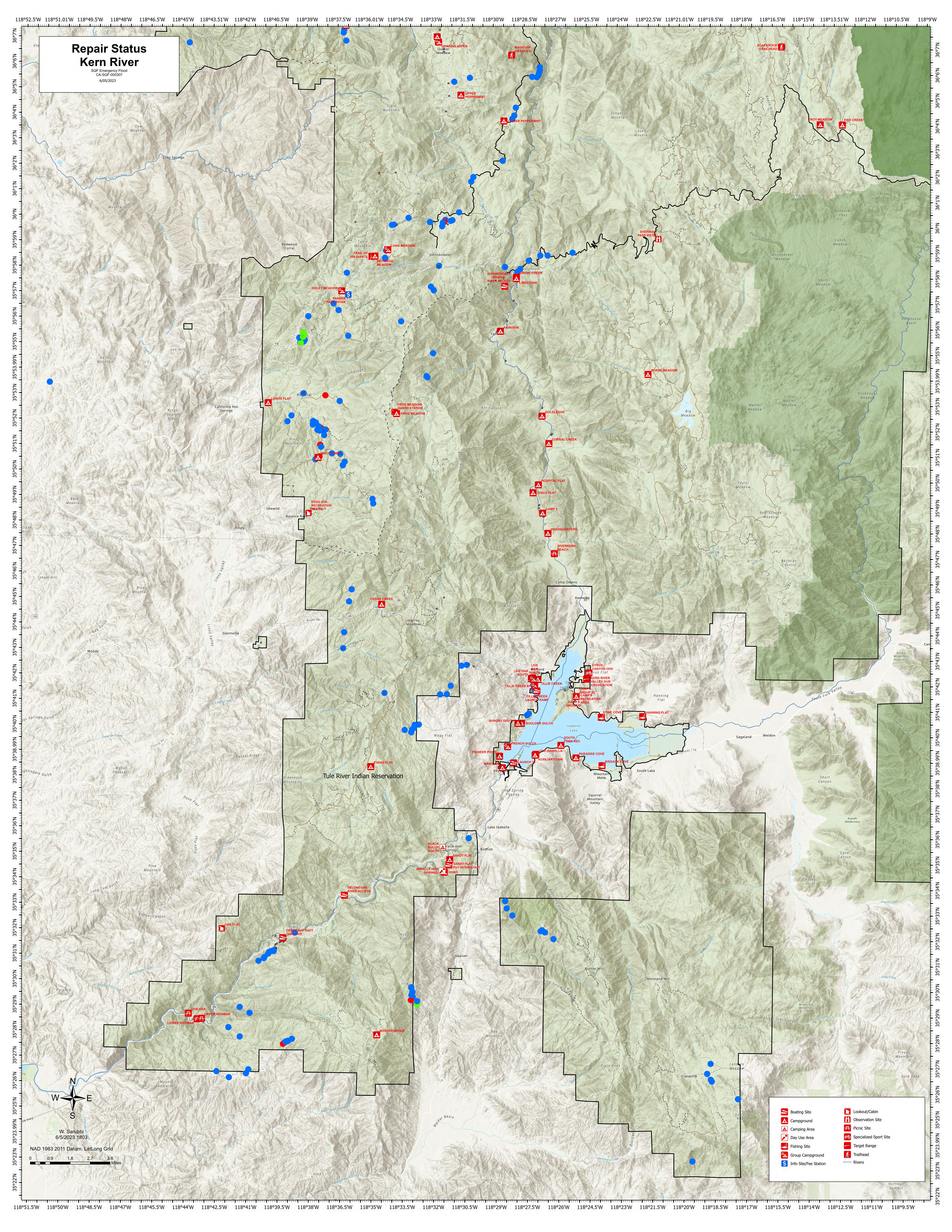
This map shows the status of road damage repairs across the Kern River District.  Not all roads may have been surveyed.

Image options: [ Full Size ] - [ PDF ]

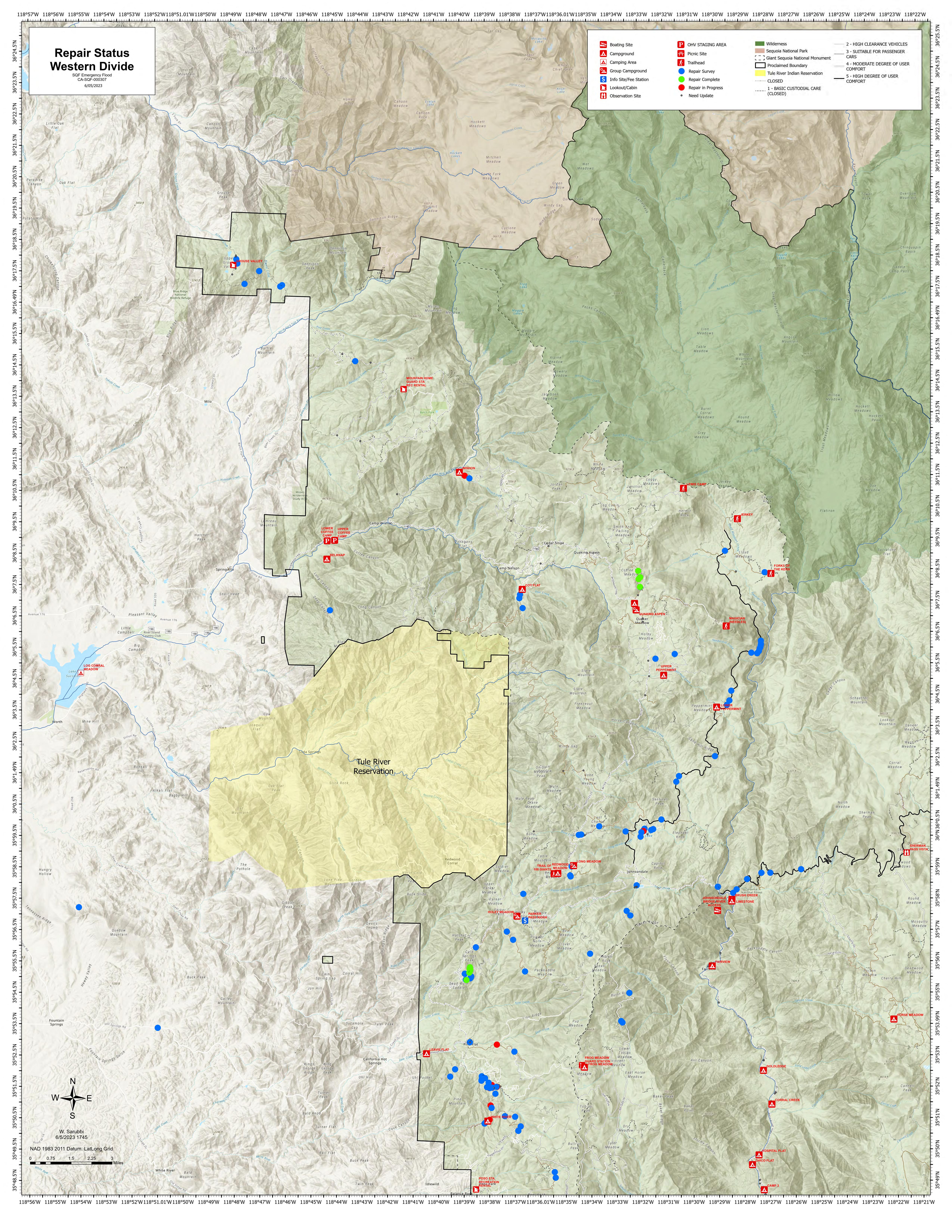
This map shows the status of road damage repairs across the Western Divide District.  Road surveys have not been completed across the roads.

[ PDF ]

Image options: [ Full Size ] - [ PDF ]

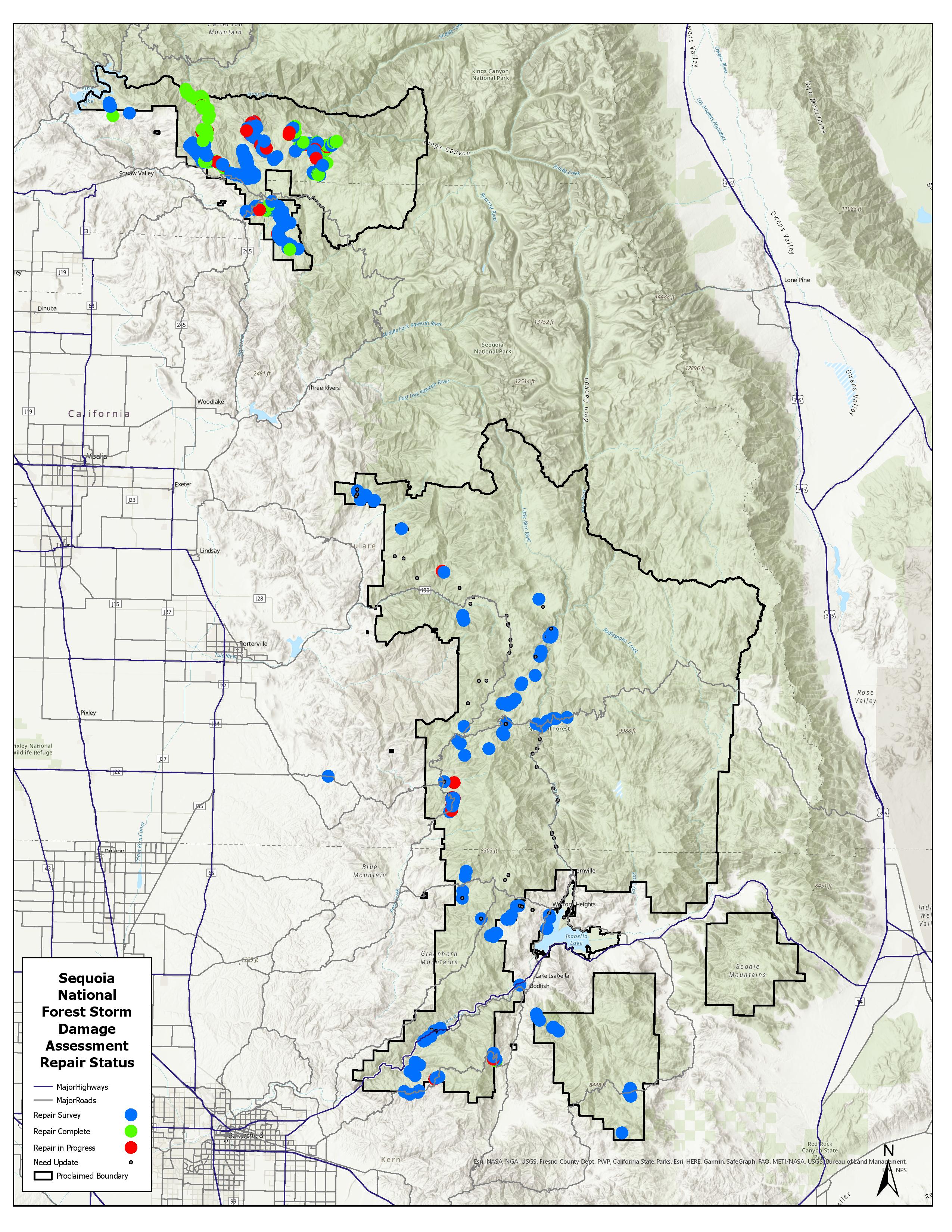
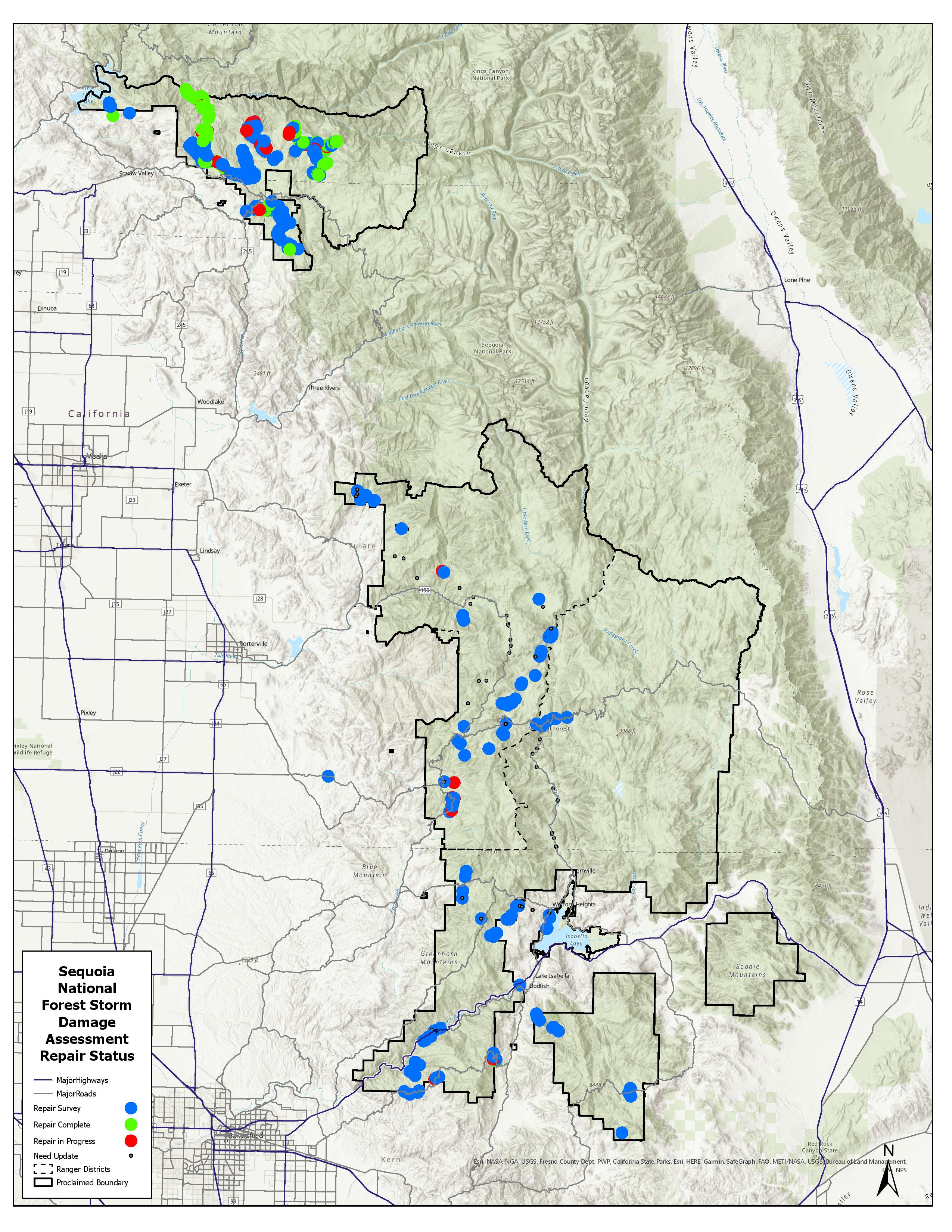
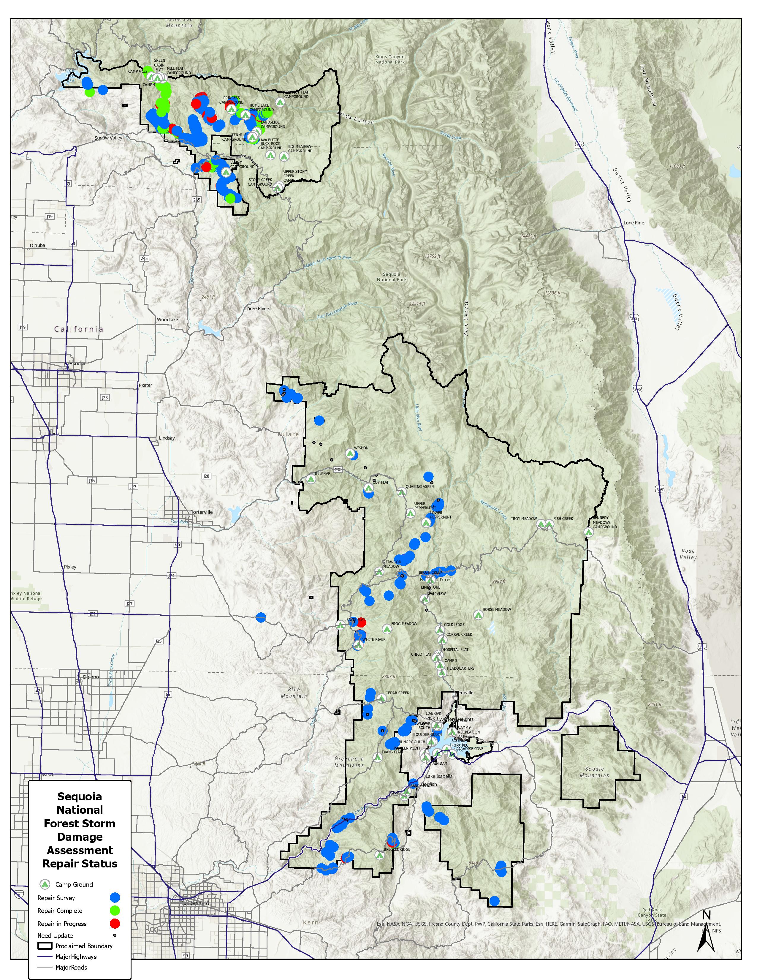
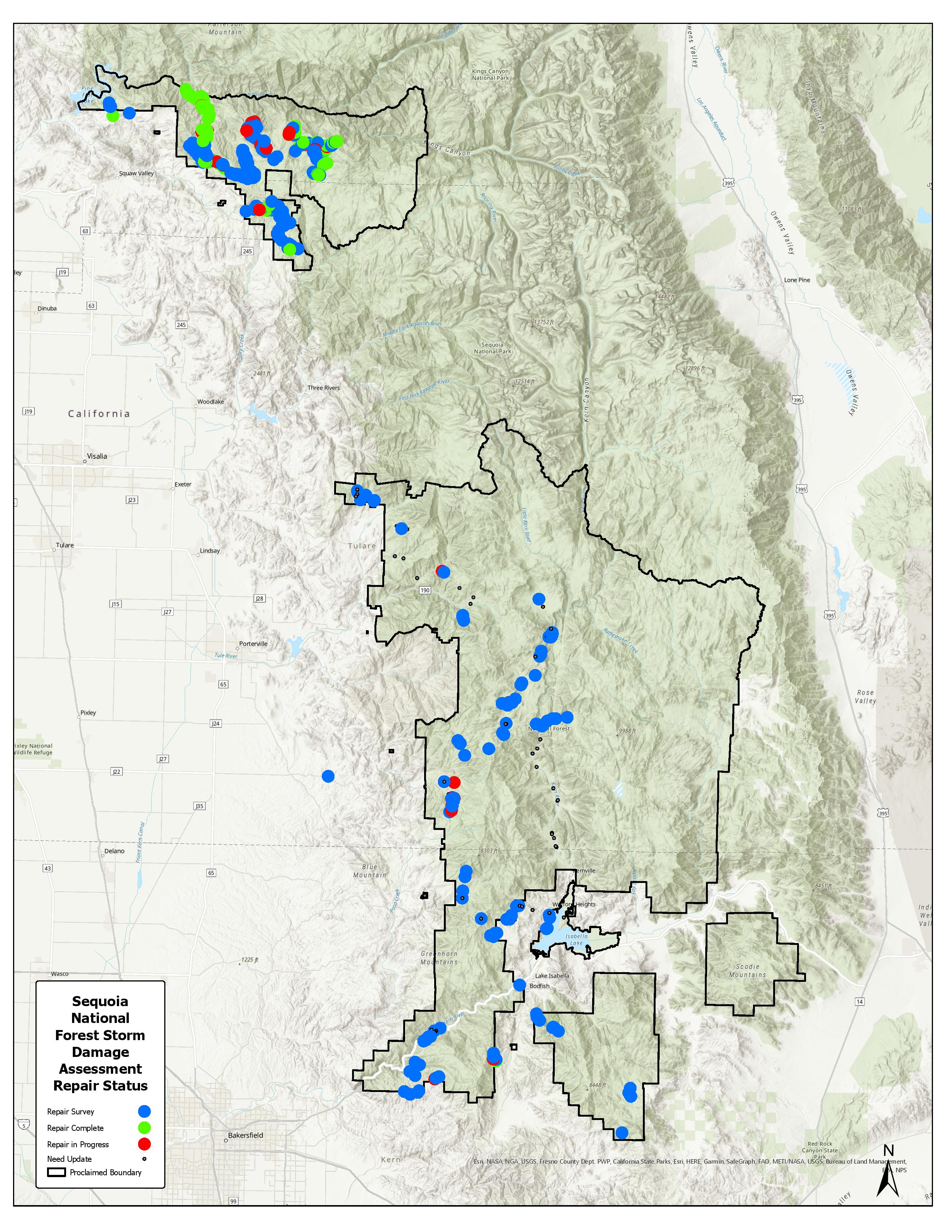
This map shows locations on Forest Roads on the Sequoia National Forest where damage to roads and road infrastructure has been reported, and the status of the repair.  Additional data will be added as snowmelt continues and areas become accessible.  

Image options: [ Full Size ] - [ PDF ]

This map shows the location of current known damage to Forest Service Roads on the Sequoia National Forest, and the status of repairs to those damaged areas.

Image options: [ Full Size ] - [ PDF ]

This map shows the location of identified storm / flood damage to forest roads and recreation sites, and the status of that repair.  Some damage items may be minor, others significant.

Image options: [ Full Size ] - [ PDF ]

This map shows locations on Forest Roads on the Sequoia National Forest where damage to roads and road infrastructure has been reported, and the status of the repair.  Additional data will be added as snowmelt continues and areas become accessible.