Incident Media Maps
Settings - change map background and toggle additional layers
Filter - control incident types displayed on map.
Zoom to your location
Reset map zoom and position
Could not determine your location.
Show Legend
 Wildfire
 Prescribed Fire
 Burned Area
Response
Burned Area
Response Other
Other
Maps Gallery
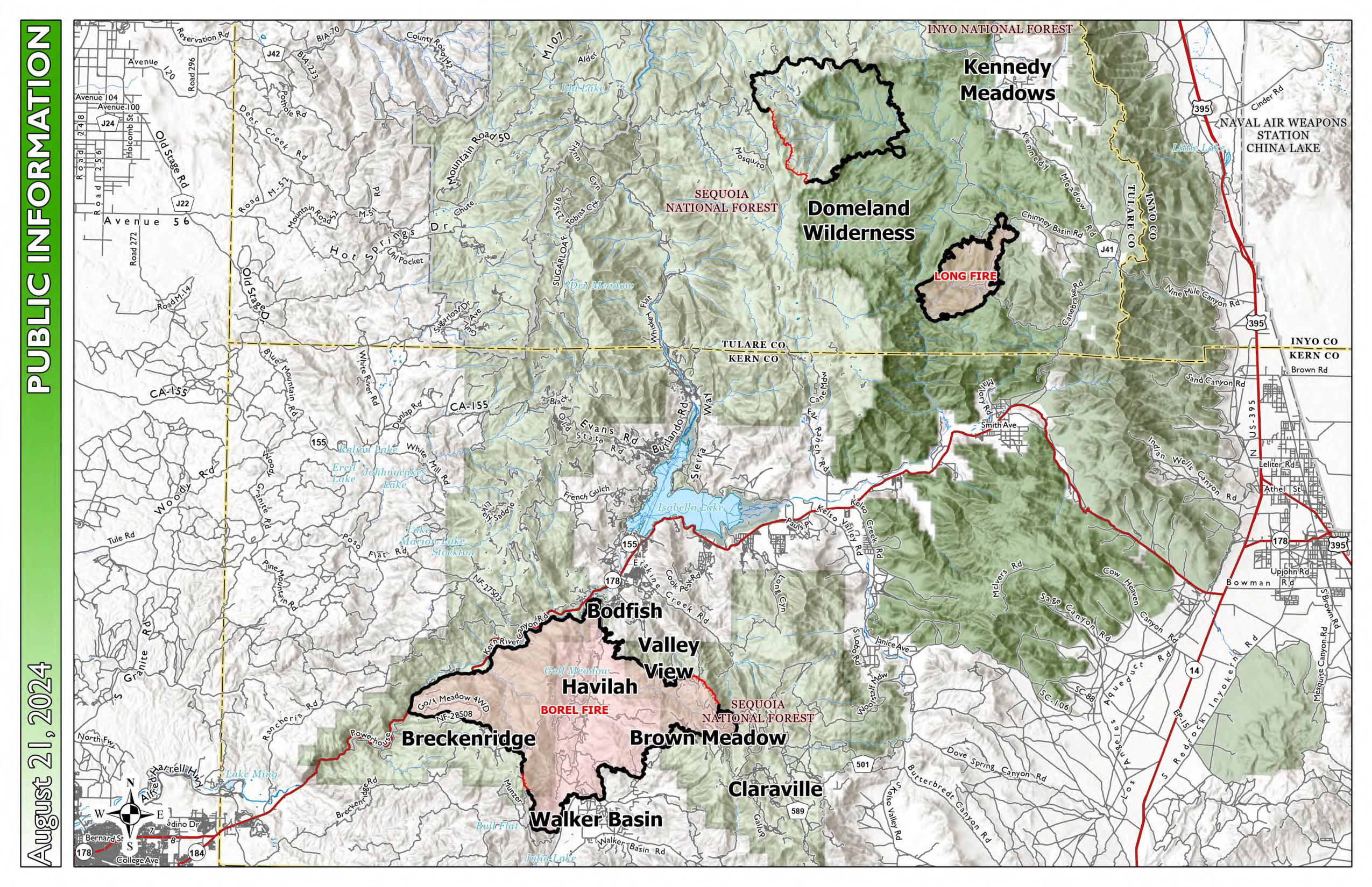
Image options: [ Full Size ] -

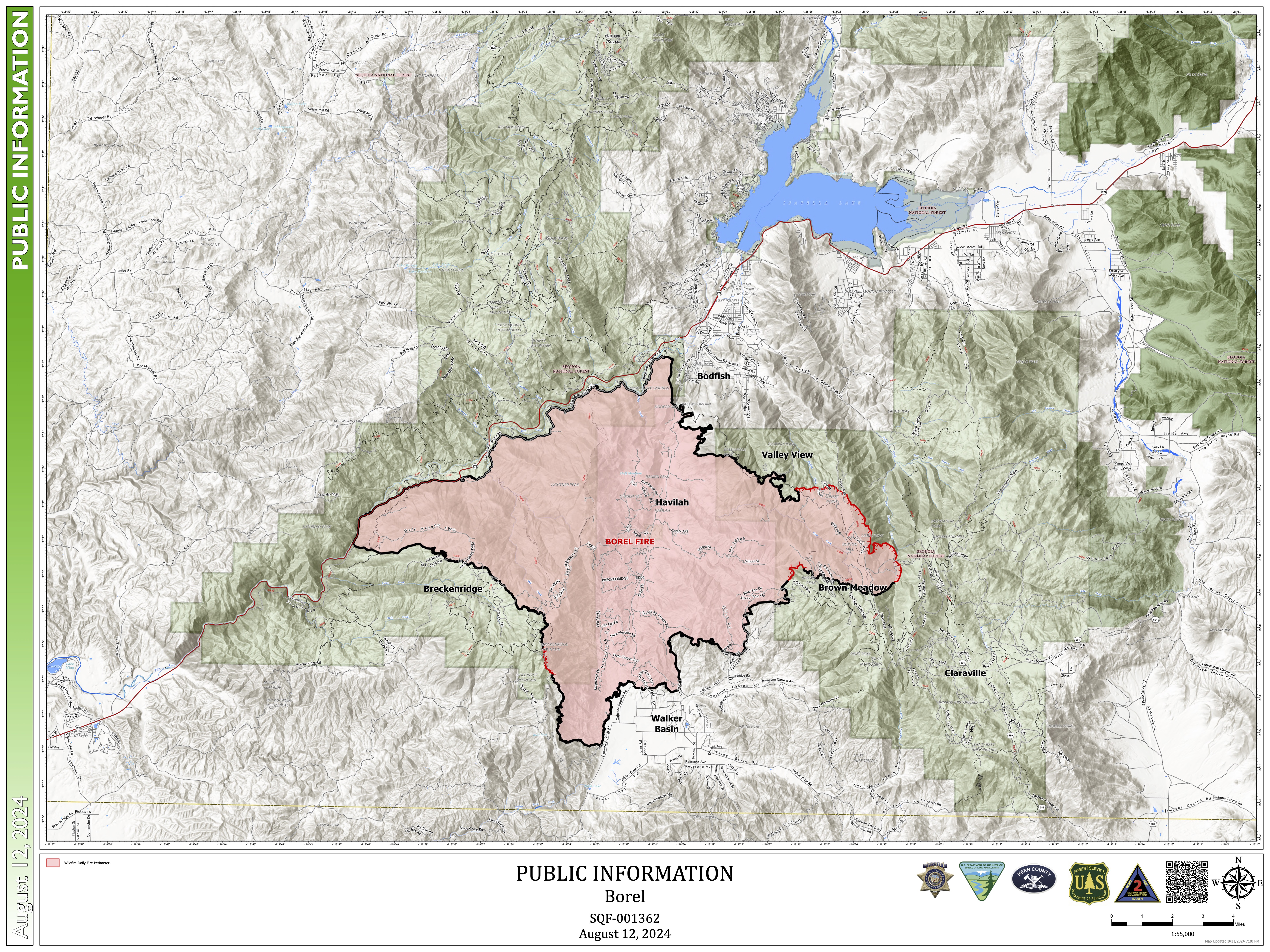
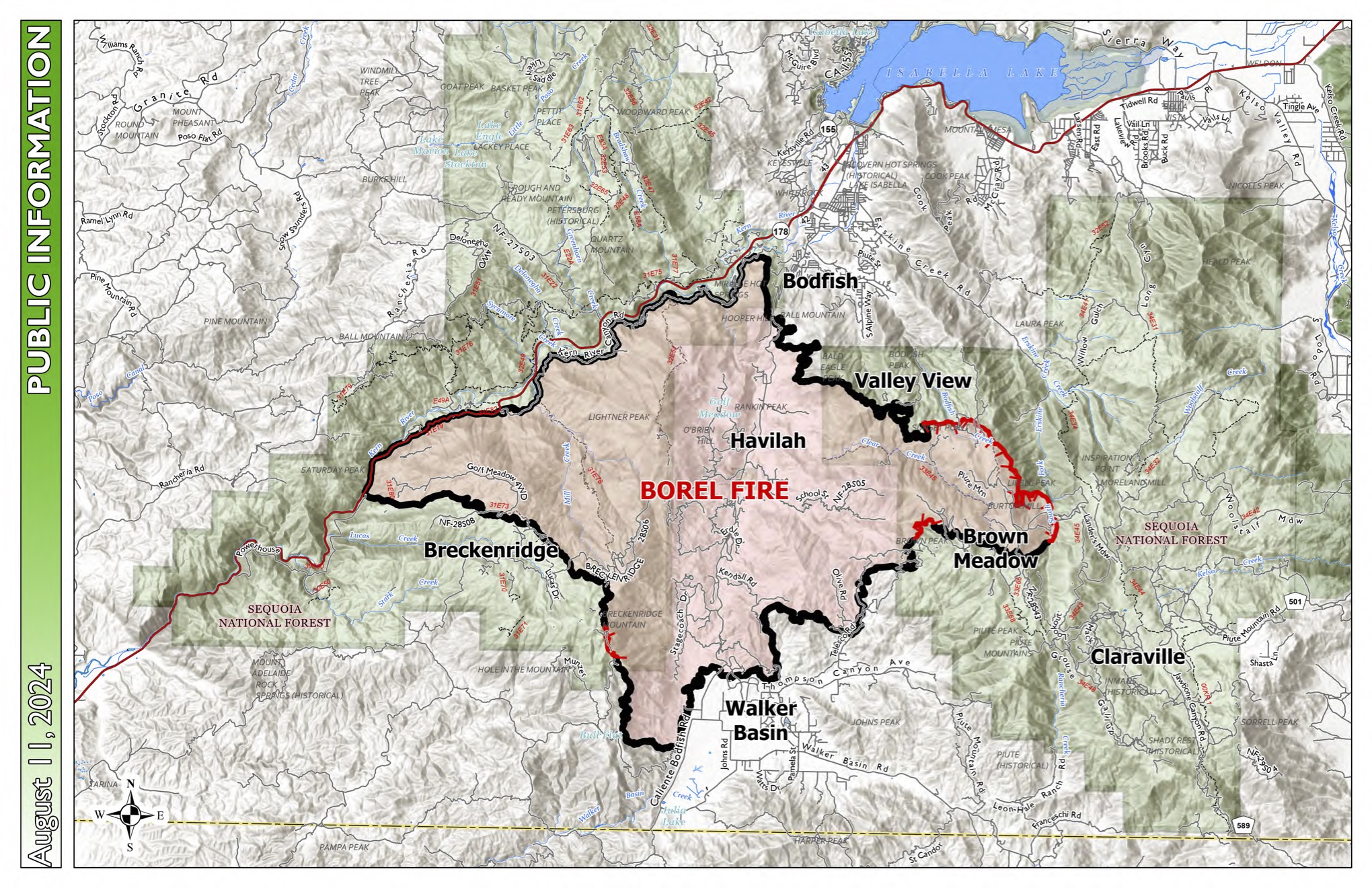
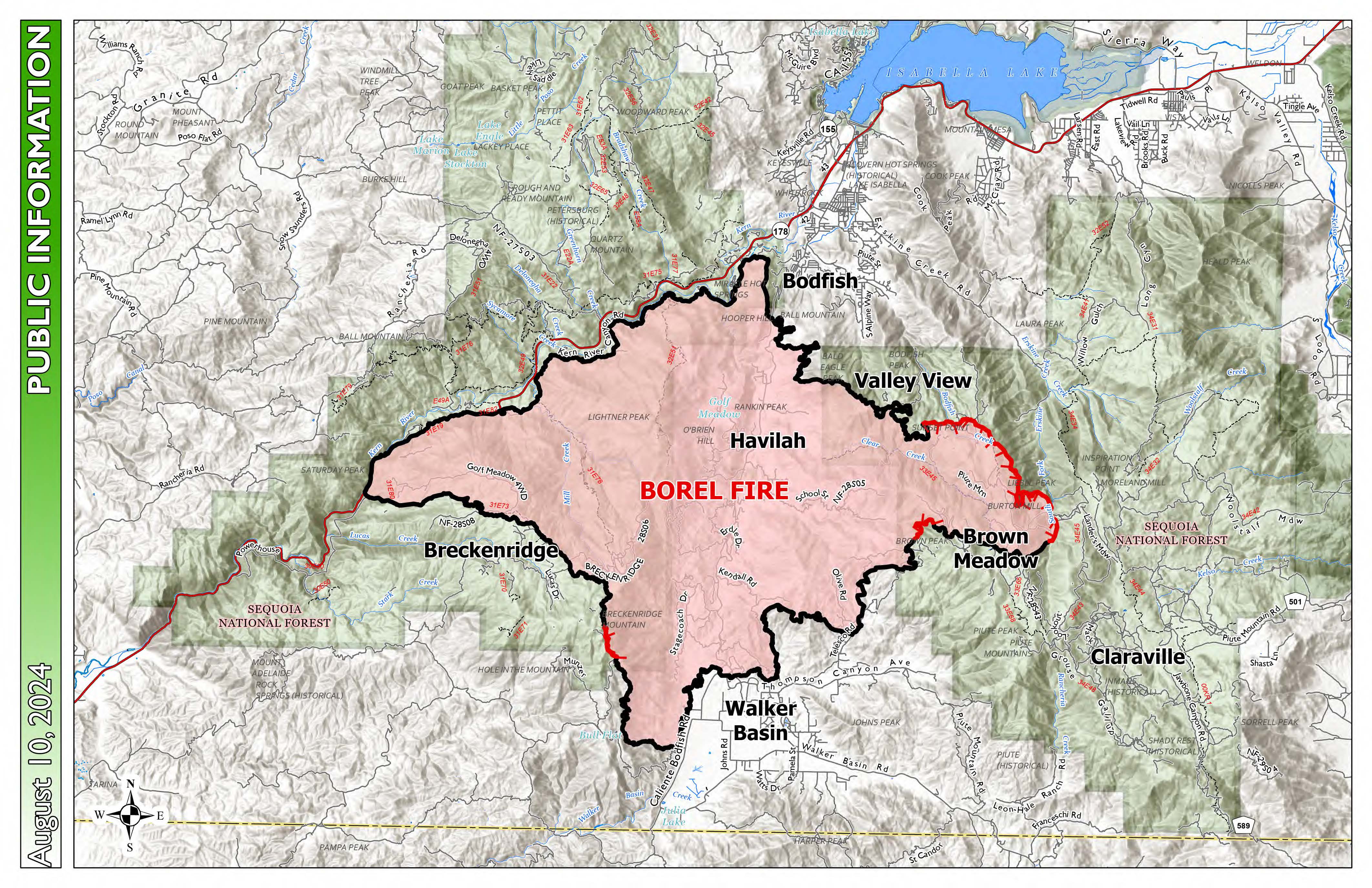
This map shows land ownership in shades of white and green, fainter lines for roads and highways, and the Trout and Long Fire perimeters in shades of pink. The outline of the fire perimeters varies from red to black; the black portions represent containment.