Highlighted Activity
Highlighted Media

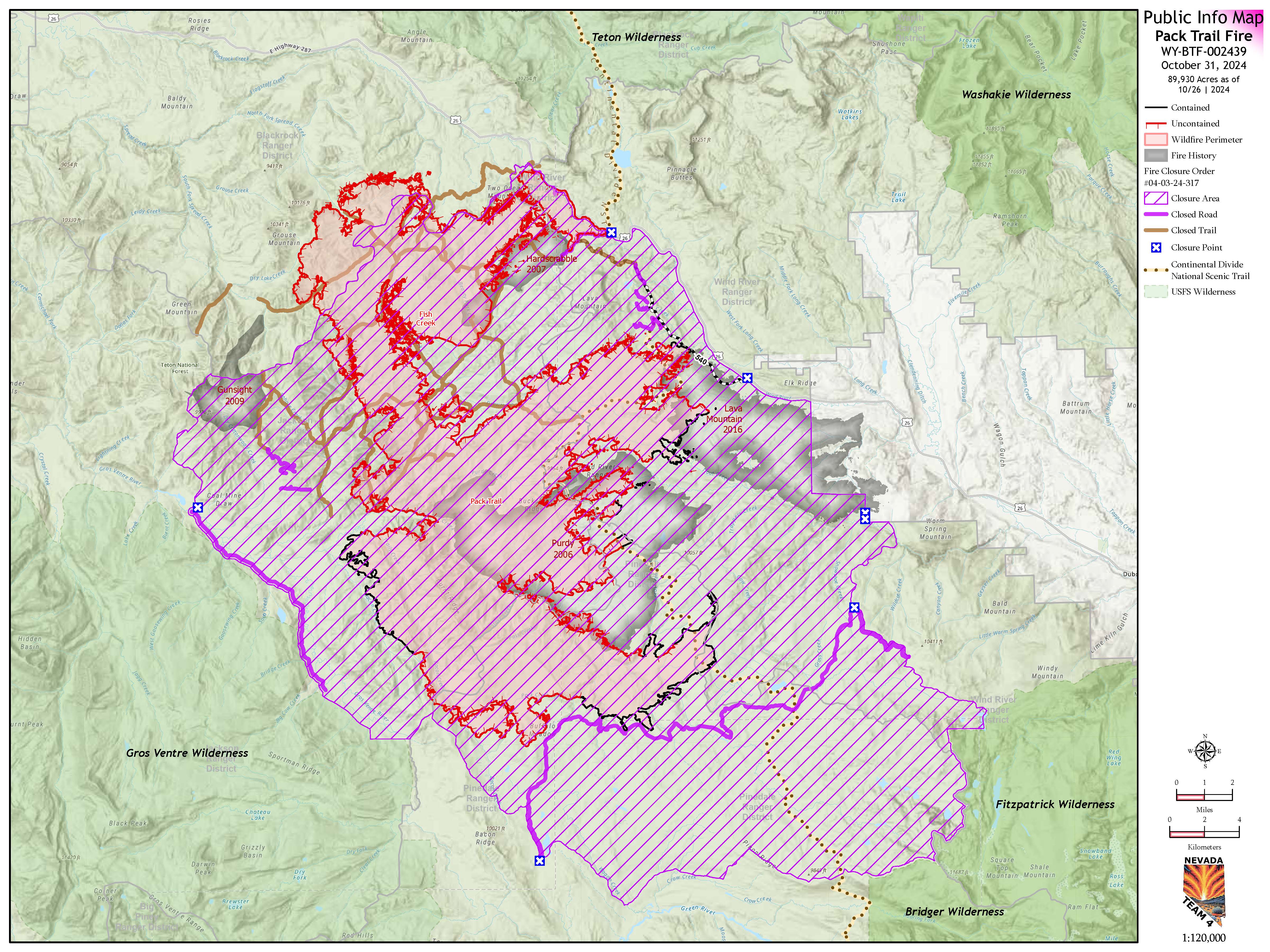
Pack Trail Fire Mao October 31, 2024

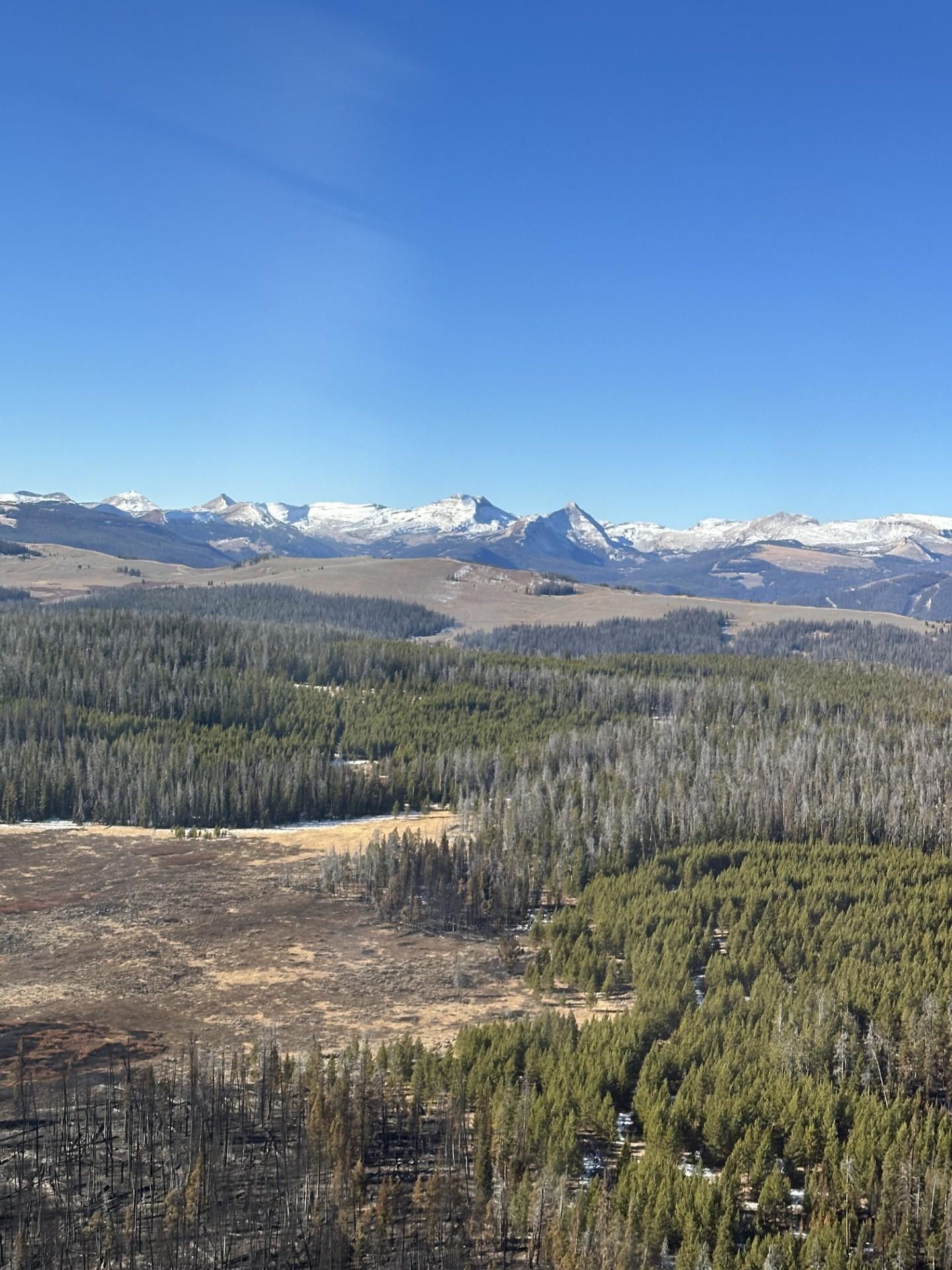
The lightning-caused Pack Trail fire was discovered September 15, 2024 and was burning 23 miles southeast of Moran, WY. The fire was burning on both the Bridger-Teton National Forest and the Shoshone National Forest in Western Wyoming. The fire’s location is in remote, rugged, and inaccessible terrain with few roads.
An Incident Management Team has suppressed the majority of the fire. The fire is in a patrol and monitor status as some interior smoke and heat are still present. The fire area will be monitored by the Bridger-Teton and Shoshone National Forests as needed. Winter weather and snow should continue to reduce fire and smoldering activity.
Please use caution while driving near the fire areas, especially on narrow secondary roads due to snow or ice accumulation. Drivers are encouraged to visit https://www.wyoroad.info especially if you are planning to travel on US-2 6 across the Continental Divide.
All evacuation areas within the Pack Trail Fire have been lifted. See the Fremont County Emergency Management Facebook Page or the Teton County Emergency Management website for additional information. Residents and visitors are reminded to exercise extreme caution when dealing with fires or other ignition sources.
| Current as of | Mon, 11/04/2024 - 21:39 |
|---|---|
| Incident Time Zone | America/Denver |
| Incident Type | Wildfire |
| Cause | Lightning |
| Date of Origin | |
| Location | 2 miles northeast of the confluence of the South Fork and North Fork of Fish Creek |
| Incident Description | Fire is being managed in a 50% confine and 50% point-protection strategy. It is currently 95% completion of containment actions. |
| Coordinates |
43° 35' 39'' Latitude
-110° 8' 48
'' Longitude
|
| Total Personnel: | 73 |
|---|---|
| Size | 89,930 Acres |
| Percent of Perimeter Contained | 0% |
| Fuels Involved | Timber (litter and understory), Brush (2 feet), Medium Logging Slash The fire is burning in heavy timber with a 60% standing dead component. Sagebrush/grass component is largely dormant and receptive to rapid fire spread. Downed logs are carrying fire in the timber component but not consuming completely. |
| Significant Events | Fire activity is described as minimal with smoldering.
|
| Planned Actions |
|
|---|---|
| Projected Incident Activity |
12 hours: Snow continues to be forecasted for the fire area and no fire behavior will be observed. Heat sources will continue to disappear. 24 hours: Snow continues to be forecasted for the fire area and no fire behavior will be observed. Heat sources will continue to disappear. 48 hours: This period could see more possible snow forecasted for the fire area. No fire behavior will be observed. Heat sources will continue to disappear. 72 hours: Snow continues to be forecasted for the fire area and no fire behavior will be observed. Heat sources will continue to disappear. Anticipated after 72 hours: Wet moist conditions in the fire area should bring an end to the fire and could be the end of the fire season |
| Weather Concerns | Widespread snow showers are expected to continue through Thursday as additional disturbances move across the area and colder air is ushered in. |
|---|

 InciWeb