U.S. flag

An official website of the United States government

Here's how you know

Single Incident Information

Zoom to your location
Reset map zoom and position

Could not determine your location.

Willamette Complex Fires - South

Unit Information

Oregon 
Springfield, 
Oregon 
97477 
Oregon 
Springfield, 
Oregon 
97477 

Incident Contacts

Email: 2024.willamettecomplex@firenet.gov
Phone: 541-208-1742
Hours: 8 am to 8 pm

Highlighted Activity

UNITED STATES DEPARTMENT OF AGRICULTUREFOREST SERVICEWILLAMETTE NATIONAL FORESTSPRINGFIELD, OREGONORDER # 06-18-10-24-26FOREST ORDERMOSS MOUNTAIN-POTTER FIRE EMERGENCY AREA CLOSUREPursuant to 16 U.S.C. § 551 and 36 CFR § 261.50 (a) and (b), and to provide for public safety, the following acts are prohibited on the National Forest System (“NFS”) areas, roads, and trails described below within the… Read more
Publication Type: Closures -
UNITED STATES DEPARTMENT OF AGRICULTUREFOREST SERVICEWILLAMETTE NATIONAL FORESTSPRINGFIELD, OREGONORDER # 06-18-10-24-22FOREST ORDERCHALK FIRE EMERGENCY AREA CLOSUREPursuant to 16 U.S.C. § 551 and 36 CFR § 261.50 (a) and (b), and to provide for public safety, the following acts are prohibited on the National Forest System (“NFS”) areas, roads, and trails described below within the administrative… Read more
Publication Type: Closures -
Wednesday, August 14, 2024Total Willamette Complex South Personnel: 759Total Willamette Complex South Acres: 12,668Resources: 24 Type 6 Engines, 11 Dozers, 12 Masticators, 2 Skid SteersFire Cause: Lightning Community MeetingThere will be a community meeting for the Willamette Complex Fires South held on Friday, August 16th at 6:30 pm at the Banner Bank Amphitheater in Greenwaters Park… Read more
Publication Type: News -

Highlighted Media

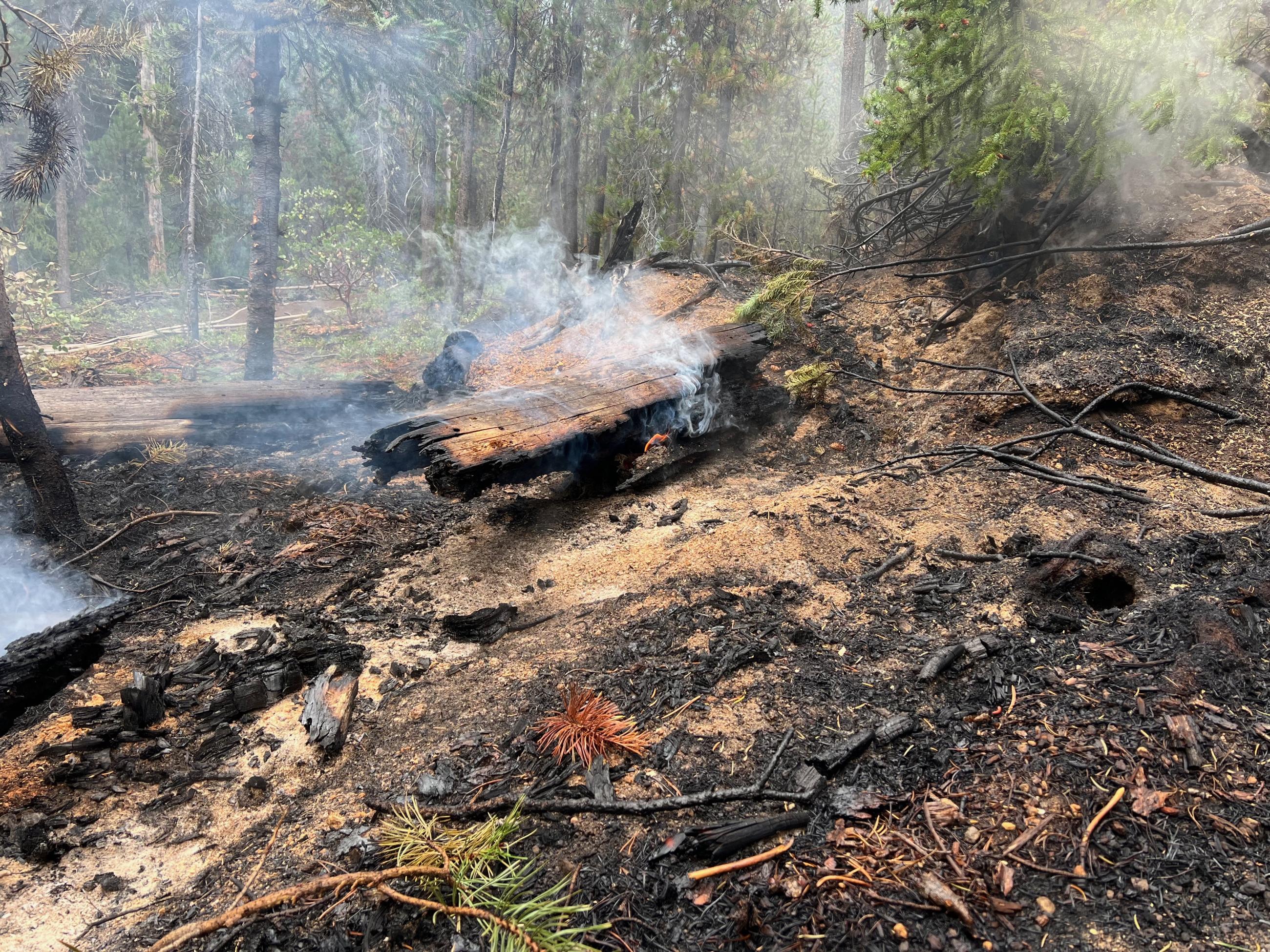
light smoke rises from the moss mountain fire, Aug 3

Previously called the Oakridge Lightning Fires, the Willamette Complex Fires-South include the Chalk, McKinley, Tire Mountain, Moss Mountain, Coffeepot, 217, and 208 Fires. 

The Chalk Fire and McKinley Fire are approximately 5 miles north of High Prairie, Oregon. The Tire Mountain Fire is approximately 5 miles northwest of Westfir. The Coffeepot Fire is approximately 9 miles southeast of Oakridge, and on the east side of Hills Creek Lake. The Moss Mountain Fire is approximately 15 miles southeast of Oakridge. The 217 and 208 fires are located on the west and south slopes of Diamond Peak, approximately 10 miles west of Crescent Lake Junction, Oregon.

The Alaska Complex Incident Management Team (CIMT) 3 assumed command of the fires on Saturday morning, August 10 from the previous team, the Rocky Mountain CIMT1.

The fires were discovered after an intense lightning storm on July 17. All of the fires are burning in heavy timber in the Willamette National Forest. 


Basic Information
Current as of Wed, 08/14/2024 - 13:23
Incident Type Wildfire
Cause Lightning
Date of Origin
Location Willamette Complex fires are to the north and south of Oakridge.
Incident Commander Peter Butteri, Incident Commander
Jason Devcich, Incident Commander Trainee

Coordinates 43° 53' 14'' Latitude
-122° 25'
52
'' Longitude
Current Situation
Total Personnel: 759
Size 12,668 Acres
Percent of Perimeter Contained 48%
Estimated Containment Date 10/31/24
Fuels Involved

Brush (2 feet)

Closed Timber Litter 

Timber (Litter and Understory) 

Fuels are primarily composed of Timber litter and understory with shrub. Mixed aged conifer including old growth with lichen, snags and heavy surface fuel concentration of dead fuels is common. Woody and herbaceous live fuels are also contributing to fire spread. The 208 fire is an exception with fewer trees and lighter fuel loads. It occurs at 6,400 to 8,700 ft. with talus slopes and avalanche chutes.

Significant Events

Moderate, Backing, Creeping

Generally moderate fire behavior, especially in the lighter fuels where the fuel moisture has recovered with the higher humidity from the marine air which has moved in over much of the fire area.  Pyramid: The pyramid is holding within control lines. Substantial heat remained across the interior of the fire and heavy fuels continued to burn, but higher humidity and lower temperatures limited fire spread and consumption. Heavy fuels have retained heat for more than 3 weeks and continue to burn. Intense or scattered heat was detected across the entire fire. 


- Chalk: Active fire on the west side where there is uncontained fire edge and crews are burning out to secure indirect lines. Otherwise, minimal activity across the fire. Fuel and slope alignment has potential for fire to grow to the north. 

- Coffeepot: Minimal fire activity on the south, west, and northern portions where suppression actions have been successful. Moderate fire activity as the fire backs from burnout operations along indirect line through a large, unburned island towards the main fire. Constant threat from adverse winds could cause long-distance spotting across east and south perimeter control lines. 

- Moss Mountain: The fire is backing down hill to the west with potential for slope reversal and rapid growth from uphill runs. Southern line threatened by spot fires from rolling material and group tree torching. 

- 208 Fire: Expect the 208 fire to grow 15-20 acres daily to the northwest, west and south from creeping and backing fire. Spread to the east is being limited by natural barriers consisting of talus slopes and avalanche chutes.


Outlook
Planned Actions

- Chalk: Chalk: Continue to hold and improve control lines on the south and east portions of the fire. On the southwest-west portion, continue to improve and deepen completed control lines from the main body of the fire, west along Road 1912 and tying back into the main body of the fire on Road 1925. UAS with AI will are required for strategic firing operations as available. Continue to prep indirect lines. Continue to address fire weakened trees and snags. 

- Coffeepot: Along the west portion, continue to patrol, hold and improve control lines along Hills Creek Lake.
Along the north and northwest portions, secure, patrol, and mop up control lines.
Southeast portion, improve control lines and continue filling in the large, unburned island. Improve contingency lines to the southeast of the fire along Roads 2120 and 2129.

- Moss Mountain: - Look for opportunities to minimize fire spread south of Road 2120. Scout for opportunities to tie spots south of Road 2120 into the main body of the fire and secure where practical. Continue to construct indirect line along Roads 2120 and 23 in preparation of future fire spread. West of the fire, scout for possible control lines along Roads 490 and 2309 to minimize burned acres.
Continue to prep dozer lines along the north side of the fire along Roads 23, 2307 and 2308. 

- 208 Fire: Currently unstaffed. Patrol and monitor using air resources as available. 

Projected Incident Activity

12 hours
Willamette Complex (South): Minimal growth is expected, mostly continued interior burning on all fires.  Moss Mountain will continue to slowly expand on the south, west, and north sides.   

24 hours:
Willamette Complex (South): Minimal growth is expected, mostly continued interior burning on all fires.  Moss Mountain will continue to slowly expand on the south, west, and north sides. 

48 hours:

Willamette Complex (South): Warmer and drier conditions on Wednesday will result in more active fire behavior, mostly on Moss Mountain fire. 

72 hours: 

Willamette Complex (South): Residual drying from the warmer and drier weather on Wednesday combined with the increased fire activity will result in slightly more active fire behavior on all the fires. 

Anticipated after 72 hours:

Willamette Complex (South): Residual drying from the warmer and drier weather on Wednesday combined with the increased fire activity will result in slightly more active fire behavior on all the fires. 


Remarks

AK-CIMT3 is managing the Willamette Complex South, which includes the Moss Mountain, 208, Chalk, Coffeepot, 217, McKinley and Tire Mt fires.  CA-CIMT13 is managing the Pyramid Fire which is also a part of the Willamette Complex, and included within this 209.   Resource Summary includes Willamette Complex South and Pyramid Fire resources combined.  Reduction in the number of personnel from yesterday is due a fix of an accounting error in the 8/11/2024 reporting period.  Due to limitations in the 209 system, Willamette Complex costs were added to the Moss fire to show an accurate total for all fires including Willamette Complex specific costs. 

Stage 2 Fire Restrictions are in place for the entire Willamette National Forest. Prohibitions include: 

1-Building, maintaining, attending or using a fire, campfire or stove fire, including a charcoal, wood, or coal fire. However, pressurized liquid or gas stoves, lanterns, and heaters that can be switched on and off are allowed. 

2- Smoking, except within an enclosed vehicle or building or a developed recreation site. 

3- Operating an internal combustion engine, including but not limited to generators and chainsaws, except in areas devoid of vegetation and those located inside of buildings. 

4- Welding or operating an acetylene or other torch with open flame. 

5- Possessing or using a motor vehicle off National Forest System roads, except when parking in an area devoid of vegetation for 10 feet around the vehicle. 

North Zone: 
Division locations on the map were adjusted to prevent miscommunication between the fires. 

South Zone: 
To date, 84 miles of control lines have been completed on South Zone fires, which is 12 miles further than
Eugene, Oregon to Roseburg, Oregon. 

- Area Closure 1: Moss Mountain-Potter Closure Number 06-18-10-24-26: Effective 7/30/2024 closes 20 trails, the Bingham Boat Launch, the Loggers Butte, Diamond Peak Wilderness, and 7 campgrounds,
including the Campers Flat, Indigo Springs, Sacandaga, Sand Prairie, Secret, Timpanogas, and Youngs Flat
campgrounds. 
- Area Closure 2: Tire Mountain Closure Number 06-18-10-24-18: Effective 7/20/2024. 
- Area Closure 3: Chalk Fire Closure Number 06-18-10-24-22: Effective 7/29/2024 closes 7 trails, the
Huckleberry Flats OHV Area, and the Kiahanie Campground. 
More information is available at https://www.fs.usda.gov/alerts/willamette/alerts-notices/?aid=61574. 

Multiple Cooperator meetings have been conducted. Additional community meetings and cooperator
meetings will continue to occur on a regular basis.


Current Weather
Weather Concerns

Current through 72 hours: 

Monday, marine air lowered temperatures by 5 to 10 degrees and increased humidity. Gusts reached upwards of 20 mph across the fire area. Weather is expected to be somewhat warmer and dryer mid-week with limited cloud cover, with cooling temperatures and possible precipitation later in the week. Winds will remain from the northwest.

72+ hours: 
Increasing cloud cover, decreasing temperatures, increasing humidity are all expected as an offshore low increasingly moves inland and influences the fire area.  There is a slight chance of showers later in the week.