
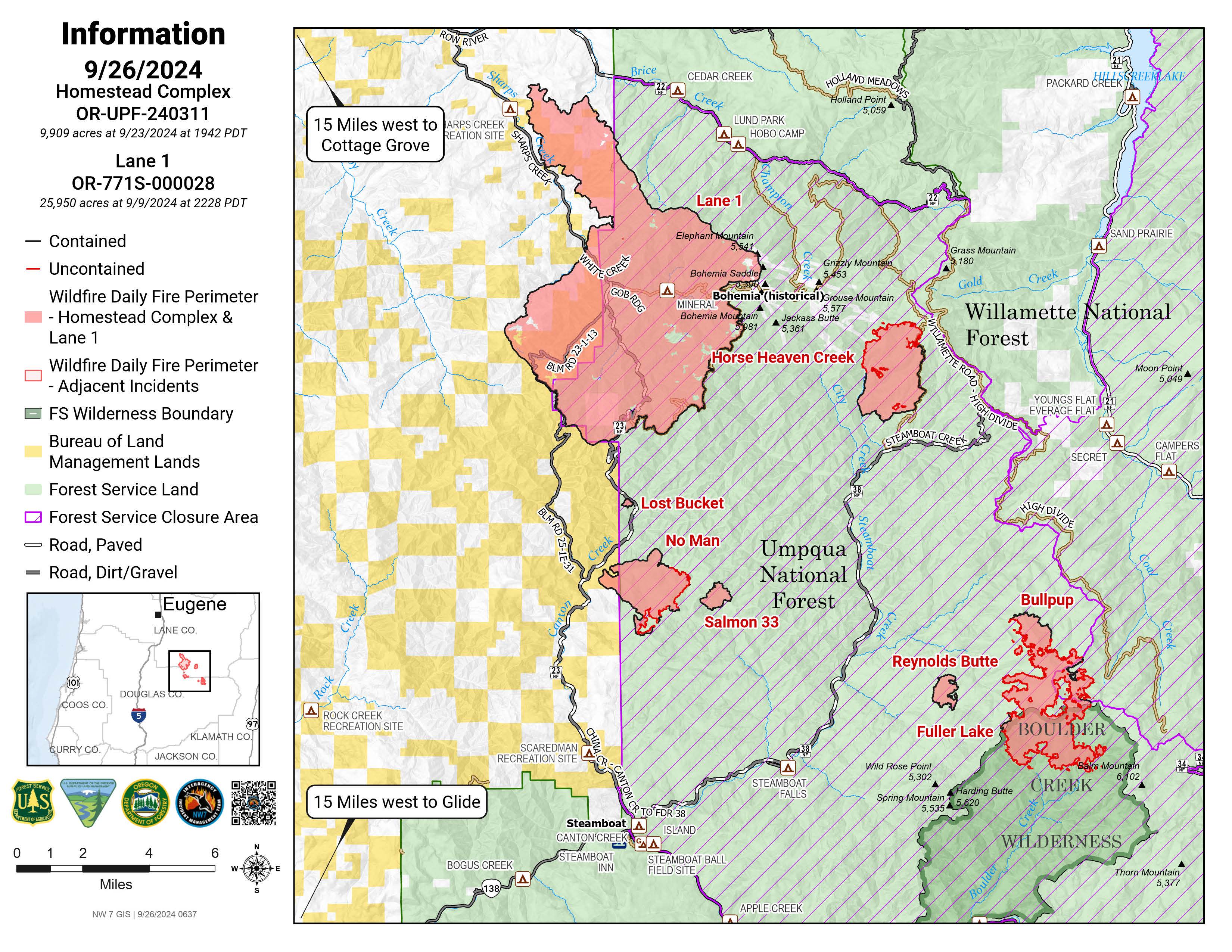
The Lane 1 Fire is located approximately 6 miles southeast of Dorena, Oregon. A lightning storm on Thursday, July 17th, started eight separate fires that merged into the Lane 1 Fire. Northwest Complex Incident Management Team 7 assumed command of the Lane 1 and Homestead Complex fires on September 13th. For more information, please see the Homestead Complex fire information page: https://inciweb.wildfire.gov/incident-information/orupf-homestead-complex
The Lane 1 Fire is located approximately 6 miles southeast of Dorena, Oregon. A lightning storm on Thursday, July 17th, started eight separate fires that merged into the Lane 1 Fire. Northwest Complex Incident Management Team 7 assumed command of the Lane 1 and Homestead Complex fires on September 13th. For more information, please see the Homestead Complex fire information page: https://inciweb.wildfire.gov/incident-information/orupf-homestead-complex
| Current as of | Wed, 10/09/2024 - 12:20 |
|---|---|
| Incident Time Zone | America/Los_Angeles |
| Incident Type | Wildfire |
| Cause | Lightning/Natural |
| Date of Origin | |
| Location | Approximately 16 miles SE of Springfield, OR |
| Incident Commander | Nate LeFevre, Northwest Complex Incident Management Team 7 |
| Coordinates |
43° 39' 2'' Latitude
-122° 47' 30
'' Longitude
|
| Total Personnel: | 92 |
|---|---|
| Size | 25,952 Acres |
| Percent of Perimeter Contained | 99% |
| Estimated Containment Date | 10/01/24 |
| Fuels Involved | Fuels include: Timber (litter and understory), Closed Timber Litter, and Light Logging Slash |
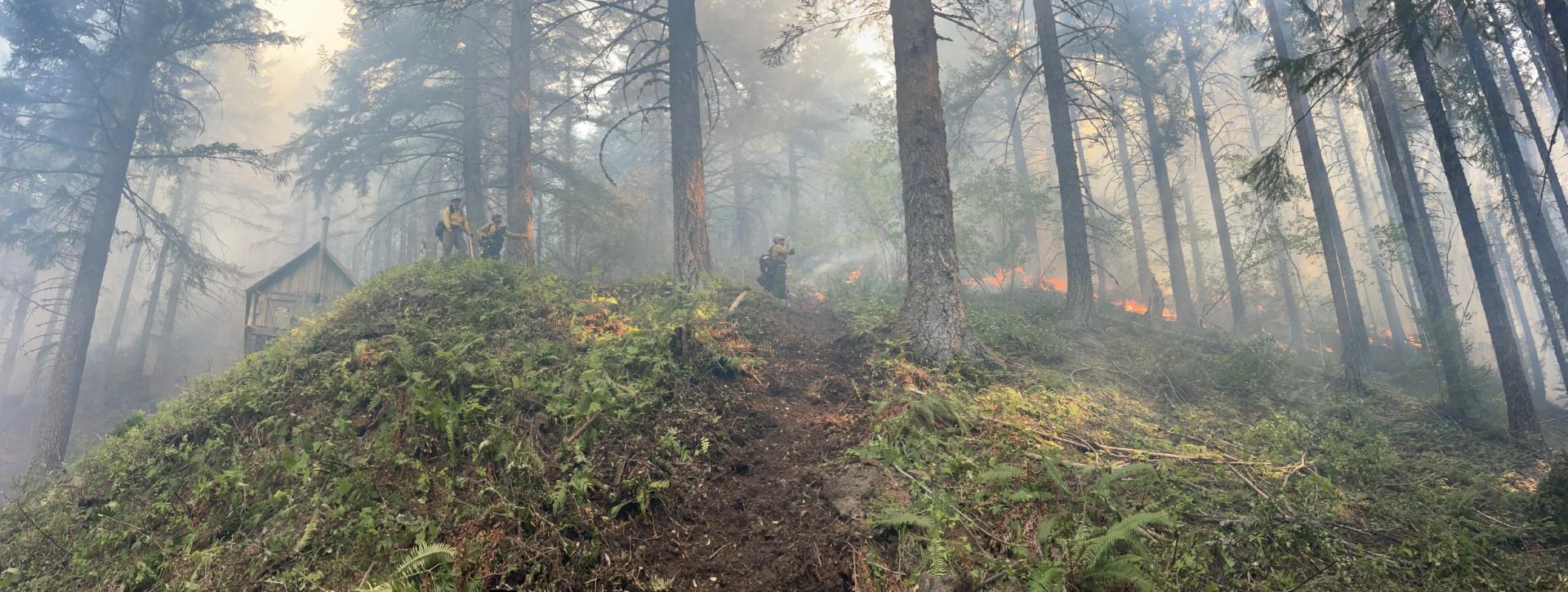
| Significant Events | Fire behavior has been mainly backing and smoldering with occasional tree torching.
|
| Planned Actions |
Firefighters will continue to secure fire perimeter and repair damage that occurred during suppression of the fire. This work will include repairing handlines, dozer lines, creating erosion prevention measures, and the removal of hazardous trees.
For more information, please see the Homestead Complex fire information page: https://inciweb.wildfire.gov/incident-information/orupf-homestead-complex |
|---|---|
| Projected Incident Activity |
Perimeter growth has been limited. Where islands of unburnt fuel exist backing and smolder will continue to be the primary fire behavior, with occasional tree torching. |