


The Oregon Department of Forestry (ODF) Incident Management Team 1 will transition the fire to a local Type 3 organization as of 7:00 a.m. Thursday July 18th. The fire is 100% lined at 4,102 acres and is 84% contained as of July 17th.
The Salt Creek Fire, located 10 miles east of Eagle Point, began on Sunday, July 7. The Oregon Department of Forestry's Incident Management Team 1 took command of the fire on July 8.
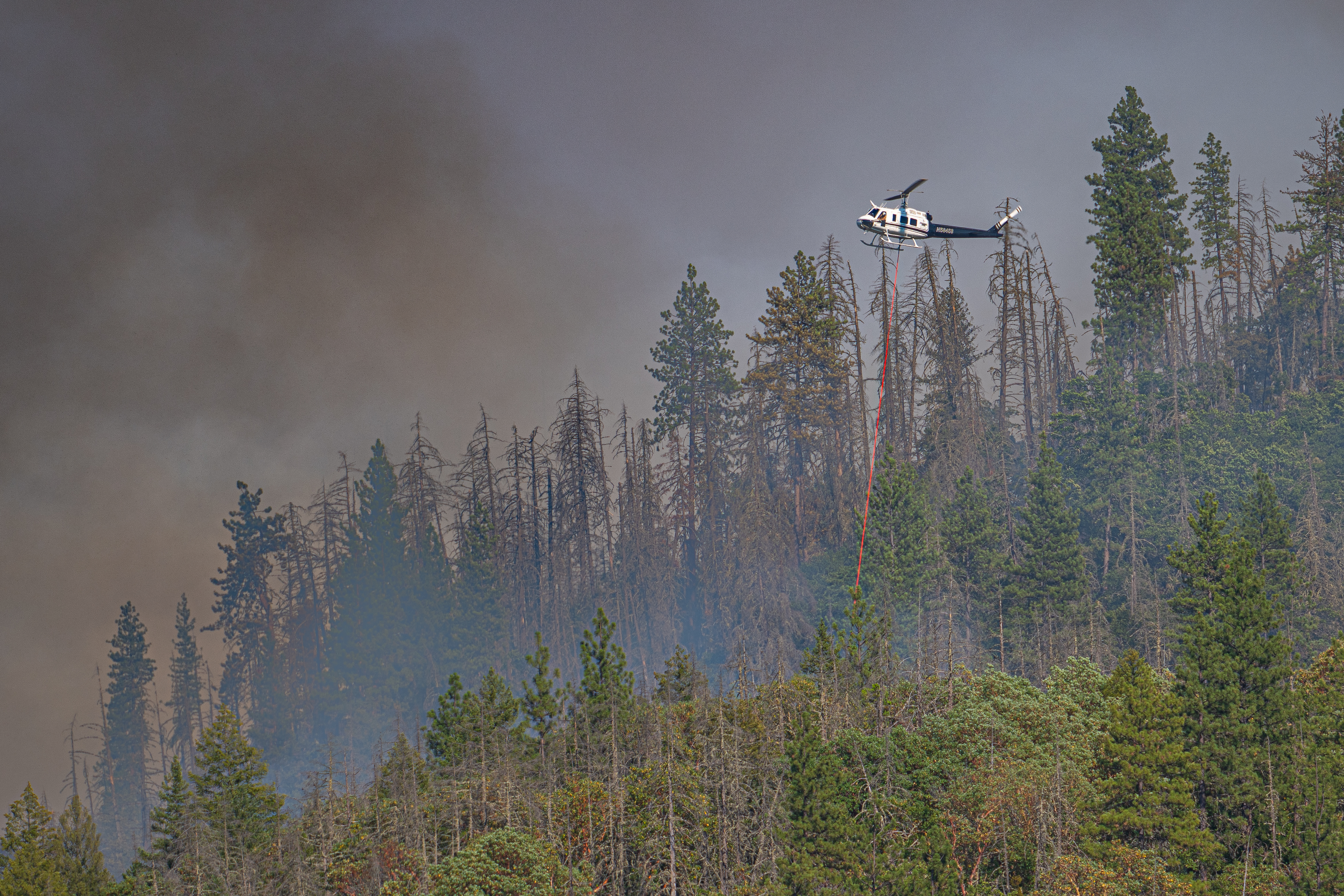
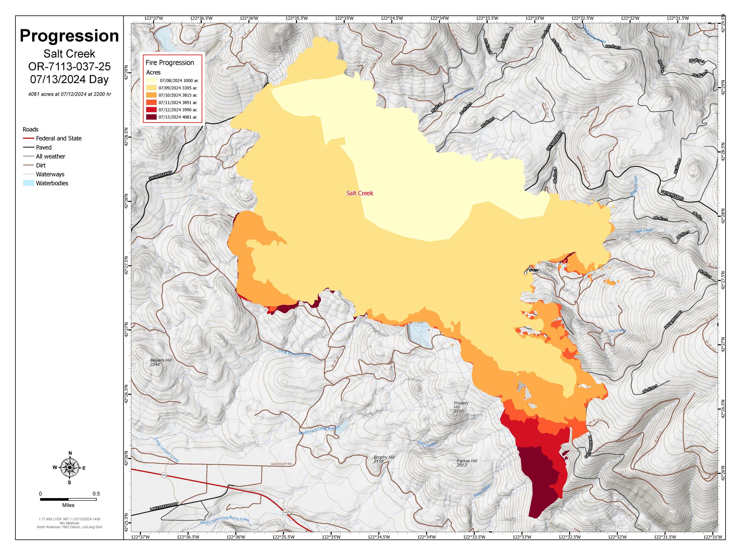
Background: The Salt Creek Fire was first reported Sunday afternoon just after 4 p.m. on July 7. Both ODF Southwest Oregon District and Lake Creek Fire District initially responded. When firefighters arrived on scene, it was estimated to be 2-5 acres and growing quickly in the hot, dry and windy conditions. Numerous resources were ordered, including engines, bulldozers, water tenders and multiple types of aircraft. The fire grew to an estimated 10 acres within the half hour, and 200 acres an hour and a half into initial attack. Six helicopters, two Large Air Tankers (LATs) and a Very Large Air Tanker (VLAT) were ordered, and numerous retardant drops helped to box in the fire by creating temporary retardant lines around the majority of the incident. By the afternoon of July 8, the fire had grown to approximately 1,500 - 2,000 acres and local crews had lined 40% of the fire.
The Oregon Department of Forestry (ODF) Incident Management Team 1 will transition the fire to a local Type 3 organization as of 7:00 a.m. Thursday July 18th. The fire is 100% lined at 4,102 acres and is 84% contained as of July 17th.
The Salt Creek Fire, located 10 miles east of Eagle Point, began on Sunday, July 7. The Oregon Department of Forestry's Incident Management Team 1 took command of the fire on July 8.
Background: The Salt Creek Fire was first reported Sunday afternoon just after 4 p.m. on July 7. Both ODF Southwest Oregon District and Lake Creek Fire District initially responded. When firefighters arrived on scene, it was estimated to be 2-5 acres and growing quickly in the hot, dry and windy conditions. Numerous resources were ordered, including engines, bulldozers, water tenders and multiple types of aircraft. The fire grew to an estimated 10 acres within the half hour, and 200 acres an hour and a half into initial attack. Six helicopters, two Large Air Tankers (LATs) and a Very Large Air Tanker (VLAT) were ordered, and numerous retardant drops helped to box in the fire by creating temporary retardant lines around the majority of the incident. By the afternoon of July 8, the fire had grown to approximately 1,500 - 2,000 acres and local crews had lined 40% of the fire.
| Current as of | Mon, 07/22/2024 - 18:55 |
|---|---|
| Incident Time Zone | America/Los_Angeles |
| Incident Type | Wildfire |
| Cause | Human |
| Date of Origin | |
| Location | 5 miles SSW of Butte Falls, Oregon |
| Incident Commander | Joe Hessel - ODF Incident Management Team 1 |
| Coordinates |
42° 28' 39'' Latitude
-122° 36' 11
'' Longitude
|
| Total Personnel: | 695 |
|---|---|
| Size | 4,102 Acres |
| Percent of Perimeter Contained | 100% |
| Estimated Containment Date | 07/24/2024 |
| Fuels Involved | Timber (Grass and Understory) and brush (2 feet). Briefings were focused on heat and thunderstorm chances given the potential impacts today from both of these hazards. It was noted that thunderstorm chances were much greater to the east of the Cascades. This notable heatwave continues to impact the Salt Creek Fire. Forecast temperatures today around 100 degrees resulted in another Heat Advisory with some lower elevations closer to 105 degrees. Humidity values continue to be dry around 20% during peak heating. Wind speeds were very similar today as they have been with speeds roughly around 5-10 mph with occasional gusts to around 15 mph. Sheltered areas have been reporting speeds of 5 mph or less. Thunderstorms could be seen in the distance this afternoon with cloud cover increasing. |
| Significant Events | Minimal, Creeping, Smoldering Fire will continue to smolder. |
| Planned Actions |
DIV A: Mop-up 300 feet from perimeter. Ensure all line is patrolled. Locate, identify, and mitigate hazard trees. Be prepared to provide initial attack resources if requested. DIV F: Locate, identify, and mitigate hazard trees. Ensure all line is patrolled. Mop-up 300 feet from perimeter. Be prepared to provide initial attack resources if requested. DIV W: Mop-up 150 feet from perimeter. Ensure all line is patrolled. Locate, identify, and mitigate hazard trees. Be prepared to provide initial attack resources if requested. DIV Z: Locate, identify, and mitigate hazard trees. Mop-up 300 feet from perimeter. Ensure all line is patrolled. Be prepared to provide Initial Attack resources if requested. |
|---|---|
| Projected Incident Activity |
12 hours: Fire behavior is not expected to be a concern. 24 hours: Fire behavior is not expected to be a concern. 48 hours: Fire behavior is not expected to be a concern. 72 hours: Fire behavior is not expected to be a concern. |
| Weather Concerns | A flag warning for low humidity and gusty winds and a heat advisory were in effect Tuesday. It was another hot, dry day with high temperatures from the low 90s over the ridges to the low 100s in the valleys, and humidity bottomed out in the 13-18% range. Thunderstorms developed in all directions during the afternoon, but the largest cells were about 10-15 miles north of the fire. Winds were relatively calm throughout the day. Thunderstorms remain possible through the evening hours, and gusty west winds are expected to develop and last until sunset. Overnight, the threat for thunderstorms ends, and we will see another mild night with moderate humidity recoveries. Conditions on Wednesday are expected to improve with no threat for lightning and less hot weather. |
|---|