
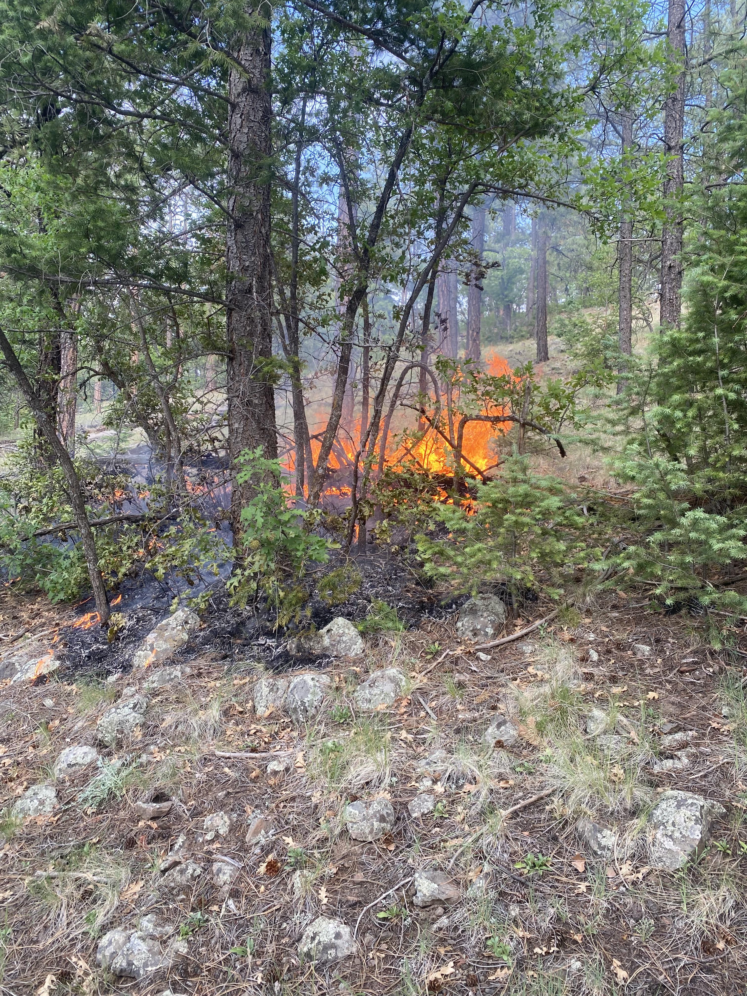
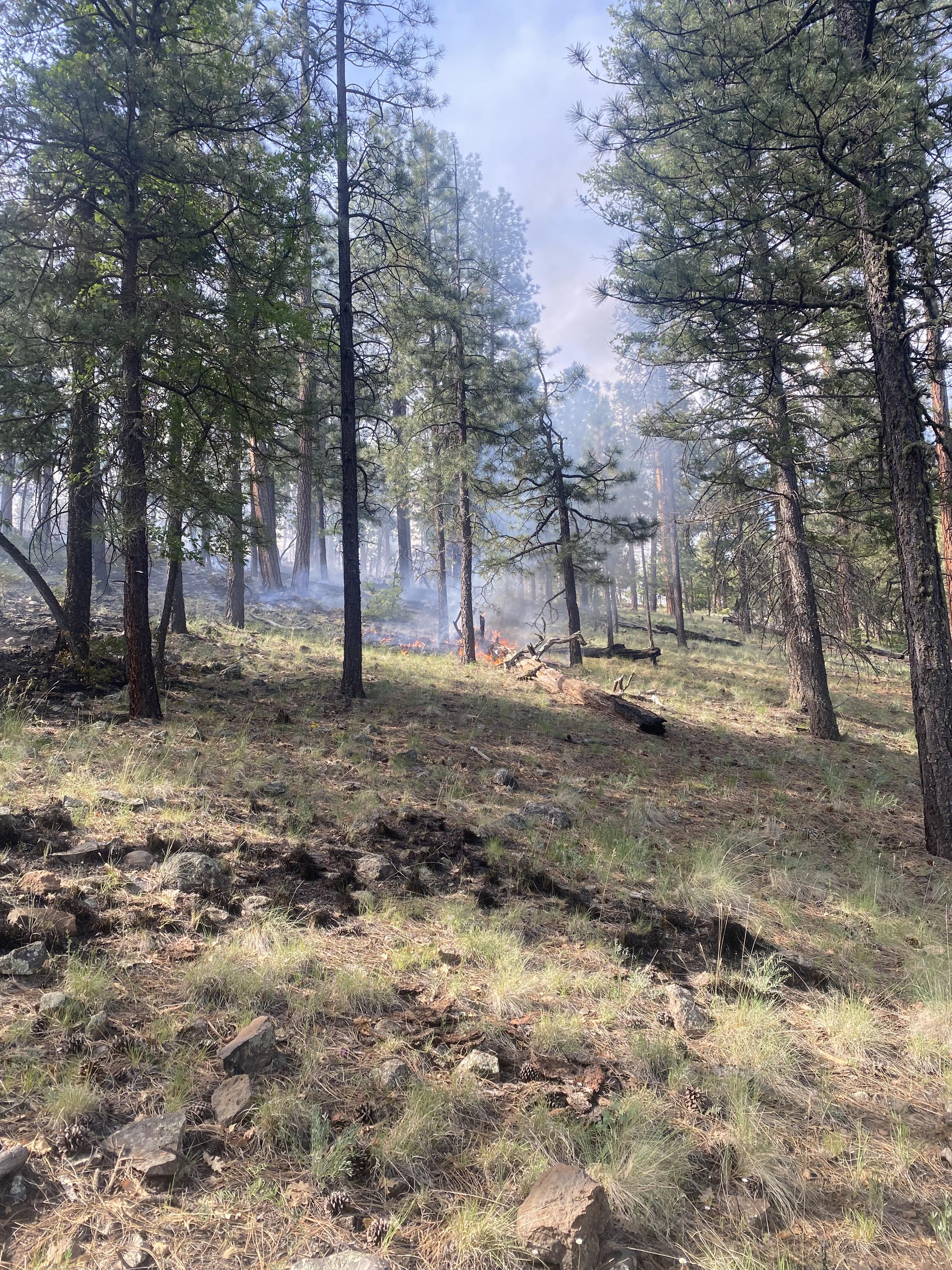
The lightning-caused Antone Fire is burning primarily in ponderosa pine and some mixed conifer forest, in terrain that is easily to moderately accessible in the San Antone Canyon area of the Quemado Ranger District. Given the location, fire and prescribed fire history, values at risk, and resources available, this fire is being managed with a confine and contain strategy. Direct and indirect suppression and point-protection tactics will be used to protect values at risk.
[Spanish translation]
El incendio de Antone, que fue provocado por un rayo, está ardiendo principalmente en bosques de pino ponderosa y algunos bosques mixtos de coníferas, en un terreno de fácil a moderadamente accesible ubicado en la zona de la barranca de San Antone Canyon del Distrito de Guardabosques de Quemado. Dada la ubicación, el historial de incendios y de quemas controladas (prescritos), lasi como los valores de la comunidad en riesgo y los recursos disponibles, este incendio se está manejando bajo una estrategia de confinamiento y contención. Se utilizarán tácticas de supresión directa e indirecta y de protección de puntos estratégicos para proteger los valores de la comunidad que se encuentran en riesgo
| Current as of | Thu, 06/20/2024 - 12:47 |
|---|---|
| Incident Time Zone | America/Denver |
| Incident Type | Wildfire |
| Cause | Lightning |
| Date of Origin | |
| Location | San Antone Canyon Forest Road 93/13, Slaughter Mesa, Mangas |
| Incident Commander | John DiGiando (IC) and Ty Oliver (IC Trainee) |
| Incident Description | Lightning-caused wildfire |
| Coordinates |
34° 01' 52'' Latitude
-108° 21' 29
'' Longitude
|
| Total Personnel: | 72 |
|---|---|
| Size | 12,396 Acres |
| Percent of Perimeter Contained | 91% |
| Fuels Involved | Ponderosa pine, short grass, heavy dead and down debris, mixed conifer, and pinon/juniper |
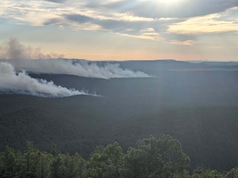
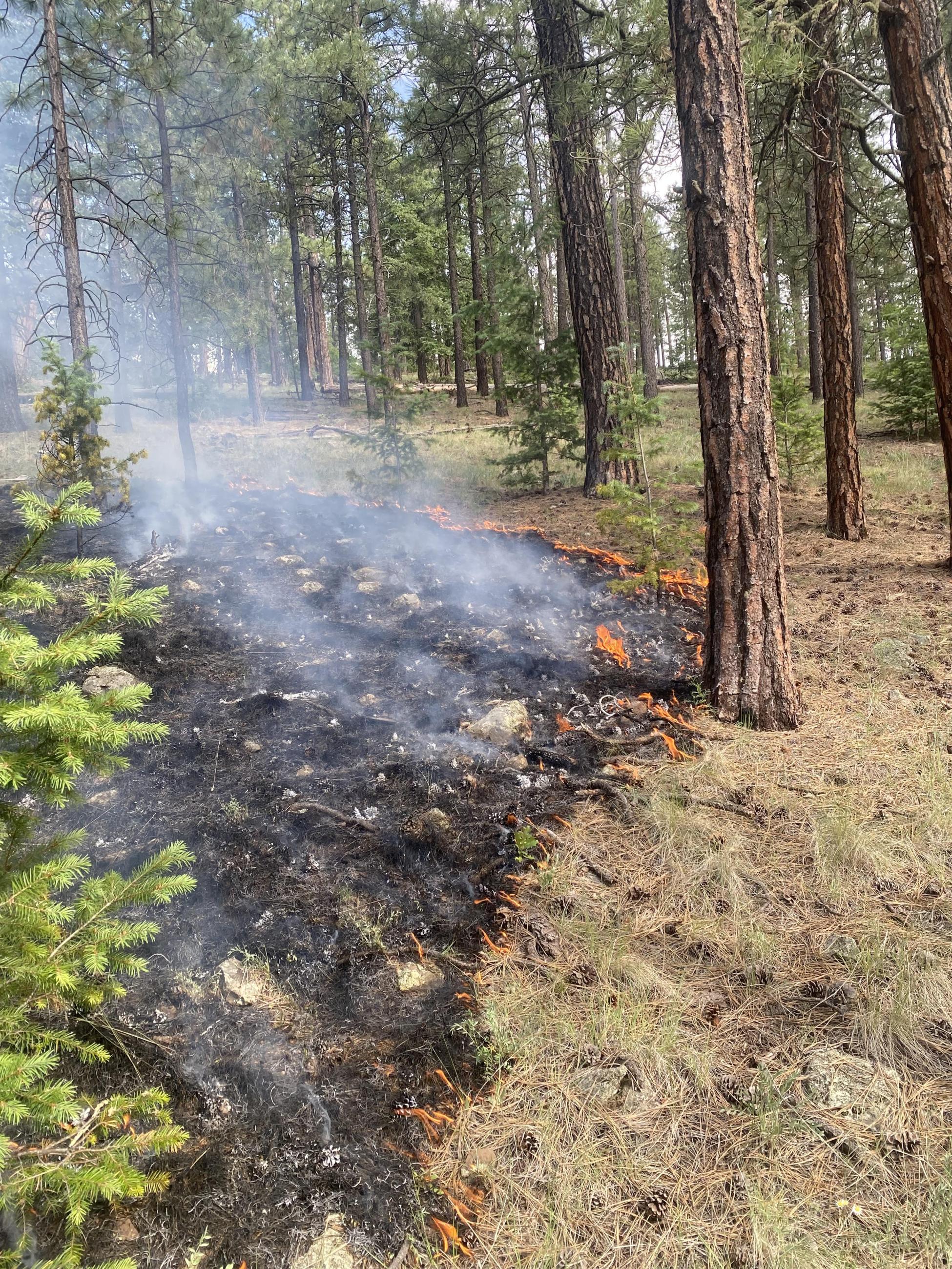
| Significant Events | Minimal fire behavior with some creeping and smoldering. The fire continues to move in the interior as unburned pockets ignite. |
| Planned Actions |
Holding CAT A095 Rd and monitoring as fires creeps south towards 13 RD to ensure fire stays west of CAT A095 and north of Forest Rd 13. |
|---|---|
| Projected Incident Activity |
Resources will hold and secure the perimeter of the fire. Interior will continue to spread as weather and terrain dictates. Fire behavior has moderated due to recent precipitation but may increase as winds align. |
| Weather Concerns | Extremely dry conditions will be observed over the area through Tuesday with single digit RH values. Winds will remain light with gusts up to 20-25 mph in the afternoons. |
|---|