
Firefighters are closely monitoring conditions for potential burn windows for this project. Please continue to check this page for the latest information.
________________________
General Information about the Project:
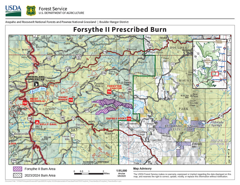
The Forsythe II Project is part of the Forest Service’s on-going effort to improve forest health conditions on the Boulder Ranger District. The project area is located near Gross Reservoir and Winiger Ridge in Boulder County, Colo. The entire project area encompasses 18,954 acres; 9,940 of those acres are National Forest System lands, 1,892 acres are Boulder County Parks and Open Space lands, and 7,122 acres are private lands. Elevation ranges from 6,082 to 8,945 feet. The project is generally located east of Nederland, CO and west of Gross Reservoir.
The broadcast burn units from the Forsythe II Decision are located 7 miles southwest of Boulder and 5.5 miles east of Nederland, totalling 931 acres. Forest thinning and pile burning treatments for areas near the planned prescribed burn area are mostly complete. The area has two main burn units that are subdivided into multiple sub-units that vary in size from 18 acres to 130 acres and provides a variety of options for control using existing roads, water, natural features and control lines. Current project plans allow for treatment of up to 340 acres per year. These prescribed burning treatments will be implemented over several years, with the amount treated per year dependent on weather, ground conditions, fuel receptiveness, and available resources.
All burning will be implemented in close coordination and with assistance from local cooperating agencies and partners, state and county public health agencies, and multiple local agency fire cooperators.
Smoke will be in the air, and fire managers work closely with experts to minimize the impacts to the extent possible. Air quality is carefully monitored before and during a prescribed fire and all prescribed burns comply with state air quality regulations to minimize impacts to communities. To learn more about the potential health impacts of smoke visit www.colorado.gov/pacific/cdphe/wood-smoke-and-health.
To receive updates, join our email list and select list "Forest Health & Fire: North of Hwy 72 (Coal Creek Canyon) to Hwy 119 Boulder Canyon (Nederland and Magnolia areas)". Have questions? Email ARPFireInfo@usda.gov.

| Current as of | Fri, 04/04/2025 - 14:24 |
|---|---|
| Incident Type | Prescribed Fire |
| Coordinates |
39° 57' 0'' Latitude
-105° 22' 5
'' Longitude
|