
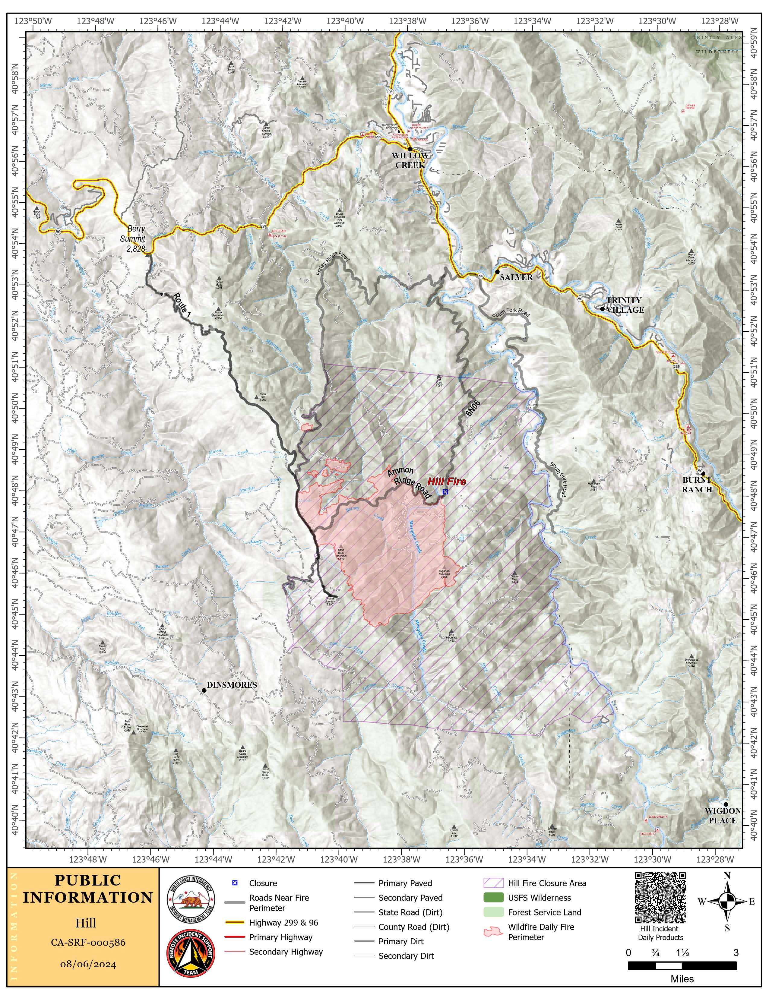
The Hill Fire started July 15, 2024, and is located 11 miles south of Willow Creek in the Mosquito Creek Drainage. The fire is burning in steep, inaccessible terrain, with heavy timber and dry vegetation. All evacuation orders and warnings have been lifted.
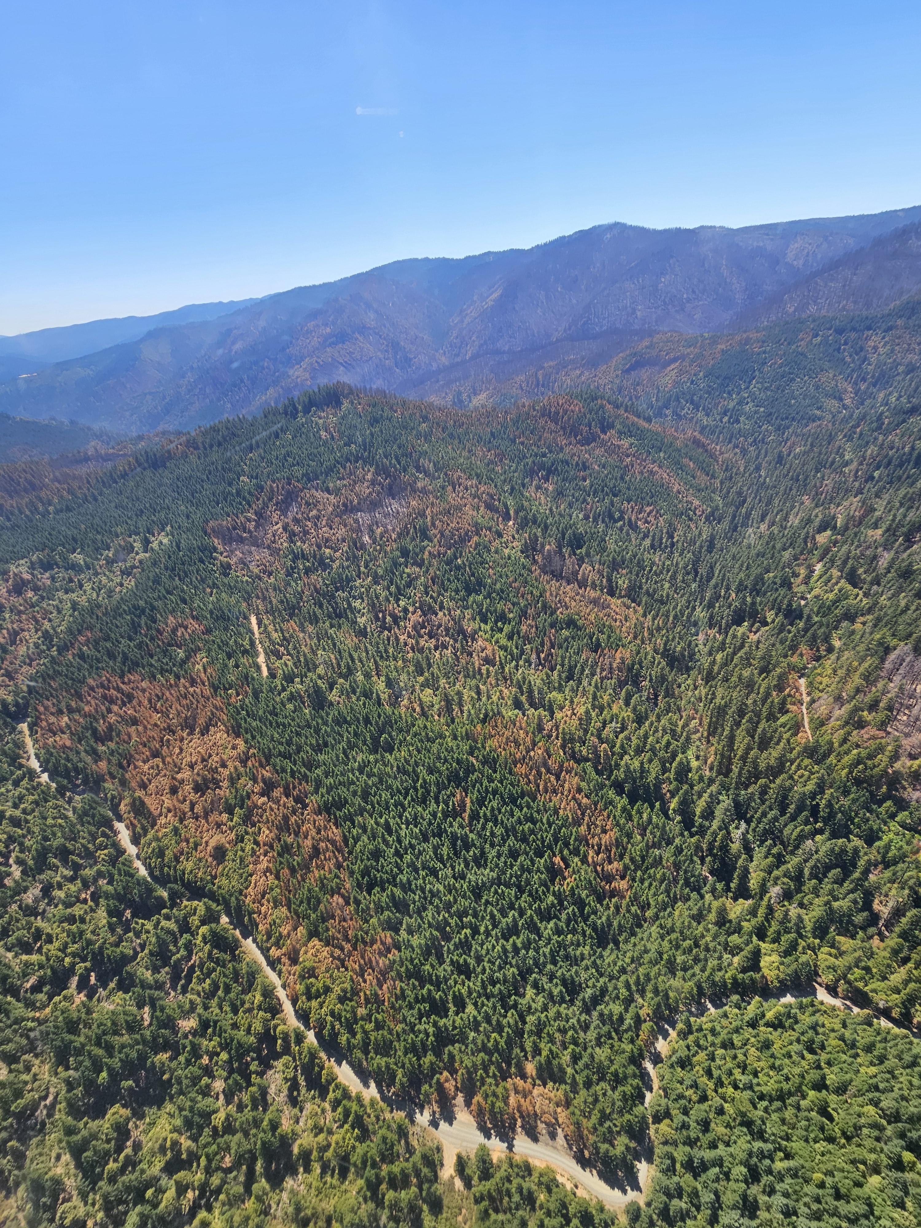
Fire behavior has moderated and primarily is driven by weather conditions with mixed hardwood-conifer timber at lower elevations. Upper elevations are dominated by light brush and litter under a conifer overstory. The northern edge of the fire has burned into the footprint of 2022’s Ammon Fire where reduced fuel loads have led to reduced fire activity.
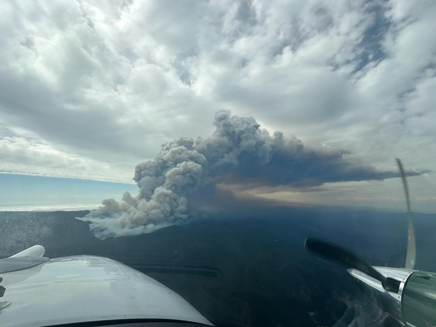
Early on, the fire grew rapidly and prompted evacuations as well as the use of significant air resources. Because the fire is burning on both state and federal lands, two incident management teams were called in to share in suppression efforts, one federal team and one CAL FIRE team. As of 8/15/2024, Hill Fire is 100% contained and now managed by local staff from the Lower Trinity Ranger District.
The Hill Fire started July 15, 2024, and is located 11 miles south of Willow Creek in the Mosquito Creek Drainage. The fire is burning in steep, inaccessible terrain, with heavy timber and dry vegetation. All evacuation orders and warnings have been lifted.
Fire behavior has moderated and primarily is driven by weather conditions with mixed hardwood-conifer timber at lower elevations. Upper elevations are dominated by light brush and litter under a conifer overstory. The northern edge of the fire has burned into the footprint of 2022’s Ammon Fire where reduced fuel loads have led to reduced fire activity.
Early on, the fire grew rapidly and prompted evacuations as well as the use of significant air resources. Because the fire is burning on both state and federal lands, two incident management teams were called in to share in suppression efforts, one federal team and one CAL FIRE team. As of 8/15/2024, Hill Fire is 100% contained and now managed by local staff from the Lower Trinity Ranger District.
| Current as of | Thu, 08/15/2024 - 15:39 |
|---|---|
| Incident Time Zone | America/Los_Angeles |
| Incident Type | Wildfire |
| Cause | Undetermined |
| Date of Origin | |
| Location | Humboldt County, CA. Approx. 8 miles south of Willow Creek |
| Coordinates |
40° 46' 19.779'' Latitude
-123° 38' 23.1
'' Longitude
|
| Total Personnel: | 154 |
|---|---|
| Size | 7,224 Acres |
| Percent of Perimeter Contained | 100% |
| Estimated Containment Date | 08/15/2024 |
| Fuels Involved | The primary carrier of fire at lower elevations is timber under-story in mixed hardwood-conifer stands. The mid and lower elevation surface fuels contain pockets of substantial hardwood dead and down component resulting from previous winter snow and ice events. Upper elevations are a timber under-story dominated by moderate brush & conifer reproductions with conifer litter beneath conifer overstory. The eastern portion of the fire entered a 2008 fire footprint (Hell's Half Fire) that burned at mixed low to moderate severity in most places. The fuels in this area are composed of a heavy amount of large dead and down logs with dense brush and tree reproduction, including ceanothus species, madrone and conifers. |
| Significant Events | Minimal fire activity. Smoldering, creeping and backing. |
| Planned Actions |
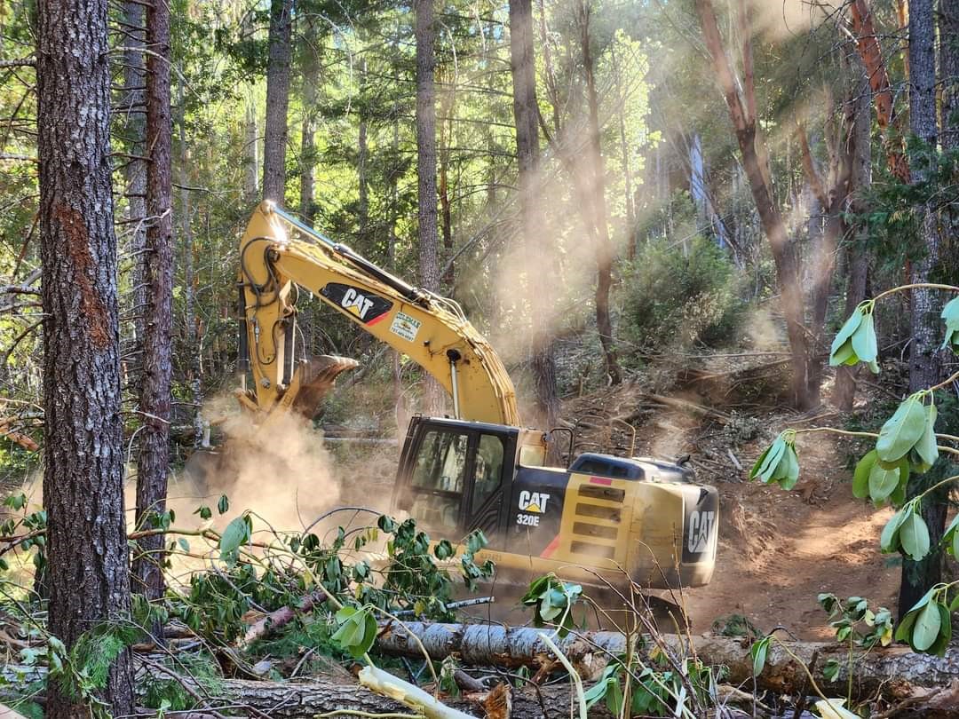
- Mop up and eliminate heat near control lines to fortify the perimeter and strengthen containment, mitigating the risk of hot spots challenging the control lines. - Back haul excess supplies and equipment. - Identify and mitigate hazard trees in the operational area. - Coordinate with the Lead Resource Advisor to identify areas for repair, in accordance with the suppression repair plan. |
|---|---|
| Projected Incident Activity |
Fire expected to remain within current footprint. Only activity is continued interior consumption of heavy dead and down material and some isolated consumption in areas where surface fuels remain well interior of the containment line. |