
Highlighted Media
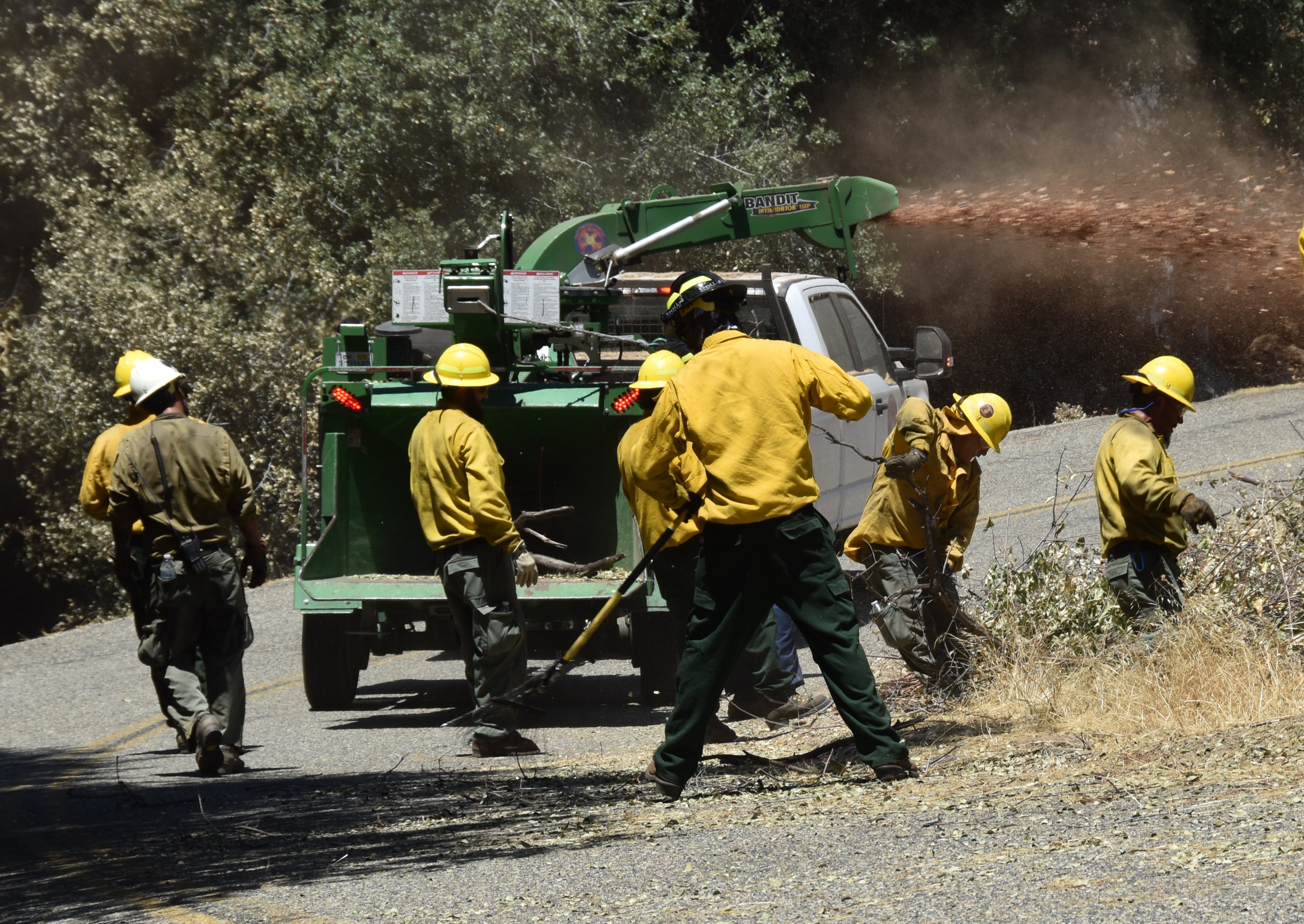
Chipping Brush along the highway. Photo Credit Nicholas Arnett
On June 24th, 2024 the High Sierra Ranger District of the Sierra National Forest, was in the path of a lightning storm that created 18 fires. An additional fire, and by far the largest, is the Basin Fire which was detected, June 26th, 2024. The fire traveled in a northeast direction toward Black Rock at a rapid rate.
Air resources from the surrounding 18 fires on the High Sierra Ranger District were reassigned to the Basin Fire. Aircraft was utilized to slow the rate of spread. The cause of the Basin Fire is currently under investigation.
Over a hundred firefighters responded to the Basin Fire. Hot Shots, hand crews, dozers, and engines focused on point protection for structures in the Balch Camp area. Resource orders were placed to mobilize more forces, to not only focus on the initial attack of the Basin Fire, but to also continue suppressing the 18 other fires that are on the district.
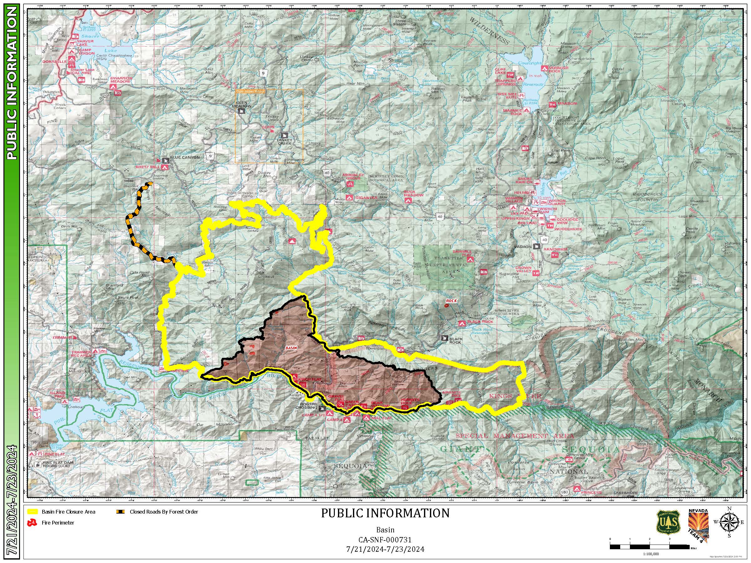
The fire is at 2000-4500 feet elevation, northeast of Pine Flat Lake, west of the Spanish Mountain, south of Black Rock Rd (11S012) and north of the South Fork of the Kings River.
| Current as of | Mon, 07/22/2024 - 16:10 |
|---|---|
| Incident Time Zone | America/Los_Angeles |
| Incident Type | Wildfire |
| Cause | Undetermined |
| Date of Origin | |
| Location | 46 miles East of Sanger, CA, near Balch Camp (PG&E Hydro-electric Camp/Community) |
| Incident Commander | Milam NV Team 4 ICT3 |
| Incident Description | The Basin Wildfire is burning in grass, chapparal and oak timber. It is also burning in steep terrain. |
| Coordinates |
36° 51' 52'' Latitude
-119° 6' 9
'' Longitude
|
| Total Personnel: | 90 |
|---|---|
| Size | 14,023 Acres |
| Percent of Perimeter Contained | 100% |
| Estimated Containment Date | 07/31/2024 |
| Fuels Involved | Tall Grass, Chaparral, Hardwood Litter |
| Significant Events | Minimal, Creeping, Smoldering |
| Planned Actions |
Suppression repair efforts will continue throughout the fire area until completed. Firefighters are using heavy equipment and hand tools to return fire areas to as natural a state as practical. |
|---|---|
| Projected Incident Activity |
With 100% fire containment and full firefighter focus on suppression repair within the fire area, we expect this to be the last Basin Fire update. |