
The York Fire began on July 28th in the New York Mountain Range of the Mojave National Preserve located in eastern San Bernardino County, CA. As of 8/16/2023 the acreage is 93,078 acres with 9,127 acres located in Clark County, Nevada.
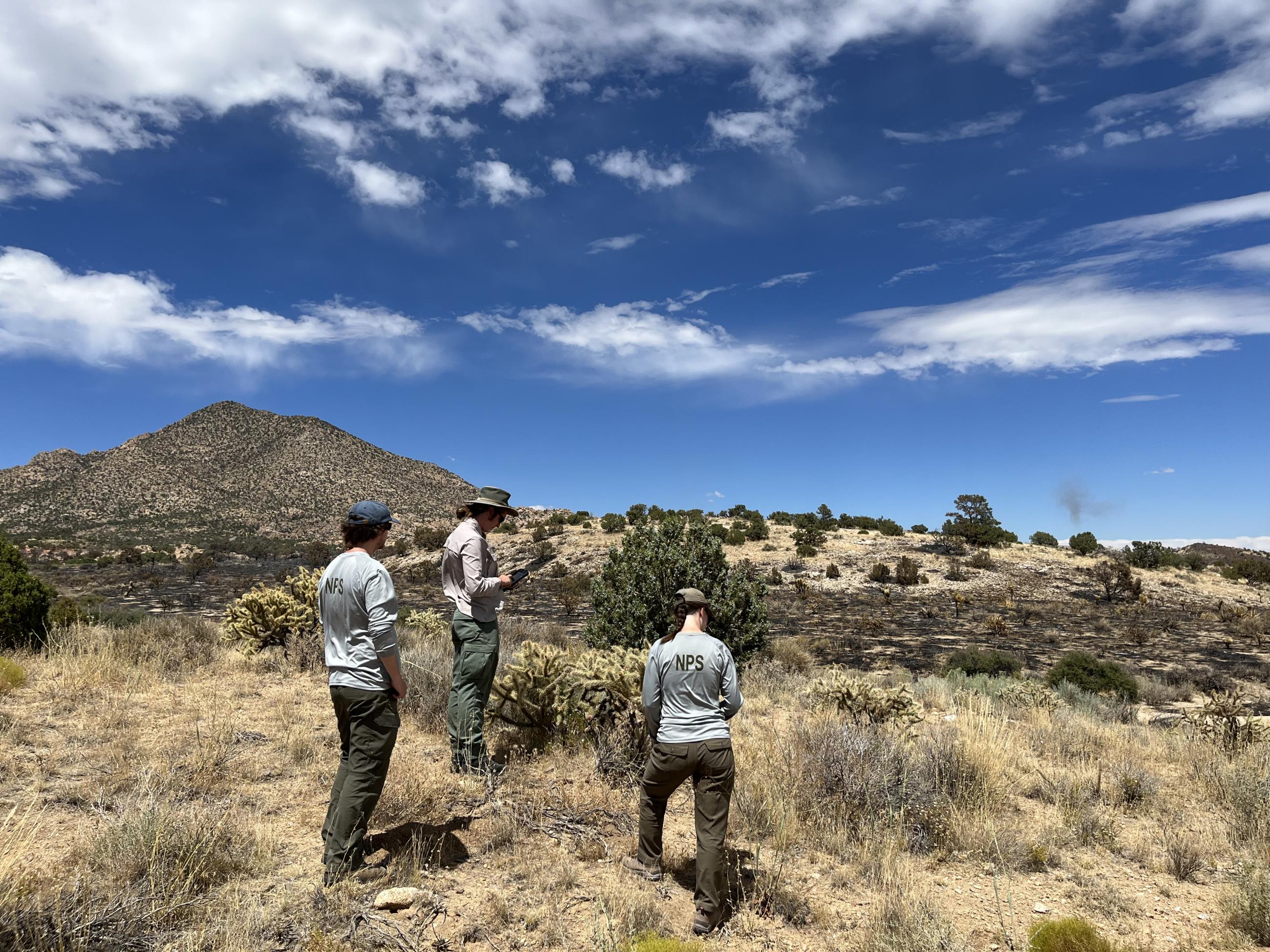
A Burned Area Emergency Response (BAER) team is in the process of assessing the impacts of the York Fire on natural resources, cultural resources, and infrastructure. This team is composed of scientists and resource specialists including hydrologists, vegetation ecologists, and GIS technicians. These specialists are working closely with BLM and NPS land managers to create a plan to address the fire's impacts over the coming weeks and months. The BAER team is expected to complete their planning work by Monday 8/21/23.
For continued updates on the York Fire incident response, please visit the incident webpage: Camnp 2023 York Fire Information | InciWeb (wildfire.gov)
The York Fire began on July 28th in the New York Mountain Range of the Mojave National Preserve located in eastern San Bernardino County, CA. As of 8/16/2023 the acreage is 93,078 acres with 9,127 acres located in Clark County, Nevada.
A Burned Area Emergency Response (BAER) team is in the process of assessing the impacts of the York Fire on natural resources, cultural resources, and infrastructure. This team is composed of scientists and resource specialists including hydrologists, vegetation ecologists, and GIS technicians. These specialists are working closely with BLM and NPS land managers to create a plan to address the fire's impacts over the coming weeks and months. The BAER team is expected to complete their planning work by Monday 8/21/23.
For continued updates on the York Fire incident response, please visit the incident webpage: Camnp 2023 York Fire Information | InciWeb (wildfire.gov)
| Current as of | Mon, 09/04/2023 - 11:39 |
|---|---|
| Incident Type | Burned Area Emergency Response |
| Date of Origin | |
| Location | New York Mountains, San Bernardino County (CA), and Clark County (NV) |
| Incident Commander | Burned Area Emergency Response Lead: Chris Holbeck (NPS) |
| Incident Description | Burned Area Emergency Response (BAER) |
| Coordinates |
35° 12' 30.8'' Latitude
-115° 15' 2.6
'' Longitude
|
| Total Personnel: | 8 |
|---|---|
| Size | 93,078 Acres |
| Fuels Involved |
|
| Significant Events | A Burned Area Emergency Response (BAER) team is in the process of assessing the impacts of the York Fire on natural resources, cultural resources, and infrastructure. This team is composed of scientists and resource specialists including hydrologists, vegetation ecologists, and GIS technicians. These specialists are working closely with BLM and NPS land managers to create a plan to address the fire's impacts over the coming weeks and months. The BAER team is expected to complete their planning work by Monday 8/21/23. |
| Planned Actions |
BAER has finalized the field assessment. They are in the planning process with associated agencies, including National Park Service and Bureau of Land Management. |
|---|
| Weather Concerns | Sunny skies with hot and dry conditions are expected to continue in the fire area. Relative humidities at the Ox Ranch and Mid Hills RAWS sites have fallen into the 5-10% range with highs topping out in the lower to middle 90's. South-southwest winds will continue to be gusty this afternoon before diminishing this evening. Rainstorms from Hurricane Hilary are expected to move into the area the weekend of 8/18/23. Flash flooding within the fire area is possible through Tuesday 8/22. |
|---|