
Quick Links: Fire Map | Mojave National Preserve Road Map | Videos
Facebook: Mojave National Preserve | Bureau of Land Managment - Nevada
Twitter: Mojave National Preserve | Bureau of Land Management - Nevada
Burned Area Emergency Response: 2023 York Fire BAER
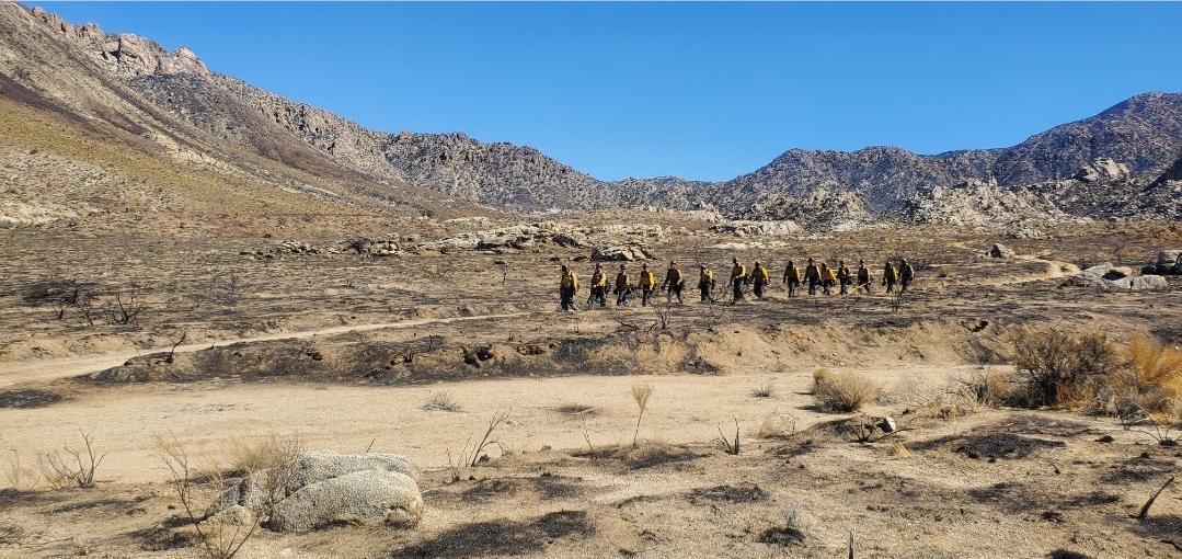
The York Fire began on July 28th in the New York Mountain Range of the Mojave National Preserve located in eastern San Bernardino County. As of 8/19/2023 the estimated acreage is 93,078 acres with 9,127 acres located in Clark County, Nevada. The fire is 100% contained.
Burned area emergency response (BAER) has begun - find more information at the BAER page
Due to Hurricane Hilary, all roads in Mojave National Preserve are closed until further notice. Fire-related closures will remain in effect when the site reopens.
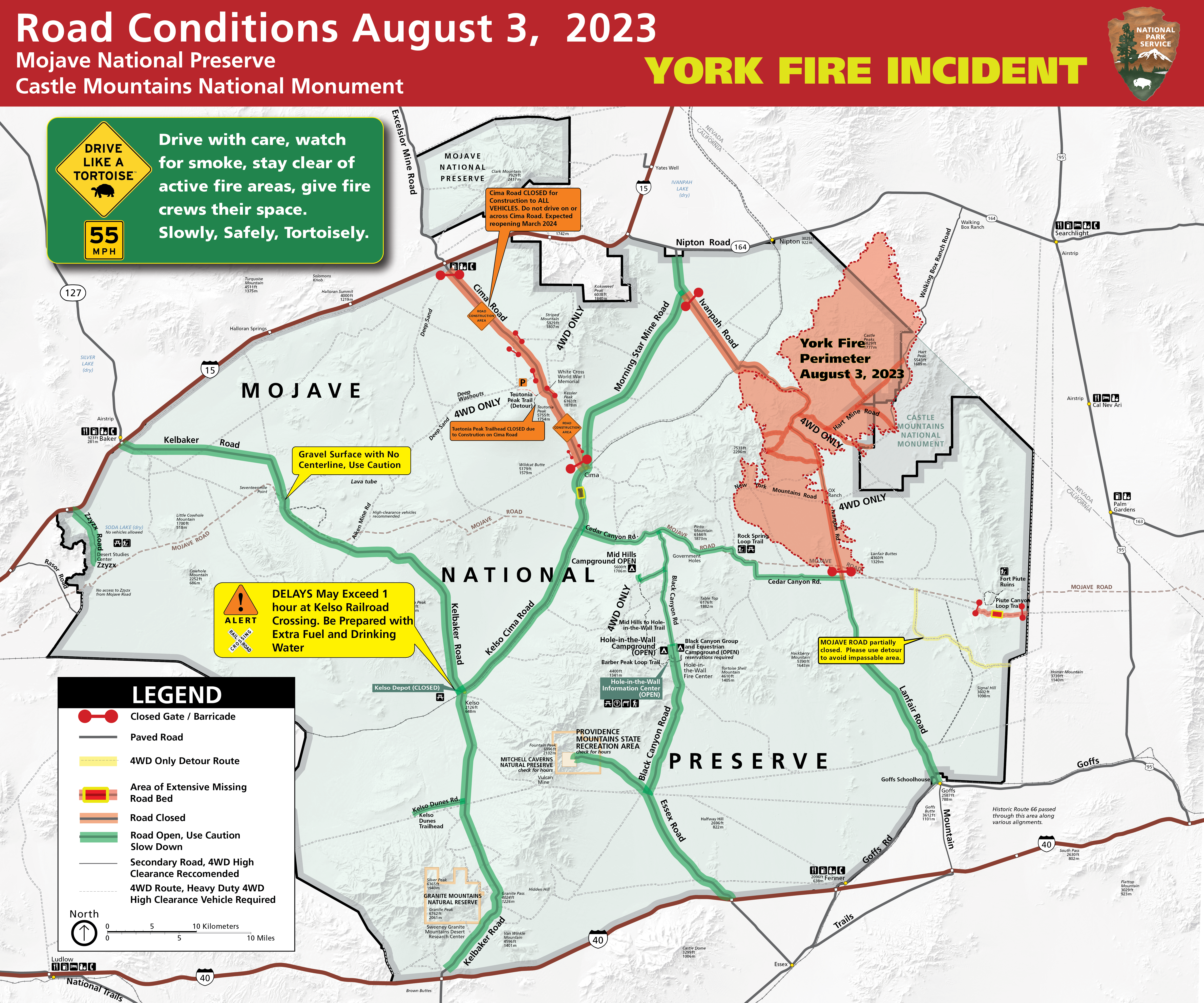
Road and Area Closures: Ivanpah Rd. between Morning Star Mine Rd and Cedar Canyon Rd., as well as all of Hart Mine Rd. are closed due to hazardous wildfire conditions and fire suppression operations. Mojave National Preserve is also under Extreme Fire Restrictions, please visit their website for more information on restrictions and closures: Alerts & Conditions - Mojave National Preserve . Please visit Road Conditions - Mojave National Preserve to view a detailed map of current park closures.
Fire History within Mojave National Preserve: A combination of a wet winter combined with increasing levels of invasive grasses and mustards expanding across the Mojave and Colorado Deserts, the Mojave National Preserve is seeing an increase in fire frequency over the past decade. This is a departure from historic norms, as Joshua Trees and other desert-adapted plants have limited natural defenses or propagation techniques when fires occur around them.
Dome Fire: In August of 2020, the 43,230-acre Dome Fire burned through a portion of the Joshua Tree Woodland near the Cima Dome. Read an article about the Dome Fire, and its effects on the plants and animals found in the Mojave National Preserve.
Quick Links: Fire Map | Mojave National Preserve Road Map | Videos
Facebook: Mojave National Preserve | Bureau of Land Managment - Nevada
Twitter: Mojave National Preserve | Bureau of Land Management - Nevada
Burned Area Emergency Response: 2023 York Fire BAER
The York Fire began on July 28th in the New York Mountain Range of the Mojave National Preserve located in eastern San Bernardino County. As of 8/19/2023 the estimated acreage is 93,078 acres with 9,127 acres located in Clark County, Nevada. The fire is 100% contained.
Burned area emergency response (BAER) has begun - find more information at the BAER page
Due to Hurricane Hilary, all roads in Mojave National Preserve are closed until further notice. Fire-related closures will remain in effect when the site reopens.
Road and Area Closures: Ivanpah Rd. between Morning Star Mine Rd and Cedar Canyon Rd., as well as all of Hart Mine Rd. are closed due to hazardous wildfire conditions and fire suppression operations. Mojave National Preserve is also under Extreme Fire Restrictions, please visit their website for more information on restrictions and closures: Alerts & Conditions - Mojave National Preserve . Please visit Road Conditions - Mojave National Preserve to view a detailed map of current park closures.
Fire History within Mojave National Preserve: A combination of a wet winter combined with increasing levels of invasive grasses and mustards expanding across the Mojave and Colorado Deserts, the Mojave National Preserve is seeing an increase in fire frequency over the past decade. This is a departure from historic norms, as Joshua Trees and other desert-adapted plants have limited natural defenses or propagation techniques when fires occur around them.
Dome Fire: In August of 2020, the 43,230-acre Dome Fire burned through a portion of the Joshua Tree Woodland near the Cima Dome. Read an article about the Dome Fire, and its effects on the plants and animals found in the Mojave National Preserve.
| Current as of | Sun, 08/27/2023 - 11:48 |
|---|---|
| Incident Type | Wildfire |
| Cause | Undetermined |
| Date of Origin | |
| Location | New York Mountains, San Bernardino County (CA), and Clark County (NV). |
| Incident Commander | Local type 4 incident management group IC Jacob Lemus (BLM) |
| Incident Description | Wildfire |
| Coordinates |
35° 11' 30.8'' Latitude
-115° 19' 2.6
'' Longitude
|
| Total Personnel: | 0 |
|---|---|
| Size | 93,078 Acres |
| Percent of Perimeter Contained | 100% |
| Estimated Containment Date | 8/19/2023 |
| Fuels Involved | Brush (2 feet) Timber (Litter and Understory) Tall Grass (2.5 feet)
|
| Planned Actions |
This incident is in the burned area emergency response (BAER) phase - find more information at the BAER page |
|---|