
Oak Ridge Fire update 06 29 2024
Related Incident: Oak Ridge Fire
Publication Type: News
Location: Three miles northwest of Beulah, CO
Date Reported: June 22, 2024
Cause: Lightning
Size: 1,156 acres
Containment: 0
Total Personnel: 467
Most of the area north, west, and south of the fire is in country that is steep and rugged and increases the time it takes for firefighters to get to safety in the event of increased fire behavior or an accident. The next line of defense is constructing indirect fireline, incorporating natural features such as meadows and rocky areas as well as other existing containment features including trails and roads, that will box in the fire and provide opportunities to conduct burnout operations to reduce fuel loads with the highest probability of success. Records show there hasn’t been any fire inside and outside the current fire perimeter for over 100 years. This has allowed the area between the Junkens Fire burn scar to the north and the Mason Gulch Fire burn scar to the south to become overgrown and dense. If fuels aren’t reduced, it’s not a matter of if fire will occur, it’s a matter of when. Reducing the fuels will provide a higher rate of success of keeping wildland fire away from Beulah and other surrounding communities.
Current Situation
Firefighters worked on reinforcing existing fireline that follows along the curvature of the east fire perimeter in Division K and Division A by extinguishing hot spots along the fireline. This created a buffer between the fire and the town of Beulah. They will continue to monitor the fireline and mop up any hot spots. Firefighters are now positioned to transition from a direct or reactive approach to a proactive approach as they continue building indirect lines to box in the fire.
Fire Crews are working on indirect firelines south of Beulah in Division K tying into a two-track road on private land and building handline south to Soldier Park and Second Mace Trails. On the west side of the fire in Division U, heavy equipment began constructing fireline along a ridgeline off Silver Circle Trail. The objective is to box in the fire and utilize the lighter fuels in the Junkens Fire perimeter to contain the fire.
Structure protection crews will continue scouting to locate and assess structures east of the fire and along the Hwy 78 corridor and the Hwy 165 corridor west of the fire.
Weather & Smoke Information: Morning temperatures will be cooler with light winds from the east and southeast. Isolated thunderstorms will develop over the fire around 3:00 p.m. bringing the potential for lightning, brief downpours, hail and wind gusts up to 60 mph.
The U.S. Interagency Wildland Fire Air Quality Response Program is now producing a daily smoke outlook report specific to south central Colorado and the Oak Ridge Fire. You can read and download the outlook by going to https://outlooks.airfire.org/outlook/d9fa3c77.
Closures: The Middle Creek Road is closed. The San Carlos Ranger District of the Pike and San Isabel National Forests issued an area, trail and road closure effective June 26, 2024. Go to www.fs.usda.gov/alerts/psicc/alerts-notices to read and download the entire order.
Evacuations: Homes along the Middle Creek Canyon Road are under a mandatory evacuation. The following are in a pre-evacuation status: Vine Mesa, Cascade Ave., Pine Ave., and Beulah Highlands Rd. Go to www.puebloemergency.info for all evacuation information.
Temporary Flight Restrictions: There is a Temporary Flight Restriction (TFR) over the fire area. If you FLY, we CAN’T. Do not fly or operate your own drones in this area, as it will impede firefighting efforts and ground our aircraft.
OAK RIDGE FIRE INFORMATION
Fire Information Phoneline: 719-315-1536 Time: 7:00 a.m. to 7:00 p.m.
Facebook: @OakRidgeFire2024 Email: 2024.oakridge@firenet.gov
InciWeb: www.inciweb.wildfire.gov/incident-information/copsf-oak-ridge-fire
Park Ridge Prescribed Fire Morning Update 06 29 2024
Related Incident: 2024 Park Ridge & Big Stump East Prescribed Burn
Publication Type: News
6-29-24 Morning Update - Sequoia & Kings Canyon National Park is transitioning the Park Ridge Prescribed Burn to patrol status for ongoing monitoring. This proactive measure allows firefighters to swiftly address any potential hot spots or flare-ups, maintaining effective control over the fire.
Just a reminder to visitors and residents they may still see smoke in the internal footprint of a fire, it typically means that there are still burning or smoldering materials within the burned area. Even after the flames have been extinguished or controlled, certain fuels such as logs, roots, or thick vegetation may continue to smolder. This can produce smoke that rises from the ground or drifts up intermittently.
This transition signifies a significant milestone in the burn's management, showcasing the professionalism and expertise of the firefighting team. Continuous monitoring of the area not only ensures environmental safety but also reassures the local community that the situation remains under control.
Visibility in the area is low. Please drive carefully with your headlights on and be mindful of firefighters working nearby.
There will be no more updates on this prescribed burn.
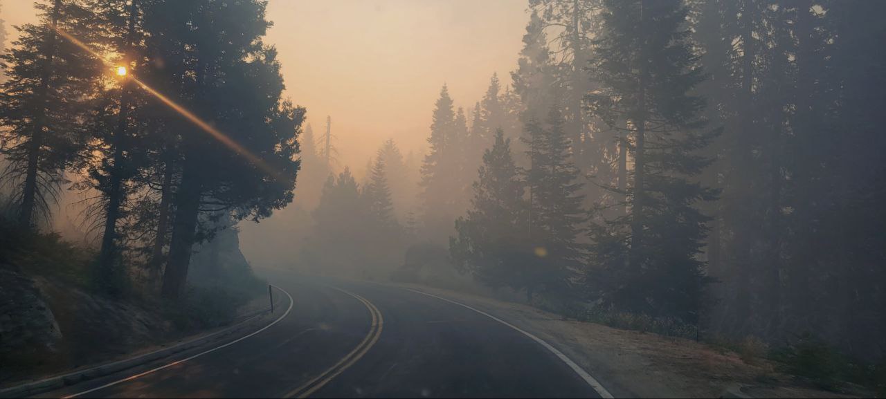
Highway 180 has low visibility from the entrance to Grant Grove Village. Please drive careful.
Update Boulder View Fire 06 29 2024
Related Incident: Boulder View Fire
Publication Type: News
Highlights: The Central West Zone Type 3 Incident Management Team assumed command of the Boulder View Fire from Arizona Department of Forestry and Fire Management and the Tonto National Forest at 6 p.m. Friday.
Summary: Yesterday, the Boulder View Fire was active throughout the day. Firefighters made progress on the north end of the fire that spread across Bartlett Lake Road. Handcrews and engines worked to stop fire spread in that area. The western perimeter of the fire largely follows the north-south Powerline Road and crews made improvements to use the road as a holding feature. The eastern side of the fire burned into the Wildcat Fire burn area. Vegetation is regrowing in the Wildcat Fire area which could contribute to reburn in that area. Fire crews are working to suppress the southwest corner of the fire area utilizing engines and UTVs. Airtankers and helicopters were used along the south edge of the fire to improve a two-track road for use as a holding feature. In the early morning hours of Friday, 60 residences north of Dove Valley Road and east of 136th St were put into GO, evacuate status. Firefighters proactively burned vegetation around these houses to protect them from approaching flames. Air resources and ground crews worked together throughout the day Friday on the southeast edge of the fire which had the most fire activity. Crews continued working in that area overnight and this morning, improving retardant lines.
Today, crews will focus on improving firelines and continue structure protection efforts. Crews will especially focus on the southeast part of the fire due to residences at risk and wind direction.
Bartlett Lake recreation areas are inaccessible due to Maricopa County Sheriff’s Office closing Bartlett Dam Road at Cave Creek Road. There is no entry for recreation currently. To get the most up-to-date information and news about the Tonto, follow them on X @TontoForest and Facebook @TontoNationalForest.
Weather: Yesterday, the high temperature over the fire area was 100 degrees, with unseasonably high humidity of 26-31%. Wind gusts were 15-20 mph. Even with high humidity, fire activity was moderate to extreme.
Safety: The health and safety of firefighters and the public are always the highest priority. Please avoid the area while crews conduct fire suppression operations. The public is urged to sign up for the Maricopa County Emergency Notification System. The system allows you to be quickly notified of emergency evacuations. To learn more about the Arizona Emergency Information Network visit: https://ein.az.gov/ready-set-go. Firefighting aircraft and drones are a dangerous combination. Drones in the area could lead to accidents or slow down wildfire suppression operations. If you fly…we can’t.
Start Date: Thursday, June 27, 2024
Cause: Human, Under investigation
Location: 5 miles east of Carefree
Acres: 3,736 – Containment: 0%
Personnel Assigned: 242
Evacuation: GO/SET for residences southeast of the fire
Incident Information: https://inciweb.wildfire.gov/incident-information/aza4s-boulder-view-fire
Twitter: @azstateforestry: https://twitter.com/azstateforestry
Facebook: Arizona Department of Forestry and Fire Management: https://www.facebook.com/arizonaforestry
Media/Public Phone: 480-581-1094
Ready, Set, Go: https://ein.az.gov/ready-set-go
South Fork and Salt Fires Update 06 29 2024
Related Incident: South Fork and Salt
Publication Type: News
Southwest Area
Incident Management Team
TEAM 5 – Mark Bernal– INCIDENT COMMANDER
All zones now open to residents; Crews remain vigilant in detecting hot spots
Daily Update, Saturday, June 29, 2024
Mescalero Apache Tribe Emergency Operations Center: 575-464-9214 (8am-12am)
Village of Ruidoso and Lincoln County Emergency Operations Center: 575-258-6900 (7am-10pm)
Fire Information Phone: 575-323-8378 or 575-323-8258 (8am-8pm)
Media Information Phone: 575-323-8053 (8am-8pm)
Email: 2024.southfork@firenet.gov
Acres: South Fork – 17,569; Salt – 7,939
Start Date: June 17, 2024
Location: South Fork – Ruidoso Area, Salt – 7 mile west of Mescalero, NM
Personnel: 780
Containment: South Fork – 77%; Salt – 77%
Fuels: mixed conifer, grass, pine/juniper
Resources: The South Fork and Salt fires are currently staffed with 18 crews, 4 helicopters, 31 engines,
4 bulldozers, and 10 water tenders.
Highlights: As of today, Saturday June 29, the South Fork and Salt fires burned roughly 25,000 acres across private, public, and tribal lands.
Mescalero Apache Reservation evacuation and donation sites: Evacuation sites on the Mescalero Apache Reservation are now closed. Donations will be taken and distributed to tribal members in need at the Inn of the Mountain Gods’ convention center from 9 AM – 4 PM daily.
FEMA is located outside the Mescalero Community Center from 8 AM – 6:30 PM (until further notice). They are assisting the public with general government assistance (unemployment, EBT, etc.).
Village of Ruidoso reentry: All No Entry/Exclusion zones are now open. There are still firefighters, firefighting equipment, utility company workers and vehicles travelling through the area. Their work is critical to restore utilities and services, and conditions in the exclusion zones pose a safety risk to the emergency personnel as well as the public. Please be patient and allow them to complete their work. Contact the Village of Ruidoso and Lincoln County Emergency Operations Centers for more information.
Fire Activity: Friday’s clear skies, warmer temperatures, and decreased humidity created an environment favorable for the remaining isolated heat sources to dry out and increase combustion rates, making them easier to detect and extinguish. Additionally, thanks to infrared detection, ten remaining hot spots were identified and are a primary focus for firefighters this weekend. Crews will also conduct suppression repair, including chipping operations near Villa Madonna and repairing dozer lines where needed.
Weather: The South Fork and Salt fires experienced a brief drying trend as scattered showers moved away from the area Thursday through Friday. Saturday brings with it warmer temperatures and increased potential for scattered afternoon rains.
Smoke: Smoke will continue to have the biggest impact during the late overnight and morning hours for areas near the fires. Additional details are available at https://outlooks.wildlandfiresmoke.net/outlook/430b2c05.
Closures: A South Fork Fire Emergency Closure Order was issued on June 20, 2024, for national forest lands within the Smokey Bear Ranger District. The identified areas, and roads and trails therein, are closed to public access to allow firefighting personnel to work and through the fire area safely. More information is available at www.fs.usda.gov/alerts/lincoln/alerts-notices/?aid=88199.
The Mescalero Apache Tribe issued a Class V/Stage II – Extreme Fire Restriction Notice on June 28, 2024. More information is available at https://mescaleroapachetribe.com.
A Temporary Flight Restriction (TFR) is in place over the fire area. Public/commercial drone flights are also prohibited within this area. If you fly, we may have to ground our air resources. Visit https://tfr.faa.gov/tfr2/list.html for more information.
More information:
Inciweb: https://inciweb.wildfire.gov/incident-information/nmmea-south-fork-and-salt
Facebook: https://www.facebook.com/SWIMT5
Smoke Outlook: https://outlooks.wildlandfiresmoke.net/outlook/430b2c05
Lincoln County Government: www.lincolncountynm.gov
Mescalero Apache Tribe: https://mescaleroapachetribe.com
Village of Ruidoso: www.ruidoso-nm.gov/south-fork-fire
Evening Update for the Basin Fire June 28 2024 06 29 2024
Related Incident: Basin Fire
Publication Type: News
People and Equipment: 430 personnel, crews, dozers, with 9 helicopters and 1 airplane
Current Situation:
The Basin Fire is 7,462 acres with 0% containment. The fire started on Wednesday, June 26th and the cause is currently under investigation. It is on the High Sierra Ranger District of the Sierra National Forest. It is northeast of Pine Flat Lake, west of Spanish Mountain, south of Black Rock Rd (11S012) and north of the South Fork of Kings River.
A response of over 400 professional firefighters are working on this fire with significant personnel and equipment ordered or enroute. Both fixed-wing aircraft and helicopters are assisting especially in areas that are unsafe or inaccessible to firefighters. California Critical Incident Management Team 11 has been delegated the authority to manage the fire and is coordinating the fire response efforts for Sierra National Forest. The fire perimeter has been divided into 5 divisions for precision management of the firefighting efforts.
The main fuels are grass and brush. The grass is dead and dried and very dense after 2 years of significant rainfall in the area. This fuel type has been surprisingly resistant to control on this fire, as a result of its very thick and dense base.
The fire is burning at 2000 – 4500 feet in elevation. Temperatures at this elevation will increase a few degrees each day for the next few days to 90 degrees on Sunday. Relative humidity minimums will remain at 15-18%, with a maximum overnight recovery to 45%. Winds will remain calm with 6-9 mph upslope and gusts up to 12 mph. An inversion layer has developed and is blanketing much of the fire area with smoke, limiting the use of aircraft, particularly fixed wing. Next week, temperatures are expected to increase to triple digits, beginning on July 3rd.
Evacuations:
There is a mandatory evacuation order for the following Fresno County zones: KK30, K29, K73 north and K75 south of Elwood.
There is an evacuation warning for these Fresno County zones: K72, K73 south, K75 north of Elwood, K 93 and K 134..
Please check the Fresno County Evacuation map: https://www.arcgis.com/apps/webappviewer/index.html?id=e7d6006a016a444db8b210ac4d2eb5cf
Closures:
Road closure signs have been placed on the perimeter of the fire. The public should review which roads are closed before traveling into the area because no one will be allowed to enter zones under evacuation warnings. To access websites showing both evacuation orders, road closures and many other emergency resources, visit:
http://www.fresnocountyemergency.com
A Forest Closure for the operation area of the Basin Fire will be issued in the coming days, and will very closely match the Fresno County evacuation zones listed above.
South Fork Salt BAER Update6282024 06 28 2024
Related Incident: South Fork and Salt Fires Burned Area Emergency Response
Publication Type: News
INCIWEB UPDATE
SOUTH FORK AND SALT BAER ASSESSMENTS
JUNE 28, 2024
The Burned Area Emergency Response (BAER) team continues its rapid assessment of the South Fork and Salt burned areas--assessing for potential risk of future damage from increased water runoff and debris flows. The BAER assessment is an essential step for determining and prioritizing immediate actions to mitigate post-fire impacts to critical values at the greatest risk. Products produced from the assessment will be available to partners in the community and local governments to assess risk to places downstream where people live, work, commute, or gather. Recent good weather has allowed the BAER team members to spend the bulk of their time taking observations and measurements of soil burn severity (SBS) across both the South Fork and Salt Fire burned areas. Specialists are focusing on areas where cloud cover has created gaps in the satellite imagery, necessitating additional data collection. The Southwest Incident Management Team 5 air operations group will assist BAER with an Unmanned Aerial System (UAS, a.k.a. drone) to collect additional imagery in the most remote canyons to fill in gaps and support a completion of SBS maps for each fire.
In collaboration with local partners, the BAER team also continues to identify and map the locations of potential critical values at risk. This information will allow partners to focus on protecting lives where people reside, commute, work, or recreate downstream from the burned areas. In addition to assessing buildings, roads, culverts, dams, parking lots, trails, and campgrounds, BAER specialists are assessing important natural and cultural resources that may be at risk, like endangered species habitat and historic Native American sites. As specialists survey which critical values are at risk, they also document other post-fire dangers like hazard trees in locations where people are likely to congregate which may need to be felled. In areas where field surveying is complete, team members are beginning preliminary assessments of the level of risk for each value. These risk assessments will be informed by the BAER’s Watershed Response and USGS Debris Flow models. The Watershed Response and the USGS Debris Flow maps will highlight catchments that are likely to see significant increases in water flow and the potential for debris flows for a modeled rainstorm event.
BAER SAFETY MESSAGE: Everyone near and downstream from the burned areas should remain alert and stay updated on weather conditions that may result in heavy rains and increased water runoff. Flash flooding may occur quickly during heavy rain events--be prepared to act. Current weather and emergency notifications can be found at the National Weather Service website: www.weather.gov/abq/.
###
BAER Briefing Paper Fire Severity Fire Intensity Effects 06 28 2024
Related Incident: South Fork and Salt Fires Burned Area Emergency Response
Publication Type: Announcement
BAER BRIEFING PAPER: FIRE SEVERITY & FIRE INTENSITY EFFECTS
There are several types of fire severity and intensity maps that you may see. Although they look different for the same fire, they may also all be accurate. This is because fire severity or intensity are different measures of the fire effects on a specific resource such as soils, tree canopies, vegetation or wildlife habitat. Burned Area Emergency Response (BAER) maps are primarily measures of fire effects on soils. The following is a description of BAER fire severity mapping for soil burn severity levels.
SOIL BURN SEVERITY RATING OVERVIEW:
High Soil Burn Severity Rating: (severe damage to the soils): deeply burned soils with high water repellent soils (tend to be places where the fire burned the forest canopy, ground cover, roots, and organic matter in the topsoil).
Moderate Soil Burn Severity Rating: burned soil with moderate water repellent soils (much of the root, soil structure, and organic matter stayed intact and could help buffer the rainstorms that might cause erosion) can produce increased water run-off and soil erosion depending on the timing, magnitude, and duration of future precipitation. The remaining vegetation could quickly re-sprout and provide some cover from dead needles and leaf fall to reduce erosion.
Low Soil Burn Severity Rating: light soil burning includes land that may have burned in recent occurrences with brush or young timber growing on it.
KEY MESSAGES:
• Fire severity and intensity are separate measures of the effects of fire on a defined resource.
• All fire severity or intensity maps view landscapes from different perspectives, so various maps of the same fire can look very different, and all be accurate.
• The BAER soil burn severity maps specifically focus on severity to soils and watersheds.
• There are also several other types of fire severity or intensity maps – many of which focus on different aspects of vegetation such as, Burned Area Reflectance Classification (BARC) and Vegetation severity or intensity maps are both vegetation maps but will also look different for the same location and time.
• Vegetation severity and intensity maps also come from a number of different perspectives and can be short-term or long-term views.
• During post-fire assessments, the BAER team uses the term “soil burn severity” to differentiate post-fire soil properties from fire effects on vegetation (such as tree mortality), and/or general fire effects on the long-term ecosystem health.
• When a fire slowly consumes fuel (long residence time), the fire (soil burn) severity is usually high.
• Ground cover refers to the organic material on the top of the soil layer, and includes vegetative litter, duff, and woody debris.
• When organic material within the ground cover and within the soil structure burns at high intensity, some of the water repellent components vaporize, and condense on the soil at the surface or deeper depending on the severity of the fire.
• The correlation between fire intensity and soil burn severity is not always direct because the amount of heat generated and time duration both plays a critical role in the fire effects to soil.
• Because of the variability of fuel consumption, soil heating typically is non-uniform across landscapes.
• Wildfire does not always impact soils and vegetation in the same way.
• A hot, fast-moving fire can consume much of the vegetation and move through so quickly that the soils remain largely intact.
• Soil scientists evaluate preliminary burn maps from satellite imagery to determine the effects and create a soil burn severity map.
• Hydrologists use that information to model storm runoff over the burned area to estimate potential flood impacts to lives and property.
• Foresters use the same satellite images to create a different map that displays post-fire impacts to the trees.
• A hot, fast-moving fire (wind-driven) can consume the majority of vegetation (especially when dry with low fuel moistures) in a burned area and can be classified as a high intensity fire area by fire ecologists/fire behavior analysts.
• When the duration (also described as residency time) of the fire is short (fast moving, wind-driven), it can result in a low-to-moderate soil burn severity rating by BAER soils scientists because the soil did not get a lot of lingering heat on the ground.
BAER SAFETY MESSAGE: Everyone near and downstream from the burned areas should remain alert and stay updated on weather conditions that may result in heavy rains and increased water runoff. Flash flooding may occur quickly during heavy rain events--be prepared to act. Current weather and emergency notifications can be found at the National Weather Service website: www.weather.gov/abq/.
BAER Briefing Paper Forest Service BAER Program Overview 06 28 2024
Related Incident: South Fork and Salt Fires Burned Area Emergency Response
Publication Type: Announcement
BAER BRIEFING PAPER: FOREST SERVICE BAER PROGRAM OVERVIEW
The Burned Area Emergency Response (BAER) program is designed to identify and manage potential risks to resources on National Forest System lands and reduce these threats through appropriate emergency measures to protect human life and safety, property, and critical natural or cultural resources. BAER is an emergency program for stabilization work that involves time-critical activities to be completed before the first damaging event to meet program objectives:
BAER Objectives:
- Determine whether imminent post-wildfire threats to human life and safety, property, and critical natural or cultural resources on National Forest System lands exist and take immediate actions, as appropriate, to manage the unacceptable risks.
- If emergency conditions are identified, mitigate significant threats to health, safety, human life, property, and critical cultural and natural resources.
- Prescribe emergency response actions to stabilize and prevent unacceptable degradation to natural and cultural resources, to minimize threats to critical values resulting from the effects of a fire, or to repair/replace/construct physical improvements necessary to prevent degradation of land or resources.
- Implement emergency response actions to help stabilize soil; control water, sediment and debris movement and potentially reduce threats to the BAER critical values identified above when an analysis shows that planned actions are likely to reduce risks substantially within the first year following containment of the fire.
- Monitor the implementation and effectiveness of emergency treatments that were applied on National Forest System lands.
While many wildfires cause minimal damage to the land and pose few threats to the land or people downstream, some fires result in damage that requires special efforts to reduce impacts afterwards. Loss of vegetation exposes soil to erosion; water run-off may increase, and cause flooding, soil and rock may move downstream and damage property or fill reservoirs putting community water supplies and endangered species at-risk.
The BAER team presents these findings in an assessment report that identifies immediate and emergency actions needed to address post-fire risks to human life and safety, property, cultural and critical natural resources. This includes early detection and rapid response (EDRR) treatments to prevent the spread of noxious weeds into native plant communities. The BAER report describes watershed pre- and post-fire watershed response information, areas of concern for life and property, and recommended short-term emergency stabilization measures for Forest Service lands that burned.
In most cases, only a portion of the burned area is actually treated. Severely burned areas steep slopes, and places where water run-off will be excessive and may impact important resources, are focus areas and described in the BAER assessment report if they affect critical values. Time is critical if the emergency stabilization measures are to be effective.
A BAER assessment team conducts field surveys and uses science-based models to rapidly evaluate and assess the burned area and prescribe emergency stabilization measures. The team generates a “Soil Burn Severity” map by using satellite imagery which is then validated and adjusted by BAER team field surveys to assess watershed conditions and model potential watershed response from the wildfire. The map identifies areas of soil burn severity by categories of very low/unburned, low, moderate, and high which may correspond to a projected increase in watershed response. The higher the burn severity, the less the soil will be able to absorb water when it rains. Without absorption, there will be increased run-off with the potential of flooding.
BAER Funding:
Special Emergency Wildfire Suppression funds are authorized for BAER activities and the amount of these expenses varies with the severity of the fire season. Some years see little BAER activity while other years are extremely busy.
Because of the emergency nature of BAER, initial requests for funding of proposed BAER treatments are supposed to be submitted by the Forest Supervisor to the Regional Office within 7 days of total containment of the fire. The Regional Forester’s approval authority for individual BAER projects is limited. Approval for BAER projects exceeding this limit is to the Washington Office.
BAER SAFETY MESSAGE: Everyone near and downstream from the burned areas should remain alert and stay updated on weather conditions that may result in heavy rains and increased water runoff. Flash flooding may occur quickly during heavy rain events--be prepared to act. Current weather and emergency notifications can be found at the National Weather Service website: www.weather.gov/abq/.
BAER Briefing Paper Key Elements of a BAER Assessment 06 28 2024
Related Incident: South Fork and Salt Fires Burned Area Emergency Response
Publication Type: Announcement
BAER BRIEFING PAPER: KEY ELEMENTS OF A BAER ASSESSMENT
Forest Service BAER assessment teams are established by Forest Supervisors before wildfires are fully contained. The teams coordinate and work with the USDA Natural Resources Conservation Service (NRCS), Bureau of Land Management (BLM), Fish & Wildlife Service (FWS), National Weather Service (NWS), local counties, State Department of Transportation, and other federal, state, and local agencies to strategically assess potential post-fire impacts to the watersheds burned from wildland fires.
The BAER assessment teams are evaluating watershed conditions to determine the level of potential risks to human life, safety, property, critical natural and cultural-heritage resources, and determine if there are appropriate and effective emergency stabilization measures that can be implemented on federal lands in a timely manner to reduce unacceptable risks from potential flooding and debris flow threats.
The BAER assessment team conducts field surveys and uses science-based models to rapidly evaluate and assess the burned area.
BAER assessment teams are staffed by specially trained professionals that may include: hydrologists, soil scientists, engineers, geologists, biologists, botanists, archeologists, geographic information system mapping specialists, recreation and trails specialists, and others who evaluate the burned area and prescribe emergency response actions to protect the land quickly and effectively.
BAER assessments usually begin before a wildfire has been fully contained.
The BAER assessment team generates a “Soil Burn Severity” map by using satellite imagery which is then validated and adjusted by BAER team field surveys to assess watershed conditions and watershed response to the wildfire. The map identifies areas of soil burn severity by categories of low/unburned, moderate, and high which corresponds to a projected increase in watershed response.
The BAER team presents these findings and treatment recommendations to the Forest Supervisor in an assessment report that identifies immediate and emergency stabilization actions needed to address potential post-fire risks to human life and safety, property, cultural-heritage and critical natural resources on National Forest System lands.
The BAER report describes watershed pre- and post-fire response information, areas of concern for human life, safety and property, and recommended short-term emergency stabilization actions for federal lands that burned.
In most cases, only a portion of the burned area is actually treated.
If the BAER assessment team determines there may be potential emergency situations, the short-term goal is to have flood and erosion control protection measures completed before the first large, damaging rain events occur.
Timely implementation is critical if BAER emergency response actions are to be effective.
The BAER assessment team coordinates with other federal and local agencies, and counties that assist private landowners in preparing for increased run-off and potential flooding.
Federal assistance to private landowners regarding post-fire potential impacts is the primary responsibility of the NRCS through the Emergency Watershed Protection (EWP) program (www.nrcs.usda.gov/wps/portal/nrcs/main/national/programs/landscape/ewpp/)
NRCS in coordination with additional state, local and federal agencies conduct damage survey reports for the private land adjacent to and downstream from the burned areas. NRCS uses these reports, along with the BAER team’s assessment report, to develop recommended emergency measures for businesses and private home and landowners to reduce the impacts to their property from potential increased water and debris flows.
BAER SAFETY MESSAGE: Everyone near and downstream from the burned areas should remain alert and stay updated on weather conditions that may result in heavy rains and increased water runoff. Flash flooding may occur quickly during heavy rain events--be prepared to act. Current weather and emergency notifications can be found at the National Weather Service website: www.weather.gov/abq/.