
FINAL Update for September 4 2020
Related Incident:
Publication Type: News
Alder and Rockhouse Fires – September 4, 2020 Final Update
Alder Fire: 633 acres 0% contained Cause: Lightning Vegetation: Grass and Brush
Started 8/27 Location: 16 miles north of San Carlos, AZ
Rockhouse Fire: 19,506 acres 37% contained Cause: Lightning Vegetation: Grass and Brush
Started 8/21 Location: 22 miles southeast of San Carlos, AZ
Resources: 378 total including: 6 Crews; 14 Engines; 4 bulldozers; 5 water tenders; 3 helicopters; 9 Ambulances
Final Update; Firefighters Focus on Suppression Repair; Transition to Type 3 Organization on Saturday
Ko’ Ba Nagoni i’
This is the final update for the Alder and Rockhouse Fires unless significant events occur. Beginning Saturday, August 5, visit the San Carlos Apache Forest Resources Program – Forestry Facebook page, https://www.facebook.com/SCATFORESTRY or call 928.475.2326 for fire information.
No smoke was observed during aerial surveys on the Alder Fire yesterday. Chipping will continue on the 1300 Road today.
No fire activity was observed on the Rockhouse Fire yesterday afternoon. Crews will continue to monitor and patrol the fire perimeter.
Excessive heat and drying is expected through the weekend.
The Southwest Area Type 1 Incident Management Team #1 will transition command of the Rockhouse and Alder Fires to a Type 3 Incident Commander effective 7 a.m. on Saturday, September 4. Firefighters will continue to focus on fire suppression repair.
Some smoke may be visible from time to time within the perimeter of the fires until the area receives significant precipitation. Heavy fuels, like downed logs, can hold heat for a long time. Fire activity may occur within pockets of unburned vegetation within the fire’s perimeter, especially on hot, dry, windy days and in steep, rugged terrain.
Firefighters will continue to protect values at risk as needed where they can do so safely and effectively. Challenges include extreme temperatures and steep and remote terrain. Firefighter and public safety are the highest priority. Firefighters are working to protect local communities; power lines; mines; range improvements; historical, cultural, and ceremonial sites; and natural resources.
Highway 60 is open. There is a reduced speed limit of 55 mph along Highway 60 due to firefighters working in the area. Please use caution when travelling, observe posted speed limits, and drive with lights on for safety. For current road status call 511, visit https://az511.gov/, https://www.az511.com/aout/mobileapp, or follow https://twitter.com/ArizonaDOT.
Road 1300 near Highway Tanks, SC Route 6, and Road 900 remain closed on the San Carlos Apache Reservation.
Wildfires are a No Drone Zone. If you fly, we can’t! Every time a drone is spotted near a fire, all aircraft are grounded until we can be sure the drone is clear of this area. http://knowbeforeyoufly.org/
This region is experiencing an active fire season and all residents should consider themselves in “READY” status, be aware of hazards, and keep up to date on changing conditions. For current emergency management information, visit Gila County Emergency Management at http://www.readygila.com/ or San Carlos Apache Tribe Emergency Response Commission https://tinyurl.com/y50067jr. Learn more about Ready (Prepare Now) – Set (Be Alert) – Go (Evacuate) at https://ein.az.gov/ready-set-go.
Fire Information Through Friday, September 4
Fire Information: 928-421-4539 through 9/4; 928-475-2326 beginning 9/5
Alder Fire: https://inciweb.nwcg.gov/incident/7113/
Rockhouse Fire: https://inciweb.nwcg.gov/incident/7103/
Facebook: https://www.facebook.com/SaltGinGriffinFire
Fire Information Beginning Saturday, September 5
Fire Information: 928-475-2326
Alder Fire: https://inciweb.nwcg.gov/incident/7113/
Rockhouse Fire: https://inciweb.nwcg.gov/incident/7103/
Facebook: https://www.facebook.com/SCATFORESTRY
Regional Fire Information
Interactive Fire Map: https://maps.nwcg.gov/sa/
Arizona Fire Information: https://wildlandfire.az.gov/ and https://ein.az.gov/
Gila County Emergency Management: http://www.readygila.com/
San Carlos Apache Tribe Emergency Response Commission (TERC): https://tinyurl.com/y50067jr
Rockhouse Fire Operations Update Video September 3 2020
Related Incident:
Publication Type: Announcement
Rockhouse Fire Operations Update Video for September 3, 2020 with Planning Operations Trainee Caleb Finch is now available on the Salt Gin Griffin Fire Information Facebook page at http://bit.ly/OpsUpdateVideo
A version in Apache will also be available
Griffin Fire Contained Another Day of Warming and Drying
Related Incident:
Publication Type: News
Griffin, Alder, Rockhouse – September 3, 2020 Morning Update
Griffin Fire: 61,821 acres 100% contained Cause: Lightning Vegetation: Grass and Brush
The Griffin Fire (started 8/17) merged with the Gin Fire (started 8/16) and Champion Fire (started 8/23).
Location: 5 miles northeast of Globe, AZ in the Apache mountains west of Hwy 60
Alder Fire: 633 acres 0% contained Cause: Lightning Vegetation: Grass and Brush Started 8/27 Location: 16 miles north of San Carlos, AZ
Rockhouse Fire: 19,506 acres 37% contained Cause: Lightning Vegetation: Grass and Brush Started 8/21 Location: 22 miles southeast of San Carlos, AZ
Resources: 419 total including: 7 Crews; 17 Engines; 5 bulldozers; 7 water tenders; 7 helicopters
Griffin Fire Contained; Another Day of Warming and Drying
Ko’ Ba Nagoni i’
The Griffin Fire is 100% contained. This means that a control line has been completed around the entire fire perimeter with a reasonable expectation that fire will not spread beyond that point. Smoldering will continue within the fire’s perimeter until significant moisture is received over the fire area. Firefighters are nearing completion on chipping and grading to restore roads impacted by fire suppression efforts.
Firefighters inserted by helicopter on the Alder Fire yesterday were successful in suppressing areas of heat near the fire’s edge on the ridgetop. Crews continue to monitor the fire where it is inaccessible in steep, rugged terrain. Firefighters continue to chip materials along the 1300 Road to the east of the fire.
Firefighters used heavy equipment to improve access to areas east of the Rockhouse Fire. This will provide opportunities for firefighters to access the fire from roads if necessary in the future. Firefighters will be in the area to monitor, patrol and respond to any new fires detected.
Significant warming and drying is predicted through the upcoming holiday weekend. Excessive heat with temperatures climbing above 100 degrees is forecasted for lower elevations. No precipitation is forecasted for the next few days. Weather conditions could allow fire behavior to pick up in the afternoon.
Today is the last day for a South Central Arizona Smoke Outlook at https://wildlandfiresmoke.net/outlooks/SouthCentralArizona. Smoke production has almost ceased. Any smoke generated will likely be within the interior of the fire as flames creep through unburned pockets of vegetation. Smoke is not likely to move far beyond the fire perimeter. Wildfire Smoke and COVID-19 Frequently Asked Questions can be found at https://tinyurl.com/y3xp4cy3.
Firefighters are focused on protecting values at risk where they can do so safely and effectively. Challenges include extreme temperatures and steep and remote terrain. Firefighter and public safety are the highest priority. Firefighters are working to protect local communities; power lines; mines; range improvements; historical, cultural, and ceremonial sites; and natural resources. We are working with nearby Incident Management Teams and agency administrators to share resources where they are needed most.
This region is experiencing an active fire season and all residents should consider themselves in “READY” status, be aware of hazards, and keep up to date on changing conditions. For current emergency management information, visit Gila County Emergency Management at http://www.readygila.com/ or San Carlos Apache Tribe Emergency Response Commission https://tinyurl.com/y50067jr. Learn more about Ready (Prepare Now) – Set (Be Alert) – Go (Evacuate) at https://ein.az.gov/ready-set-go.
Highway 60 is open. There is a reduced speed limit of 55 mph along Highway 60 due to firefighters working in the area. Please use caution when travelling, observe posted speed limits, and drive with lights on for safety. For current road status call 511, visit https://az511.gov/, https://www.az511.com/aout/mobileapp, or follow https://twitter.com/ArizonaDOT.
Road 1300 near Highway Tanks, SC Route 6, and Road 900 remain closed on the San Carlos Apache Reservation.
The Tonto National Forest has issued Public Safety Closure Orders for the areas impacted by these fires. Visit https://www.fs.usda.gov/alerts/tonto/alerts-notices for details.
Temporary Flight Restrictions are in effect. Wildfires are a No Drone Zone. If you fly, we can’t! Every time a drone is spotted near a fire, all aircraft are grounded until we can be sure the drone is clear of this area. http://knowbeforeyoufly.org/
Fire Information: 928-421-4539 Email: 2020.griffin@firenet.gov
Griffin Fire Inciweb: https://inciweb.nwcg.gov/incident/7020/
Alder Fire: https://inciweb.nwcg.gov/incident/7113/
Rockhouse Fire: https://inciweb.nwcg.gov/incident/7103/
Facebook: https://www.facebook.com/SaltGinGriffinFire and https://www.facebook.com/SCATFORESTRY
Arizona Fire Information: https://wildlandfire.az.gov/ and https://ein.az.gov/
Gila County Emergency Management: http://www.readygila.com/
San Carlos Apache Tribe Emergency Response Commission (TERC): https://tinyurl.com/y50067jr
Interactive Fire Map: https://maps.nwcg.gov/sa/
FINAL Smoke Outlook September 34 2020
Related Incident:
Publication Type: News
Special Statement
This is the last smoke outlook for these fires.
Fire
The Griffin fire is now 100% contained (61,821 acres) and the Rockhouse is 37% contained (19,520 acres). The Alder stands at 633 acres and 0% contained. The fires will be turned over to another team soon. Visit the incident's inciweb link for the latest fire details: https://inciweb.nwcg.gov/incident/7020/
Smoke
Smoke generation has almost ceased. Any smoke generated will not move far beyond the fire perimeter
Ozone
Ozone levels could climb in the next few days if smoke from the fires in California is transported into the area.
Weather Forecast Predicts Return to Hot and Dry Conditions
Related Incident:
Publication Type: News
Griffin, Alder, Rockhouse – September 2, 2020 Morning Update
Griffin Fire: 61,822 acres 88% contained Cause: Lightning Vegetation: Grass and Brush
The Griffin Fire (started 8/17) merged with the Gin Fire (started 8/16) and Champion Fire (started 8/23).
Location: 5 miles northeast of Globe, AZ in the Apache mountains west of Hwy 60
Alder Fire: 632 acres 0% contained Cause: Lightning Vegetation: Grass and Brush Started 8/27 Location: 16 miles north of San Carlos, AZ
Rockhouse Fire: 19,520 acres 0% contained Cause: Lightning Vegetation: Grass and Brush Started 8/21 Location: 22 miles southeast of San Carlos, AZ
Resources: 496 total including: 10 Crews; 25 Engines; 7 bulldozers; 10 water tenders; 2 masticators; 5 helicopters; 2 super scoopers
Weather Forecast Predicts Return to Hot and Dry Conditions
Ko’ Ba Nagoni i’
Crews on the Griffin Fire are mulching limbs and branches removed in suppression efforts to help restore the land to its natural state and minimize potential soil erosion. Vegetation within the fire’s perimeter continues to smolder. Crews will monitor and respond to any activity near the fire’s edge to prevent perimeter growth.
A helicopter was used for water drops on the Alder Fire yesterday. The fire is burning in extremely steep terrain, much of which is inaccessible. If conditions allow, a helitack crew and a hotshot crew will be inserted by helicopter today to respond to areas of heat on the ridgetop near the fire’s perimeter as fuels dry out in warming temperatures.
Crews on the Rockhouse Fire continue to patrol and monitor the fire and address any hotspots along the perimeter. Firefighters are working to hold and secure control lines to protect values at risk near Coolidge Dam.
Westerly breezes and sunshine are expected today. A warming and drying trend is predicted through the end of the week with temperatures well above normal by the weekend. Little or no rain is expected for the next seven days. Drying fuels could lead to increased fire behavior.
A South Central Arizona Smoke Outlook with specific smoke forecasts for various communities is available at https://wildlandfiresmoke.net/outlooks/SouthCentralArizona. Strong west winds are expected to push smoke to the east toward Bylas today, with similar but lighter winds tomorrow. Wildfire Smoke and COVID-19 Frequently Asked Questions can be found at https://tinyurl.com/y3xp4cy3.
Firefighters are focused on protecting values at risk where they can do so safely and effectively. Challenges include extreme temperatures, steep and remote terrain, flash flooding, lightning, and outflow winds associated with thunderstorms. Firefighter and public safety are the highest priority. Firefighters are working to protect local communities; power lines; mines; range improvements; historical, cultural, and ceremonial sites; and natural resources. We are working with nearby Incident Management Teams and agency administrators to share resources where they are needed most.
This region is experiencing an active fire season and all residents should consider themselves in “READY” status, be aware of hazards, and keep up to date on changing conditions. For current emergency management information, visit Gila County Emergency Management at http://www.readygila.com/ or San Carlos Apache Tribe Emergency Response Commission https://tinyurl.com/y50067jr. Learn more about Ready (Prepare Now) – Set (Be Alert) – Go (Evacuate) information at https://ein.az.gov/ready-set-go.
There is a reduced speed limit of 55 mph along Highway 60 due to firefighters working in the area. Please use caution when travelling, observe posted speed limits, and drive with lights on for safety. For current road status call 511, visit https://az511.gov/, https://www.az511.com/aout/mobileapp, or follow https://twitter.com/ArizonaDOT.
Road 1300, near Highway Tanks, and Road 900 remain closed on the San Carlos Apache Reservation.
The Tonto National Forest has issued Public Safety Closure Orders for the areas impacted by these fires. Visit https://www.fs.usda.gov/alerts/tonto/alerts-notices for details.
Temporary Flight Restrictions are in effect. Wildfires are a No Drone Zone. If you fly, we can’t! Every time a drone is spotted near a fire all aircraft are grounded until we can be sure the drone is clear of this area. http://knowbeforeyoufly.org/
Fire Information: 928-421-4539 Email: 2020.griffin@firenet.gov
Griffin Fire Inciweb: https://inciweb.nwcg.gov/incident/7020/
Alder Fire: https://inciweb.nwcg.gov/incident/7113/
Rockhouse Fire: https://inciweb.nwcg.gov/incident/7103/
Facebook: https://www.facebook.com/SaltGinGriffinFire and https://www.facebook.com/SCATFORESTRY
Arizona Fire Information: https://wildlandfire.az.gov/ and https://ein.az.gov/
Gila County Emergency Management: http://www.readygila.com/
San Carlos Apache Tribe Emergency Response Commission (TERC): https://tinyurl.com/y50067jr
Interactive Fire Map: https://maps.nwcg.gov/sa/
Smoke Outlook September 23 2020
Related Incident:
Publication Type: News
Fire
On Tuesday there was minimal growth on the Griffin-Alder (62,454 acres, 88% containment) and the Rockhouse (19,520 acres, 0% containment) fires. They will be watched closely because the fuels are drying out and fire activity could increase. Visit the incident's inciweb link for the latest fire details: https://inciweb.nwcg.gov/incident/7020/
Smoke
Strong west winds expected today will push smoke to the east. Similar but lighter winds tomorrow. Expect similar smoke conditions as the last two days. Long term outlook shows trends toward hot and dry conditions.
Ozone
Ozone is expected to continue in the Moderate category. Ozone is currently driving the AQI ratings versus fine particulates (PM2.5)
Rockhouse Fire Operations Update Video September 1 2020
Related Incident:
Publication Type: Announcement
Rockhouse Fire Operations Update Video for September 1, 2020 with Planning Operations Trainee Caleb Finch is now available on the Salt Gin Griffin Fire Information Facebook page at http://bit.ly/OpsUpdateVideo
A version in Apache will not be available today
Highway 60 Reopened All areas back to READY status
Related Incident:
Publication Type: News
Griffin, Alder, Rockhouse, Juniper Fires – September 1, 2020 Morning Update
Griffin Fire: 61,822 acres 81% contained Cause: Lightning Vegetation: Grass and Brush
The Griffin Fire (started 8/17) merged with the Gin Fire (started 8/16) and Champion Fire (started 8/23).
Location: 5 miles northeast of Globe, AZ in the Apache mountains west of Hwy 60
Alder Fire: 632 acres 0% contained Cause: Lightning Vegetation: Grass and Brush Started 8/27
Location: 16 miles north of San Carlos, AZ
Rockhouse Fire: 19,506 acres 0% contained Cause: Lightning Vegetation: Grass and Brush Started 8/21
Location: 22 miles southeast of San Carlos, AZ
Juniper Fire: 2,867 acres 100% contained Cause: Under Investigation Vegetation: Grass and Brush
Started 8/24 Location: 7 miles northeast of Roosevelt, AZ
Resources: 472 total including: 8 Crews; 34 Engines; 6 bulldozers; 11 water tenders; 2 masticators; 5 helicopters; 2 super scoopers
Highway 60 Reopened; All areas back to “READY” status
Ko’ Ba Nagoni i’
The Arizona Department of Transportation (ADOT) has reopened US Highway 60 between Globe and SR 73. There is a reduced speed limit of 55 mph due to firefighters working in the area. Please use caution when travelling, observe posted speed limits, and drive with lights on for safety. For current road status call 511, visit https://az511.gov/, https://www.az511.com/about/mobileapp or follow https://twitter.com/ArizonaDOT.
Road 1300, near Highway Tanks, and Road 900 remain closed on the San Carlos Apache Reservation.
As a result of successful firefighting efforts on the Griffin Fire, the Gila County Sheriff’s Office and Gila County Emergency Management determined it is safe for residents to return to all areas on the east side of US Highway 60, north from the ADOT yard to Winters Ranch, including all residents of Fairgrounds Road, Winters Ranch, and Johnson Ranch. Residents in this area should consider themselves in “READY” status, be aware of hazards, and keep up to date on changing conditions. For current emergency management information, visit Gila County Emergency Management at http://www.readygila.com or San Carlos Apache Tribe Emergency Response Commission https://tinyurl.com/y50067jr. Learn more about Ready (Prepare Now) – Set (Be Alert) – Go (Evacuate) information at https://ein.az.gov/ready-set-go.
Firefighters are focused on protecting values at risk where they can do so safely and effectively. Challenges include extreme temperatures, steep and remote terrain, flash flooding, lightning and outflow winds associated with thunderstorms. Firefighter and public safety are the highest priority. Firefighters are working to protect local communities; power lines; mines; range improvements; historical, cultural, and ceremonial sites; and natural resources. We are working with nearby Incident Management Teams and agency administrators to share resources where they are needed most.
The weather forecast for today includes an elevated chance for scattered thunderstorms with strong outflow winds and lightning. After today, high pressure will build in the area, resulting in a warming and drying trend through the end of the week.
Crews on the Griffin Fire are working today to repair areas affected by fire suppression efforts. This includes grading roads, repairing dozer lines, and chipping woody debris. There is minimal smoldering within the Griffin Fire.
The Alder Fire is active with uphill runs possible when the sun shines on the hillside and winds expose the heat. Fireline has been constructed to prevent further spread to the northeast. If conditions allow, a helitack crew may be inserted in the northwest part of the fire to work in otherwise inaccessible terrain.
The Rockhouse fire is active on the northwest, south, and east ends. Helicopters may be used to transport firefighters to respond to fire activity. Two amphibious water scoopers, also known as super scoopers, are available to drop water on these areas.
The Juniper Fire and Starlight Fire are 100% contained.
A South Central Arizona Smoke Outlook with specific smoke forecasts for various communities is available on https://wildlandfiresmoke.net/outlooks/SouthCentralArizona. Strong west/southwest winds over the next few days are predicted to push smoke to the east. The Bylas area may be the most affected today. Wildfire Smoke and COVID-19 Frequently Asked Questions can be found at https://tinyurl.com/y3xp4cy3.
The Tonto National Forest has issued Public Safety Closure Orders for the areas impacted by these fires. Visit https://www.fs.usda.gov/alerts/tonto/alerts-notices for details.
Temporary Flight Restrictions are in effect. Wildfires are a No Drone Zone. If you fly, we can’t! Every time a drone is spotted near a fire all aircraft are grounded until we can be sure the drone is clear of this area. knowbeforeyoufly.org
Fire Information: 928-421-4539 (public) 928-421-4579 (media) Email: 2020.griffin@firenet.gov
Griffin Fire Inciweb: https://inciweb.nwcg.gov/incident/7020/
Alder Fire: https://inciweb.nwcg.gov/incident/7113/
Rockhouse Fire https://inciweb.nwcg.gov/incident/7103/
Juniper Fire https://inciweb.nwcg.gov/incident/7106/
Facebook: https://www.facebook.com/SaltGinGriffinFire/ and https://www.facebook.com/SCATFORESTRY/
Arizona Fire Information: https://wildlandfire.az.gov and https://ein.az.gov/
Gila County Emergency Management: http://www.readygila.com/
San Carlos Apache Tribe Emergency Response Commission (TERC): https://tinyurl.com/y50067jr
Interactive Fire Map: https://maps.nwcg.gov/sa/
Smoke Outlook September 12 2020
Related Incident:
Publication Type: News
Fire
On Monday there was minimal growth on the Griffin-Alder (62,454 acres, 81% containment) fire and the Juniper fire was contained. The Rockhouse (19,506 acres, 0% containment) also showed minimal growth Monday but will be watched closely over the next couple days due to its potential to grow. Smoke from this fire and the nearby Light fire could affect Bylas.
Smoke
Slight chance of thunderstorms today. Concern for storms to create dry lightning. Strong west/southwest winds expected today and tomorrow pushing smoke to the east. Some wetting rain received on the Rockhouse otherwise none fell on fires in previous days. Long term outlook brings back hot and dry conditions.
Ozone
Ozone is expected to continue in the Moderate or Good categories. Ozone is currently driving the AQI ratings versus fine particulates (PM2.5)
Latest Update from Gila County Sheriffs Office for Evacuation Status
Related Incident:
Publication Type: Announcement
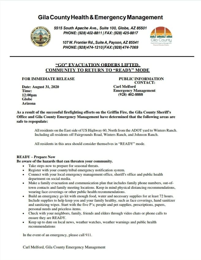
Latest Update from Gila County Sheriff's Office for the #GriffinFireAs a result of the successful firefighting efforts on the Griffin Fire, the Gila County Sheriff's Office and Gila County Emergency Management have determined that the following areas are safe to repopulate:
All residents on the East side of US Highway 60, North from the ADOT yard to Winters Ranch. Including all residents off Fairgrounds Road, Winters Ranch, and Johnson Ranch. All residents in this area should consider themselves in “READY” mode.
Read more at https://www.facebook.com/Gila-County-Sheriffs-Office-641987809193824