
Highlighted Media
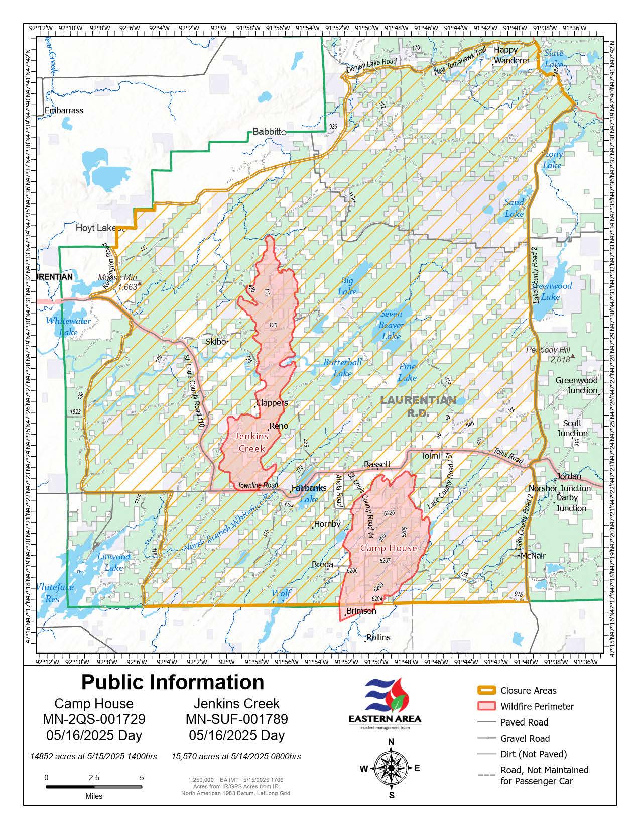
Map of the Camp House & Jenkins Creek Fires as of May 15, 2025 with the FOrest Closure Area also identified.
The Jenkins Creek Fire was detected on Monday, May 12, 2025 east of County Road 110 and north of County Road 16 near Jenkins Creek approximately 15 miles southeast of Hoyt Lakes, MN.
Northerly fire growth occurred over the past two days fueled by hot temperatures, low relative humidity levels, and strong south winds.
| Current as of | Fri, 05/16/2025 - 11:15 |
|---|---|
| Incident Type | Wildfire |
| Cause | undetermined |
| Date of Origin | |
| Incident Time Zone | Central Standard Time |
| Location | 15 miles SE of Hoyt Lakes, MN |
| Incident Commander | Eastern Area Complex Incident Management Team 1 - Brian Jenkins, IC |
| Coordinates |
47° 22' 33'' Latitude
-91° 58' 64
'' Longitude
|
| Total Personnel: | 63 |
|---|---|
| Size | 15,571 Acres |
| Fuels Involved | Timber (litter and understory) |
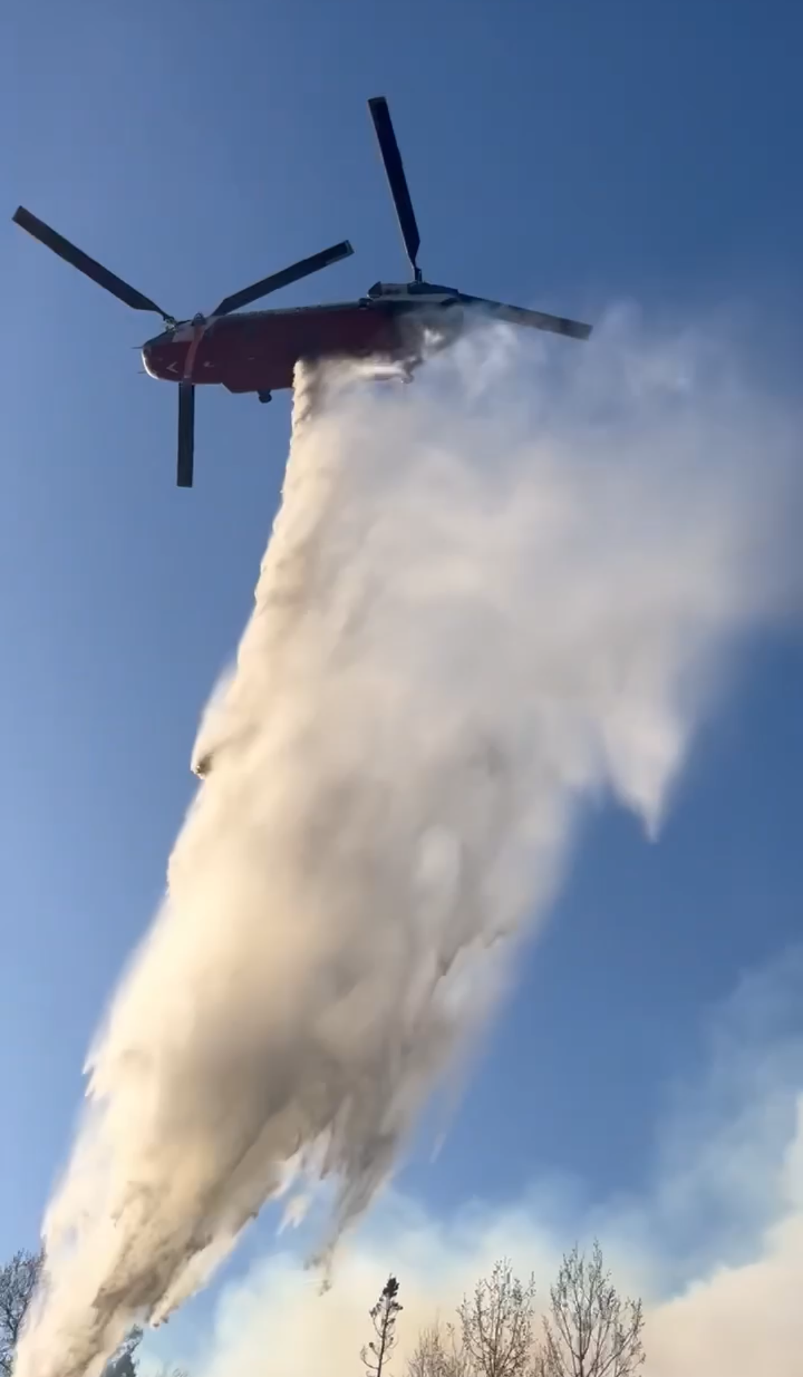
| Significant Events | Extreme fire behavior has been observed over the last 24-36 hours with wind driven runs, especially in areas of spruce budworm affected forest. |
| Planned Actions |
Holding and extending existing control line, structure evaluation and protection, evaluate indirect control lines/features. |
|---|---|
| Projected Incident Activity |
12 hours: Continued growth overnight with southerly winds |