
Single Publication
Could not determine your location.
 Wildfire
 Prescribed Fire
 Burned Area
Response
Burned Area
Response Other
Other
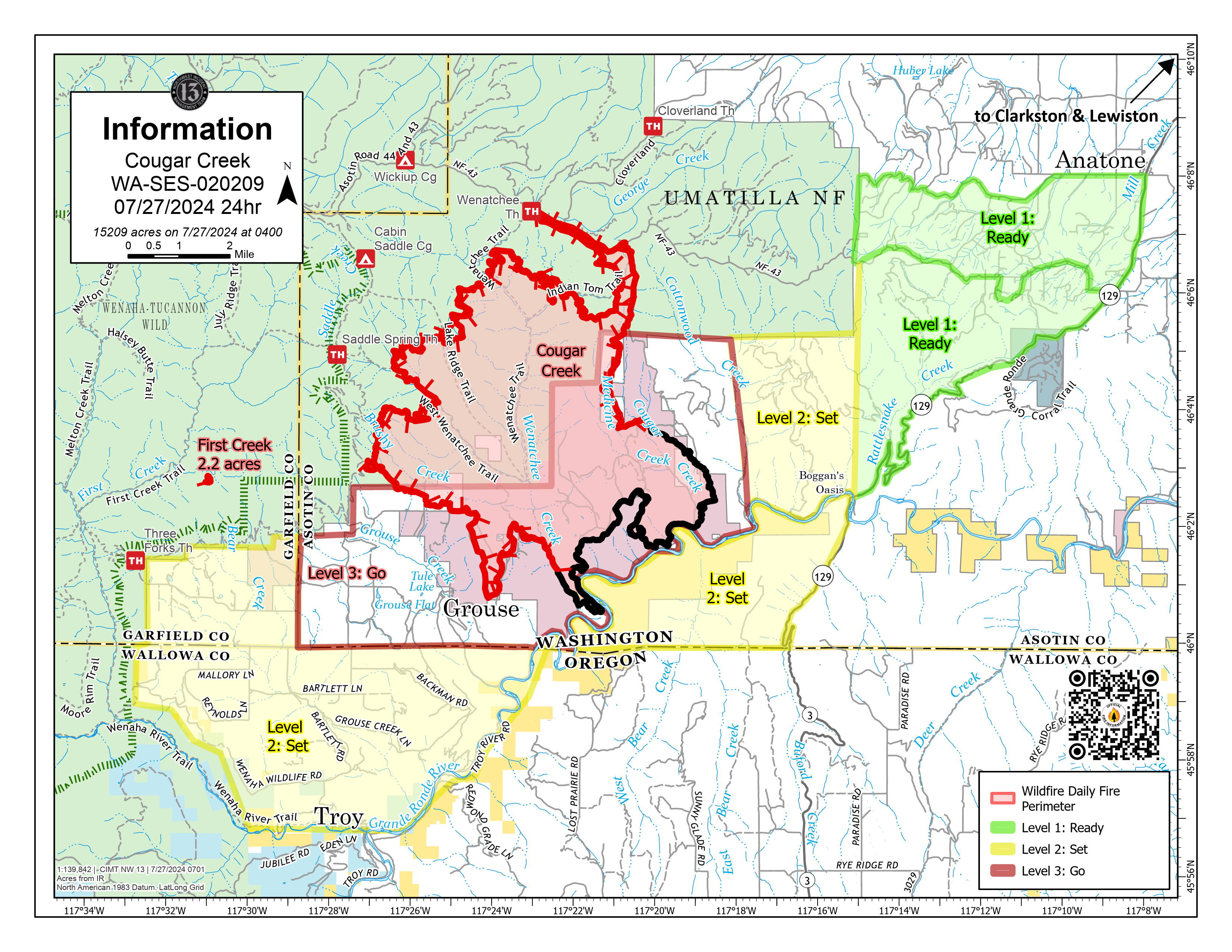
Cougar Creek Fire Update 07-27-2024
Cougar Creek Fire
Publication Type: News - 07/27/2024 - 09:14
Cougar Creek Fire Update for Saturday July 27, 2024
CURRENT STATUS:
A new lightning ignition in the Temporary Flight Restriction was detected yesterday approximately three miles west of Cougar Creek Fire. A Type 3 helicopter was utilized to scout and confirm the location of the new start. It then conducted five fuel cycles of water drops as rappellers directly engaged the fire in steep, rough terrain. The Air Attack assigned to the Cougar Creek Fire provided relief to other fires as community needs were assessed. All primary lines on the fire continue to hold, and indirect lines are still being developed on the western flank.
Night operations continue in the fire area as Incident Officials monitor weather conditions and evaluate tactical firing options to connect containment lines. Structure protection efforts continue in the Grouse Flats area.
An Unmanned Aerial System was used to detect heat signatures below the smoke layer in the valleys, which provided more accurate mapping capabilities. Firefighters were then better able to plan and carry out supersession operations. On the east flank of the fire, crews are mopping up from the fire’s edge into the black in order to find hotspots and secure against future re-ignition.
FIRE BEHAVIOR AND WEATHER:
No smoke column developed on the fire today, with no new fire progression on the southern end. The fire advanced to west further into the National Forest at a rate of one tenth to one quarter of an acre per day.
The winds will shift this evening and will be come from the west. Humidity levels have remained below average levels. Chances of thunderstorms will spike early next week, followed by an increase in temperatures and drying trends.
EVACUATIONS AND CLOSURES:
Forest closure descriptions and maps are available online on the Umatilla National Forest Closure page. In Washington, evacuation notices are posted on the Asotin County Sheriff webpage and Asotin County Emergency Management Facebook page. Grande Ronde Road is closed from Troy, Oregon to Highway 129 junction in Washington. In Oregon, a level 2 evacuation is in effect for Wallowa County, including all of Grouse Flat from Bear Creek Rd north to the State boundary and the Garfield County line to Grande Ronde River.