
Single Publication
Could not determine your location.
 Wildfire
 Prescribed Fire
 Burned Area
Response
Burned Area
Response Other
Other
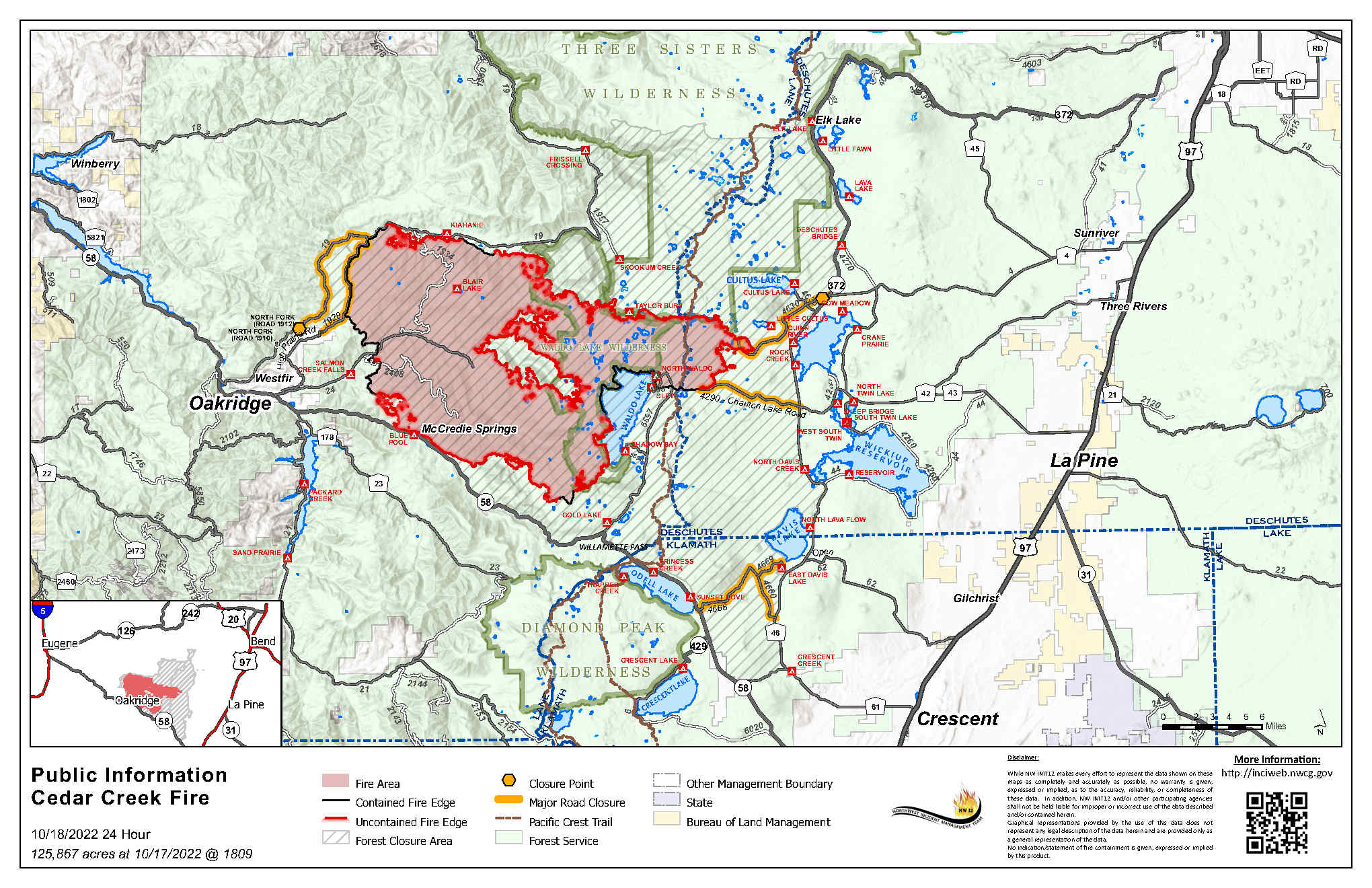
Cedar Creek Fire Update October 18, 2022
Cedar Creek Fire
Publication Type: News 10/18/2022
October 18, 2022 | Size: 125,867 acres | Origin: 15 miles E of Oakridge, OR | Containment: 50% | Cause: Lightning | Total personnel: 597 | Resources: 17 engines; 13 crews; 7 helicopters; 8 heavy equipment | Start Date: August 1, 2022
Weather: A high pressure rebound on Tuesday will provide for slightly higher temperatures conditions with potential wind gusts. Temperatures will be above normal with highs in the 70’s and relative humidity between 20-30 percent. Winds will remain out of the southeast in the morning to northwest in the afternoon. This high-pressure front will increase fire activity on Wednesday, with lower humidity and higher temperatures in the forecast. Precipitation in the 1-1/2” – 2” range is expected for our area on Saturday afternoon through Sunday evening, with snow possible on Saturday above 4000’.
Operations: Although there is a significant amount of smoke in the air, the fire remains within containment lines and crews are engaged in holding and securing any areas of increased heat. Air resources have been engaged in operations whenever it is safe to fly, providing support to firefighters on the ground. Yesterday, resources assisted in response to a new start south of Waldo Lake. Six smokejumpers dropped in near Maiden Peak and were able to catch and hold the new fire at about 1/10th of an acre.
Repair projects across the fire area are ongoing. Firefighters are focusing efforts to hold and secure control lines in areas where the fire had previously challenged containment along the southern edge. Crews will continue to monitor and patrol in areas that experienced an increase in fire behavior during Red Flag weather this past weekend. Assessment and repair continue around road systems along the northern edge of the fire. The west side of the fire perimeter will also see ongoing assessment of the road system and more chipping operations.
Suppression repairs on the Big Swamp and Potter Fires are complete.
Closures: There are closures in effect on the Deschutes National Forest and Willamette National Forest. These closures will remain in place until areas impacted by the fire are surveyed for safety risks and fire crews are able to mitigate these hazards. Please respect Forest closures for firefighter and public safety. Please visit Willamette National Forest and Deschutes National Forest for the most recent closure orders and maps. Pacific Crest Trail hikers should visit pcta.org for current information. There is a Temporary Flight Restriction over the Cedar Creek Fire area. Wildfires are a No Drone Zone - if you fly, we can’t.
Smoke: Air quality conditions due to smoke are expected to be Good to Hazardous within the forecast area. Smoke impacts will be heavily dependent on fire activity. For current conditions, see Fire.airnow.gov, oakridgeair.org, and LRAPA - Today's Current Air Quality. Smoke Forecast Outlooks are available at https://outlooks.wildlandfiresmoke.net/outlook.Evacuations: A map of the evacuation area is available at www.LaneCountyOR.gov/CedarCreek. Sign-up for emergency mobile alerts by going to oralert.gov. Please check with Lane County Sheriff’s Office at 541-682-4150 and Deschutes County Sheriff’s Office at 541-693-6911 for updates and changes.
Online: https://inciweb.nwcg.gov/incident/8307/ | www.facebook.com/CedarCreekFire2022/ www.tinyurl.com/cedarcreekfireyoutube| Fire Information Line: 541-201-2335, 8:00 AM – 8:00 PM | For Media Inquiries: 541-327-9925 | Email: 2022.cedarcreek@firenet.gov