
Single Publication
Could not determine your location.
 Wildfire
 Prescribed Fire
 Burned Area
Response
Burned Area
Response Other
Other
Closure Order 03-10-01-24-02 05-23-2024
Indios Wildfire
Publication Type: Closures - 05/23/2024 - 12:58
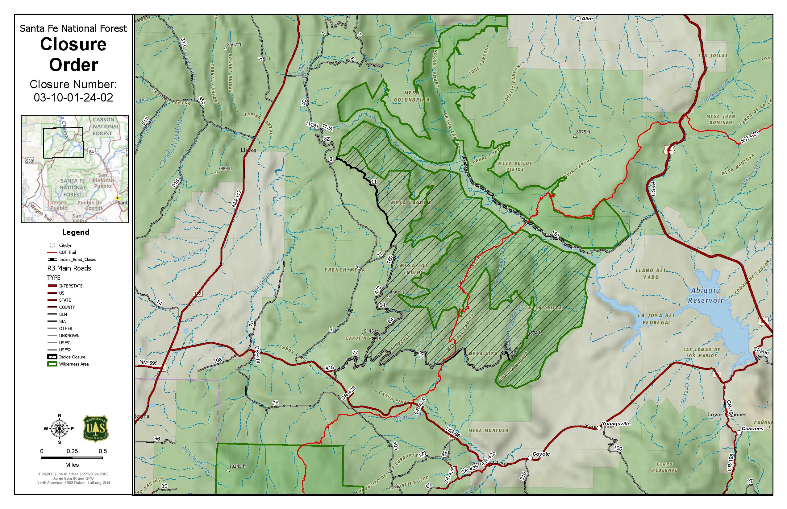
The Described Areas are within Township 23 North, Range 1 East, Sec. 13; Township 23 North, Range 2 East. Sec. 1-13; Township 23 North, Range 3 East. Sec. 2-10, 15-18. Township 24 North, Range 2 East sec. 1-6, 8-12, 13-17, 20-36; Township 25 North, Range 3 East, Sec. 7-9, 13-36. Township 25 North, Range 1 East sec. 13, 24; Township 25 North, Range 2 East, Sec. 19, 20, 27-30, 31-36.
Specifically, the Described Area includes all National Forest System lands within the boundary of the Coyote Ranger Districttsarting from the Continental Divide trail #298 at Highway 96 going north across Forest Road 77, through the Chama River Canyon Wilderness to Skull Bridge (Ojitos Trail head) on Forest Road 151. Order Number: 03-10-01-24-02
Forest Road 11 northwest to the Chama River Canyon Wilderness boundary and Junction with Forest Road 8; Forest Road 169 (from junction with Forest Road 11) south to Forest Road 473; Forest Road 473 south to Forest Road 64; Forest Road 64 South to the junction of Forest Road 77; and Forest Road 77 east to the Chama River Canyon Wilderness boundary. Forest Road 77 from the Forest boundary and County Road 418 to the junction of Forest Road 64 and Forest Road 77. The Chama River Canyon Wilderness south of Rio Gallina and south of Rio Chama.