
Single Publication
Could not determine your location.
 Wildfire
 Prescribed Fire
 Burned Area
Response
Burned Area
Response Other
Other
South Fork and Salt Fires Burned Area Emergency Response
Unit Information
Incident Contacts
- Elaina LaPaz, Mescalero Apache Tribe PIOEmail:elapaz@mescaleroapachetribe.com
- Amanda Fry, Lincoln National Forest PAOEmail:amanda.fry@usda.gov
ASH AND SEDIMENT FLOW VISIBLE FROM HULL ROAD AND PARADISE CANYON DRIVE IN RUIDOSO ON JUNE 24, 2024 06-24-2024
South Fork and Salt Fires Burned Area Emergency Response
Publication Type: News - 06/24/2024 - 12:28
ASH AND SEDIMENT FLOW VISIBLE FROM HULL ROAD AND PARADISE CANYON DRIVE IN RUIDOSO ON JUNE 24, 2024
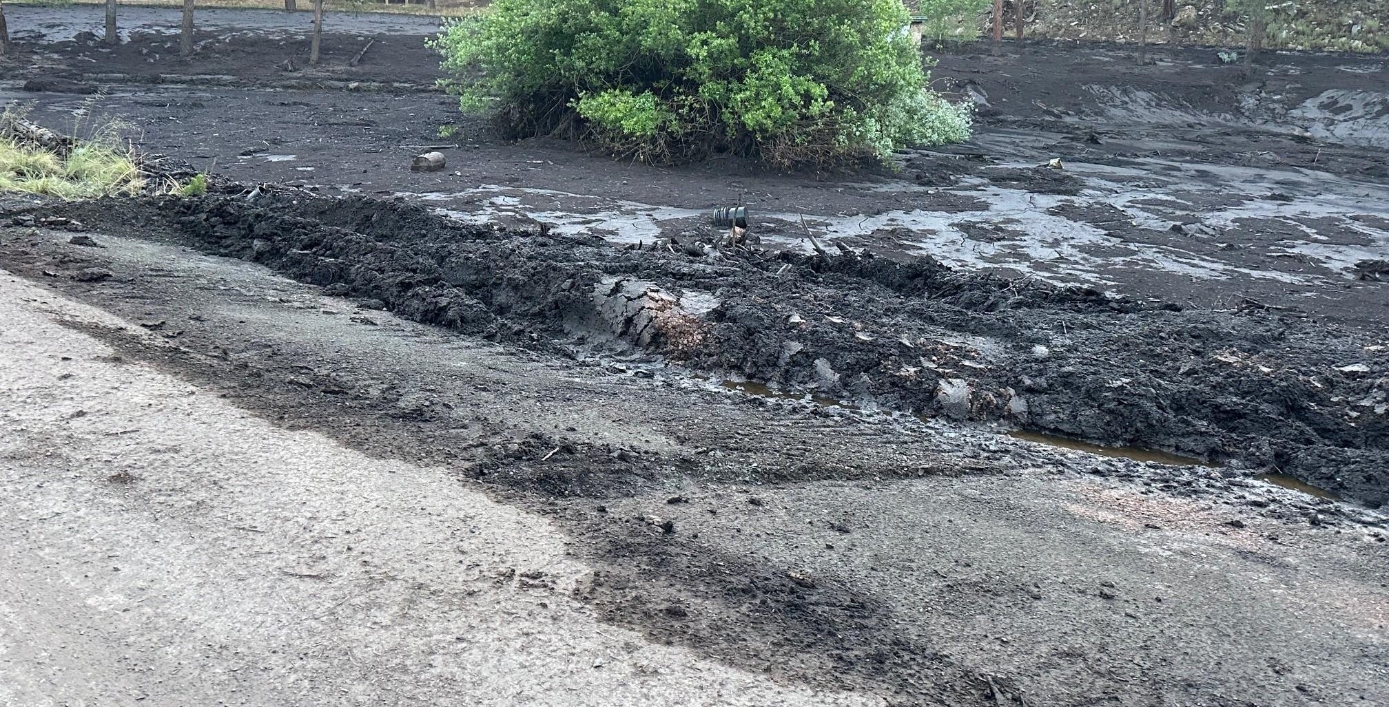
Ash and sediment flow visible from Hull Road and Paradise Canyon Drive in Ruidoso on June 24, 2024
Post-wildfire recovery teams of specialists for the Department of the Interior (DOI) and U.S. Department of Agriculture (USDA) have arrived in Mescalero, New Mexico, to evaluate impacts of the South Fork and Salt Fires on public and tribal lands. These fires have burned a combined 25,370 acres, between the towns of Mescalero and Ruidoso. The fires have crossed jurisdictional boundaries of the Mescalero Apache Tribe, Lincoln National Forest, and Lincoln and Otero counties.
Wildfires can cause complex aftereffects, from severe loss of vegetation and soil erosion to a decrease in water quality and possible flash flooding. Post-wildfire recovery is facilitated through a program called Burned Area Emergency Response (BAER). BAER addresses post-wildfire emergency stabilization and treats other post-fire threats to protect public safety, prevent further degradation of the landscape and mitigate post-fire damages to critical values.
Fires result in loss of vegetation, exposure of soil to erosion, and increased water runoff that may lead to flooding, increased sediment, debris flow, and damage to critical natural and cultural resources. BAER actions such as: seeding, mulching, installation of erosion and water run-off control structures, temporary barriers to protect recovering areas, and installation of warning signs may be implemented. BAER work may also replace safety related facilities; remove safety hazards; prevent permanent loss of habitat for threatened and endangered species; prevent the spread of noxious weeds, and protect critical cultural resources.
The Mescalero Apache Tribe has already begun to install treatments to mitigate the threat to local residences, businesses, and other important infrastructure.
The DOI BAER Team hosted an in-brief with the Mescalero Apache Tribe on June 24, 2024, and will oversee treatment priorities on Tribal Trust lands. The DOI Team will coordinate with the USDA BAER Team to assess soil burn severity and post-fire threats.
The Teams will include specialists in soils, hydrology, geology, engineering, wildlife, botany, and archeology. Each resource specialist brings a unique perspective to the BAER process, to help the team rapidly determine whether the post-fire effects constitute urgent threats to human life, safety, property, or critical natural and cultural resources. They produce an integrated plan designed to install treatments that reduce those threats.
Land managers and local officials will use the designed treatments to seek funding for immediate emergency stabilization measures. Ideally, these treatments will be installed prior to major storms.
BAER SAFETY MESSAGE: Everyone near and downstream from the burned areas should remain alert and stay updated on weather conditions that may result in heavy rains and increased water runoff. Flash flooding may occur quickly during heavy rain events--be prepared to act. Current weather and emergency notifications can be found at the National Weather Service website: www.weather.gov/abq/.
###