Single Publication
Could not determine your location.
Bear Fire, Tahoe National Forest
Unit Information
Incident Contacts
- Email:Phone:(530) 559-9010
Bear Fire Incident Update 09-09-2024
Bear Fire, Tahoe National Forest
Publication Type: News - 09/09/2024 - 08:45
Location: South of Sierra Brooks off Bear Valley Rd., Tahoe National Forest
Personnel: 516
Start Date: 9/2/2024 @ 2:00 PM
Cause: Undetermined
Size: 3,325 acres
Percent contained: 45%
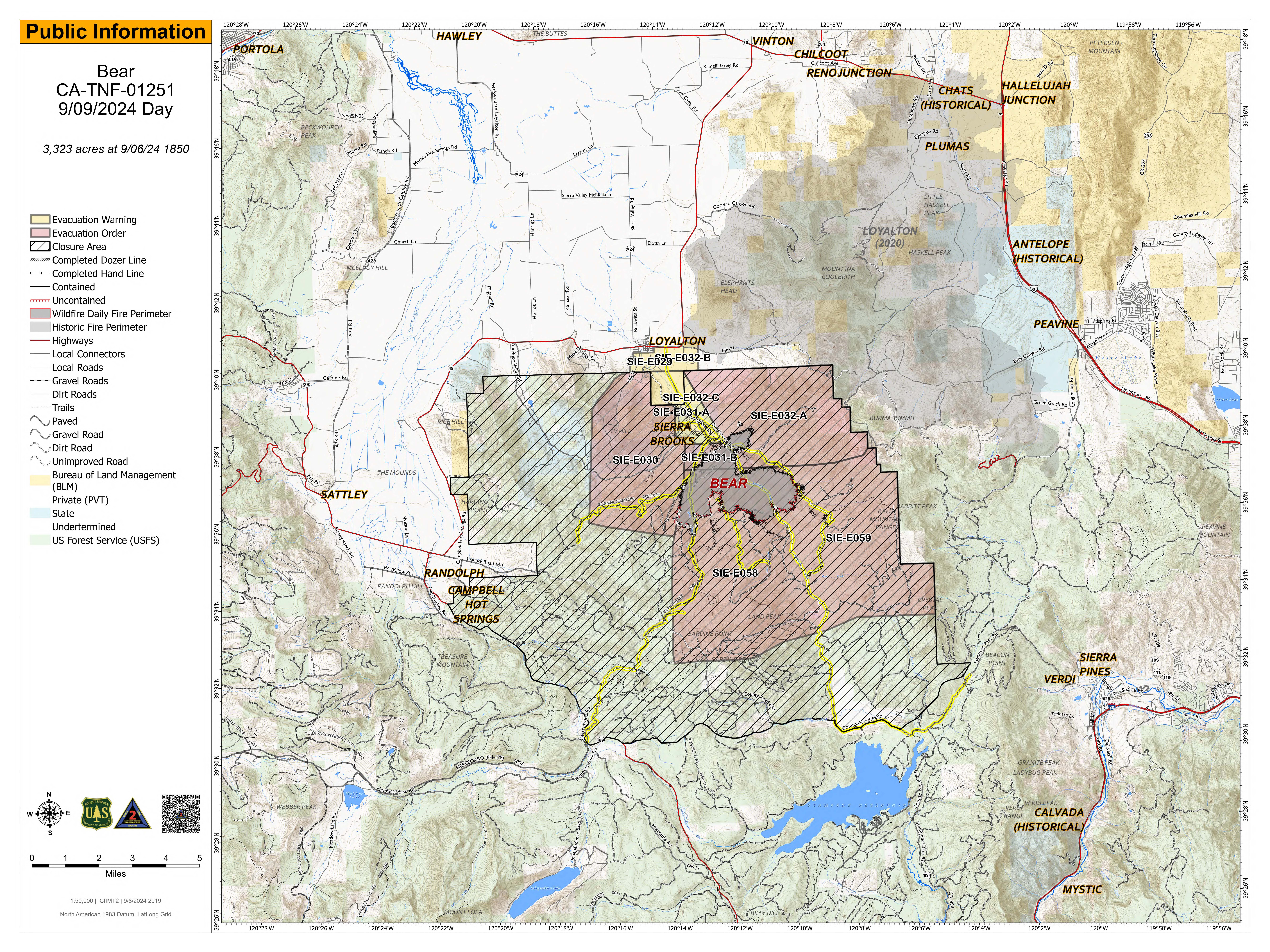
Yesterday evening, the incident transitioned out of unified command. Crews continued to focus on gaining additional depth in their mop-up efforts. With wind gusts reaching up to 29 mph, crews worked through the night to maintain containment and successfully maintained the current footprint of the fire.
Today, crews will be working on gaining depth and mop-up efforts, around the southeast area of Smithneck Road and the 56 Road. Other resources have been redirected to suppression repair, which involves restoring areas impacted by wildfire suppression activities to a more natural or stable condition. Currently, the tasks include approximately 60 miles of dozer lines, 11 miles of road lines, and 12 miles of hand lines requiring suppression repair. Overall, suppression repair aims to minimize long-term environmental impacts and facilitate the recovery of the affected landscape.
As the containment of the fire is improving, it is important to remember there are Forest Closures and Evacuation Orders that remain in effect for public and crew safety. Any public entry to these areas are prohibited. The closure area boundary travels north along State Highway 89 until it reaches end of National Forest System Lands south of Sierraville. The closure continues generally east and then north along the forest boundary to the Antelope Valley State Wildlife Area. At the eastern most boundary with the Antelope Valley State Wildlife Area the closure boundary then travels generally east along the forest boundary to its junction to the Humboldt Toiyabe National Forest. At that junction the closure boundary travels generally south along the Tahoe National Forest boundary to the junction of the Truckee Ranger District where the closure boundary travels west along County Road 860 (Smithneck Creek Road) until it becomes County Road 450 (Henness Pass Road) and back to Little Truckee Summit.
WEATHER:
Winds are expected to decrease in speed from the previous days, with a cold front approaching on Wednesday. Wind gusts of 25 mph with cooler temperatures are expected with a 20% chance of showers forecasted for Wednesday.
EVACUATIONS:
Sierra County: Evacuation order and warnings remain in effect. For an interactive map of evacuations, visit: https://protect.genasys.com/search.
FOREST CLOSURE:
A forest closure has been issued, For more information visit the Tahoe National Forest website at: https://www.fs.usda.gov/alerts/tahoe/alerts-notices.

 InciWeb
