
Single Publication
Could not determine your location.
 Wildfire
 Prescribed Fire
 Burned Area
Response
Burned Area
Response Other
Other
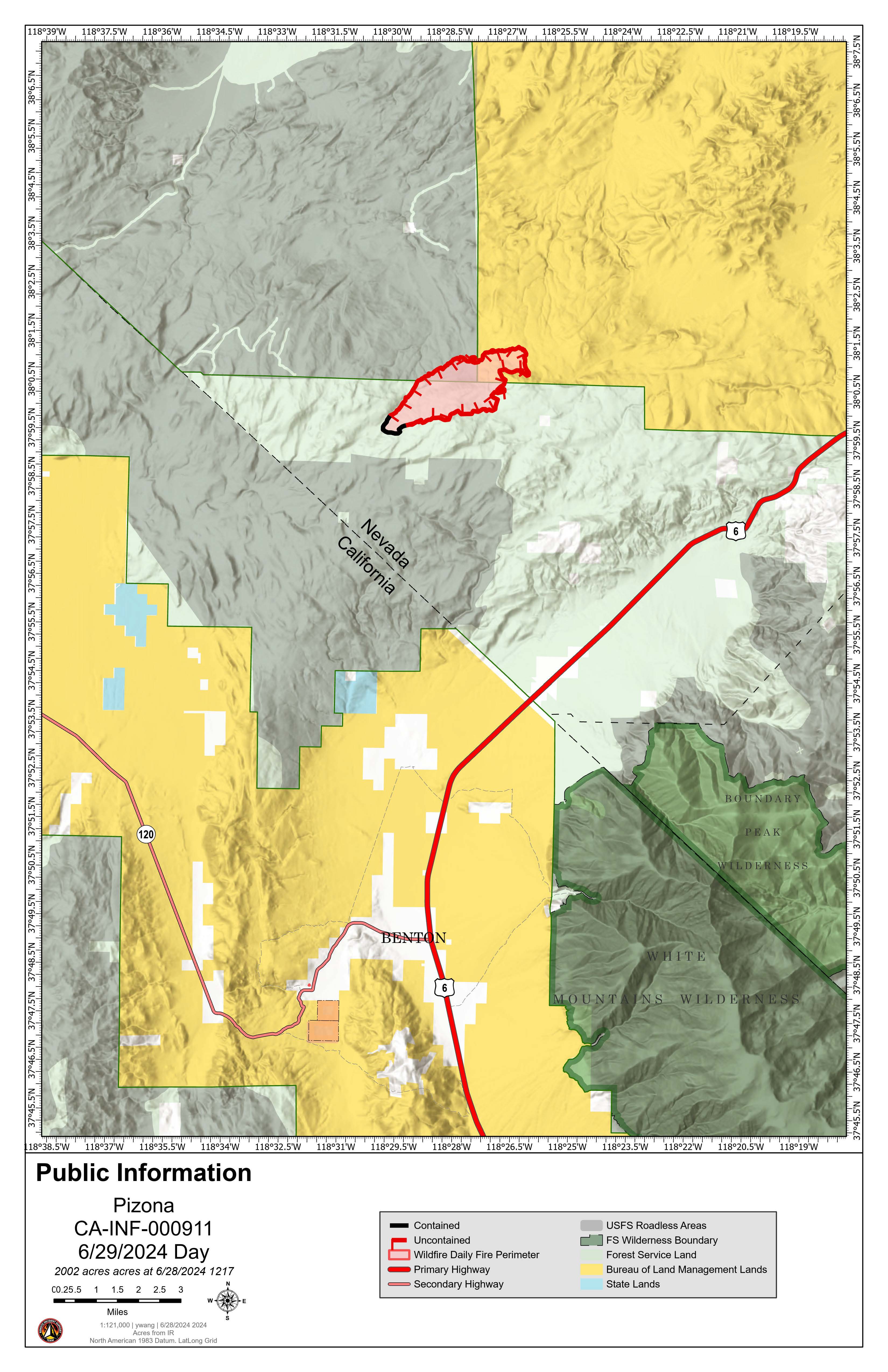
Pizona Fire daily update 06-29-2024
2024 Pizona
Publication Type: News - 06/29/2024 - 02:00
The Pizona Fire behavior significantly decreased last night and is expected to continue burning at a slow to moderate rate of spread today in dry pinyon-juniper and sagebrush vegetation, into the 2003 Sagehen Fire burn scar.
The northeast side of the fire continues to be the most active, where ground crews and water drops are being prioritized. Incident objectives are to keep the fire north of McBride Springs, south of Jack Spring, east of Forest Road 1N1132, and west of Forest Road 206.
Air resources will continue reinforcing current perimeter lines of retardant surrounding the fire, and assisting ground crews dealing with extremely rough and inaccessible terrain. Despite this, firefighters have increased containment lines up to 30% containment.
Today’s forecast will include temperatures in the mid-80s and a continuing dry pattern with some overnight humidity recoveries around 30%, winds gusting up to 20 mph. This weather pattern is expected into Sunday as well.
No bulldozers have been ordered for this incident due to the logistics and inaccessibility of the roadways, in addition to the potential for cultural resource impacts.
Resource advisors are present on the fireline to monitor sensitive cultural, archeological and ecological resources and to advise on Minimum Impact Suppression Techniques (MIST).
Acreage: 2,002
Percent Containment: 30%
Current Resources: 168 total personnel (6 hand crews, 3 engines, 5 helicopters, 2 type 1 air tankers, 2 air attack, 1 lead plane, 2 water tender, 32 overhead)
Location: Adobe Hills in Mineral County, Nevada, just over 12 miles north of Benton, CA
Cause: Lightning
Structures threatened: 0